Kerry, Killarney, Doolin, Burren, Borrisokane, Carlow
This is the second week and covers county Kerry in south west Ireland, countys Clare, Tipperary and Carlow. For maps, follow the links.
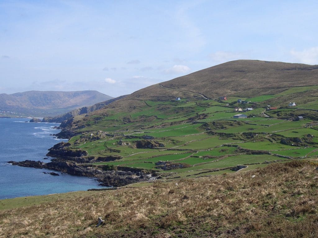
 Today (18/4) was Ring-of-Kerry day. The Ring-of-Kerry is a 179 km circuit from Killarney that goes anti-clockwise around the Kerry peninsula.
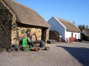
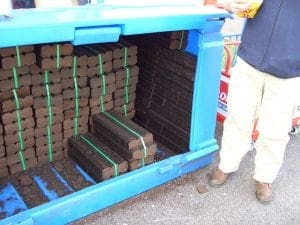
Just past Killorgan, called in at the Kerry Bog Museum (peat cutters) (Peat is everywhere. It is still a common fuel. It comes in brick-like slices sold by the Irish Peat Board – and can be seen drying on many road sides – here on sale outside a local conerstore. ) Speaking of roads, Irish roads leave a lot to be desired. Very narrow, bumpy and the passenger-side very uneven. Cars passing in opposite directions often have to slow down – even on the major roads. Like outback Oz in the 1960s. The roads today were extremely narrow. Passing cars had to find a place to pull over to let the other car pass. It was Helen’s day to drive.
 From the Bog Museum continued anti-clockwise around the Ring to the Barracks at Caherciveen . (This was a barracks for the British police force in Irish territory so had to be defended) It looks like a fort from NW India. The story is that the plans got mixed up – NW India got the Irish one. That must look out of place there too.
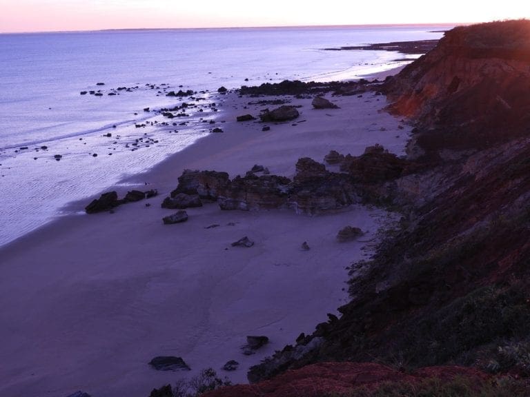
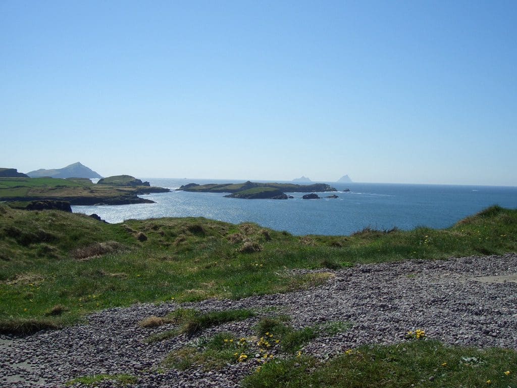
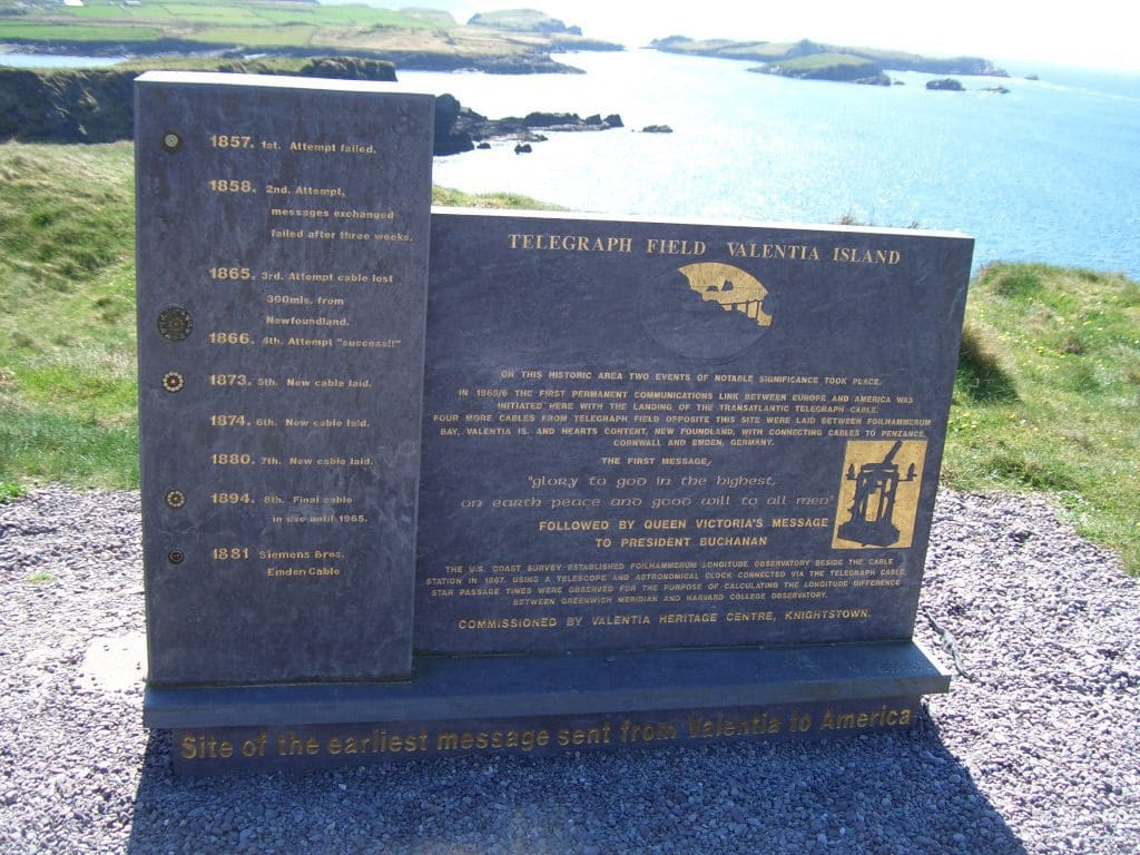
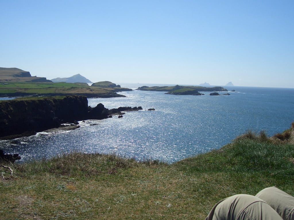
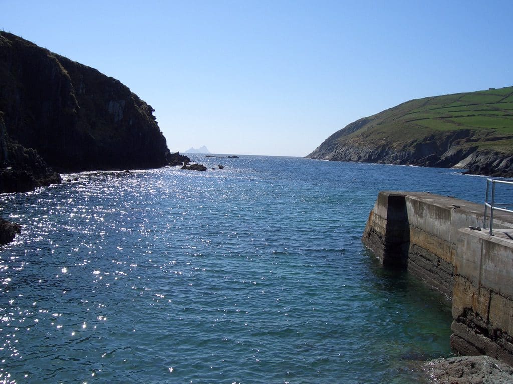
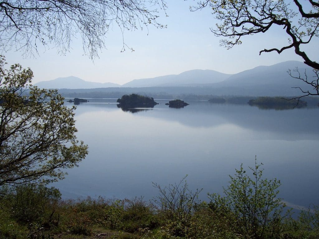
Then to Valencia Ireland – the most Westerly place of Europe. The first telegraph line was laid between there and the US in 1858. It took several attempts. A beautiful place with steep rugged cliffs, blue sea and green paddocks surrounded by stone walls right to the edge of the cliffs. (Valencia Island was so called because the Spanish Armada washed up here after being blown up around Scotland.
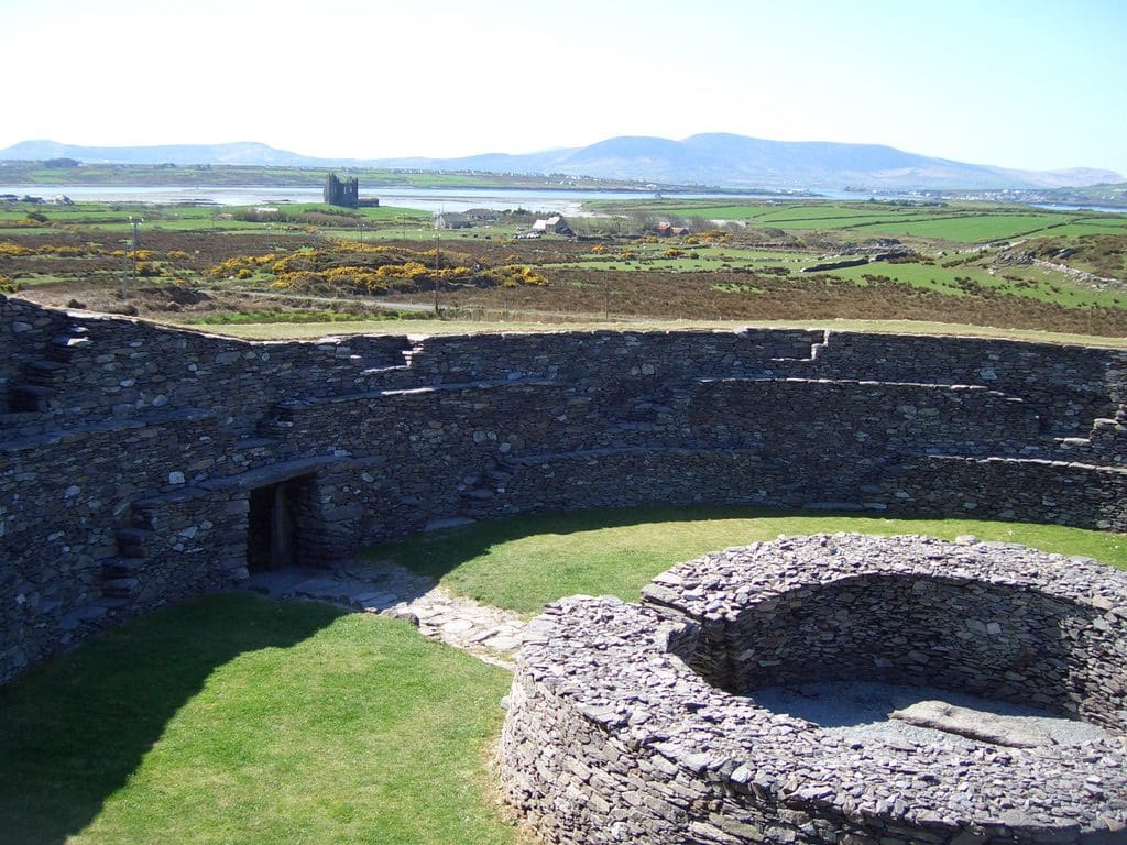
Near Valentia were these ancient Ring Forts of similar age to this link .
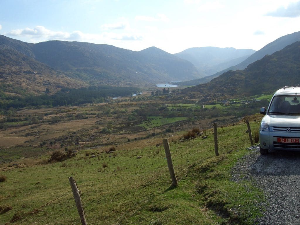
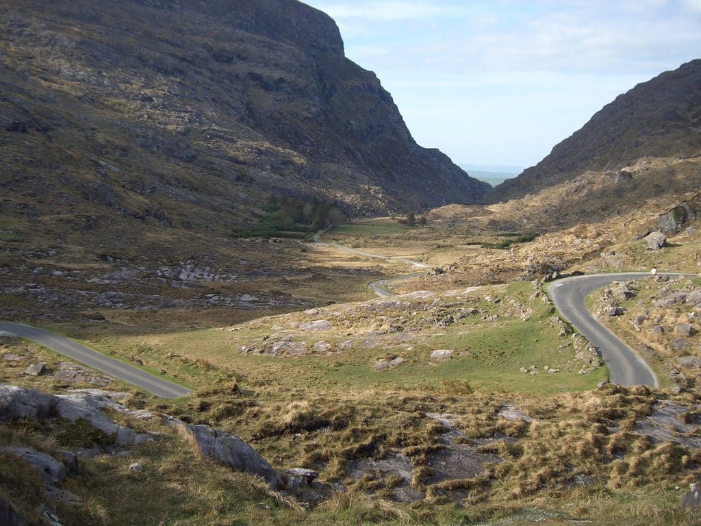
From there we abandoned the Ring cycle and headed inland across three mountain passes on winding, narrow unmarked roads. Spectacular. All three different from each other and each beautiful. No coaches on any of those – far too narrow. On one road we had to fold in the external rear vision mirrors so that we could pass. Finally up over the Gap of Dunloe beside the Macgillycuddy’s Reeks and back to Killarney.At Killarney we stayed at the Sugan – hostel with 56 beds. It is smaller than most Sydney terrace houses – about 3 metres wide. Martin (from Poland) manages it. His wife, Mata, has a very broad Irish accent. She has been in Ireland for 3 years. One of the very best hostels. Extremely friendly people. Martin’s introductory tour is a work of art – 3 minutes to tell you where everything is and how it works – delivered at 2,000 words per minute – punctuated by ‘la’. The pub next door was managed by an Irishman who had spent several years in Melbourne. Both establishments share each others corridors to get equipment in and out. It wasn’t unusual to see the publican carrying something through the hostel to access his back area. Killarney has had a building boom – lots of money put into tourist accommodation which now rings the place. Many languages being spoken – locals were saying that it was very quiet. It must be VERY busy and crowded in peak summer.
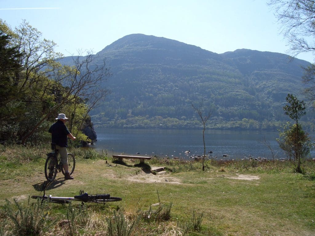
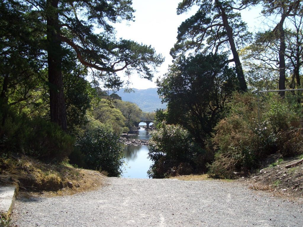
19/4 was Muckross House day – we hired bikes and rode around. Extremely beautiful setting. The house itself was well worth the visit. It was a wedding present to some extremely well off young lady from Scotland. She designed and oversaw the building of the place. Very modern for the time with all mod cons including plumbing. All of the furniture was still in place with extra extravagances to celebrate 2 nights that Queen Victoria stayed there – probably sent them broke. (Compare this to Kilkenny Castle where they had to sell the furniture in 1937 to pay off debt after the stock market crash. They have got some furniture back – but nowhere near the affluence of Muckross.) Muckross means pig shit point
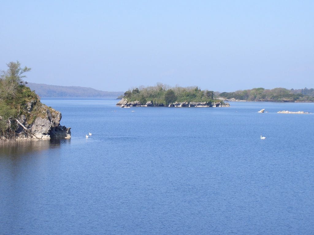
The house overlooks one of the Lakes of Kilkenny . Most of the extensive house grounds and hunting forest is now national park. We spent most of the day riding around the lake, stopping at the many coves and beaches. Some of the bridges were hundreds of years old.
Helen fell off her bike into a wall and a clump of stinging nettles. Bruises. Ouch! And double ouch!! The nettles burned for at least 48 hours – not fun
20/4 Left Killarney early for a biggish drive. Headed for the car ferry across the Shannon, which from the South, runs every hour on the half hours. We were going fairly well until yet another traffic jam in a small town (Tralee). We missed the ferry by a few minutes – which put us at the front of the line. There are signs advertising dolphin spotting tours. We just had to use our eyes on the ferry.
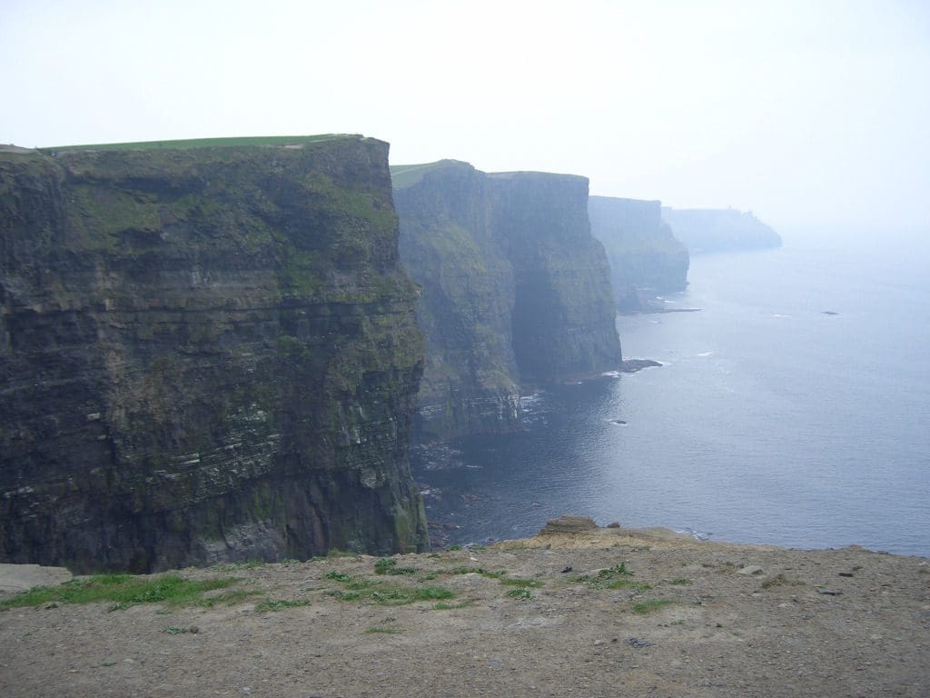
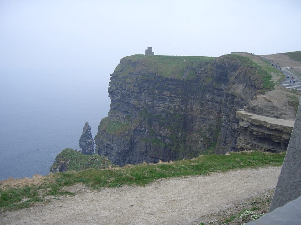
From there to the Cliffs of Moher – the major tourist stop along this coast. They have had to build a huge amount of infrastructure to handle the buses. It must be like swarming ants in the summer. They are certainly spectacular. A few gulls nesting on isolated ledges. Then spotted some birds in groups – upright stance like penguins – guillemots. Then a Puffin. Just the one. It disappeared into its burrow before we could get a good look.
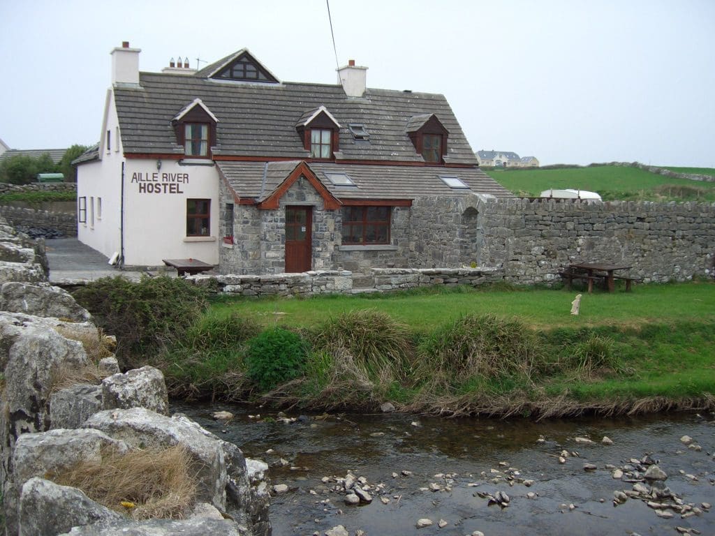
From there to Doolin – one of the music capitals of Ireland – and there is a lot of competition. Doolin is series of little villages strung out along the Aille River. We stayed in a 17th century farmhouse converted into a hostel. A very comfortable and friendly place. Karl (manger) is a wealth of information about the area. Been everywhere in the world. Passionate about the Burren and Doolin.
Went to the famous O’Connor’s pub for the nightly music session. The pub was quite packed. Three musicians (squeeze-box, 12 string guitar and flute/whistle). They were fairly good -especially when playing jigs. The woman (flute player) could sing quite well – good strong voice. Unfortunately, this other bloke kept going over to sing with them He was terrible. Drove us out.
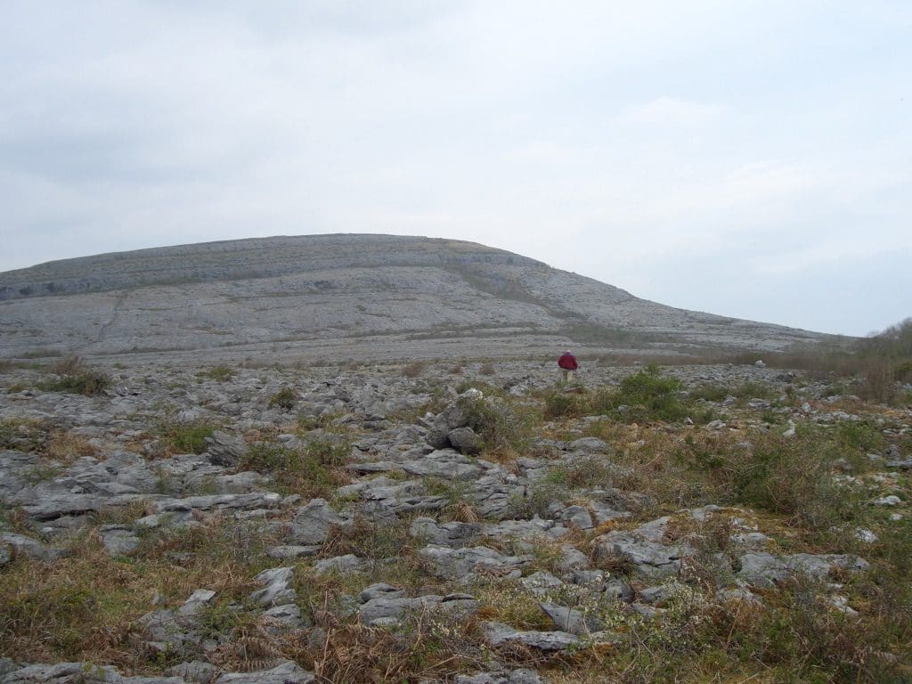
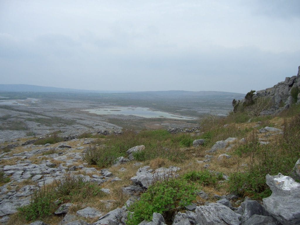
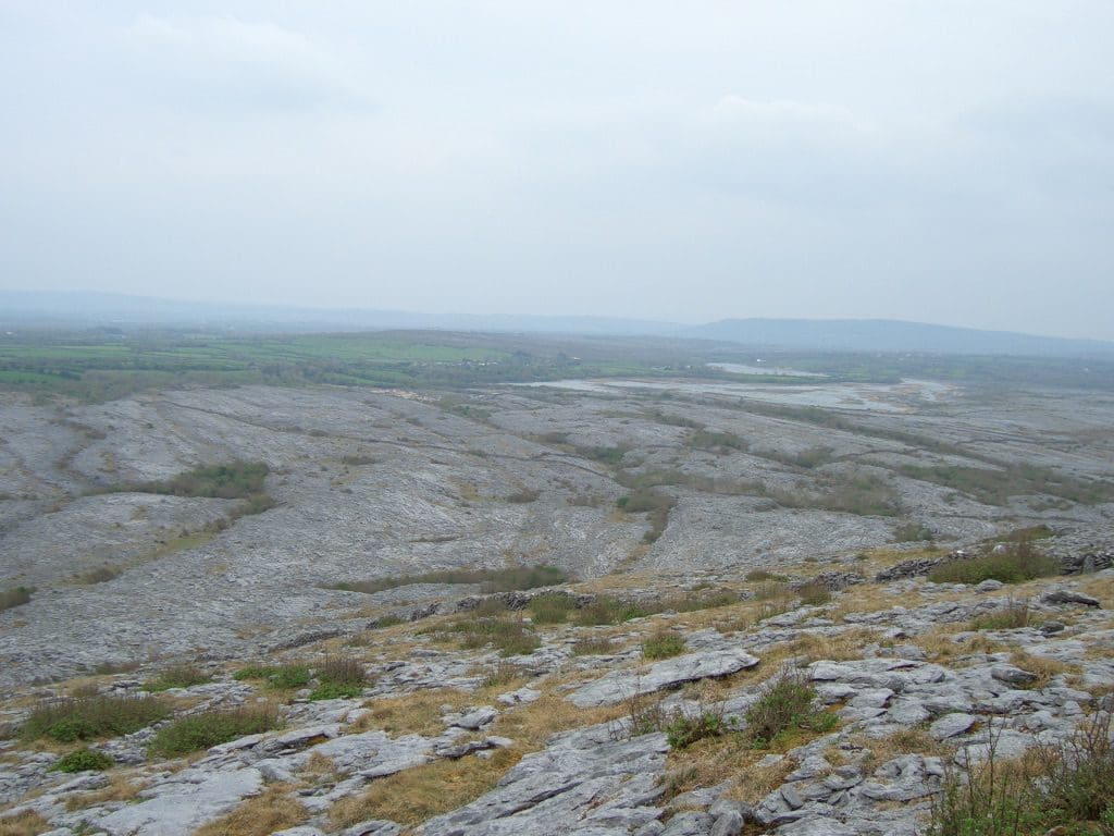
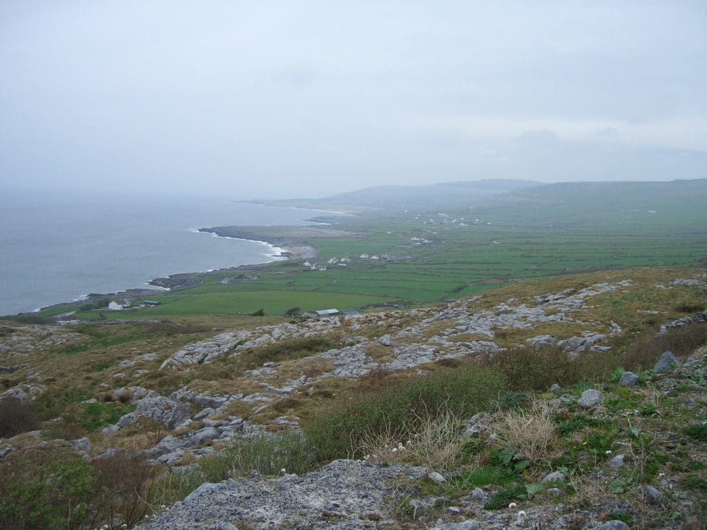
21/4 A day in the Burren . These rounded hills without any apparent vegetation are big stands of limestone – Karst country. We went for a walk part-way up one of them. Fossils (coral, shells, worm casts etc) sticking out everywhere.
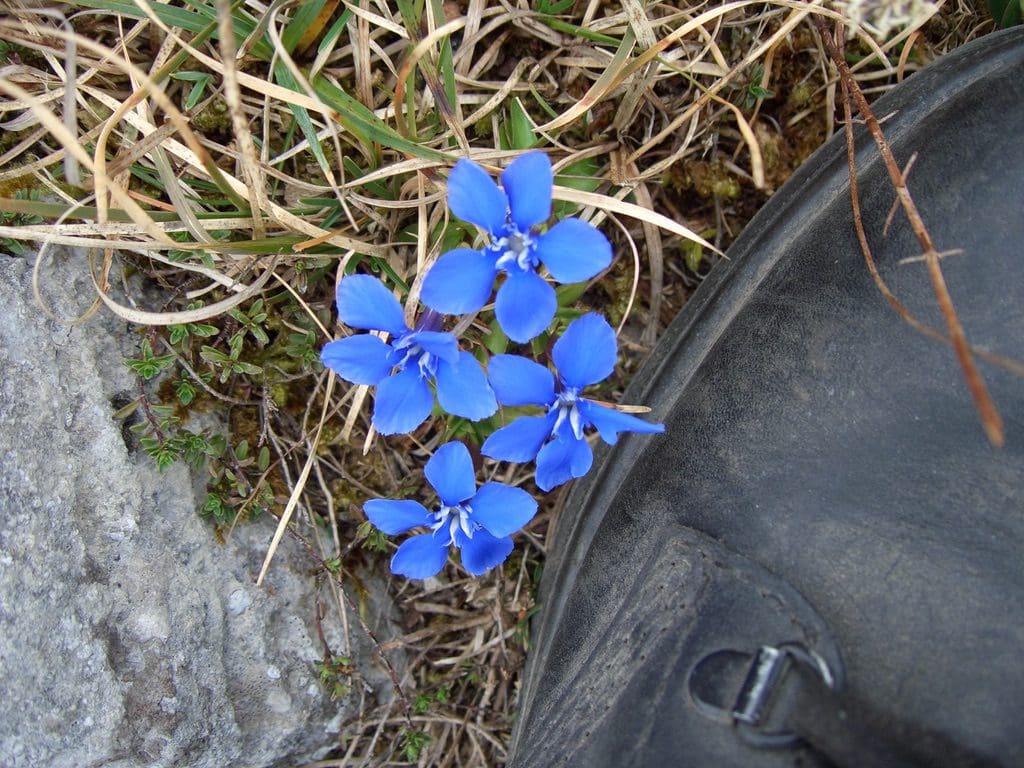
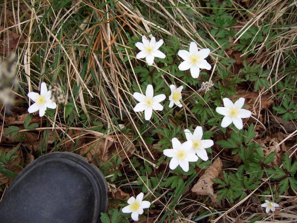
Wonderful displays of wildflowers (blue gentians, pink spotted orchids, purple dog violets, yellow primroses and cowslip) hidden in cracks and sinks in the limestone in little micro-climates.
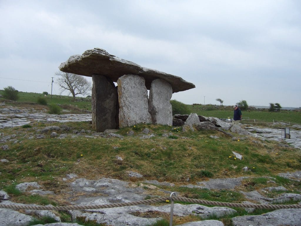
Drove back to Doolin by a zig-zag path through the centre of the Burren which took us past the Poulnabrone Dolmen (one of the most photographed places in Ireland.) (It was a bit off putting to see the coachloads of tourists pulling up, taking their photgraphs and clambering back on the bus – been there done that.) We went on via Black Head and a road diversion that took us up over a steep winding road with spectacular views. We had planned to move on to the Connamara today. However, a change of plan. Moving and driving everyday is getting too much. We will stay here for a couple more nights.
22/4 We were going to go out to Arran Island by boat to do some walking/cycling. However, for the first time so far, it rained. So we have a day in doors talking. An interesting discussion with a fellow from Northern Ireland about The Troubles and the Peace Process. Names of various splinter groups of the IRA, Provisionals, Nationalists and Unionists going past like road signs. Geoff managed an afternoon kip and Helen went for a walk down the road. The whole local area was once a huge farm. The cottage across the creek was the gate house. We were staying in one of the more prosperous farmhand houses and down the road were the ruins of the big house, enclosed by the inevitable wall. Got up to date with the washing etc and settled down to an evening in front of the fire talking about Irish history which, of course, ended in stories of faeries, ghosts and leprechauns.
One story was of a much publicised visiting singer. He was terrible and part way through his first aria, stopped and apologised that he ‘had a frog in his throat’. Instant response from the audience ‘well why don’t you fook arf and give the frog a go’.
23/4 Drove to Borrisokane (co Tipperary) where Helen’s people (Hobbs) came from. This was a Church of Ireland community and is still in contrast to Catholic Ireland – much neater and more ordered – many old houses are three storeys high as opposed to the usual Irish squat two storeys. Had lunch at a local café (breakfast all day). Asked the waitress if there were any people by the name of Hobbs still in the village. “My husband’s nephew is a Hobbs” was the reply. He and his wife are the only Hobbs left in the village. They weren’t home that day so we missed them.
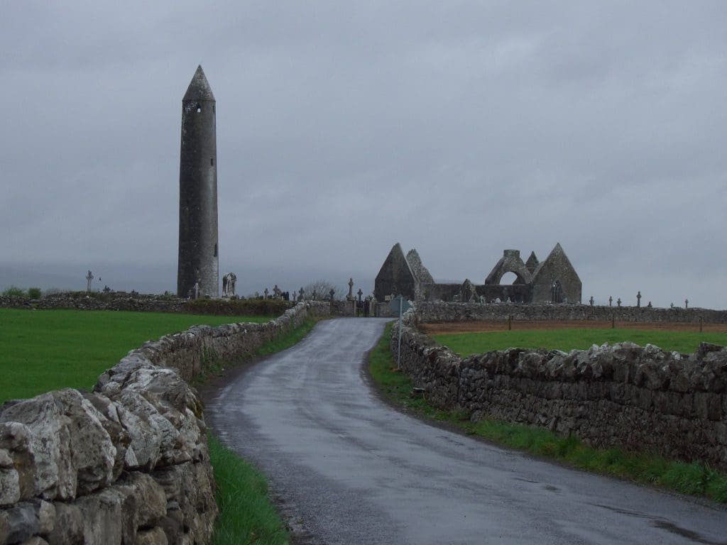
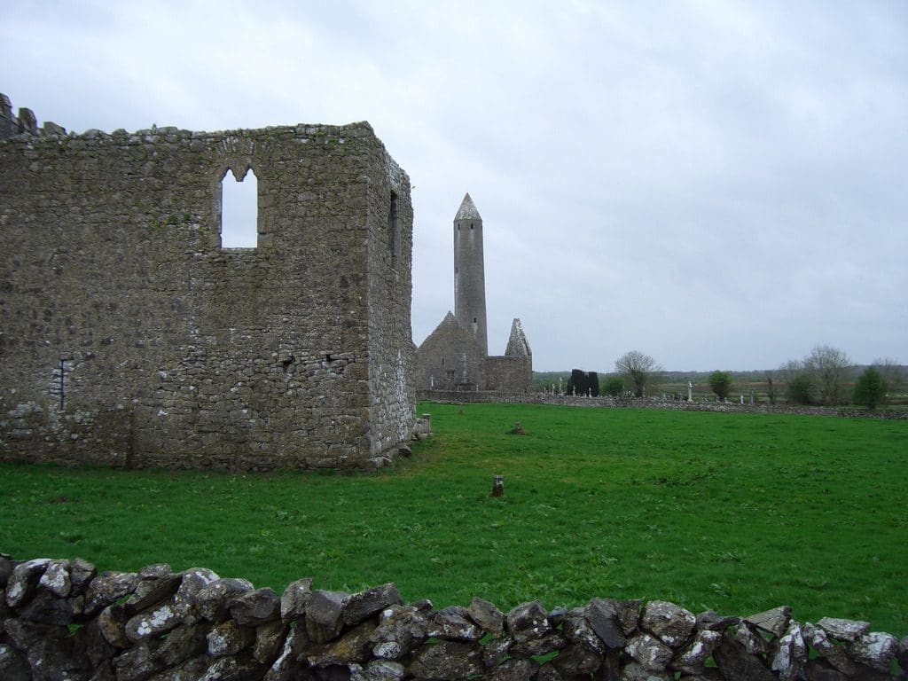
On the way to Borrisokane we came across a startling Abbey ruins. Just standing on the sign of the road with a bit of a sign post to it. Apparently one of the famous sites founded in the xth century. No tourists, just us.
From Borrisokane to Cashel – a cathedral and religious community perched in a fortress on a rock. Impressive yet in some ways disappointing. The architecture, engineering and age of the place are clearly impressive. However, it comes across as a big soulless lump of rock.
From Cashel we went to to Carlow to stay with Dolores McCann and her 4 year old son Adam. (Dolores was Geoff’s PA in Oz in 1996.) Very good to catch up again.
It is very clear that driving up to some icon or monument and taking its picture (been there done that) has little interest for us. Forgotten in 5 minutes. What we like and probably will remember are the walks and rides – something with physical activity in it where we have to discover for ourselves the small things, the flowers in a crevice or a bird.
More on the roads. They were clearly wagon tracks (between stone walls) that have just had a thin layer of tar whacked on the top and given a road number ‘N67′. Not always room for cars going in opposite directions to pass. A story last night of American tourists who hire big cars and insist on driving down the middle of the road – causing many crashes. Another story today – a superstition that to cut down a certain kind of bush will cause your death. The roads have to wind their way between these bushes. For example, the road being built approaches such a bush. Discussion, ‘do we go ahead or around it?’ ‘Well I’m not cutting it down. We’ll go around.’ Power poles sometimes encroach on to the road and are decorated with reflective arrows. Corners of houses and cow sheds sometimes stick out into the road and require navigating around – usually resulting in a blind corner.