France Road Trip – week 3 – Isle-sur-la-Sorgue
Saturday 23 April. Day 16. A biggish day. Picked up the car and drove 250km south on the Autoroute. Our landlady wanted to see us off, so we waited until 9am before setting off on the concertina bus C3 to Gare Part-Dieu (where we had arrived on the TVG fast train last week), from there we took the tram (called the Rhone Express) to the airport – to terminal 2 gate 27 to get the shuttle bus to Europcar Rental to pick up our leased Citroen C4 diesel automatic. (The lease was organised through GlobalCars in Australia and is a French government scheme that has been running for decades. For periods longer than 14 days, it is better to lease rather than rent/hire a car. Choices are French cars, of course, Renault, Peugeot or Citroen. You get temporary ownership of a new car for the fixed term. Insurance included. Unlimited kilometres. Europcar was just the pickup place. All very painless.) Driving on the right, first, we had to pick up some fuel – and here was the hilarity for the day. Unknown to us, the bowser Helen had pulled up at was an automatic payment device. It appeared to tell me to fill up so I did. The lady at the cashier told me off – insisted that we drive around to another pump so I could pay her. (Of course the car was filled by then. Huh?) She appear grumpy; so Helen did drive against one way arrows to pump 5. I went back to the cashier who was in stitches with laughter especially when I said I had to pay her €55.03. The 3 centimes did it. Tears running down her face.

Helen came home with an excellent food horde from the local Charcuterie – cheese, ham and terrine. Also news that a local ‘wine and cheese shop’ was to have a wine tasting tonight. We tasted. OK-ish. Our Grange Shiraz is at least as good as these here. Did you notice that it is a ‘Wine and Cheese’ shop. Both sold together. Also, the roadhouse on the motorway today sold wine. That to me shows a huge cultural difference from Australia. The hang over from the wowser days means Australia says ‘we, the government, will protect you and prevent you from buying this harmful alcohol thingy. However, do with it as you will. We will not hold you responsible for you actions.’ The French say ‘buy it. Use it as an adult. You are responsible and what every you do, we will hold you responsible.’ Hmm.

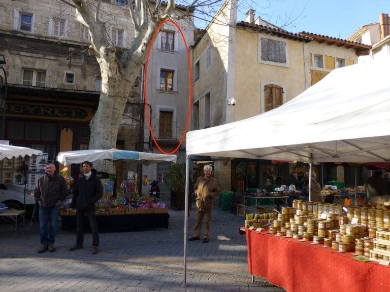
The apartment we are in is tall and thin. It is about 3 metres wide and 9 deep, occupying 3 floors connected by a very narrow corkscrew spiral staircase. The lowest floor (which is two flights of the same spiral stairs from the ground) has a kitchen and lounge; the second floor has the bedroom, bath and toilet; the third floor is a second bedroom/kids room and has a great view. Its thinness and stairs are part of the appeal – yet both lead to a inconvenience. But, hasn’t Eric done well to get the washing machine in. This place is excellent.

Monday 25 April. Day 18. We drove ESE to the south of the range of hills that runs to the south of the Luberon. Very difficult to make a living from these knarley old hills and very small plots. First, to Lourmarin (home of Albert Camus), one of the most beautiful villages in France. Coffee in a Mediterranean like village square. Surprised at the Rugby coverage in the local sports newspaper (4 pages) but in front of the 26 pages of football/soccer. Very winding and narrow roads with very slow badly driven cars. It must be terrible in summer.

We’ve been talking about the economic viability of the Luberon/Provence. Consider this. A few years ago, Luberon/Provence had many small hilltop villages scratching a sparse living out of tiny plots of land, villagers rubbing shoulders with a few painters, poets and writers down at the local tabac, most of the villages almost in ruins. Few or no tourists. Kids mainly leave because there is nothing for them here. Along comes someone who sees that the ruined villages could/should be restored – for beauty. A bit of money flows in and a few public building are saved. Along come a few people who see that there might be money to be made out of restoring, selling and renting houses. Villages are remade. Along comes Peter Mayle who wrote a book ‘A Year In Provence’ about restoring a house and the idyllic life. Tourists flocked in their hundreds to see and buy houses. A new balance. The tourists, by arriving, changed the idyllic world they came to see. The tourist influx is very seasonal: in summer a village might have 20,000 residents; in winter less than 1,000. House prices soar. A ruin that costs €10K now sells for €1.4million. Tradies flourish and become difficult to find – they are restoring their own investment properties.The locals resent the tourists but have little other source of income. Little industry survives: baristas, restaurants, house rental, plumbers, builders, renovation, subsistence agriculture. Kids definitely leave because there is even less for them here now. (Schools to only primary level.) Every summer, Southern Europe (Italy, Spain, southen France) fills up with nomads from the north seeking ‘sun’ and ‘dry’; the two main ‘products’ being sold. Plus the two levers ‘stay another day to see x’; and ‘fill in your day between meals/drinks/sex by doing y’. Is this viable? And for how long? Is it a useful method of transfer of funds from north to south? Can the region survive the exodus of its young? Who will be here in 30 years to service the tourists, restore the remains villages? Does this economic model not lead to a de-skilling: baristas not barristers?

It might not even be able to be changed. There is local resistance to changing the function of the old villages whose houses had been vacant for decades by, for example, installing a movie set or music festival. Locals want their tabac and the old ways. (It might be only 10 or 20 locals, but when they turn up on their tractors and block entrances, they get attention and projects stop.)

Tuesday 26 April. Day 19. To Gordes which was having the same market that Isle-Sur-la-Sorgue has on Sunday – same stalls and busking group. Crowded. In 1960s, Gordes was almost a ghost town. A lot of money has been poured in and it has been completely re-built. Teeming with restaurants, hotels and rental properties. Gordes’ location on its hilltop makes it look an idyllic spot.

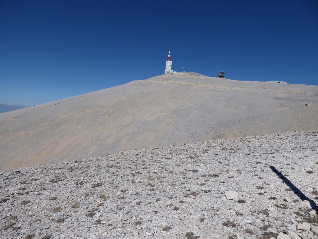
Wednesday 27 April. Day 20. A clear sunny day, so we drove up Mont Ventoux. Mont Ventoux is a major route for the Tour de France which will go up it again this year. This road is very scary. In 2013, when we tried to come up, the summit was closed with snow. This time the road to the summit was open – but temperature of zero degrees and 50+km/hr wind at the top – and the road barred to through traffic. Bloody cold. Ice on the ground and ice crystals being blown around by the wind. The 2-3 km close to the top are amongst the scariest bits of road I have driven. It must be truely terrifying on a push bike. We did pass 27 bikes grinding (or dancing) their way to the top – including several women. (On our way down we saw a cycle team on its way up. A tight group. These professionals would have to be climbing a route like this every day in preparation for a race like the Tour.) The lower slopes of the mountain are covered in forest. The last 10 or so km is through an exposed white limestone scree slope that looks like snow from a distance. This year, the Tour stage 12 finishes on top of Mont Ventoux. The photo left is the (exaggerated) profile of the last 16 km – black bits a very steep. Don’t forget that this is at the end on 185 km of racing and on day 12 with 9 days more days of racing to go.

Thursday 28 April. Day 21. We headed off to do part of the Rick Steves’ Cote du Rhone Wine Road. Cote du Rhone is a profligate wine producing area that mainly produces Shirah. We got as far as Seguret (=security) a small village clamped to its hillside and top that provided a defendable escape place throughout the Middle Ages which says a bit about what this area was like a thousand years ago – roving bands of thugs and bandits. Very narrows streets. (I suspect that there is a heritage listing over all the outside surfaces; insides are being ripped out and renovated; all being turned into apartments, rentals; few, if any, locals live here.) We tried for lunch at a very good restaurant Le Mesclun, but ‘fully booked’.

Lunch. Back to wine-making centre Gigondas (pronounced jeejondah) which is an excellent village that has had a lot of thought gone into making it attractive. We ate in the town square, under shade trees at ‘From Glass to Plate’ – very good. Helen’s favourite so far. Many good restaurants in town.

Pruning vines. We had quite a good look at the way the vines are pruned. Older vines were pruned more like a bush with four branches coming from the vine base. Modern pruning gives a single trunk to about knee high before two branches parallel to the ground; each branch has 2-4 ‘heads’ on each side of the main trunk from where the canes come. Constant pruning of unwanted canes to ensure that only grape-bearing canes remain. Vines are planted about every metre. Considerable effort is made to ensure to vines and canes get maximum sunlight. (Whereas we have a battle between too much sun – which can damage the fruit – and leaving too many shade canes – which take energy away from the fruit and can cause mildew or fungus if too much shade.) No shade canes here.

Friday April 29. Day 22. A planned day off. The main thing was, of course, lunch. The Mistral – which is just 100m down the street at the egde of the island. For me, best meal of the week. Tempted to text Eric to tell him we are staying an extra week. More about L’isle-sur-la-Sorgue. As the name suggests, the town is on an island on the Sorgue River. Looking at the number of streams and waterwheels, there might be more than one island. The ‘old town’ occupies pretty close to evey square inch of the island and was a weaving, milling town that had many water wheels. The newer, modern town (that we don’t see anything of) has spread well beyond the island. The outer edge of the island is ringed by a road – only two old mill building are on the outside of the road – between the road and the river. No parking on the island – parking places around the outside. The south-eastern edge of the island has restaurants overlooking the water. Today, we were on the western edge of those restaurants.