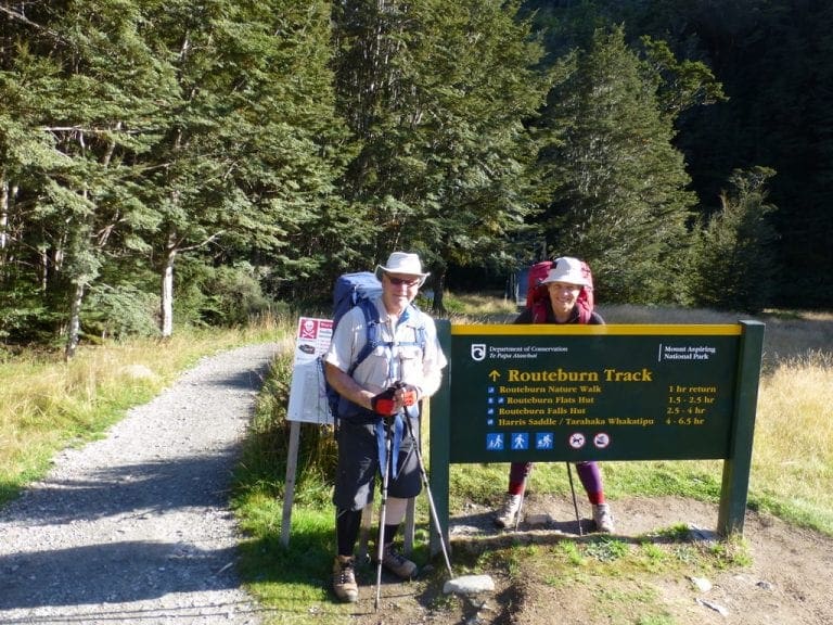
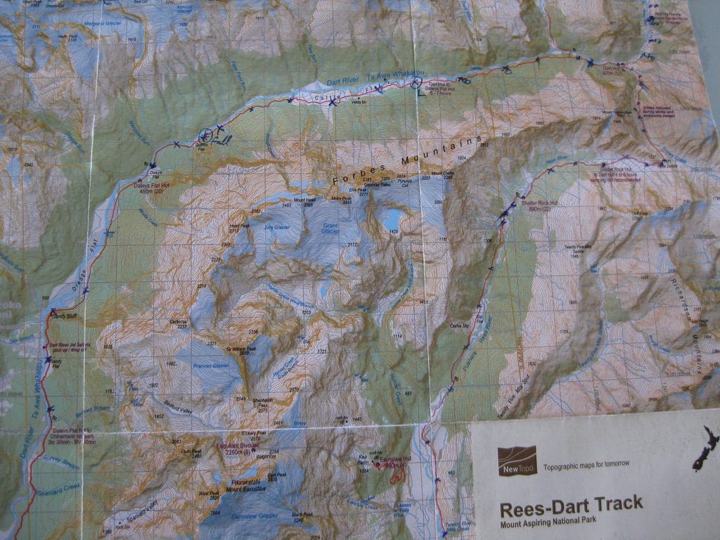
New Zealand 2011 Rees Dart Track
This and the next two posts describes our trip to NZ in March 2011. We walked two tracks. The Rees-Dart and the Routeburn. The Rees-Dart is a difficult, hard, demanding route. The Routeburn is a Great Walk. Both are excellent and my favourites.
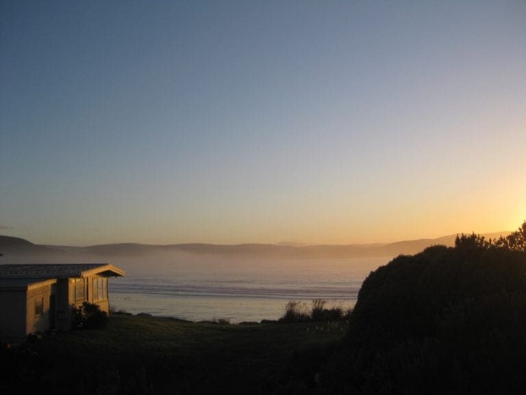
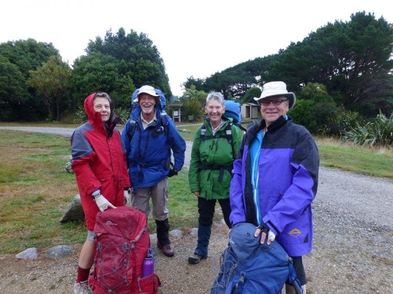
Mar 8, 2011 Tues. We are at Queenstown NZ at the start of our 26 days in NZ. Our plan is to walk the Rees-Dart Track (7 days), have a few days off, then walk the Routeburn Track (6 days). Both these tracks are accessed from Queenstown – one in Aspiring NP, the other in Fiordland National Park. We will be walking about 15km per day, carrying a heavy pack each, by ourselves and staying in huts. Planning for this trip has been intense. We began 6 weeks ago with a rush of blood to the head when one of us said ‘we could walk in NZ again’. ‘Yes’ was the reply. We mainly had to get much fitter than we were and lose weight. I had to lose at least 6 kg (no point carrying that extra weight as well as a heavy pack). With a lot of hard work at the gym, I lost 5.8kg as of yesterday morning. Helen is very pleased with herself as well.
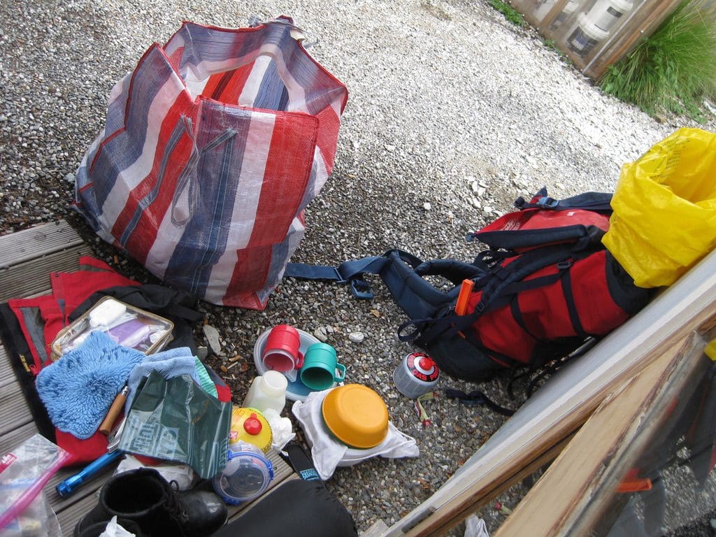
To get away was a bit of a marathon. Our checklists eventually covered 7 pages of my little notebook. Hugh and Jane (immigrating from Scotland) are looking after the cats and house. We were picked up by the Hills Shuttle Bus at 7am and delivered to Sydney airport, caught our Virgin Pacific Blue plane to Queenstown, passed through immigration from Oz and to NZ, had our boots inspected by NZ customs, got a shuttle from airport to hotel – all without effort or problem. We are at a backpackers in Queenstown called Aspen Lodge (identified by the aroma of funny cigarettes – or perhaps that is just Queenstown). It was quite an effort to get all the equipment into the packs – especially the walking poles which had to be taken apart, wrapped carefully, and put in the middle of my pack – surrounded by sleeping bag, clothes to walk in, warm clothes. The first job when we arrived was to unpack the packs and sort out all the gear into – going with us on the track and staying in Queenstown. We then had a trip downtown to buy gas (for cooking), pack liners, map of the track, and permits to stay in the huts on the Rees-Dart. (We will spend 7 nights in the huts, so it was marginally cheeper to buy six-month passes, rather than single passes for each night. Rees-Dart track and huts are owned, and operated by the NZ Department of Conservation. It is a wonderful little money spinner for them. I will report on each hut as we get to it. On the Rees-Dart, I am expecting fairly basic huts with cooking space and sleeping mats for about 20-32. We were told today that the Dart Hut is still packed with climbers from the Mt Aspiring climb and that we will be lucky to get sleeping mats. Bummer. The Routeburn on the other hand has much more luxurious huts – pre-booked places, gas provided, cold running water, $50 per night each. We will get to that later.) We ate at a hole in the wall that sold Ferg-burgers. (A woman on the shuttle this morning had recommended them.) We counted 10 staff working like crazy to serve a horde of customers – certainly the place to eat – exceptional burgers. A beautiful sunny day in Queenstown.
Why and what is a pack-liner I hear you ask. Well, it does rain here and there is no such thing as a waterproof pack. The pack-liner is a big plastic bag that goes inside your pack so that your clothes and sleeping bag will be snug and dry. (A few years ago, after a day of very heavy rain on the Routeburn, we arrived at a hut to find all these people (who had been too miserly/stupid to pay $10 for a pack-liner) moaning about their wet sleeping bags and clothes. Not much sympathy from me. (In a real emergency, the pack-liner is big enough to get inside, out of the wind and rain. Might save your life.)
Now, I hear you ask, ‘why are you doing this walking in wind and rain for days at a time’. I wish I knew. But, there is something that keeps drawing us back. It is not the views – I’m not much taken with views. There is something about carrying all necessary possessions and food on your back over difficult terrain in difficult conditions that does appeal.
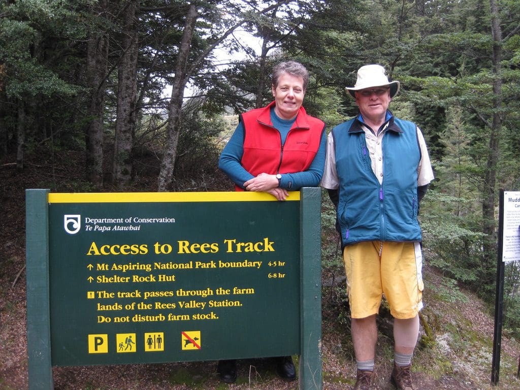
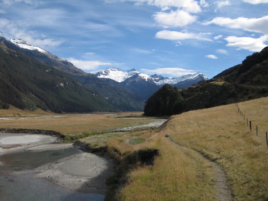
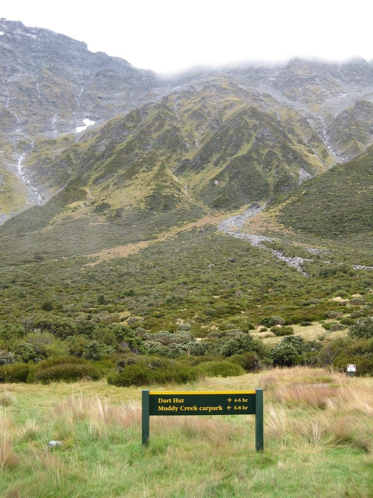
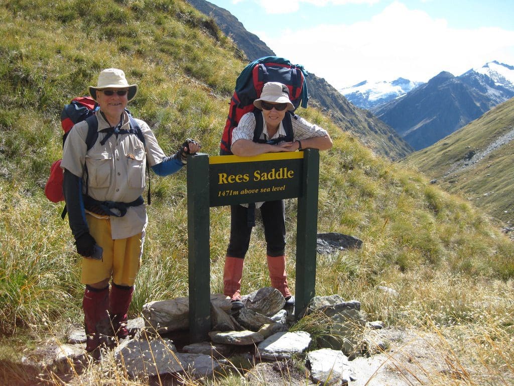
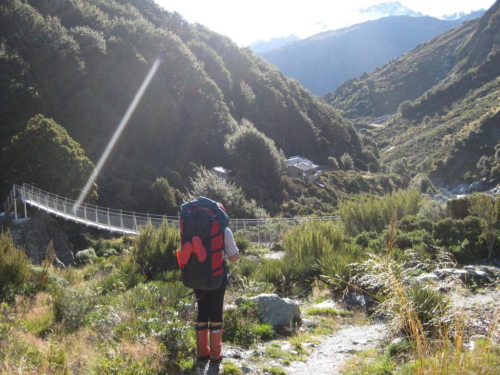
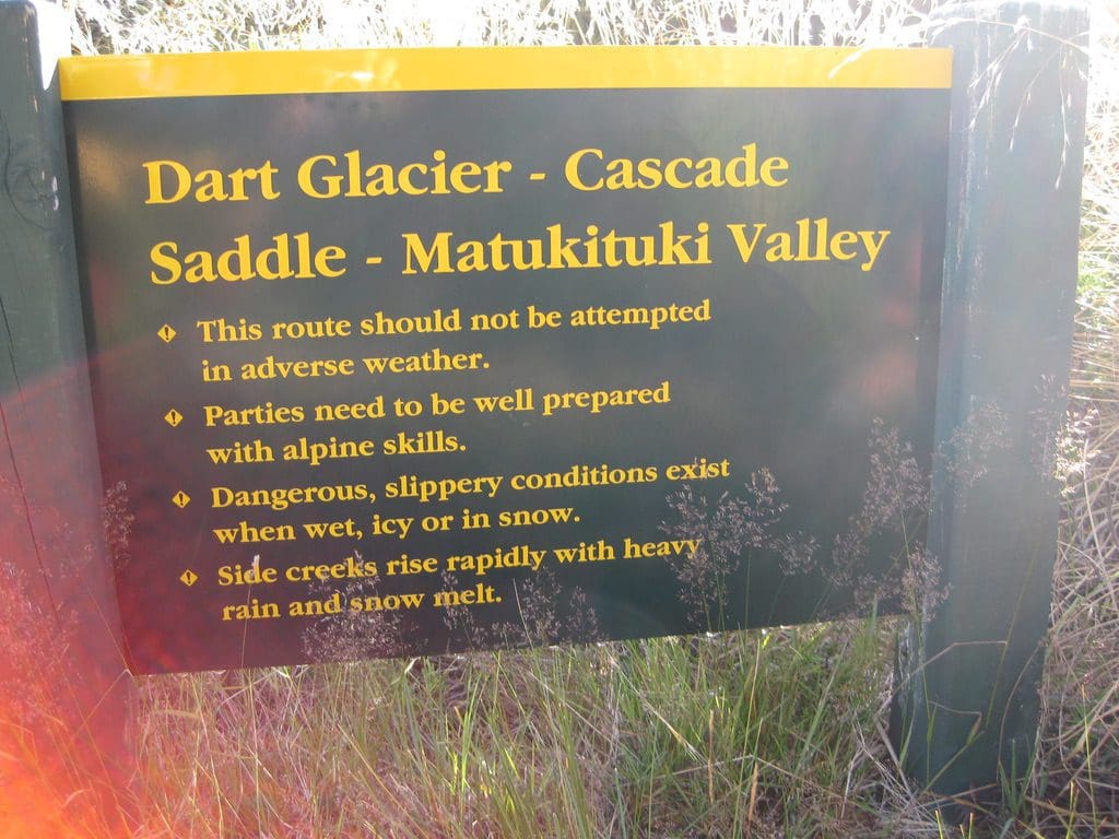
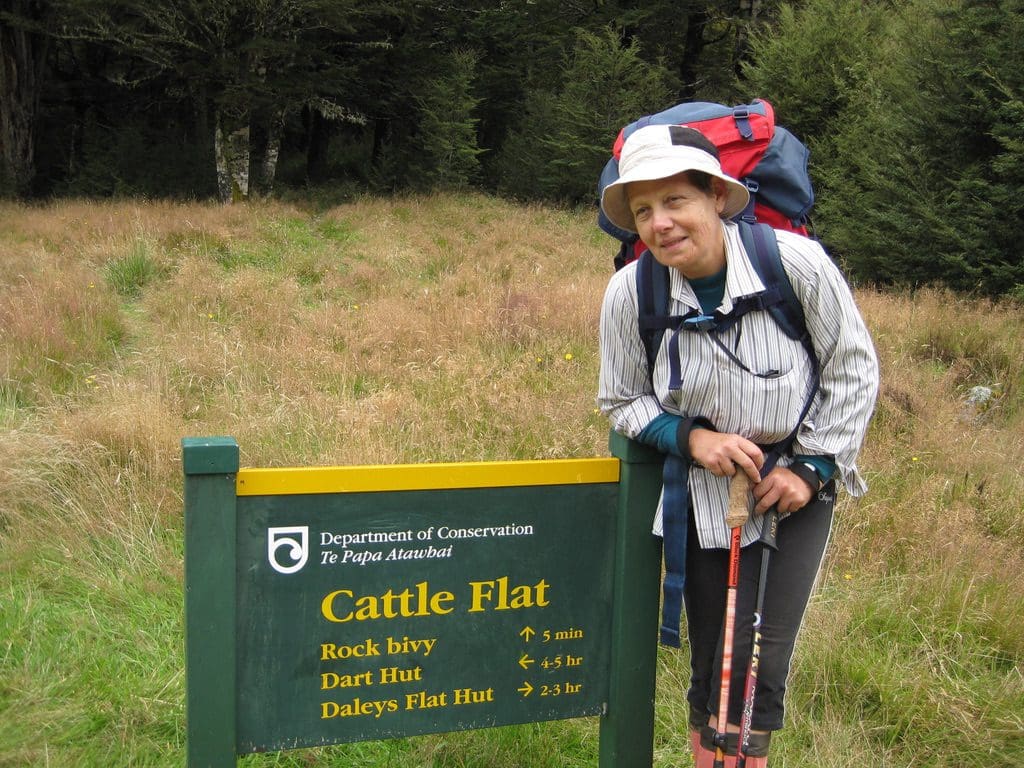
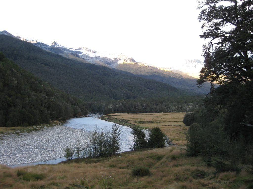
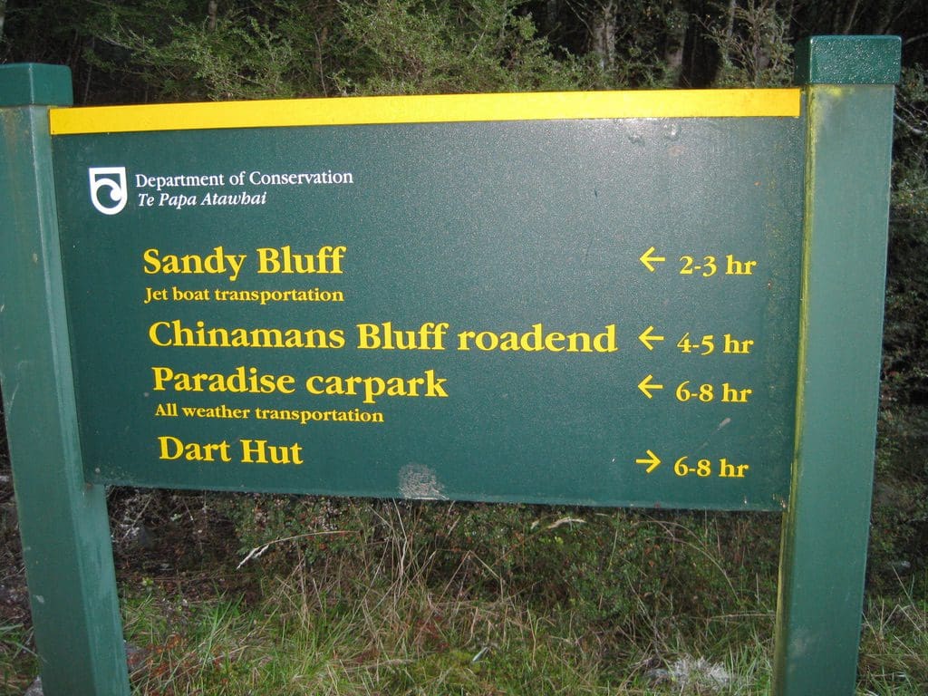
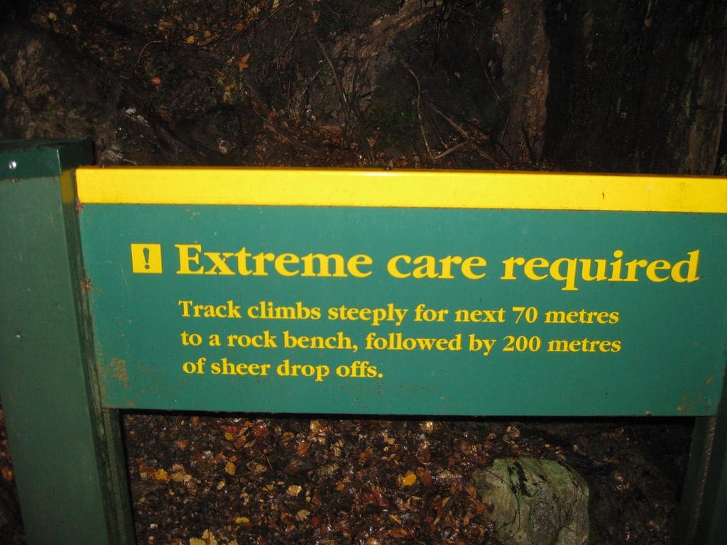
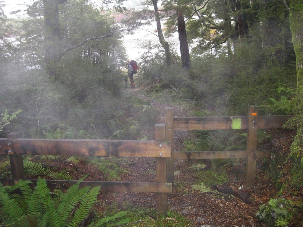
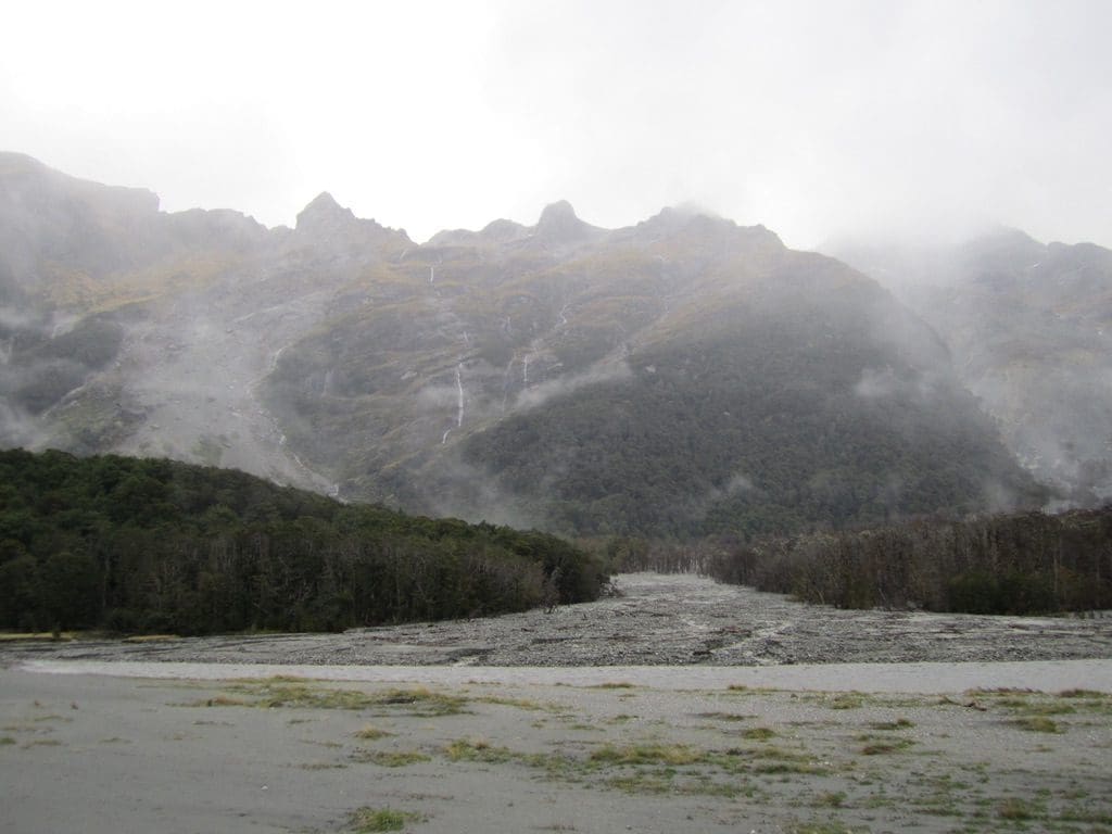
The plan sounds fairly simple. First day, delivered by bus to Muddy Creek (descriptive?) (about 450m) walk 15 km up along the Rees River to a hut (890m), spend two nights there, walk up a very steep section over the saddle (1471m) that separates Rees River from Dart River which attaches itself to glaciers and Cascade Saddle that heads towards Mt Aspiring, then descend steeply to Dart hut (920m), spend three nights there. Walk down the Dart River for 15 km to another hut (460m) (we have read about and been told about very difficult river crossings with heavy rain along this bit) and spend two nights there. (We’ve allowed a few extra days at huts because we are older, and because changes in the weather might prevent progress on the appointed day.) Then walk five km further down the Dart to where we will be picked up by a Jet Boat and delivered to Queenstown. Sounds simple, does it not. We shall see how we go!
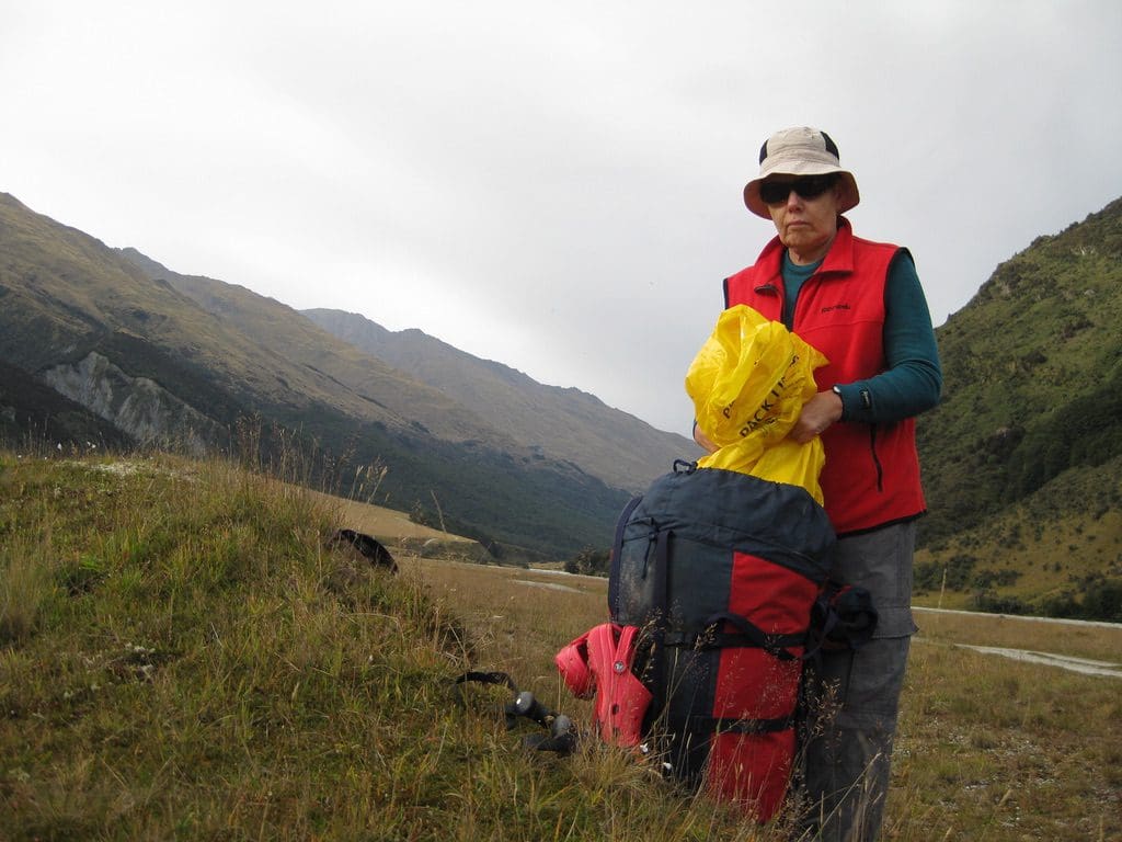
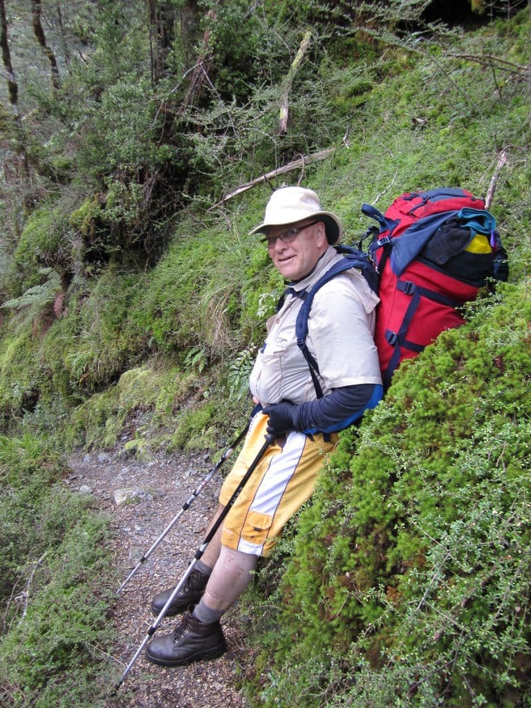
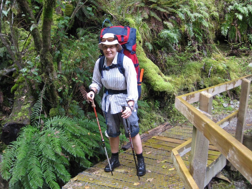
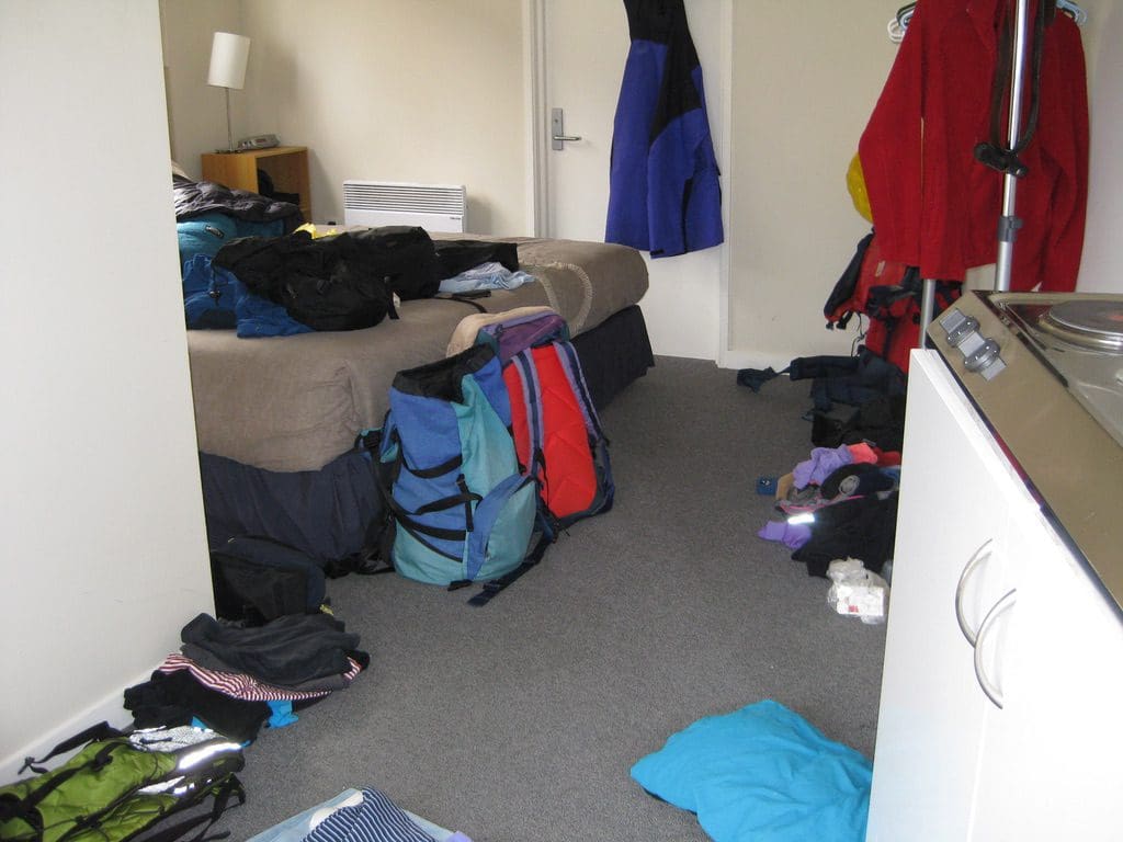

Mar 9 Wed Queenstown – We are packed. We spent the morning (after a very late start) hunting up our supply list in the Supermarket. (Oats, cheese, powdered milk, chocolate, rice, you get the picture?) Helen had fish and I a very hot lamb vindaloo at Bombay Palace for lunch (excellent). (BTW, the queue at Ferg Burger was winding along the footpath – definitely the place to eat!) Then, back to the room to pack! All in. I think (guessing) my pack will be about 18kg and Helen’s 15kg. We’ve found in the past that it is best to have that kind of difference between the pack weights so that we end up walking together. We’ll adjust it more as we go. As well as my clothes, I have the freeze dried, rice, spare oats, spare gas, block of cheese, salami?, medical kit. Helen has her clothes and all the rest of the food, the plates and cooking gear. The packs will reduce in weight as we eat our way through that food – 1/7 of the food weight each day. We will have eaten 28% of the food by the time we struggle up that saddle. And trotting along with empty packs when we get on the jet boat. Much to Helen’s amusement, I dug another hole in my belt. It used to fit a few weeks ago. Tonight, we’ve had our last showers for a week. All packed and ready for the bus to pick us up at 8am tomorrow.
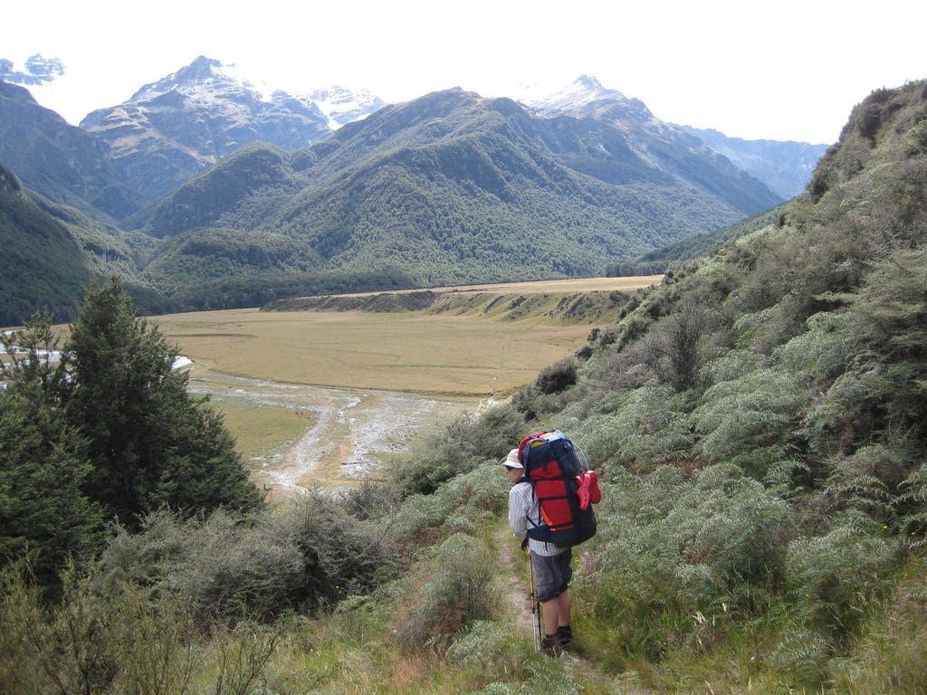
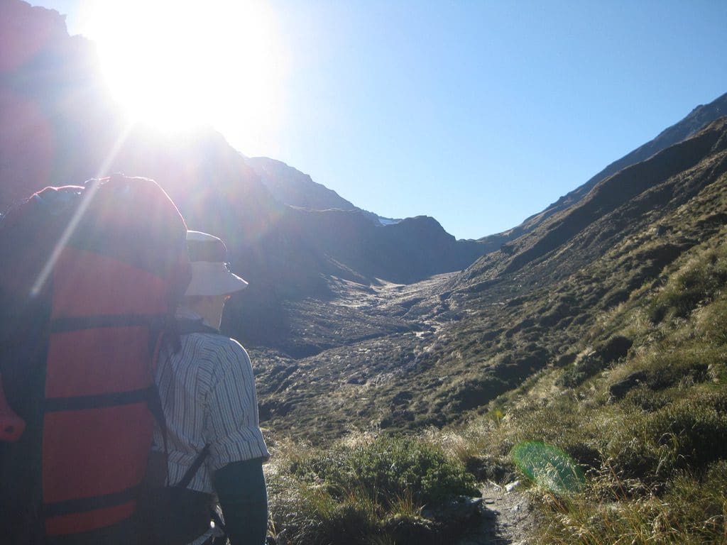
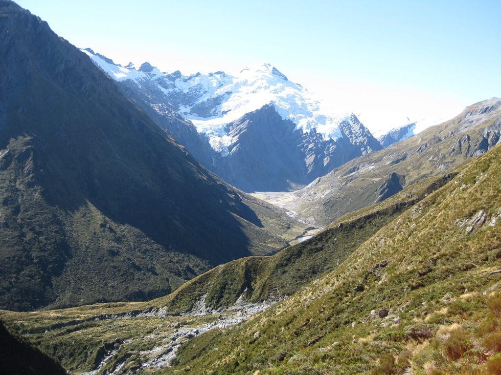
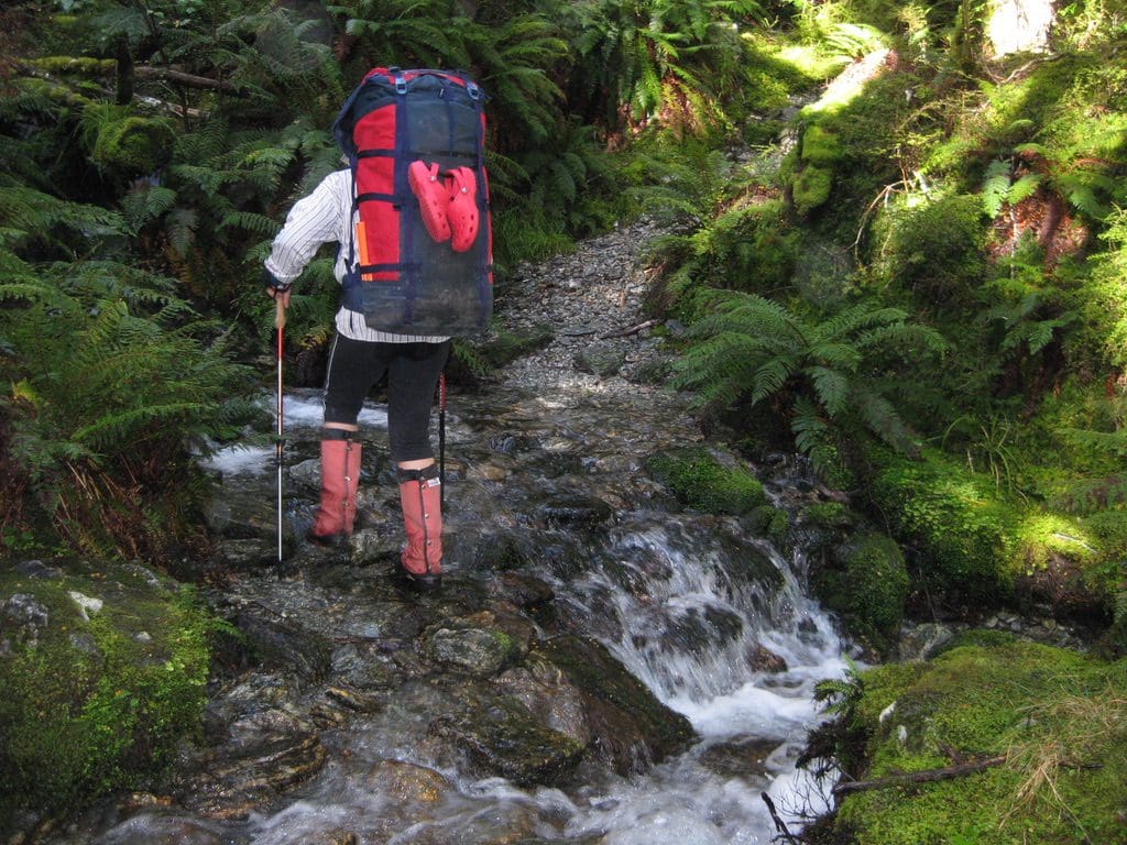
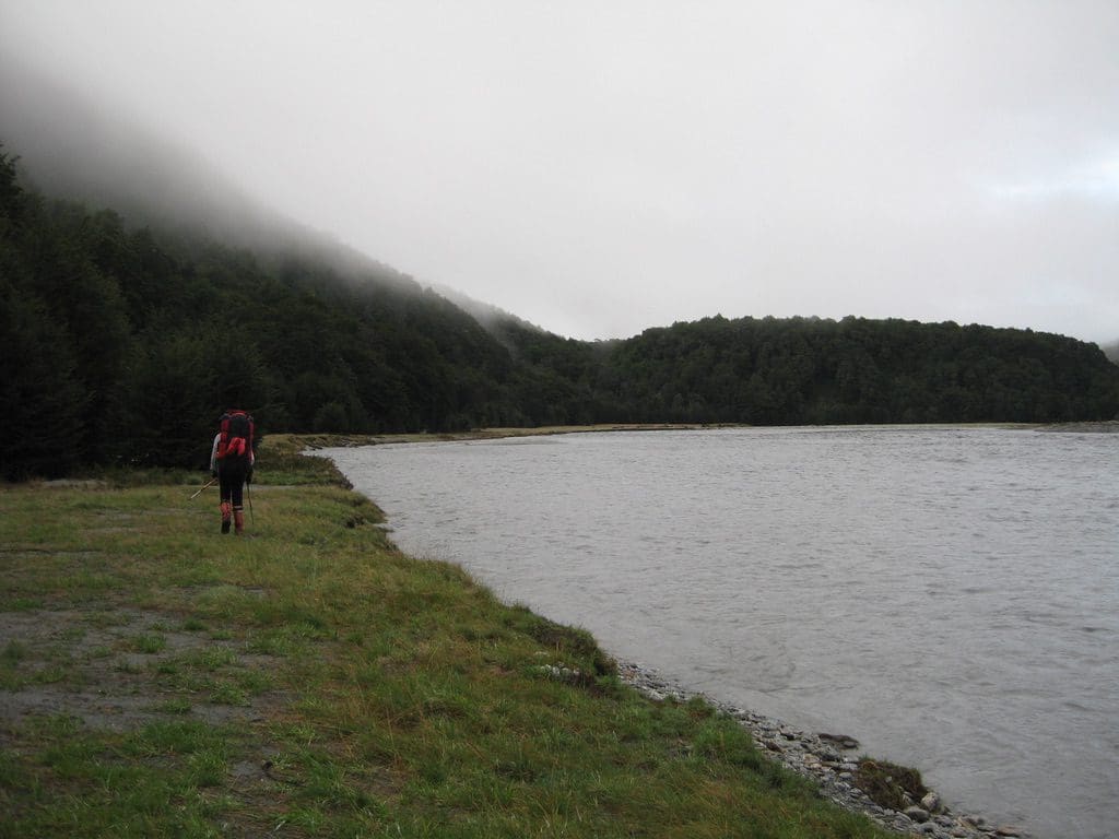
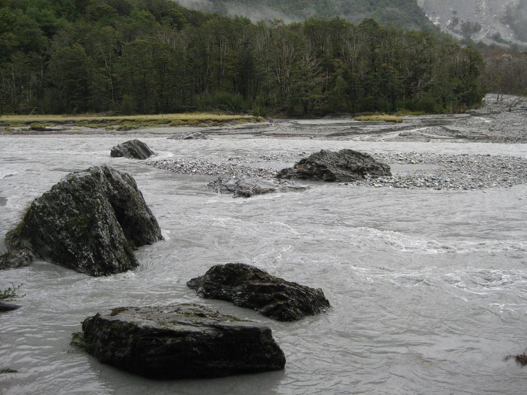
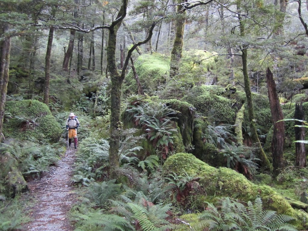
Mar 10 Thur. Walk to Shelter Rock Hut. This was about as hard a walk as I have ever done. 15km with height gain of 400m. Initially 1.5km along a road, then along the Rees River flat (except 2-3 times when the track took to the ridges to avoid bogs). And there were bogs. A track where it is impossible to keep your socks dry. We had been warned about 25 mile Creek (which has a bigger catchment than the Rees River). All morning we were walking towards a glacier that overhung our flat-bottomed valley.
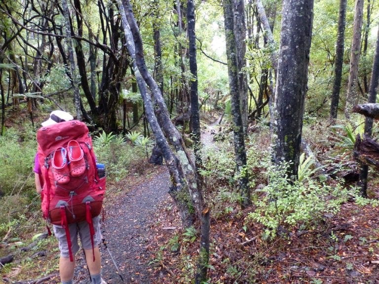
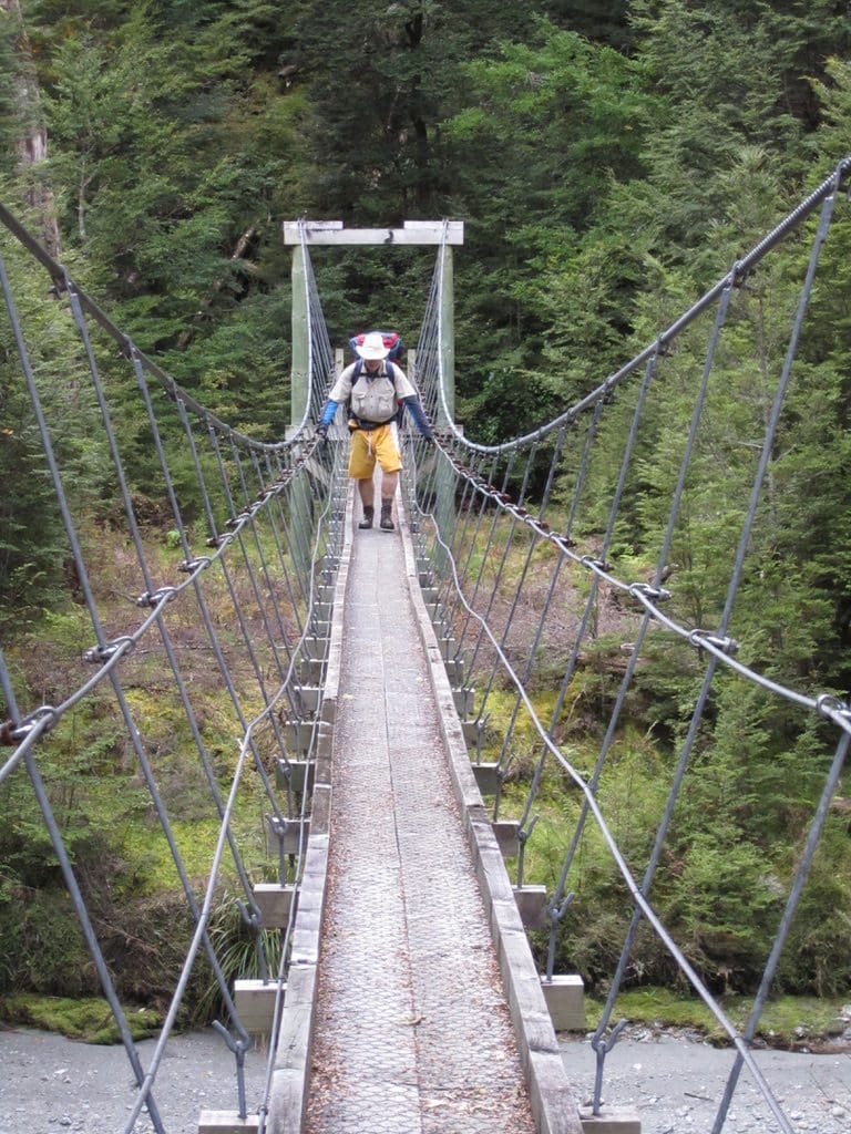
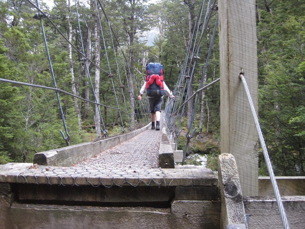
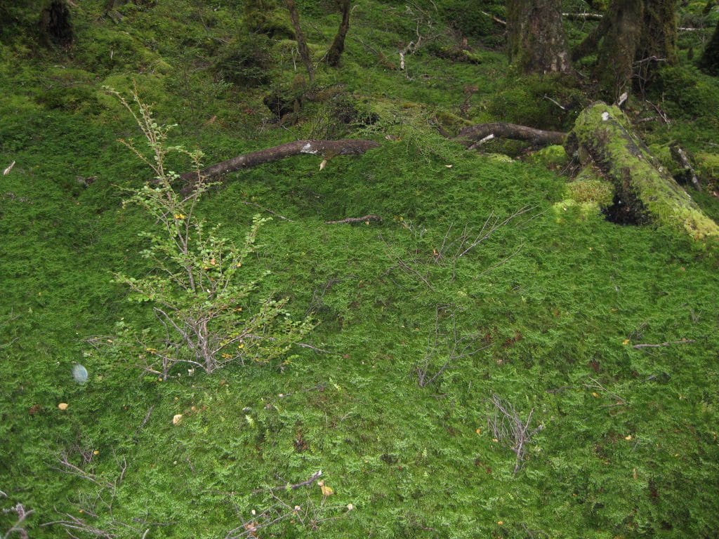
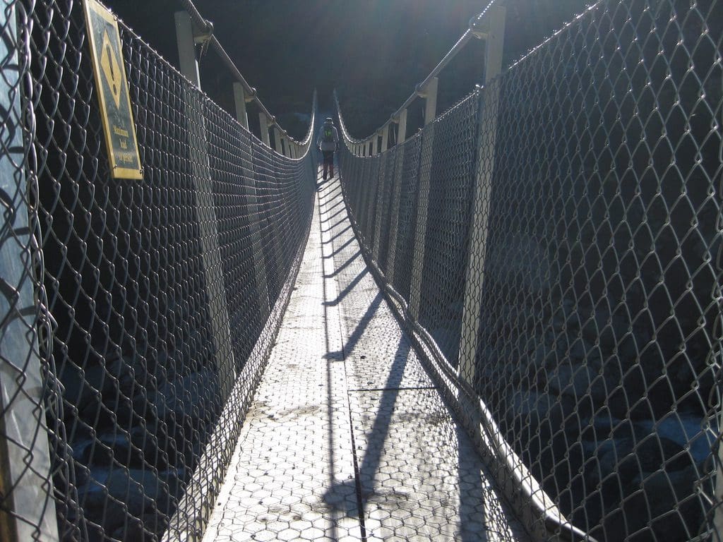
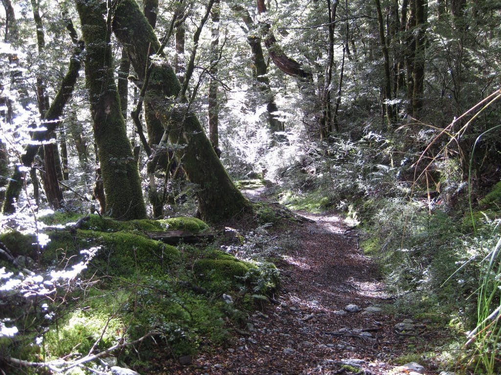
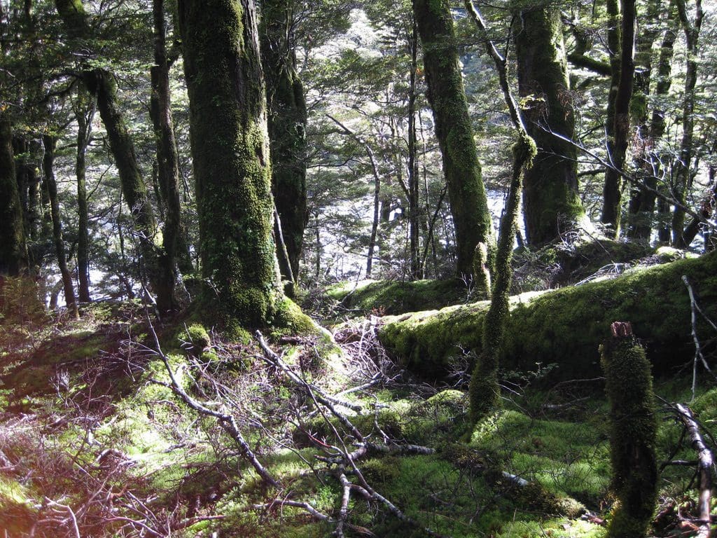
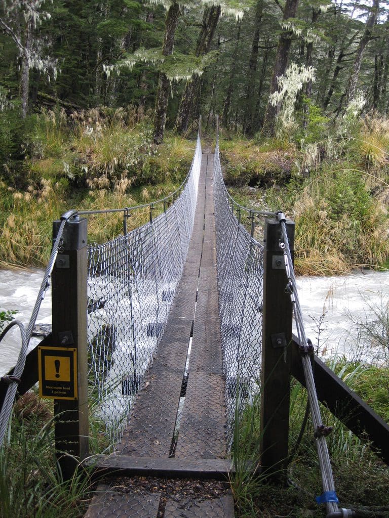
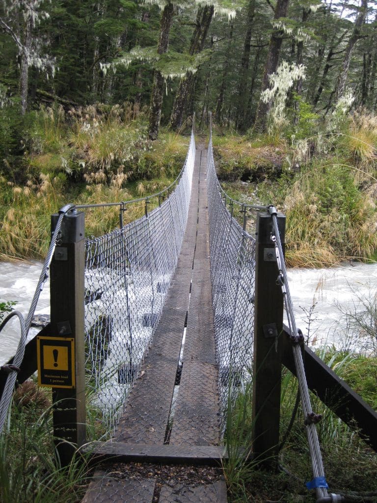
We were picked up at Aspen Lodge a bit before 8am. (We managed to leave the lunch and a water bottle on the side of the road when were getting into the bus. Damn! The kindly, chatty driver stopped for us to buy lunch.) We went back to our old method of walking – 35 mins with packs on followed by a 10 min break. With this pace, we could do about 3km/h. This year, we are a bit slower. I also underestimated the weight of my pack – which I think is 20kg. I’d forgotten about the 1kg of water and I did end up with those salamis. At the end of the Rees River flat, we entered the forest, crossed the swing bridge and began the climb – it also began to sprinkle rain. Just inside the forest is a beautiful moss forest – very puffed up with water. The climb was brutal. These kiwis do like to go up and down things. The tracks is good in part but not so good when it winds its way up and down a creek crossing or land slip.
All the work we did at the gym was far and away an inadequate preparation for the walk. One climb out of one creek was equivalent to a pump class. The 20kg pack has a mind of its own and needs to be carefully controlled to stop it throwing me over a cliff – which it almost did many times.
The 15km walk took us 9 1/2 hours. We did not get to the hut until 7:20pm by which time we were getting a little anxious. The last 3 km were very long. Very stiff and sore little bunnies at night. Two people in the hut had tried to do the Saddle over to the Dart today and failed – too scary. They were telling everyone not to do it. I tried not to listen. We will have to judge for ourselves. I was aching so much when I went to bed that there was no chance of sleep. Anti-inflamatories helped. Slept to morning. Woke stiff and walking like a sailor. A very long brutal day.
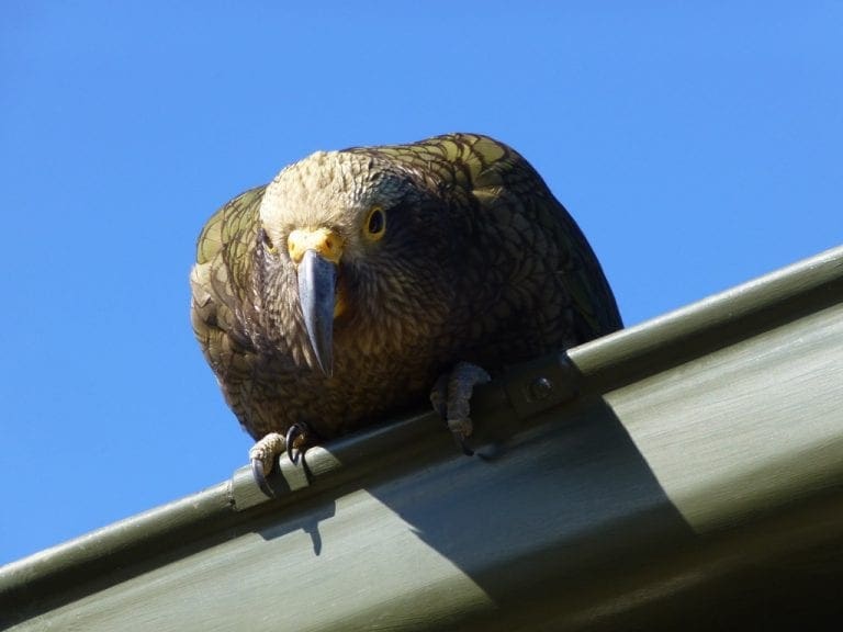
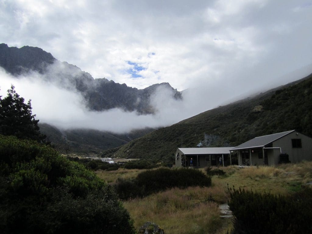
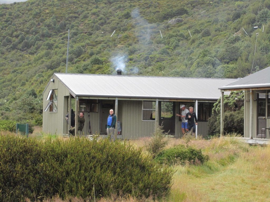
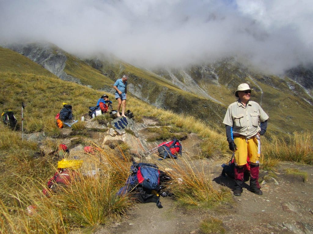
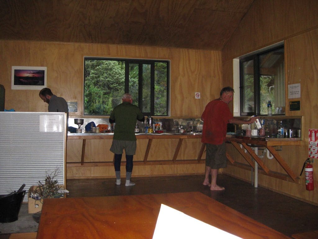
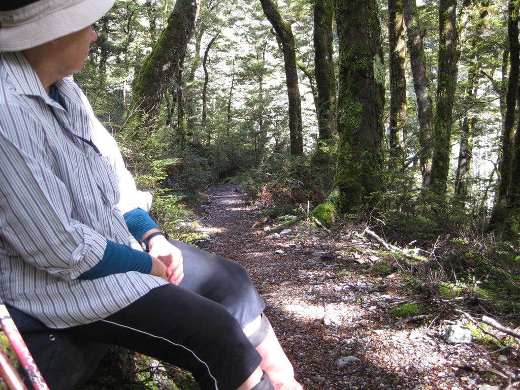
Mar 11 Friday. Day off at Shelter Rock Hut. It rained fairly steadily all morning. None who were intending to go to Dart have done so so far. Sitting around chatting, reading & writing. The Hut sleeps 23 – 7 in the kitchen & 8 in each of 2 bunk rooms. Flush toilets, cold running water, stainless steel bench tops, coal fireplace. At about mid-day, a party of 3 hunters arrived complete with rifles and 22 cans of beer. Very friendly and extremely practical young kiwis after chamois and, as I write, sitting on the hut verandah scanning the hillside opposite with binoculars. All those who were not staying over, left when the rain stopped – 4 kiwis and a young American (Lincoln) who is extremely experienced in the outdoors (on his way back from a year guiding in China); 4 kiwis went back down because the track is too tough. We spent some of the afternoon looking at chamois through the binos. One hunter went up the mountain to try for one – unsuccessfully, the Keas gave the alarm & sent the chamois up the hill. Interesting sitting at this huge panoramic window looking in detail at a mountain-side with discussion about the best way to get to parts of it. The excitement and impatience of the hunters was obvious. Extremely practical people, New Zealanders. First incoming trampers arrived at 3:30pm (after being let off at 7am by the bus at Muddy Ck – 6 1/2 hours). As the day has progressed, I have begun to get a little less stiff – still walking like a sailor because the quads and hips don’t want to do anything. Four more people arrived at 5:30pm – still with energy (which is more than I had yesterday). Thai Chicken Curry (with added rice) for tea. Excellent. It was the first packet grabbed from the bag. Tonight is a very different group of people. Last night people introduced themselves and chatted. Tonight, a group who demand how things work, want the fire lit for them, windows shut. Wingeing arseholes who know everything. Guessed their elevation – no need to look at a map. The knowall bloke kept throwing coal on the fire on a hot day making the hut unbearably hot.
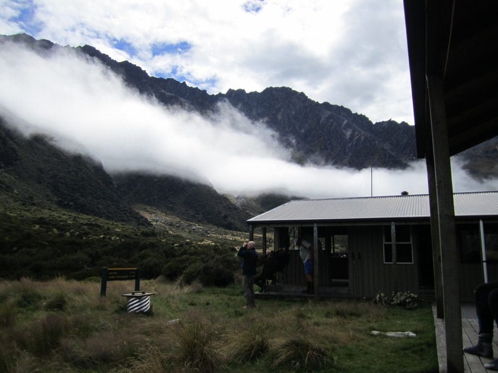
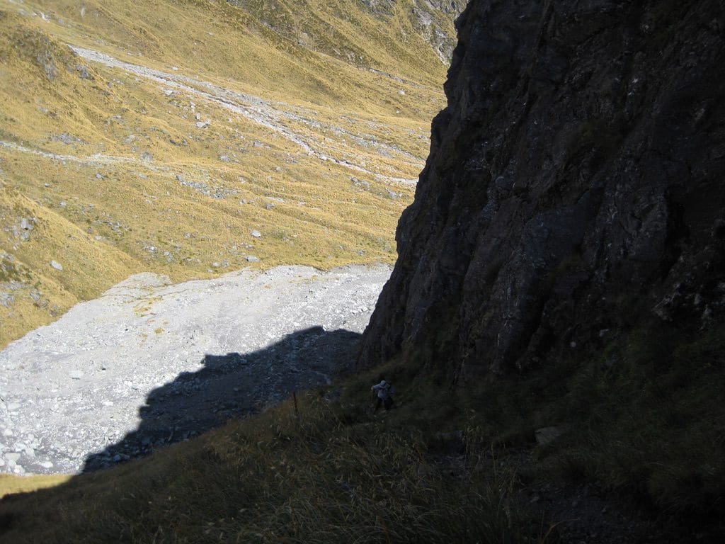
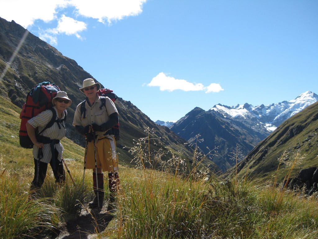
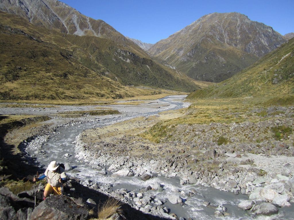
Mar 12 Sat. Now at Dart Hut. Another brutal day. I had set the alarm for 7am and we got away (first group) at 8:30am. The first half of the walk is a slog uphill from 890m to 1471m. Most of that 581m rise is just a constant grind over 6km. We just plodded along and 4 overtook us. Up a wide high energy V-shaped valley between 2 rugged ridges. The last bit of the climb is up a very steep pitch close in to a bluff. Hard work, but not dangerous – good footing all the way up. Hard to believe that this is the very pitch that caused the two at Shelter Rock to turn back and warn everyone how dangerous it is. It is not dangerous at all. Difficult does not mean dangerous. The good news was that one of the party that had passed us came back down the steep pitch to carry Helen’s pack up, That certainly helped. The second part of the walk is to descend to 930m. That 541m descent is mainly achieved in 3 steep pitches – 2 of which are very steep. Buggered me. Especially the last one. We could see the Dart Hut about a 1 km away but I found it very hard to get down – quads failing, knees not wanting to do another thing. Difficult to keep good foot and knee position when the rocks keep moving your feet, or stop your foot from rotating, or your pack gets nudged by a bush or rock while you are balanced on one pole over a 300m drop. Did I mention that most of the steep descents were on a cliff face that dropped to the raging Snowy Creek. We got in at 6pm – ie 9 1/2 hours (including stops). A bloody hard day.
The underfoot of this part of the descent is worth describing. Usually, it is a waterway – sometimes rocks, stones and pebbles higgled y piggledy – loose, firm who knows till you stand on it. Mostly steps at step height or bigger or much bigger. I lost count of the number of times I sat and wiggled my way down. Once we both had to take our packs off and lower them down. (Helen did this twice.) This certainly meant that looking at the scenery while actually walking is very dangerous. We have our pack-offs every 35mins for that. Plus numerous halts to gaze about and oo and ah at the grandeur around us.
I was trying to think of a Body Pump class that would be equivalent (or training for) the walk today. I think a 6 hour pump class – just squats, back & hams and abs (forget biceps, chest & shoulders). Perhaps a 20 minute ‘plank’.
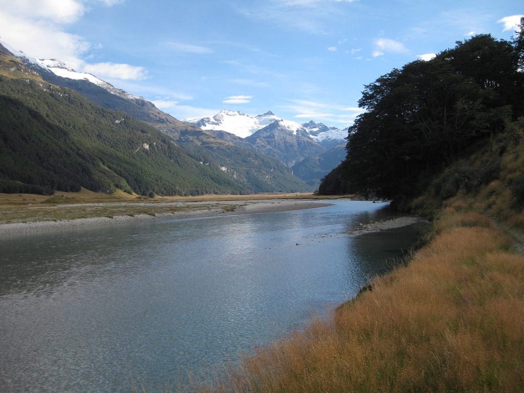
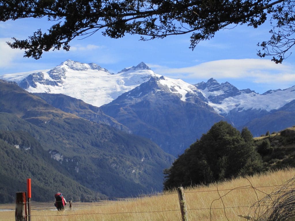
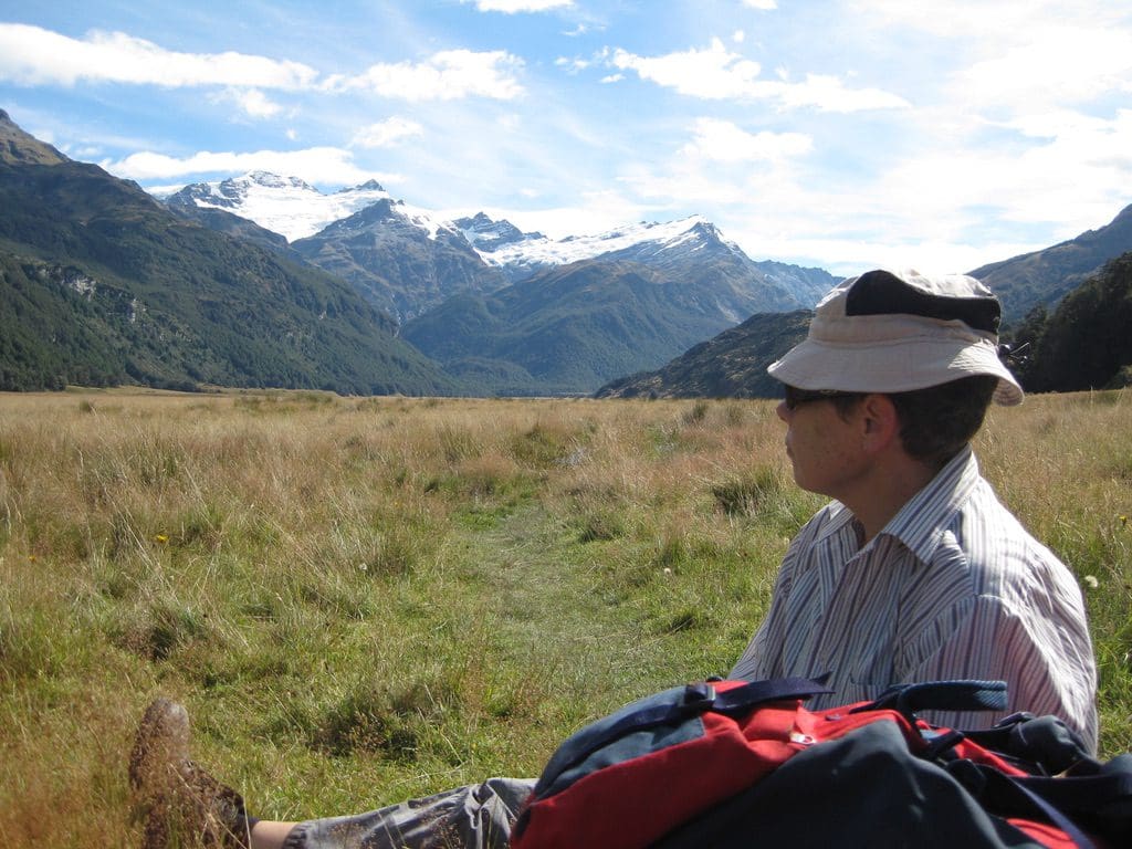
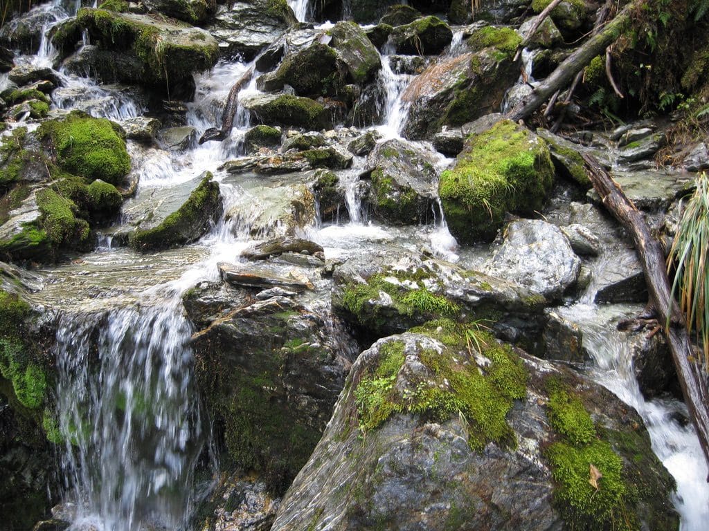
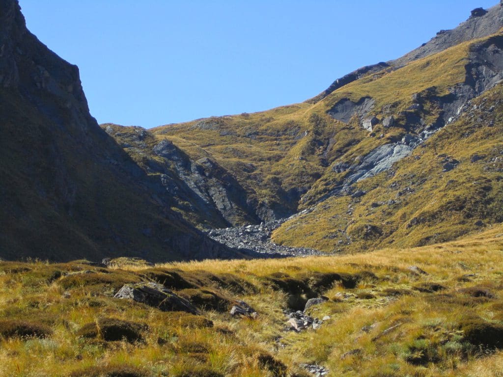
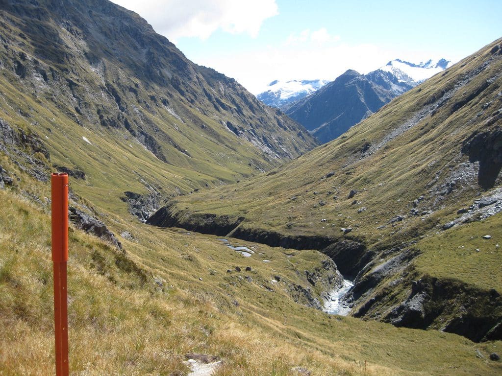
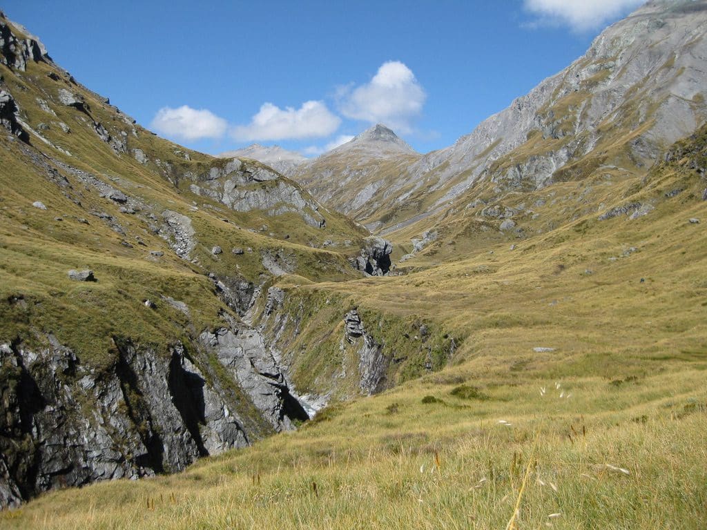
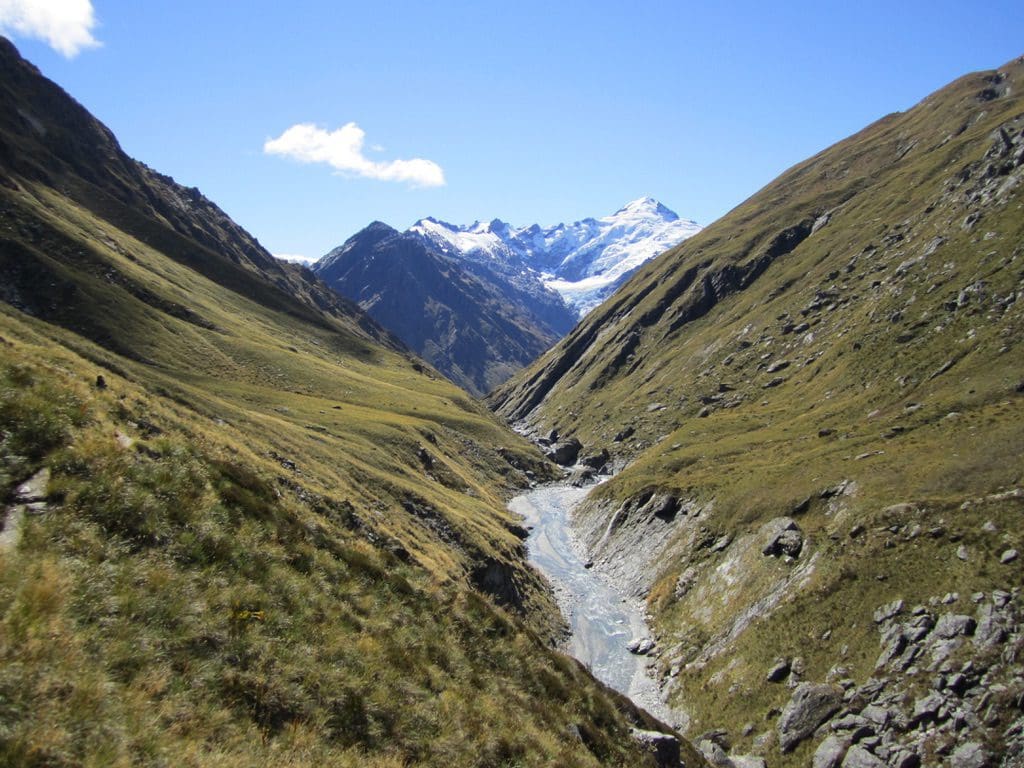
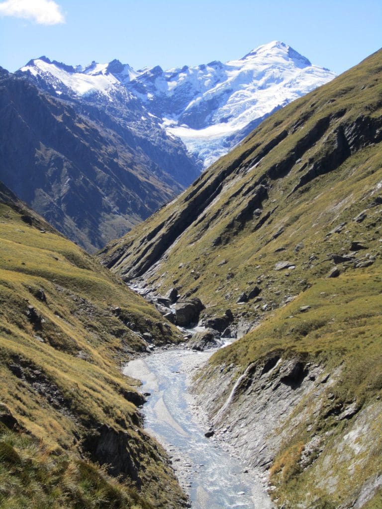
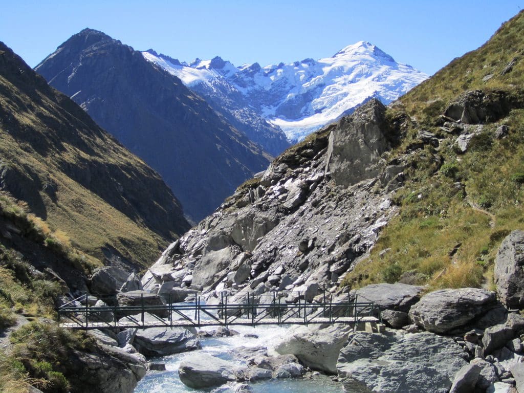
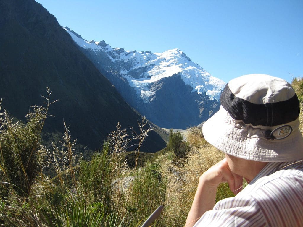
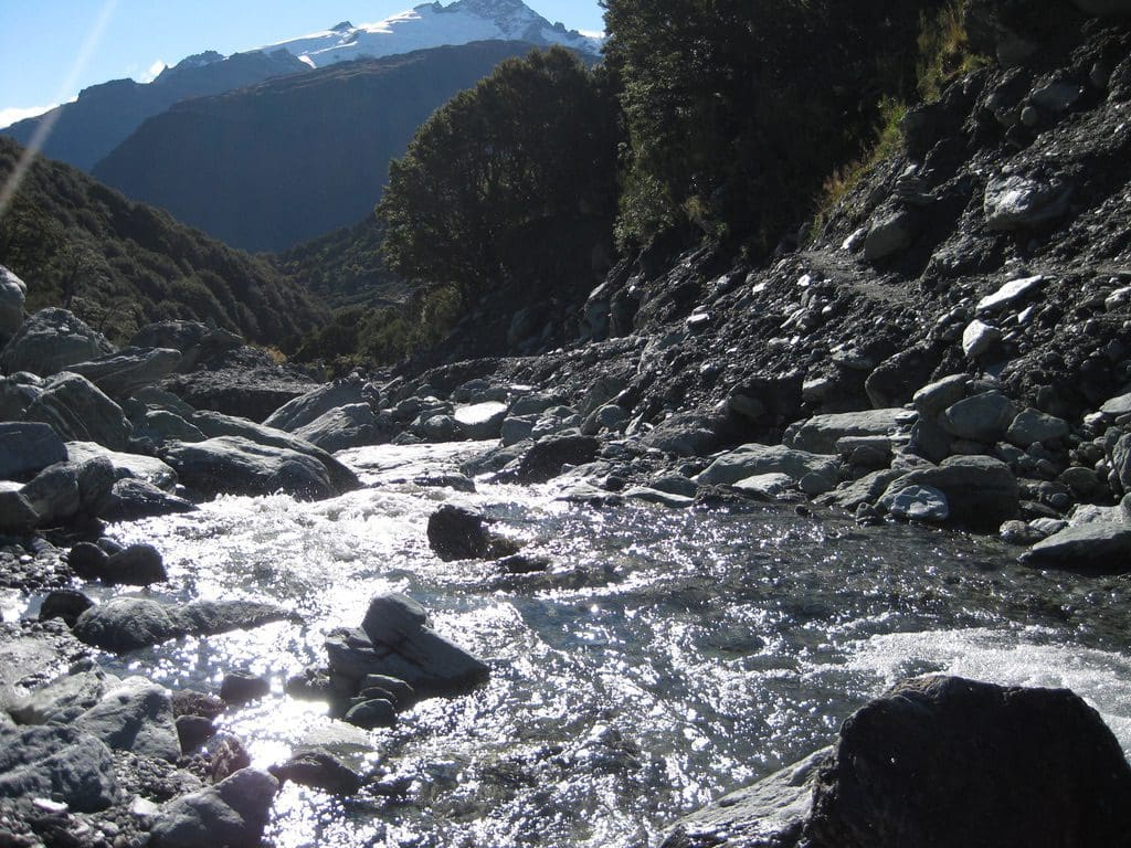
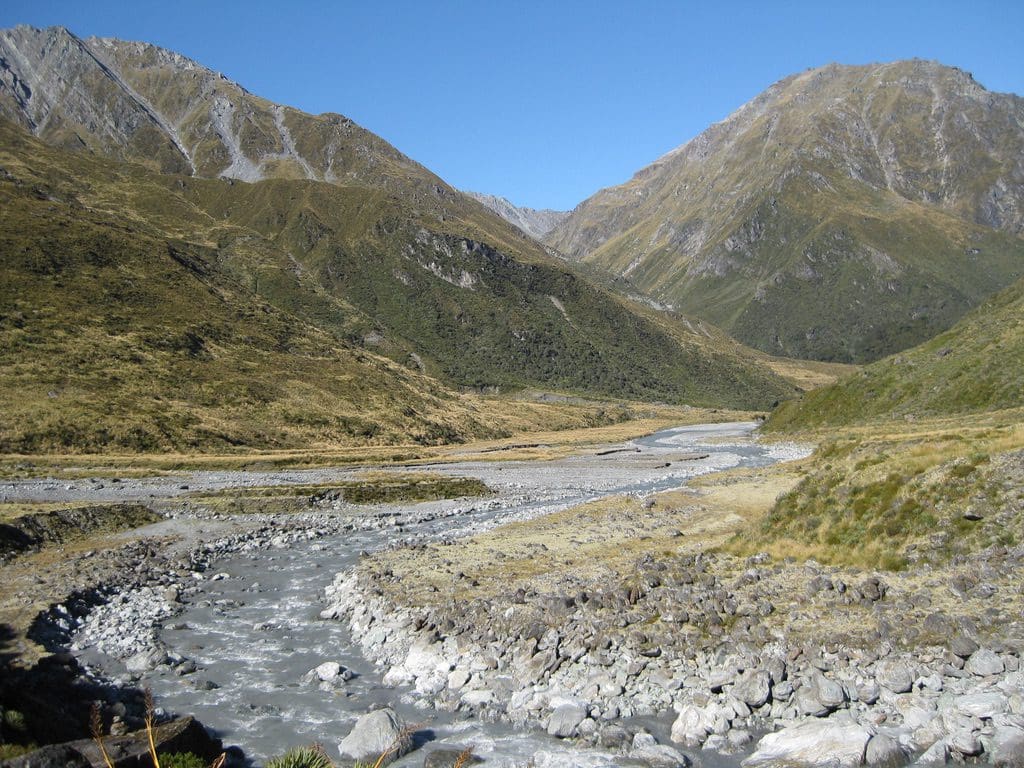
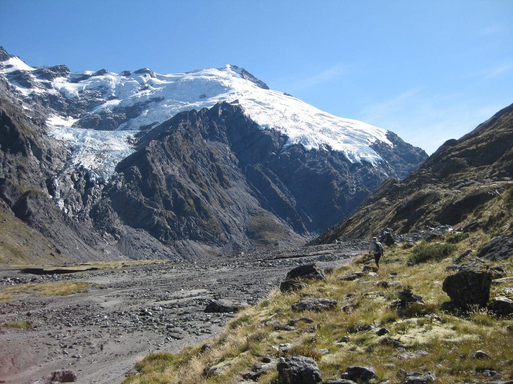
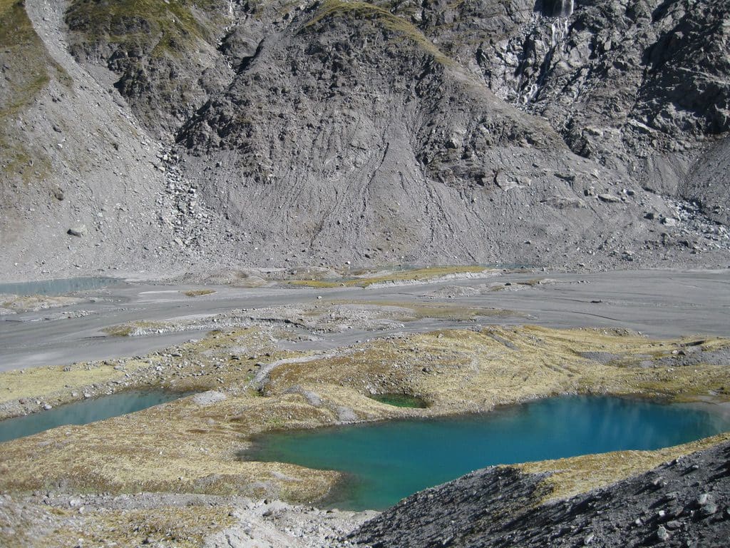
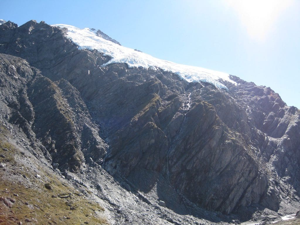
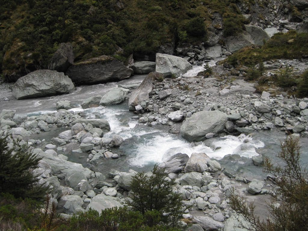
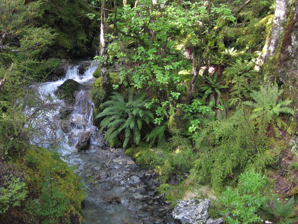
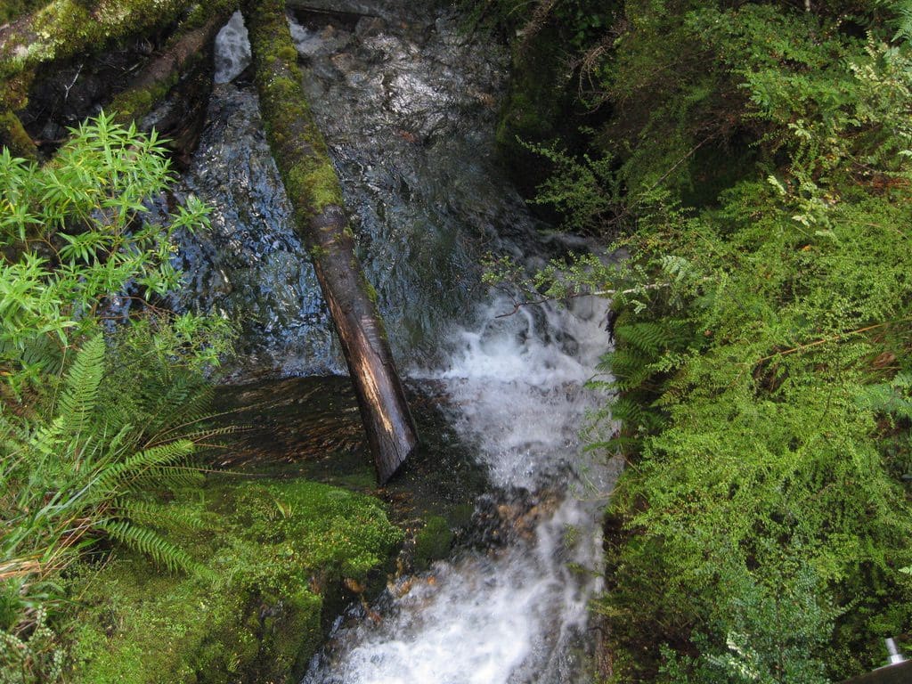
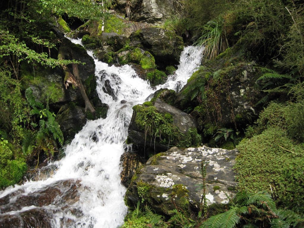
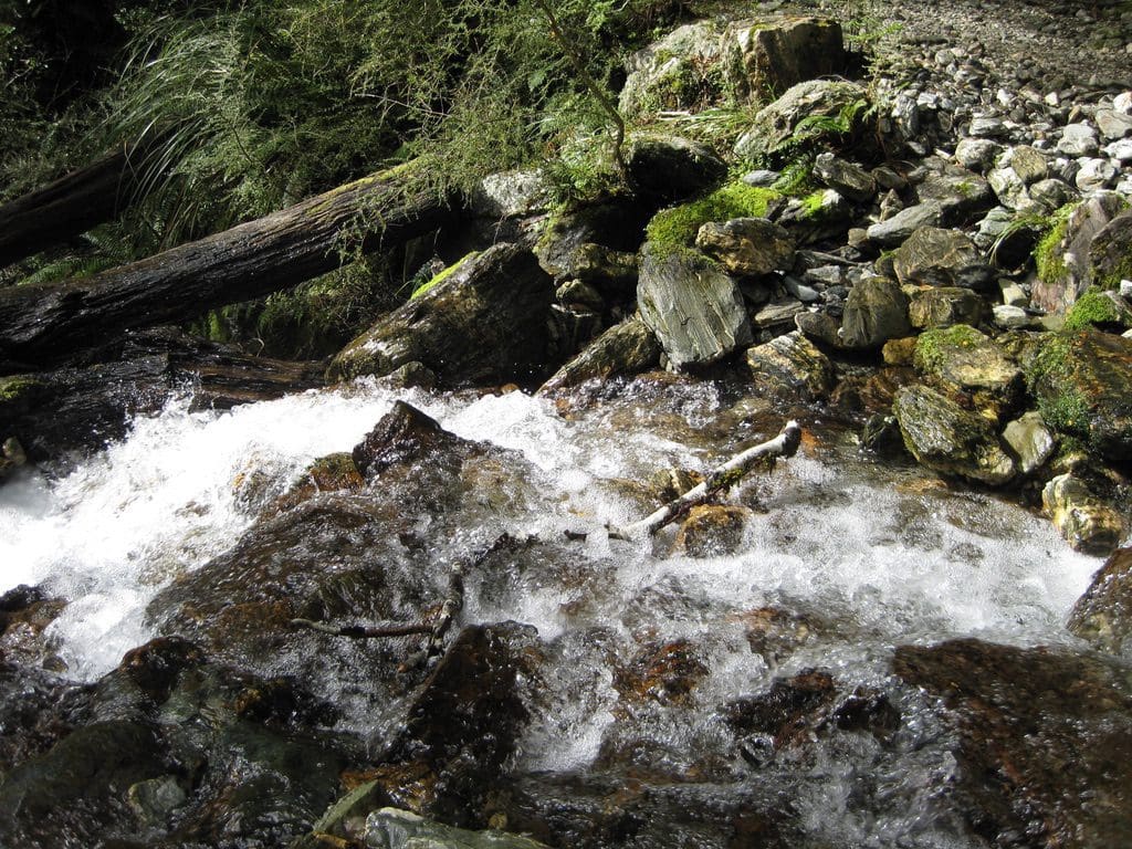
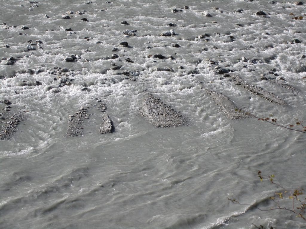
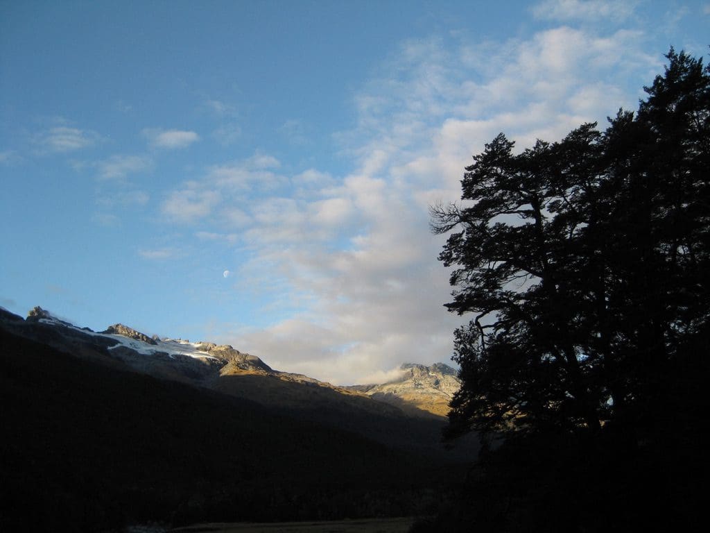
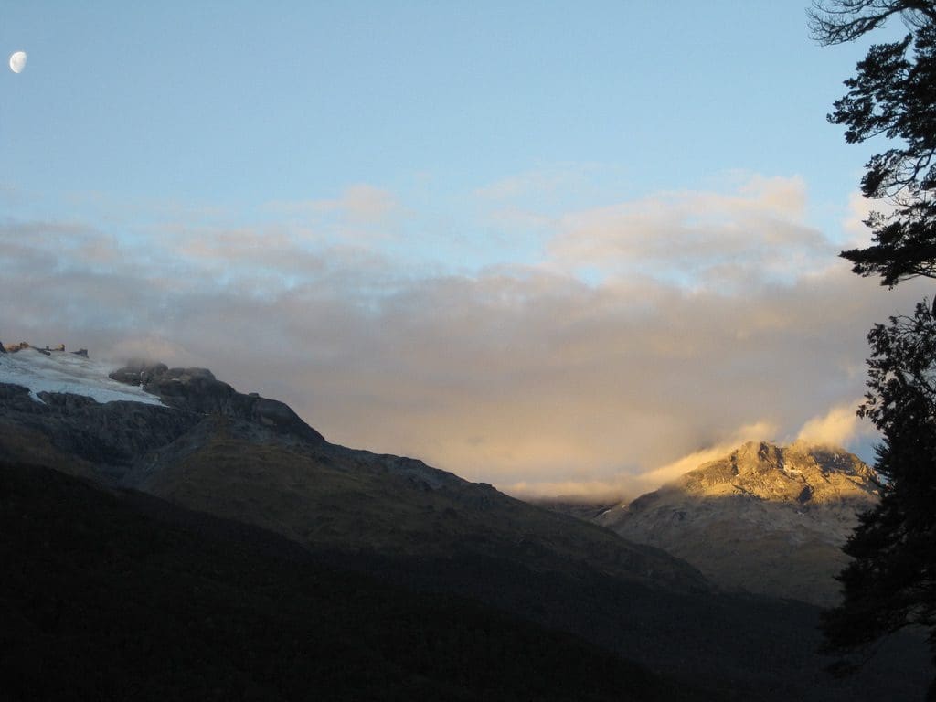
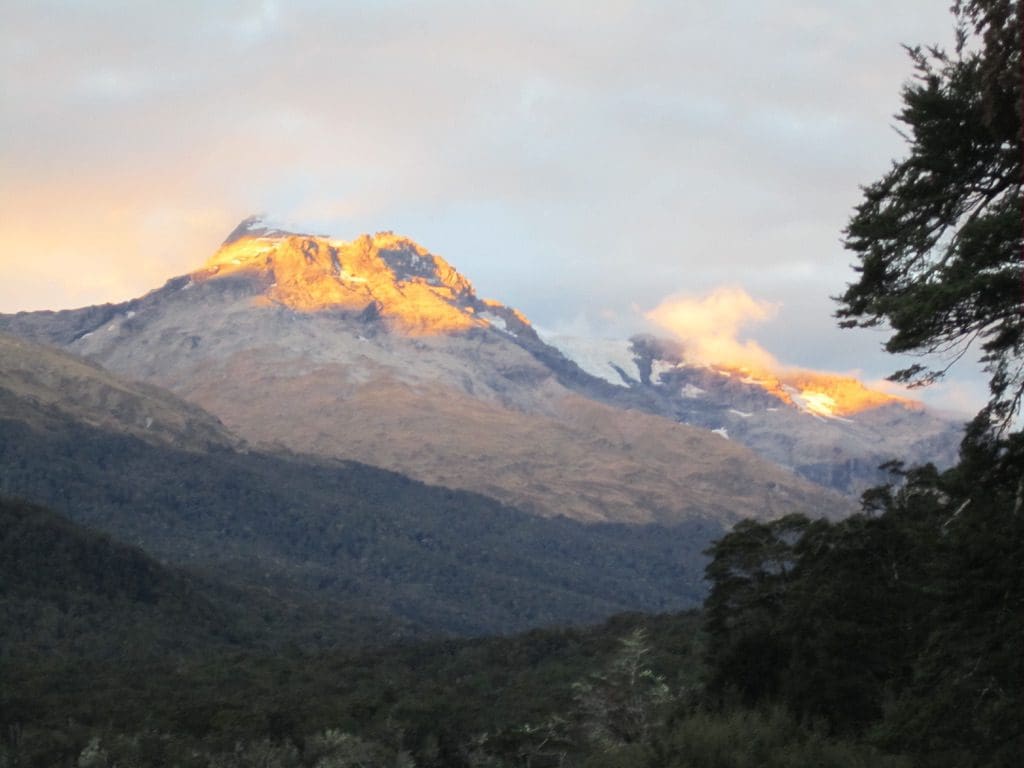
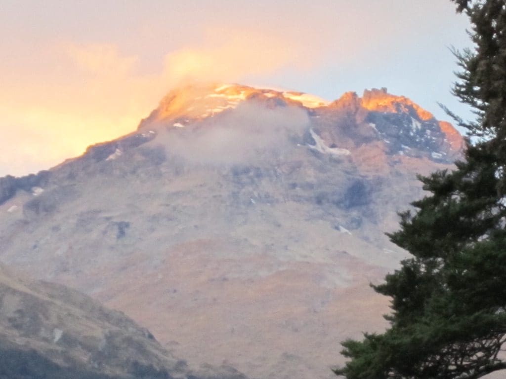
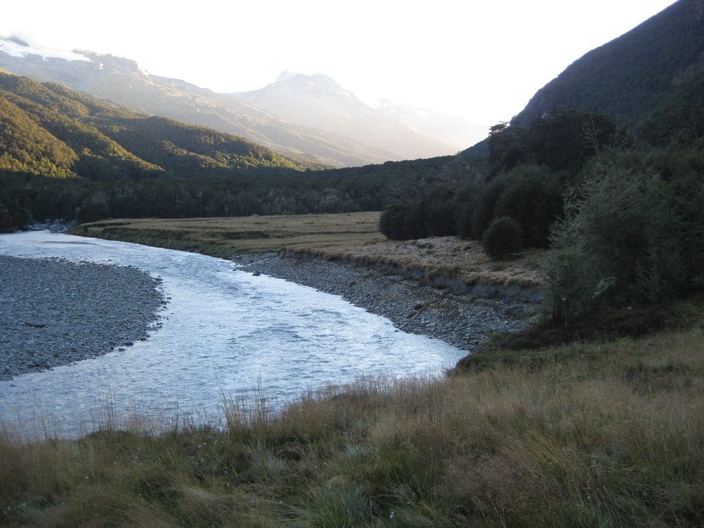
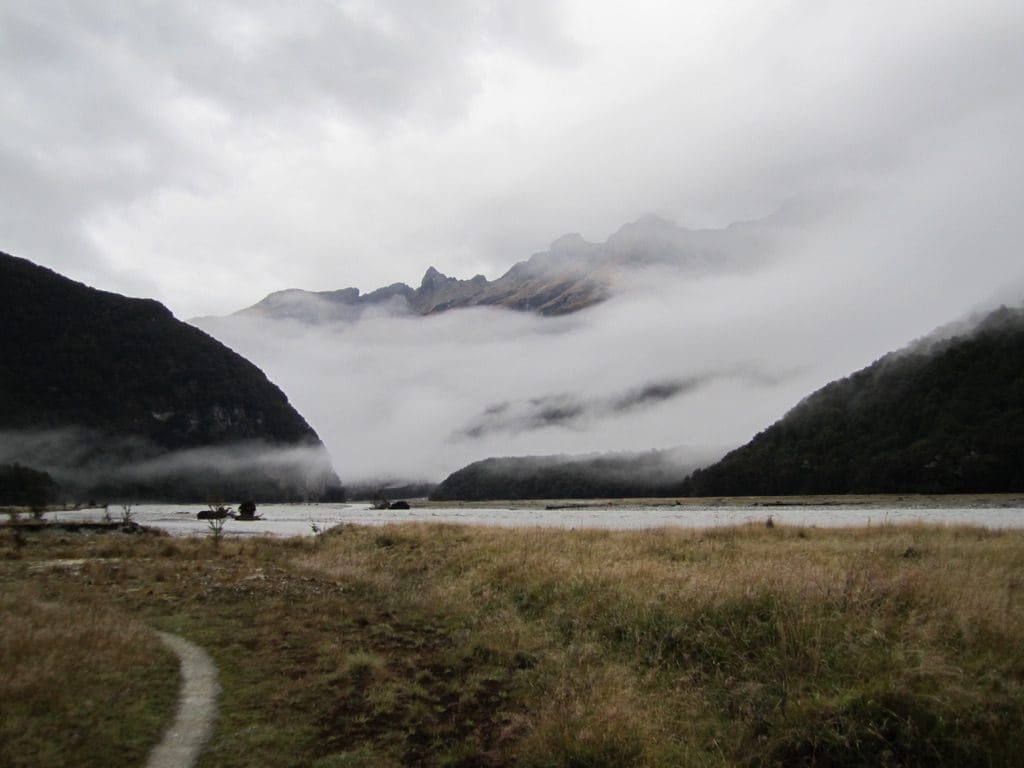
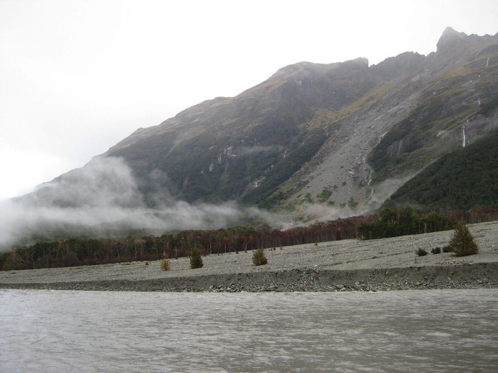
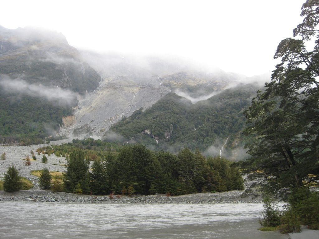
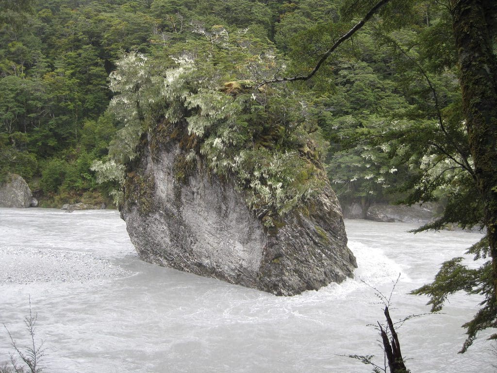
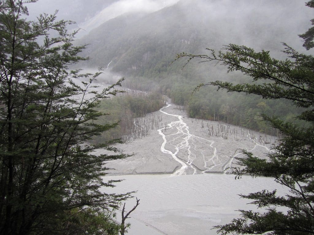
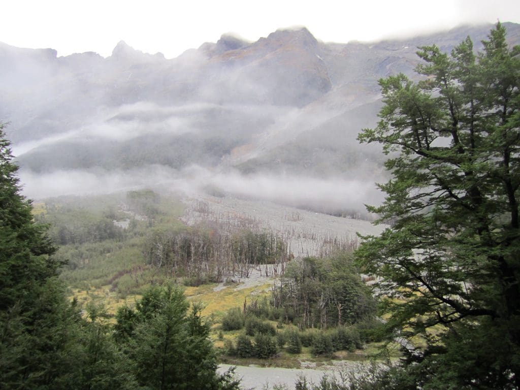
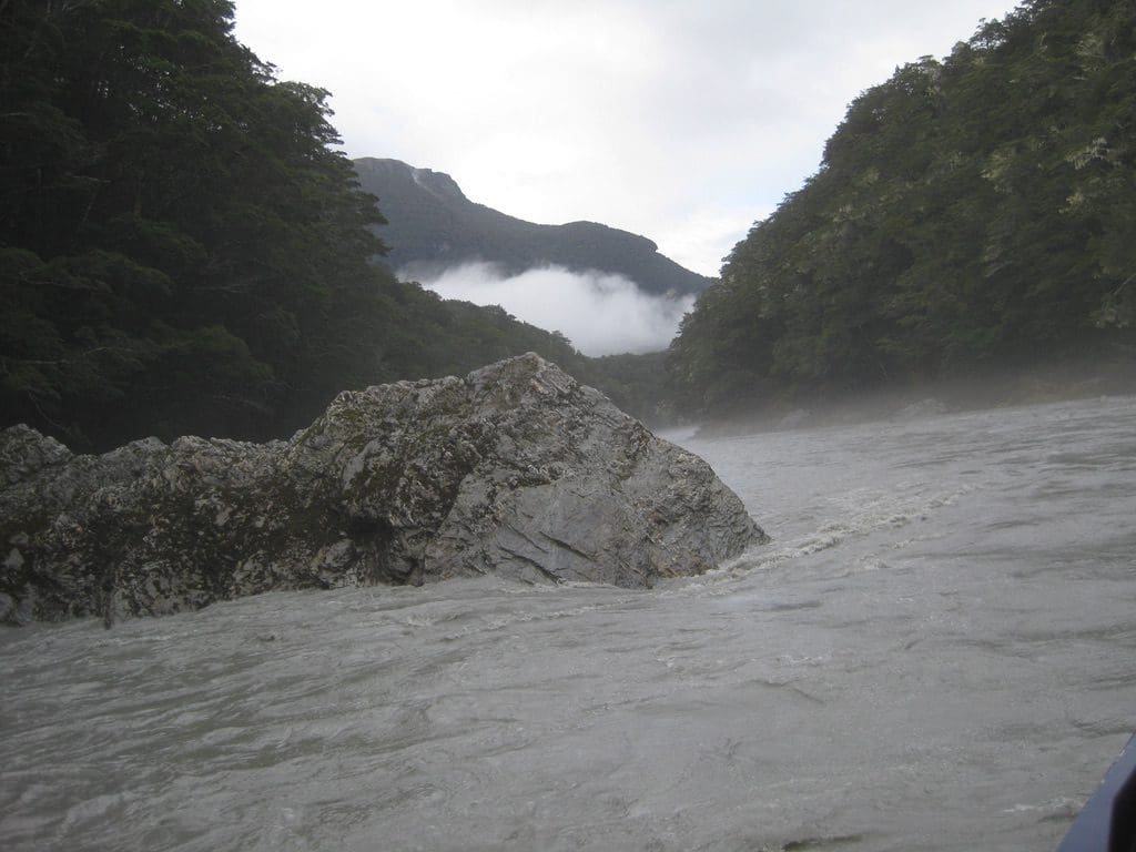
Mar 13 Sun. Still at Dart Hut – beautiful sunny day. We did a day walk along the Dart River towards the Dart Glacier. We got as far as the terminal moraine of theDart Glacier. (“The journey not the destination” says Helen. We dined in a ‘restaurant’ with a spectacular view – menu fixed – cheese and salami sambo – no waitingjust a walk in.) A truly spectacular valley. A U-shaped (glacial) valley that is being rapidly turned into a V-shaped valley by the action of water, gravity and ice – greatly helped by the flaky micaceous schist rocks. The huge (1500m thick) glaciers that had once formed the valley have long gone. All the glaciers that cap the mountains are recent add-ons. (Helen asked how much debris would be filling the Dart River flat bottom. My rough estimate is that in the 5 km from the Dart Hut to the Dart Glacier terminal moraine would be about 90million tons of sediment that makes up the creek floor. That excludes all the lateral and terminal moraine terraces.) Some bloody big boulders have either crashed from the crags or were left by the old glaciers. Most of the way up is dominated by the Hesse Glacier which hangs over the valley. The Dart Glacier is not visible until about where we stopped at the end of its terminal moraine. The Dart has carved a monstrous cirque in the schist – which forms most of the layers of the mountains (some bands of greenstone). Most of the walk is up and down over and along moraine or in the Dart riverbed. It must be a massive force of water when it is in flood. In the river itself, we were intrigued by the energy gradient that caused very fine mud (rock flower caused by glaciers grinding rock against rock) and sand to be deposited in very quiet back washed parts, while peddles and rocks were pounding away in the high energy current. The moraine itself is a poorly sorted mess that the river is constantly working and re-working depending on the height and fury of the flood.
At 3pm today, a young Brazilian arrived at the hut from the Cascade/Aspiring saddle. He was off to the Rees Saddle. He left at 5pm. That walk took us 4 hours to come down yesterday. He was going to do it (and did) in 2 hours and camp in the saddle. Very experienced young fella.
I dug another hole in my belt today. It was falling down around my bum yesterday. I found a toothpick-like thing protruding to the inside of my boot from the leather at my big toe – which accounts for the huge blister there. A flaw in my Red Back boots that I am so found of! Damn! The merino Icebreaker I bought in Queenstown is fantastic. An excellent thing to walk in. Great new product. It will replace polypro – great for sheep farmers.The Smartwool socks I bought are a complete waste of space. More like a sleeve than a sock. A terrible product.
For tea, the experiment was freeze dry mince & freeze dry vegies combined with rice, garlic, ginger & chilli. Quite good really. Dehydration is an issue on the track. Each morning before we leave, I drink about 1 litre of water. Every packoff, I drink (about 1 litre an hour) and keep filling the water bottle from the streams. No piss out. I haven’t yet pissed on the track. At night, and in the hut, I drink several litres. I piss then.
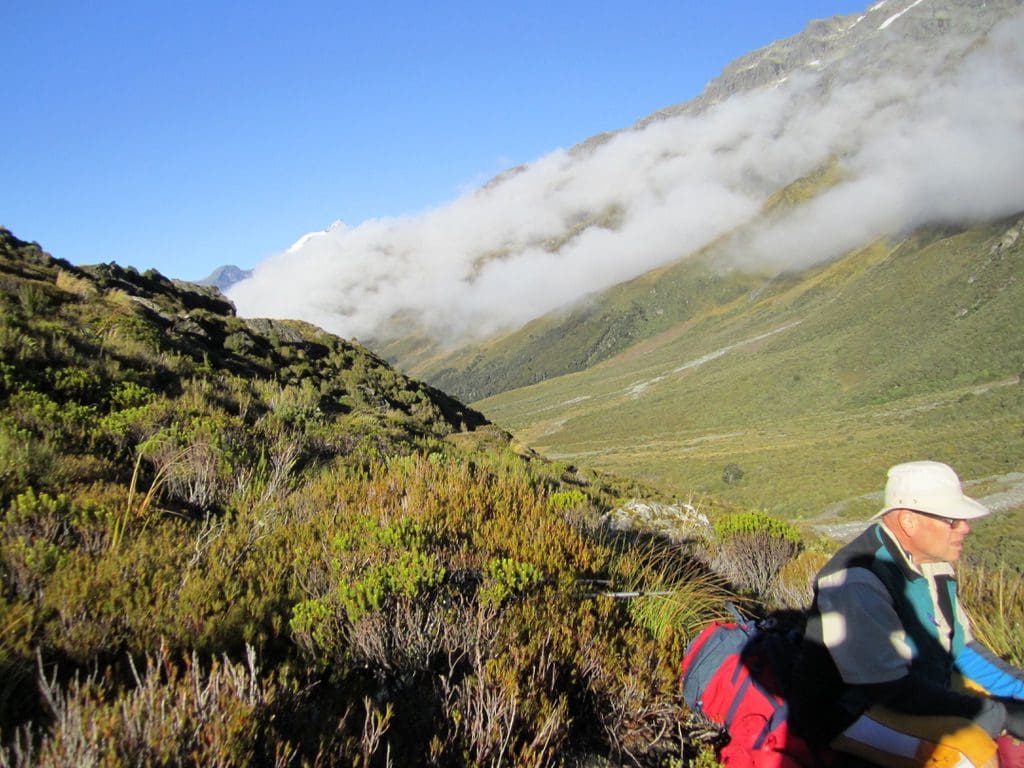
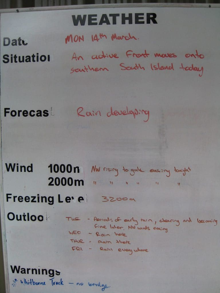
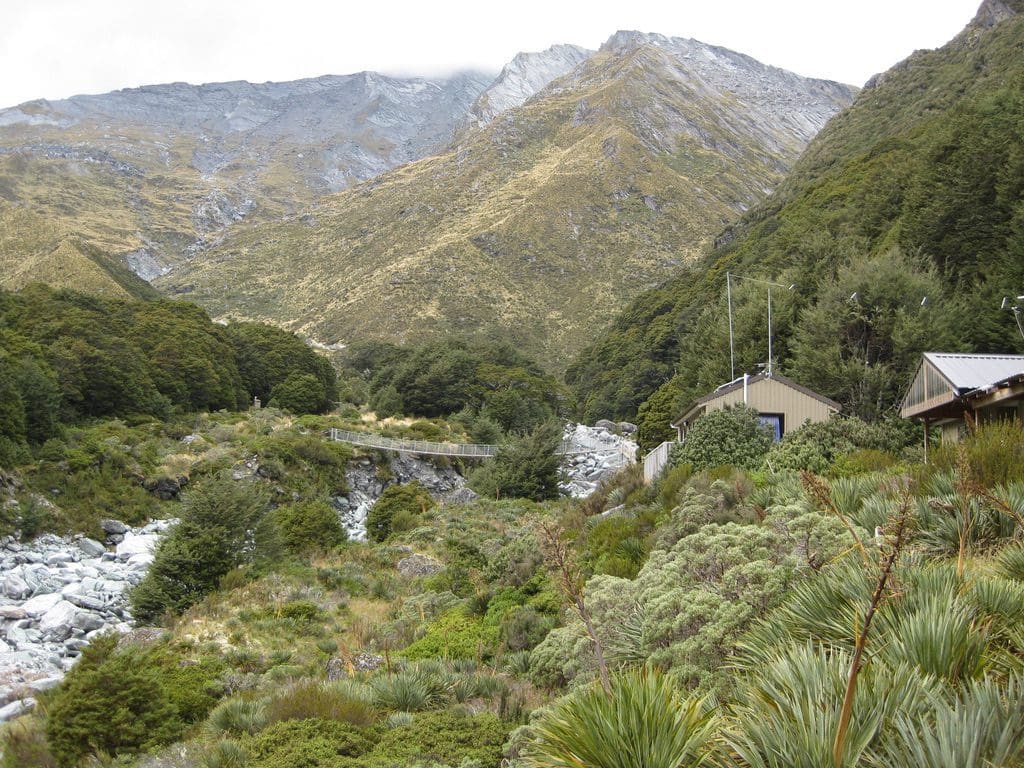
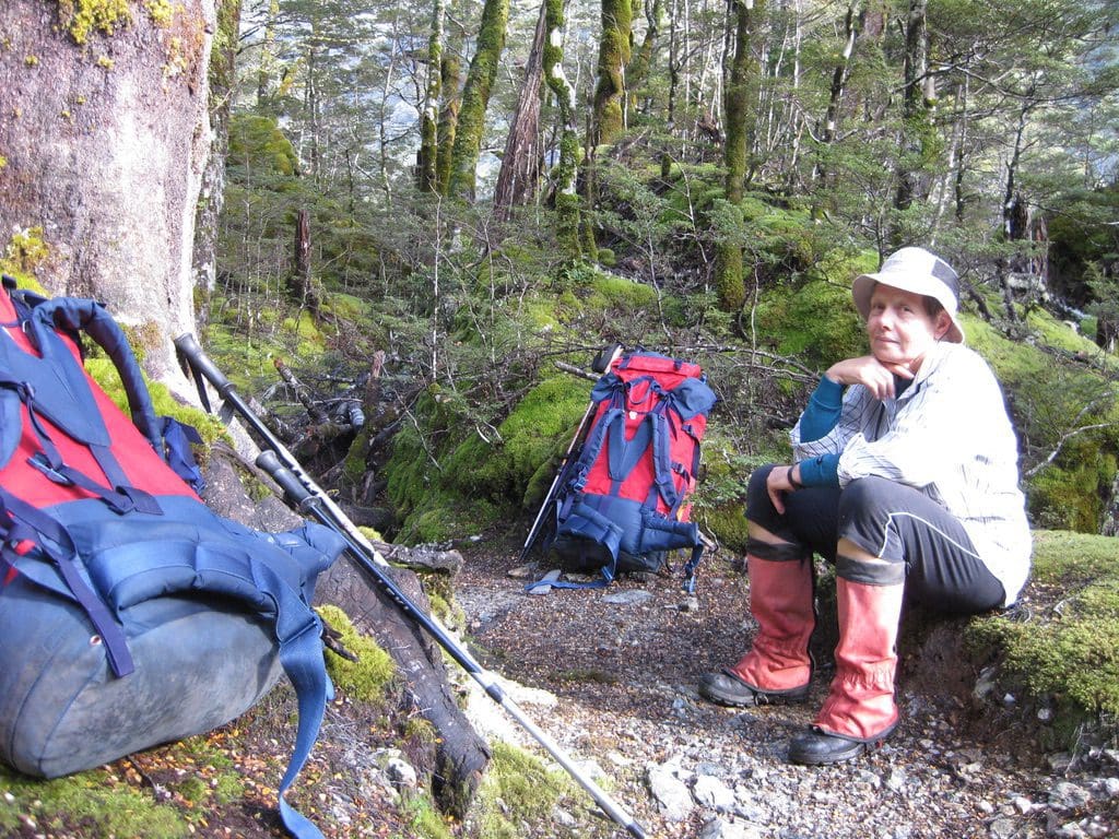
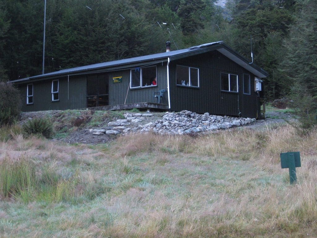
Mar 14 Mon. Day off at Dart Hut. The weather is deteriorating. The cirrus clouds at noon yesterday are developing into a front with rain expected this afternoon. Dart Hut is a bit of a palace that sleeps 32 – 8 in each of 4 bunk rooms. Good big kitchen and common area. Helen thinks the toilets are a bit far away. We had 11 here last night – 4 Oz, 2 kiwis, 2 germans, 1 israeli, 1 cypress, 1 yank (plus 1 hollander who camped). All have gone except for Helen and I. The warden got back last night from a quick trip over to Shelter Rock Hut to deny the couple there (with sore feet) a helicopter ride out – ‘sore feet does not make an emergency’. Had a good chat with the warden this morning. He bases himself at Dart Hut because ‘if trouble develops, it will be here’. In January, they had 72 turn up to sleep in this 32 bunk hut. ‘Lined up like sardines in rows on the floor’. Stories of Keas flying off with a walkers boots and the warden’s camera and tripod. Helen did a big wash yesterday of all our clothes. They’ve had 3 days walking. It turned out that we have left our deodorant back in Queenstown. Our bunk room stinks a bit. That flaw in the leather of my boot has caused an enormous blister under my right big toe. Dubin has reduced it to a dark red blister. Maybe by tomorrow it will be gone. (It was.)
The people. The two kiwis are in their 70s – Robert (a farmer) & John (who carried Helen’s pack up the saddle – a shearer). Very nice blokes – Robert feeling every step. One shy german and one confident – both determined. The Israeli very quiet – kept to himself – very nice bloke. (All nice people except the bloke from Oz – a self-centred arsehole.) The wind came up during the morning. The temperature dropped. All windows shut. The first day that I felt like walking around – not totally exhausted. The rain arrived at noon – 24 hours after we saw the first cirrus (12 hours longer than Eastern Oz).
I should report that the walk down from Rees Saddle was very scary for this little bear. A shear drop to my right for most of the way. I did not look at it. And because the pack has a tendency to push me forward, I generally had the pack towards the fall line (opposite to skiing where one always faces the fall line). Maybe the pundits will tell me to do the reverse. But what I experienced was the pack would bump things. It would try to push me forward. I wanted ‘forward’ to be into the hill rather than down the cliff. (When we got to Dart Hut, there was a story told of a Japanese girl walking by herself who disappeared – never found – on that bit of the track. Slipped, fell, gone.)
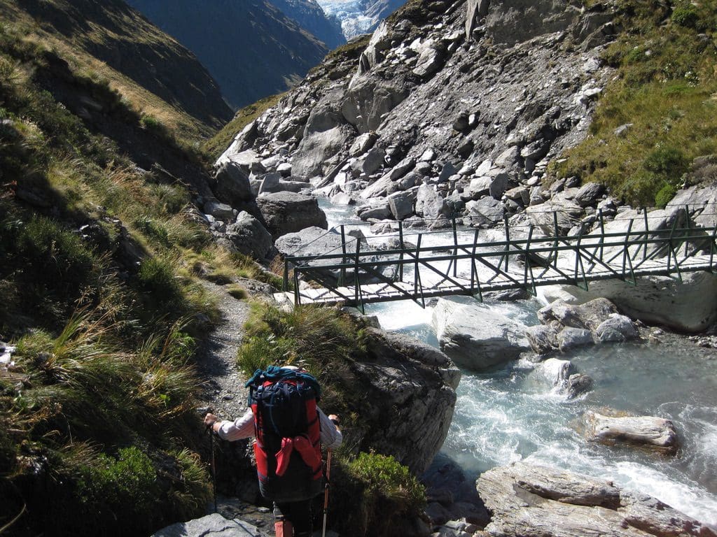
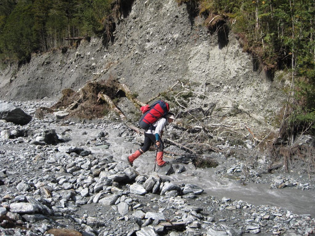
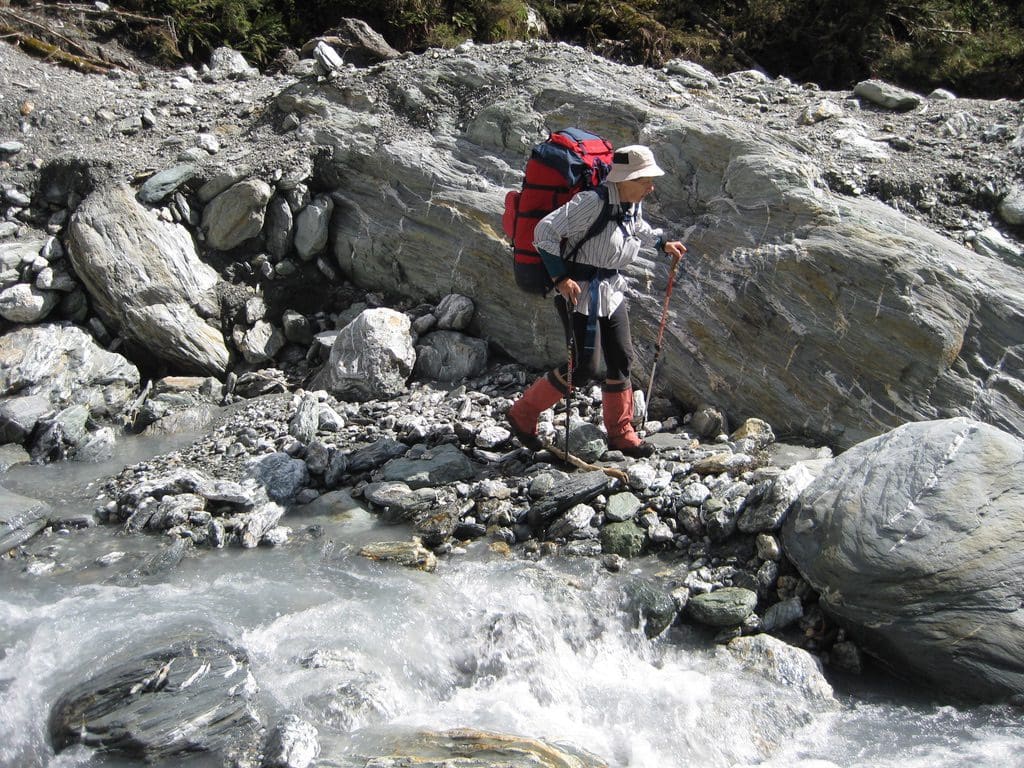
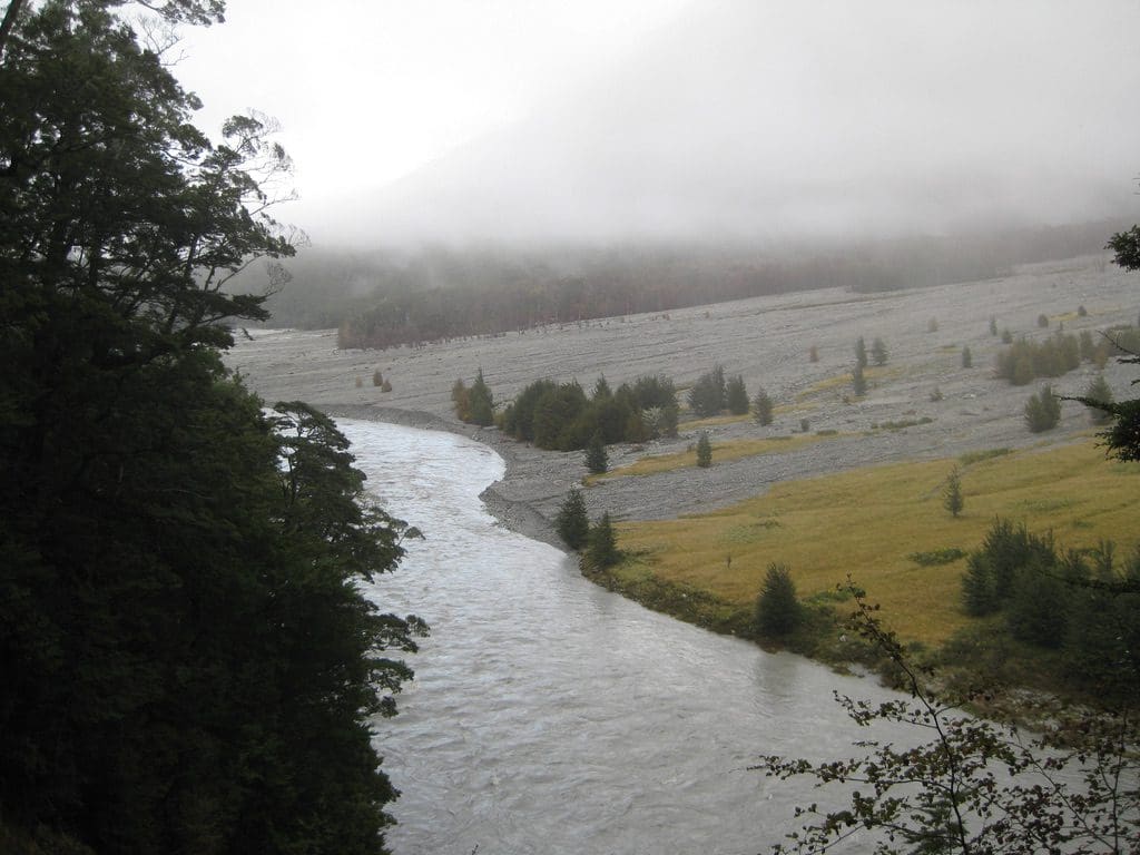
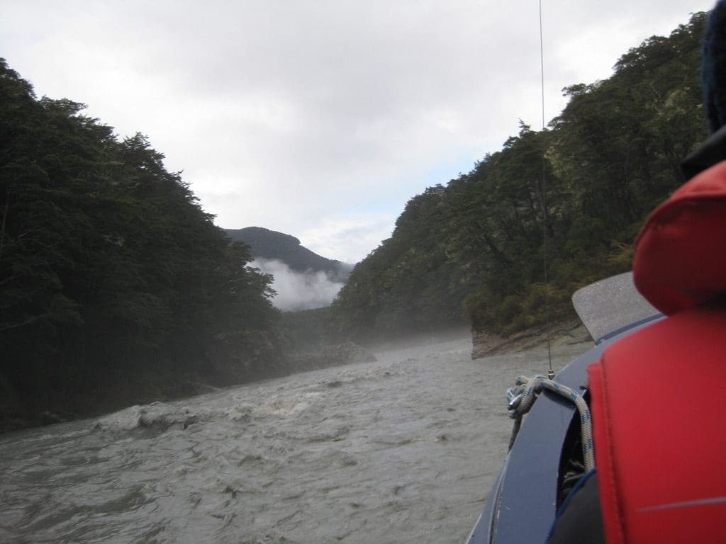
We are now 12 at the Hut. Raining hard outside from 4pm – drizzled from noon. (One german bloke just emerged from his room to complain about the smell. ‘The smelly things must be taken outside or we cannot stay here!’ And the alternative is? Unbelievable! Laughter and ‘harden up’. He addressed his remarks to us, he knew the Aussies would be the problem. Another solitary Israeli tonight sitting by himself with a haunted look. Certainly unable to compete with boisterous germans. A quiet chec couple. Tonight, we were talking to the warden (Owen) about which creek crossings will be difficult tomorrow. (Two creeks might be impossible – ‘don’t venture in if more than knee deep – the water will sweep you away’.) By chance, the subject of where our jet boat pick-up will be. He thinks the pick-up is about 4-5 km further south than where we have been told. Anxiety now. Helen confirmed the pick-up place and time with Dart River Jet Safaris on Wednesday. But, maybe the person who answered the phone just pretended to know. What to do? We could be waiting at the wrong place!
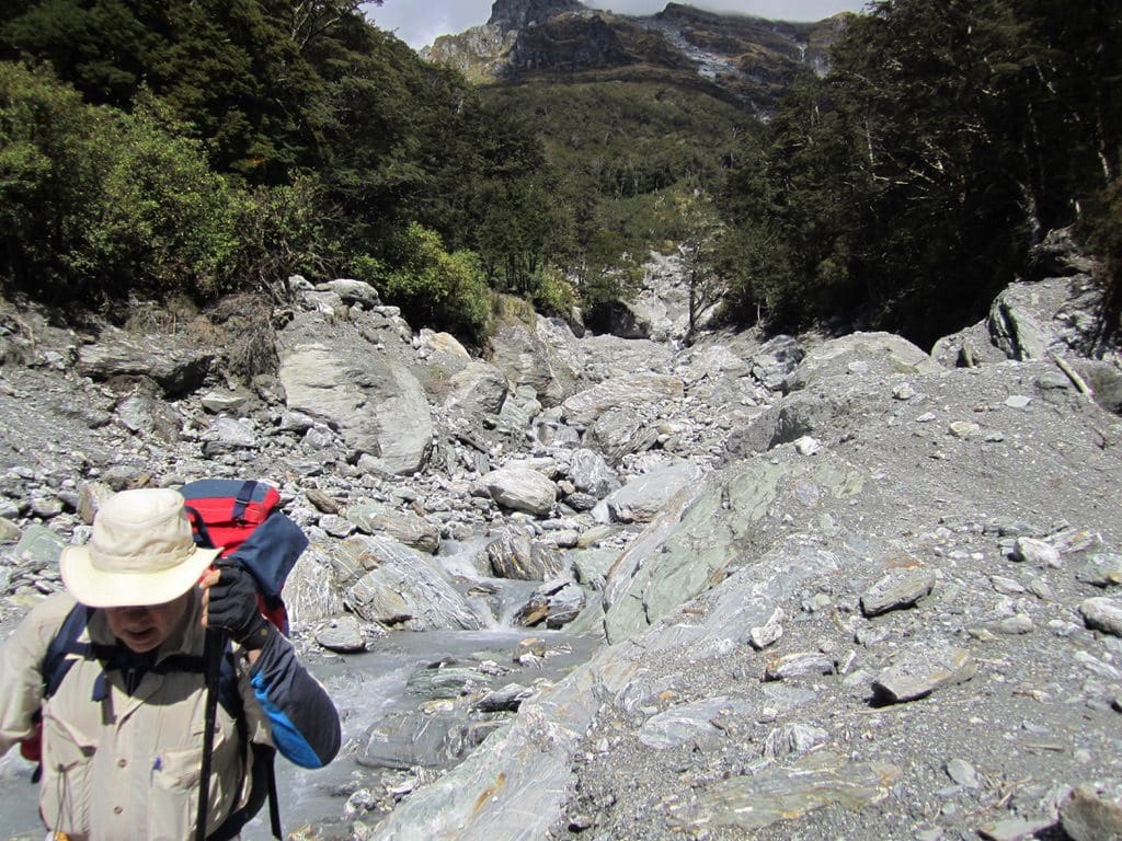
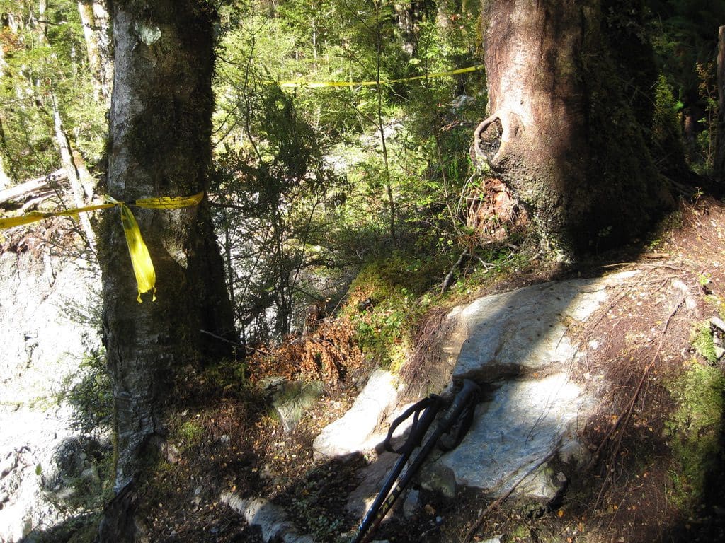
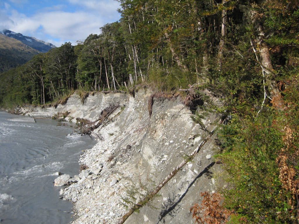
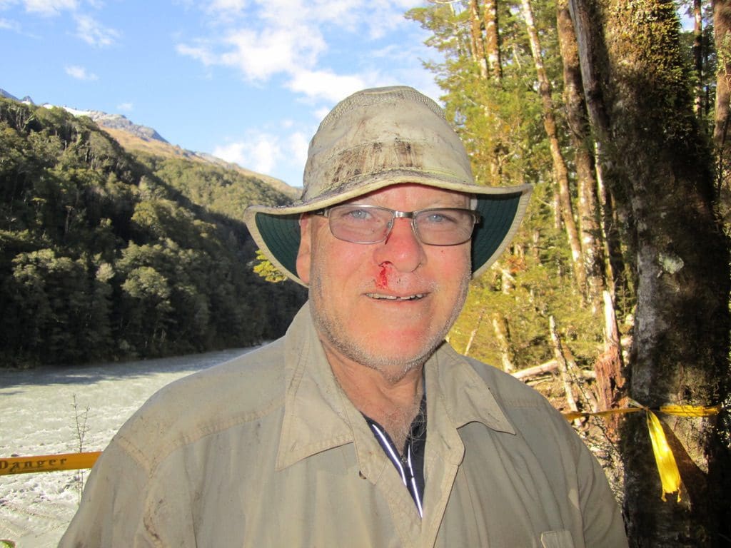
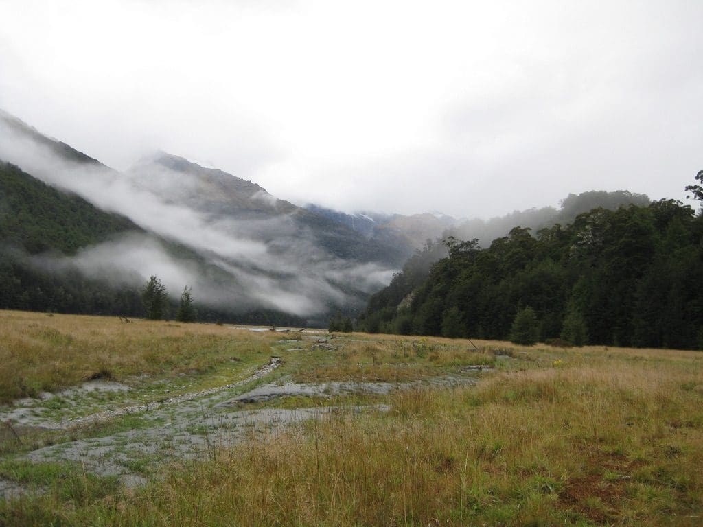
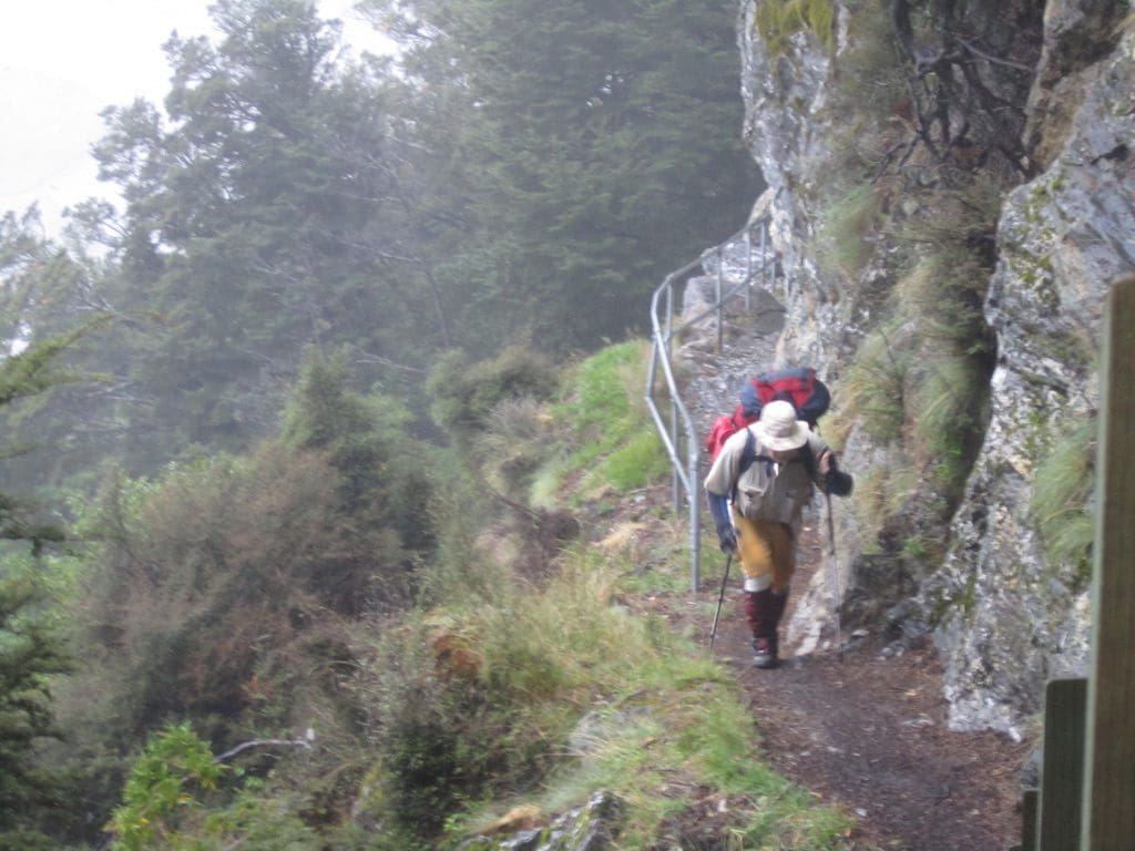
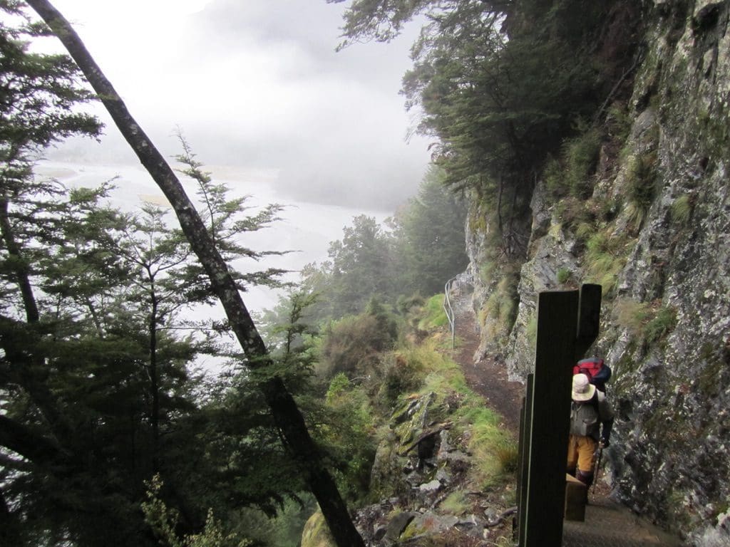
Mar 15 Tues. (Ides of March) Walk to Daley’s Flat Hut 20km. The big news is that I had a big fall – about 4 metres from the track down the cliff towards the Dart River. The bank had been cut away by the river and the track diverted with ‘Danger’ signs. At the southern end of the first diversion, my foot slipped off the boulder I was putting my weight onto and I fell out over and down the cliff. I knew I was dead. I landed on my pack and head and bounced down the slope. When I finished bouncing, I was amazed – first, that I was not dead & second, that I was still conscious. Third, after a quick, then longer assessment, that nothing seemed broken. A huge contusion oozing blood just above my right knee. Everything was gone from my pockets. My pack was still on and trying to push me further down the cliff. One walking pole still in my hand. It took quite a few minutes to make that assessment. Helen came back looking for me. Very surprised to find my walking pole on the track and me down the cliff wedged between a boulder and the cliff. I was quite dazed & shaky. (About then, I was thinking that emergency beacon would have been a good idea – we don’t have one.) I released the pack a bit and got slowly to my feet (still checking for broken bones). I climbed back up to retrieve camera, pen, map (all in a line where I had hit the ground) and began to work out how to get out. I was in a bowl with vertical walls and the river raging below. Where I had fallen was the steepest part and had a huge boulder that was very undercut and likely to fall on me. To the left of that, I could see a possible way out. I climbed up to where Helen could take my pack (with her lying down and reaching and me passing it up). She then pulled me up using the walking poles to where I could grab some bushes. Long pause. I wormed my way up and over the lip from there with brute strength. Then began the next assessment. My glasses have done a bit of damage to my nose (possible break) where I landed on them. I’ve a graze down my right cheek & my white hat is black & I’ve blood coming from my nose. Two fingers on my right hand are very suspect. After a bit of a rest and a few photos, we set off again. Helen took the remaining food, my raincoat & water bottle. We were about 3.5 km from the Hut and set an easy pace. Anything up or down was difficult. The damage to my right quad meant that it was fully switched off and did not want to do anything. Any big down, I had to sit down and slide. Uphill had to be done with my left (weaker) quad and right calf (which in turn packed up). (The ITB (Illium Tibia Band) on my right leg actually stopped hurting for this walk down from my fall. Before this, it had screamed for every step of my right leg.) We got to the hut after 1 hour 10 mins walk. Wash, sugared tea, meal & bed – thanks to Helen.By then I was feeling very sorry for myself. Slept very badly. Could not lie on either side. I’ve taped the fingers as they may be broken.
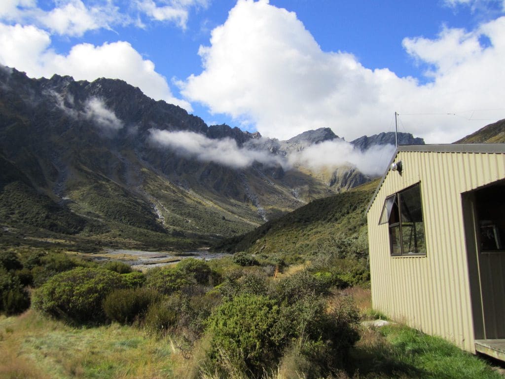
Now, the walk down from Dart Hut. A beautiful sunny day (frost when we left). This is a magnificent walk dominated by a series of glaciers overhanging the northern wall of the Dart River. (I understand that 40million ago, the site of the Dart River was the western shore of NZ – no Fiordland & Milford Sound then – all added later.) The walk is mainly through beech forest. Initially, down about 250-300m over 5 1/2 km, then across a grassland lateral moraine (Cattle Flat) for about 5 km (up and down creeks and streams crossing). Then, into the forest and down again 220m over 2 km. (It was just at the end of this that I had my fall.) Then, flattish through forest to almost the hut which is a welcome sight on the far side of a grassy patch. The Hut has a magnificent view to the NE. At the Hut were the 3 germans who had been obnoxious about smells. They turned out to be very nice people – Fabian, Ruth & ?.
Very lucky to be alive and unhurt!! Another one of the nine gone. A hard day before the fall. A tad more difficult with the fall thrown in.
Mar 16 Wed Day off at Daley’s Flat Hut. Slept in. Chatted with the young germans who I had told about the fall just before I went to bed. They got away at 9:15 am aiming for a bus at 2pm. We’ve swept the Hut and Helen has done some washing while I wrote up yesterday. I is hard to write long-hand legibly with two fingers taped on my right hand. At 9:30 am the wind picked up suddenly and blew everything (chairs) off the front verandah. A flock of 30 plus yellowheads (birds) came through, A rifleman (bird) & black robin visit the front of the hut for insects. And the insects are a problem here – swarms of sandflies attack any exposed skin outside. Not much sitting on the verandah.
Thinking about the fall yesterday, I think that I when my left foot slipped, I swung out on a tree, the weight of my pack took over to flip me head first facing out, land on the pack (and head protected by my hat) & then flop over. That accounts for the position I landed in (sitting facing down with my pack pushing me down) & lack of broken (big) bones. I am certain that any broken bones would have stopped me getting out of that bowl. Helen could not have got down to me safely (without severely damaging herself) & the brute strength that got me over the lip would not have been possible with a significant injury. Good reason to carry an Emergency Beacon.
Walking equipment. It is hard to find good, durable, robust equipment. The merino Icebreaker brand is a good new product. I’ve enjoyed walking in my 200 Icebreaker. Jocks – I’ve two pairs of Oroton silk jocks that are excellent (cotton jocks just stay wet and chafe). Our Wilderness polypro thermals & 200 weights have worked well for years – another good brand. I have a ExOfficio shirt that is good to walk in. Socks are the general bad news. Smartwool are terrible! I’ve one pair of woollen Wigwams that are very good. Gaiters are essential – they let you approach deepish mud and water with confidence – say mid calf deep. The Red Back boots have been good walking boots. However, the flaw in the toe material and the use of cardboard in the heels (which cavitated and collapsed when walking with water in the boots) may mean I’ll have to find something better – shame that. I first used Red Backs as track boots in about 2000. (Maybe the accountants have taken over the quality department at Red Back too.) (That blister under my toe was completed cleared up with Dubbin.) Raincoats: We know that there is no such thing as a water proof raincoat. The Mountain Design coats we have now are as good as we have found. Hats: I like my Tilley Airflow to walk in. Helen has gone for a cheap floppy. Walking poles are essential in my view – take the weight on the way down, help to vault creeks and probe the depth of mud. I’ve got two Lekis with springs to help reduce the shock. I’ve broken Black Diamond poles. Helen has 1 Black Diamond and a Leki. People with Berghaus gear appear to like it.Very hard to know. You certainly have to pay for good equipment. But expensive gear might not be good. It looks good in the shop & the glib salesperson palms off to you some bit of rubbish that lasts 10 minutes.
Food: Backcountry freeze drieds are excellent – we tend to like the spicy ones (of course) supplemented with rice. Museli and oats are sufficient for breakfast – just mix the milk powder in and add water (is what most people do). Cheese & salami on bread for lunch. We brought nibbles (chocolate & bars) – which I now think are a waste of time. (We are eating them today because we have them left over). OK – we are still undecided on the chocolate.
I have meant to write about what I will call the ill-equiped ‘independent’ tramper. Many walk these NZ tracks with what I would call a poorly prepared day-pack plus a few days’ food – very little severe weather or emergency gear. I’ve come to think that they are just a little bit ‘independent’ and call for help if it rains or their feet get sore. I remember that it was even worse on the Routeburn Track – many people without a raincoat or cold/wet gear at all. Shorts & thongs. ‘Please save me, Mr Ranger, it rained.’ But I suppose that is the complaint of a bloke who has been stuck in a tent in the rain and snow for 10 days. Carry what you will need to survive. (Mind, if I had broken something in that fall into the Dart, I was not equipped to survive.) So you did not need it. Good luck for that trip. Maybe next trip you will be glad to have that extra dry thermal or plastic bag.
The wind has been blowing strongly down the Dart for the morning – which is why the bus driver said that ‘you walk down the Dart, not up it’. Very strong wind. 12Cin the enclosed porch at 6pm. Drizzling but no wind. The wind stopped at about 2:10pm when the kiwis arrived. Three kiwi women in their 60s. Excellent company – out for a walk in the hills.
This Rees-Dart track is one of the best that I have walked – despite the brutal days and the fall. The scenery (especially along the Dart River and Snowy Creek) is magnificent. Very hard to beat a row of glistening glaciers, a thundering river and moss fill beech forest. Towards the end of a long hard day (especially yesterday) I could not say that. However, on reflection & thinking of the experience – first rate. By a long way, this is the hardest of the NZ tracks that we have done, but by no means the worst. One of my favourites.
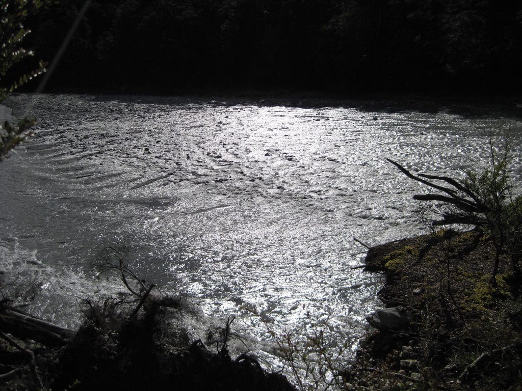
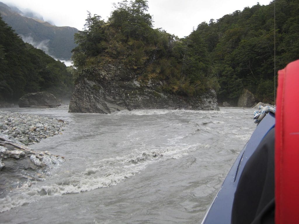
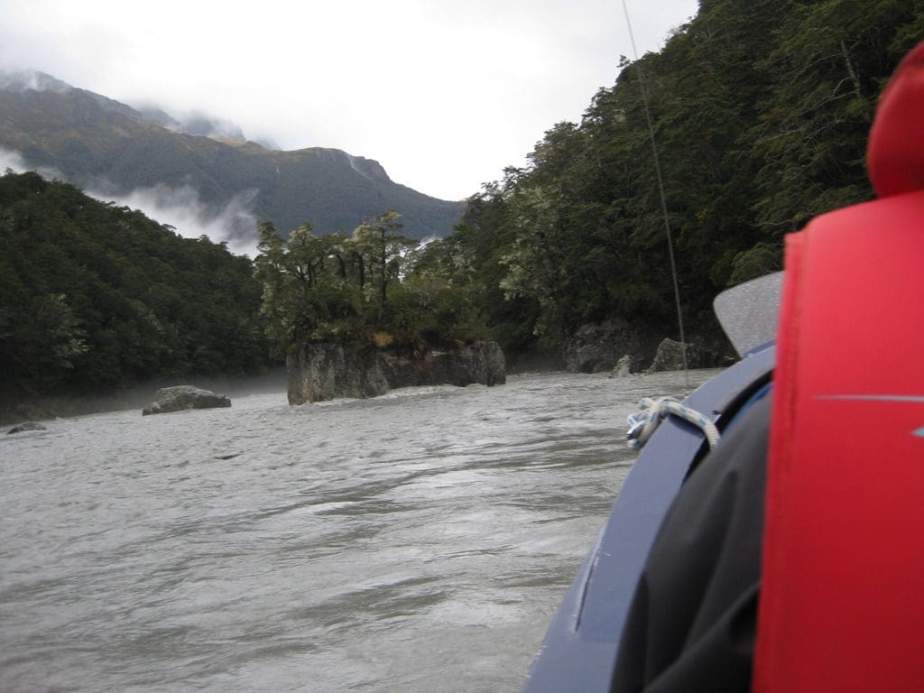
Mar 17 Thurs Queenstown. We are out. Alarm went at 5:30am and we packed and waited for first light (or enough for us to be able to see) at 7:30am. Then, we walked like crazy things to get to the jet boat pickup at 10:30am. The one marked on the map and where we were told it was, is actually 5km before the current pickup. We would easily have made the old place (which we reached at 9:35am) but I did not get to the new spot until 10:50am. Helen had gone ahead. I saw her reach the bank of the river about 300m in front of me. It is actually a very nice walk along the Dart River near Sandy Bluff – magnificent house-sized boulders in the river makes a beautiful water flow. The track up Sandy Bluff rises to about 150m above the river. I understand it used to be a chain ladder – now a path has been blasted through, plus a few steps and a rail. Good track today – well graded (that means not too many unnecessary highs and lows). The Jet Boat ride was a bit of a dream really. OK, it rushed back up through all the big house-sized boulders and did a few 360s – but anticlimax. (The highlight, seen by Helen and I but no-one else in the boat, were two blue ducks- rare ducks that live in very fast flowing water. Blue Ducks are on the NZ $5 notes. Yellow-heads, which we saw at Daley’s Flat are even rarer and are on the $100 note. Two rare birds on the one track.) A surprise to see cars again. Back to Glenorchy and Queenstown. Shower, deodorant and clean clothes. (Poor people on the bus with very smelly us.)
I want to relate a story about hut warden Owen from Dart Hut. People coming over the Cascade Saddle reported that by nightfall a party of two had not arrived. The cairns that mark the track along the Dart are often 250-300m apart and can be very hard to see in daylight. Impossible to see at night with a head lamp with a range of 90m. People get lost in that exposed part of the Dart River flat at night. Owen headed out in the dark with a light, found them and brought them in. We think he does this often – saving lives.
Advice to novice walkers. After a question from a bus passenger, I was thinking about what advice to give someone thinking about taking on a long distance tramp. No cotton – cotton is called a death fabric by trampers (ok, I have a cotton hat and cotton shirt – which I wear as an outer garment for its pockets); try very hard to get your pack less than 15 kg (I’ve never succeeded at this and always regretted it); take only things that you will need not that you might need; think through a few scenarios – it will rain (what will I need), it will snow (what will I need) , I will be wet at the end of each day (what will I need to change into – one set only); raincoat; there is no such thing as waterproof boots, waterproof pack (use a good pack liner) or waterproof raincoat (dry socks and clothes for the night – the wet ones can go back on the the morning); not everybody likes this activity (we’ve seen quite a few bail out after the first long day in the rain or first night without a shower) – every kilometre you walk in is a kilometre you will have to walk out – no-one will walk those kilometres for you even if your feet and legs are aching (and they will be); I will get a blister (how will I treat it); what will I walk in (I walk in silk jocks, woollen socks, old board-shorts (that will not rip – too many arses ripped out of pants), thermal top (Icebreaker 200), cotton shirt, hat, leather boots (Red Backs), gaiters) Helen has very similar gear; have a good pack (we have old Berghaus packs which we’ve had since mid 1980s); good down sleeping bags and sleeping sheets; walking poles (unless you are under 25 and weigh less than 60kg); huts or tent? (the tent weighs at least 2 kg but gives you more freedom about where you can go – with a tent, take a few small plastic bags to protect your dry tent socks from your wet boots when you go out for a piss); hut means ‘hut shoes’ (no boots inside) – Crocks, thongs, sandals; sleeping mat; food; eating and cooking gear (spoon, 1 sharp knife, 1 bowl to eat from, pots to cook in (we have 2 stainless steel pots without handles), stove (gas is ok – you won’t be able to light a fire to cook on anywhere you go – Trangia metho is good too), small cloth/towel to dry up & keep things clean; eco-soap (some places let you use it) & deodorant, towel (microfibre 10cm sq); toothbrush & toothpaste; map; camera; strong water bottle; emergency beacon (in case you crash). Ok, now lets do a few sums. That good pack weights about 2.5kg; sleeping bag & sheet 2kg; good raincoat 1kg; litre of water 1kg (total so far 6.5kg); food per day 1/2kg – if you are very careful (for 6days = 3kg) (total so far 9.5kg – leaving just 5.5kg for all your clothes, cooking gear and other essentials).