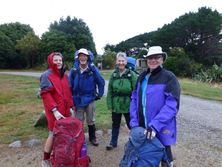
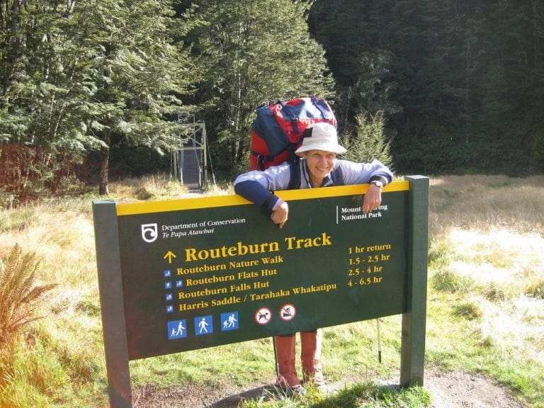
New Zealand 2015 Routeburn Track
Our 4 night heavy-pack walk into Routeburn Falls and out. A side trip up to Harris Saddle and Conical Hill. Nights at Routeburn Falls and Routeburn Flats,
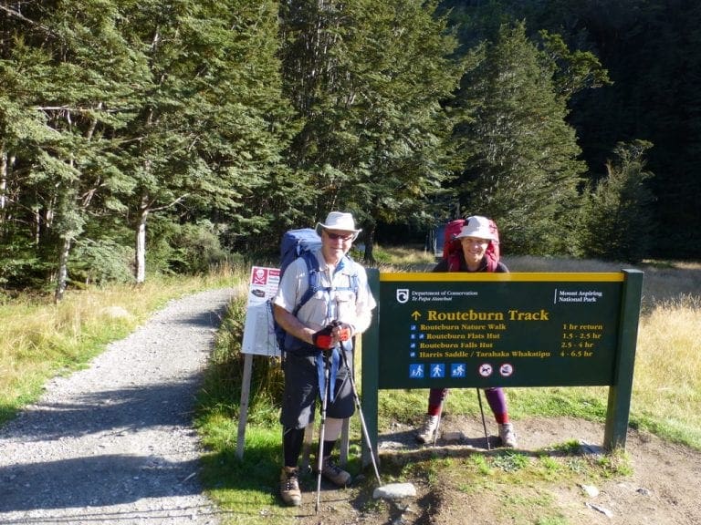
Our 4 night heavy-pack walk into Routeburn Falls and out. A side trip up to Harris Saddle and Conical Hill. Nights at Routeburn Falls and Routeburn Flats,
Sunday 1 Mar 2015. Day 12. Bus and Ferry to Stewart Island. Early start 5:50am with a bus pickup at…
Preparation. We began prep for these three walk in December 2014 and January 2015 with walks from Charlottes Pass up…
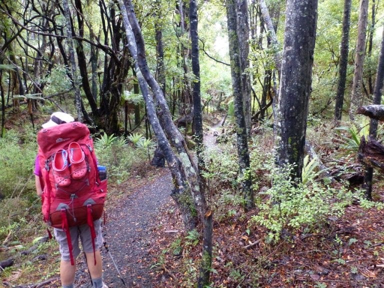
Monday 24 Mar 2014. A sparking sunny day. Almost 7 hour walk – 12 km. We really dawdled the first…
Sunday 16 March 2014. The 6:15 am alarm had us up so we would be ready for our 7:30am pickup…
Monday 10 March 2014. A relaxing day in the hot pools of Hanmer Springs spa. Excellent. We purchased a ‘senior…
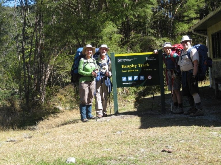
Monday 3 Mar 2014 Christchurch. Today we begin a 4 week trip to NZ – to do three walks –…
This will cover our Routeburn walk in March 2011. We have walked this NZ Great Walk before (2004). We are…
Mar 18 Friday. A day off at Queenstown. We did little except do the washing (Helen), eat and I visited…
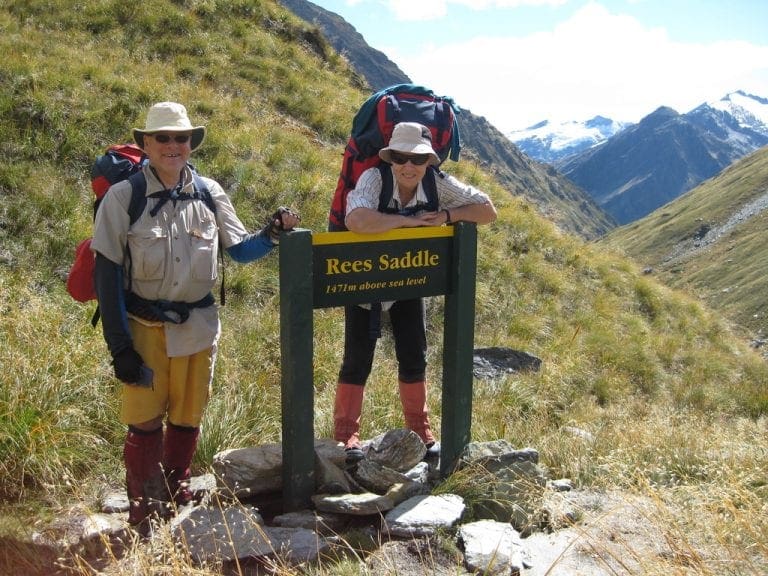
This and the next two posts describes our trip to NZ in March 2011. We walked two tracks. The Rees-Dart…

When it rains across Australia’s vast inland region, temporary pools crop up all over the arid ground, giving life to a strange desert crustacean known as the shield shrimp (Triops australiensis).
Named after the formidable carapace that shields its head and upper body, T. australiensis can grow up to 7.6 cm long, and it uses its long, segmented tail and mass of 60 or so legs to propel itself through shallow water.
It also breathes through these legs – its sub-class Branchiopoda means ‘gill-legged’ – and in the females these legs bear ovisacs for carrying their tiny eggs.
Several pix in the Photo Gallery and a movie.

A rare and endangered plant. The tree grows up to 15 to 18 metres (49 to 59 ft) high, with short horizontal branches and pendulous branchlets covered in needle-like phyllodes adapted for the arid dry climate. It has a distinctive habit more similar to a sheoak or a conifer.
Although speculated to have been widespread across central Australia during wetter climates 400,000 years ago, the population is now mostly restricted to three sites, separated by the encroaching Simpson Desert. In the Northern Territory, the species is restricted to the Mac Clark (Acacia peuce) Conservation Reserve which is surrounded by a pastoral lease, Andado Station. The other two sites are near Boulia and Birdsville in Queensland. The tree is found in open arid plains that usually receive less than 150 millimetres (5.9 in) of rain per annum. They grow on shallow sand aprons overlaying gibber or clay slopes and plains and between longitudinal dunes or on alluvial flats between ephemeral watercourses.

Owen Springs was a station on the Hugh River. The Hugh River flows into the Finke (when it actually flows). Both cut through the Western MacDonnell Ranges. The image above shows Owen Springs Reserve as a dot at lower right. The river it is next to is the Hugh. Hermannsburg, our next town, is near middle left edge. Hermannsburg is almost on the Finke River. You can see both Hugh and Finke Rivers cutting through sections of MacDonnell Ranges.

Palm Valley is within the Finke Gorge National Park southwest of Alice Springs. Palm Valley has a smallish population of Red Cabbage Palms (Livistona mariae). The nearest related species is 850 kilometres away in Katherine NT. The average rainfall for Palm Valley is just 200 mm per year. Small pockets of semi-permanent spring-fed pools allow the unique flora and fauna (desert fish, shield shrimps tadpoles and frogs) to survive.
It had been assumed that the cabbage palms were remnants of a prehistoric time when the climate supported tropical rainforest in what is now the arid inland of Australia. Genetic analysis published in 2012 determined that Livistona mariae at Palm Valley is actually the same species as Livistona rigida from samples collected near Katherine and Mount Isa, both around 1,000 kilometres (620 mi) away. It is now thought that aboriginal people brought the palms to here from Mataranka.

Mound Springs occur around the Western edge of the Great Artesian Basin and represent a natural discharge of Artesian water that was captured many hundreds of kilometers away from rain falling along the Great Dividing Range and New Guinea. This article provides details. Dalhousie is an excellent example of a mound spring.

