I am Castelnaud Castle

by | Mar 9, 2013 | France

Castelnaud Castle

Castelnaud Castle

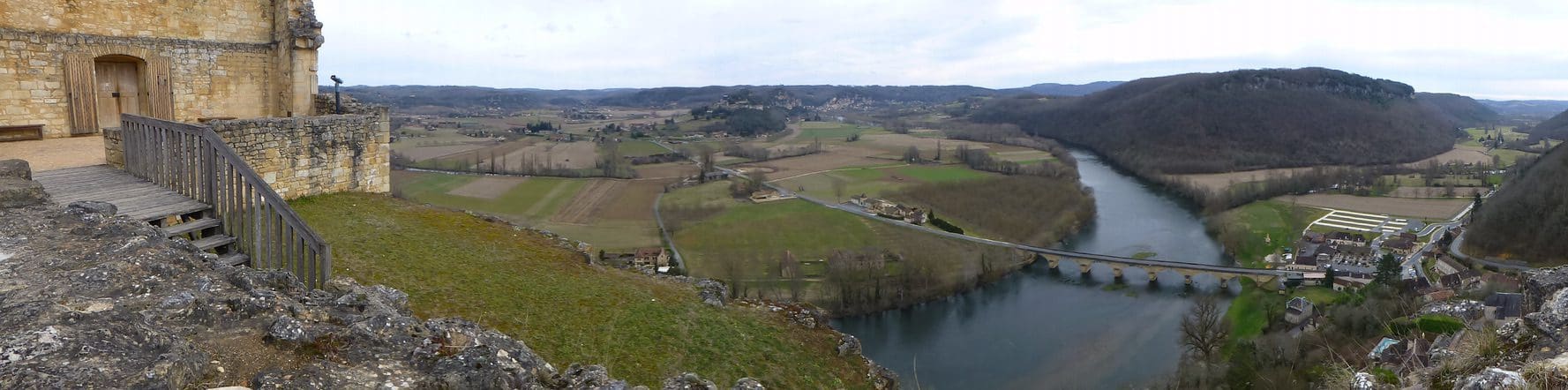
No one knows when I was first built. In the early 13th century, my lord, Bernard de Casnac, became a fervent supporter of the Cathars and so I ended up on the losing side in the ethnic cleansing of the Albigensian Crusade. In 1214, I was seized by Simone de Montfort sent to crush the Cathar ‘heretics’. Bernard got me back but a few months later I was burned by order of the Archbishop of Bordeaux. The pattern of my life is set! During the rest of the 13th century, I was rebuilt and again became a major power-centre in the Perigord, fiercely rivalling my enemy across the Dordogne River – the Chateau de Beynac.

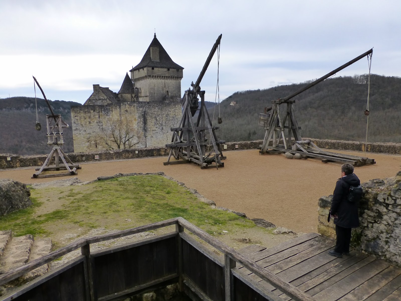
In 1337, the Hundred Years War broke out and, as chance would have it, I began (again) on the losing side – English this time. Beynac was loyal to the French. In the century of war, I changed hands seven times; the last, the 1442, when after a mere three-week siege, my English captain sold out to the French. (The easiest way to win a siege – pay the be-sieged to give up.) I was re-built and strengthened over the next century because of advances in siege weapons. (Until now the powerful rock hurling trebuchet had been the main artillery. Now, early cannon appeared.) My wall got thicker and a skirting walls were added.

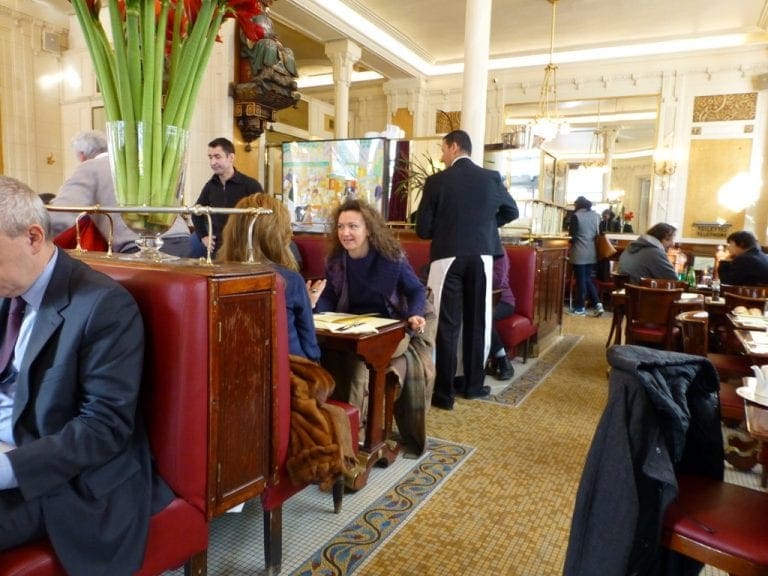
My bad luck continued, my lords, the Caumonts became Protestants at the beginning of the next round of the ethnic cleansing – the bitter Wars of Religion (1562-98) – a civil war of Catholic against Protestant. My only lucky streak was that Captain Geoffroy de Vivans was born in the chateau and fought so ferociously that he was so feared that no one dared to attack Castelnaud in all that time. By now, the family thought me too uncomfortable and lived elsewhere.


After the French Revolution of 1789, the neglected overgrown site became a stone quarry. In 1832, when stone was needed for a new bridge over the Dordogne, masons conveniently dropped big chunks of me straight down the hill to the work-site.

In 1966, I was listed as an Historic Building as part of the Preservation Laws implemented by Andre Malraux.

Shield Shrimp

When it rains across Australia’s vast inland region, temporary pools crop up all over the arid ground, giving life to a strange desert crustacean known as the shield shrimp (Triops australiensis).

Named after the formidable carapace that shields its head and upper body, T. australiensis can grow up to 7.6 cm long, and it uses its long, segmented tail and mass of 60 or so legs to propel itself through shallow water.

It also breathes through these legs – its sub-class Branchiopoda means ‘gill-legged’ – and in the females these legs bear ovisacs for carrying their tiny eggs.

Several pix in the Photo Gallery and a movie.

Acacia peuce

A rare and endangered plant. The tree grows up to 15 to 18 metres (49 to 59 ft) high, with short horizontal branches and pendulous branchlets covered in needle-like phyllodes adapted for the arid dry climate. It has a distinctive habit more similar to a sheoak or a conifer.

Although speculated to have been widespread across central Australia during wetter climates 400,000 years ago, the population is now mostly restricted to three sites, separated by the encroaching Simpson Desert. In the Northern Territory, the species is restricted to the Mac Clark (Acacia peuce) Conservation Reserve which is surrounded by a pastoral lease, Andado Station. The other two sites are near Boulia and Birdsville in Queensland. The tree is found in open arid plains that usually receive less than 150 millimetres (5.9 in) of rain per annum. They grow on shallow sand aprons overlaying gibber or clay slopes and plains and between longitudinal dunes or on alluvial flats between ephemeral watercourses.


Owen Springs Reserve on Hugh River

Owen Springs was a station on the Hugh River. The Hugh River flows into the Finke (when it actually flows). Both cut through the Western MacDonnell Ranges. The image above shows Owen Springs Reserve as a dot at lower right. The river it is next to is the Hugh. Hermannsburg, our next town, is near middle left edge. Hermannsburg is almost on the Finke River. You can see both Hugh and Finke Rivers cutting through sections of MacDonnell Ranges.

Palm Valley

Palm Valley is within the Finke Gorge National Park southwest of Alice Springs. Palm Valley has a smallish population of Red Cabbage Palms (Livistona mariae). The nearest related species is 850 kilometres away in Katherine NT. The average rainfall for Palm Valley is just 200 mm per year. Small pockets of semi-permanent spring-fed pools allow the unique flora and fauna (desert fish, shield shrimps tadpoles and frogs) to survive.

It had been assumed that the cabbage palms were remnants of a prehistoric time when the climate supported tropical rainforest in what is now the arid inland of Australia. Genetic analysis published in 2012 determined that Livistona mariae at Palm Valley is actually the same species as Livistona rigida from samples collected near Katherine and Mount Isa, both around 1,000 kilometres (620 mi) away. It is now thought that aboriginal people brought the palms to here from Mataranka.

Mound Springs

Mound Springs occur around the Western edge of the Great Artesian Basin and represent a natural discharge of Artesian water that was captured many hundreds of kilometers away from rain falling along the Great Dividing Range and New Guinea. This article provides details. Dalhousie is an excellent example of a mound spring.

Great Artesian Basin map Great Artesian Basin diagram