France 2013 – week 11 – Flavigny in Burgandy
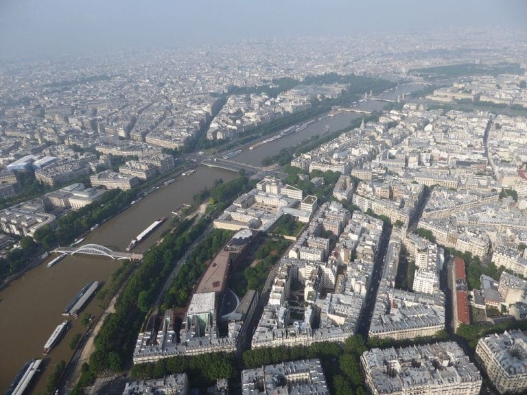
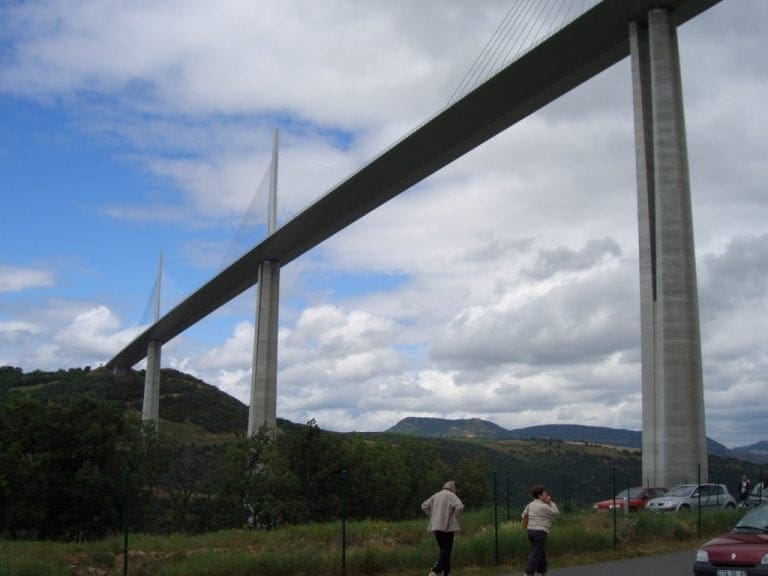
13 Apr 2013. Saturday. Day 71. Change over day again. A beautiful sunny day. 19C. This was the day of our ‘big drive’ half-way across France. We said goodbye to our very, very nice landlords Christina and Robert at 8am. (They checked to see we had not left anything and gave us back our bond.) We drove 915 km from Luchon to our new village in Burgundy. We took just over 9 hours to do the drive – including stopping for lunch and being stuck in a traffic jam in Lyons (on a Saturday!!). Almost all of the drive was on motorways. Most were actually toll-ways and we paid €65.50 for the privilege of driving at 130km/hr. Although it was stressful, it was not hugely so. Most drivers are very good and it was just a matter of following basic rules of staying well to the right, looking and signalling. We tried to sit on 130km/h using the cruise control and that worked very well. The only hassle at all is the Belgian drivers who flooded the road north of say Avignon. Belgians cannot drive – at all. They wander all over the road and appear to be in a different world. There were quite a lot on the road and we treated them all with great caution. They are even worse than the poms – who I know cannot drive.
We averaged 6.11 litres/100km for that drive – which has given us an average of 6.06 l/100km so far. I think that is amazingly good. Diving at 130km/hr and averaging 6.11 l/100km. (Because the main variable in fuel consumption is speed – it goes up at the square of the wind speed – I will guess that had we reduced our speed to 120 km/hr – the max on freeway in NSW – we would have reduced the fuel consumption to less than say 5.5.)

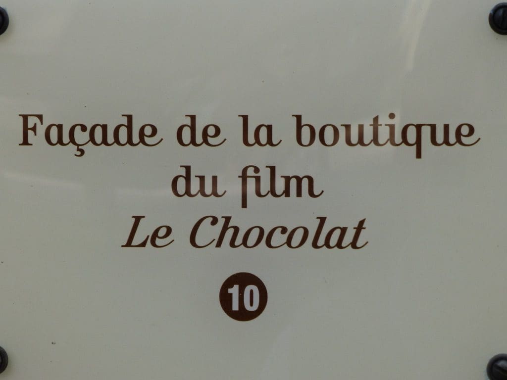
We arrived at Flavigny-sur-Ozerain at 5:15pm, found a place to park, found the cottage, found a place to park to unload, unloaded, found a place to park in the village (near the church). Fairly brain dead by now. Flavigny is the village that was used as a backdrop for the movie ‘Chocolat’ We are 2 doors down from Juliette Binoche’s chocolate shop. Flavigny is in the midst of preparation for being judged in the ‘most beautiful village in France’ competition. It currently holds a three flower rating. More on the village later.

14 Apr 2013. Sunday. Day 72. Sunny again. My reading of the weather charts is that we have had a shift in the weather pattern. Spring is here (a little late perhaps) and we should have warmer days from now – well at least for a week. I cannot see any rain for the next 6 days. Back to the villages and how they work. Flavigny-sur-Ozerain is a tiny village that is dying. Many houses (like the one we are in) are summer rentals. The village is mainly populated by people over 65. What happens when they die? There are very few young people here and no new buildings on the outskirts. Flavigny is not by itself in this. It is ‘typical’. (In fact, better than most because of ‘Chocolat’ tourism.) If Europe was bouncing along as it was before the GFC, no problem. Now, de-population of villages and the farmers surviving only by taxation, might imply a ticking bomb hidden in rural France.

We spent the day wandering around Flavigny and chatting with our friends Mavis and Neil who came over to visit for the day. Lunch at the local Farmers restaurant – which was crowded. A very pleasant day catching up with friends who we have not seen for many years.

15 Apr 2013. Monday. Day 73. Sunny 24C. A little drive. First, to the proposed site of Alesia (where Julius Caesar defeated the last stronghold of the gauls in a classic battle). I am persuaded that this is the correct location of the site. The landscape is right and makes sense from what I have read of Caesar’s commentaries. The site Crotenay? in Jura is far too steep and far too big. Of course, nothing of the battle that happened about 2069 years ago remains – no dead bodies lying about. The French have put up a huge statue to the gaul commander Vercingetorix (who was held in Rome by Caesar for several years as a prisoner – because he, Caesar, could not go back to Rome because he was fighting a civil war – something for which Caesar is often castigated.)
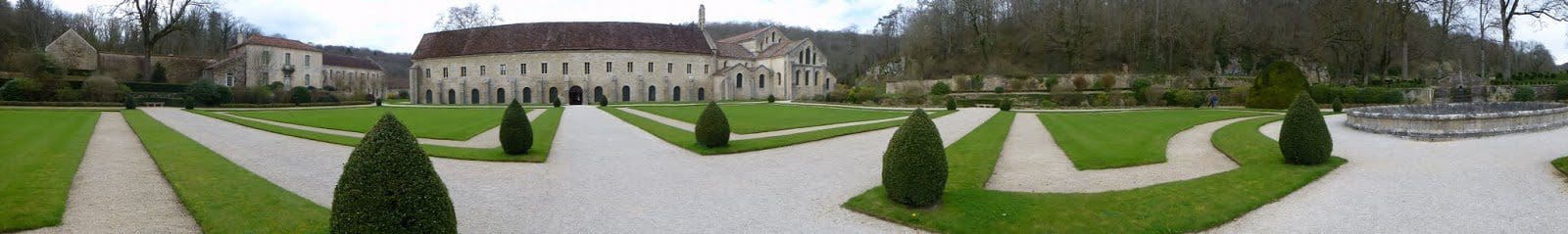

From there, we drove to the ancient Abbey of Fontenay – built by Cistercian monks in 1118 to get back to the ‘good life’ and break away from the pomp that the church had become. (Cistercian means ‘marshy bogs’ to reflect where they lived.) The Abbey was a self-supporting community – a mini city – for 700 years and had as many as 500 monks. Very wealthy from 12th to 15th centuries. They smelted iron and made and sold iron tools from 13th century. They diverted a nearby stream to drive a water wheel that drove an hydraulic hammer.

They went along very well, electing their own prior, until the king intervened in 16th century and began to appoint the prior by command – ‘commendation’. The Abbey fell into decline and by the time of the revolution in 1789, only 50 monks were on site. The Abbey was sold and became a paper mill. Sold again in 1906 and restored privately – to ‘extract Fontenay from its industrial slime’. Now a UNESCO site. Well worth a visit. We spent just over an hour wandering through the church, sleeping place (all 500 in the one room on thin mats), workplaces, forge and garden.

16 Apr 2013. Tuesday. Day 74. Sunny 20C. To the museum at Alesia. Quite a good museum that used an audio guide and photographs to tell the story of the battle of Alesia in Aug 52BC. This was one of the most important battles in history. It saw the final defeat of the waring gauls; the victory by Rome and their occupation of most of Europe for about 500 years; and the final rise of Julius Caesar to ‘consul for life’, ‘dictator’, and after his death ‘god’. I’m convinced that this is the site of the battle of Alesia. The story is something like after the Gauls (under Vercingetorix) had risen in rebellion and killed off the Romans in Orleans, Caesar (with 60,000) gave chase. The Gauls took shelter in the oppidum (hill fort) of Alesia with food for one month. Caesar built two walls around the oppidum – the inner one, 14km long to keep Vercingetorix and his 80,000 in and the outer one, 21km long to keep the relief party (of 250,000 gauls) out.
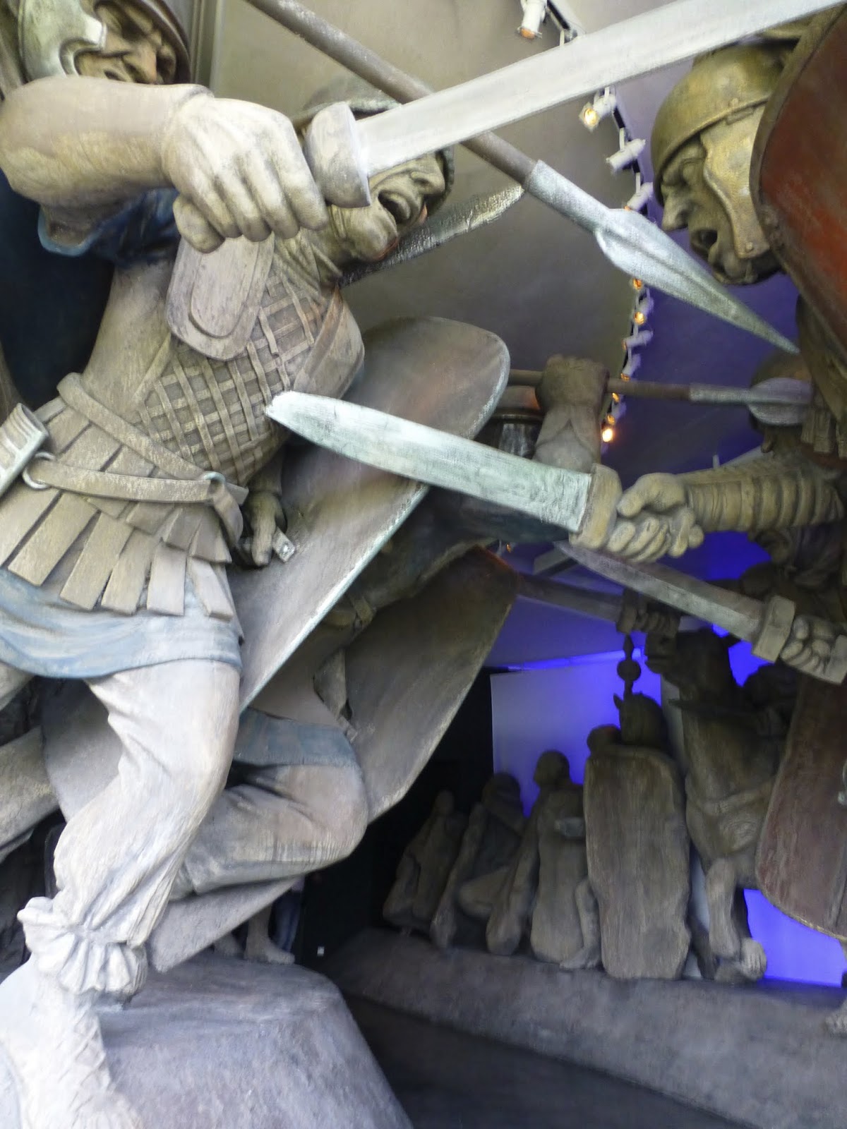
The siege lasted 2 months. The final battle lasted 5 days and was a close run thing. Caesar won. Vercingetorix surrendered. From what I could see, Caesars Camp was very close to where the village of Flavagny stands today. Many hundreds of places have claimed to be the site of Alesia. I think they have done enough archeology to prove that the battle took place here.

Another display at the museum was put in by 4 blokes done up in Roman kit who gave a display of the kind of fighting the Romans did with shield, sword and lance. They showed how a group of 4 could fight together as a unit. The Romans would have practiced these moves over and over and over every day and would have been extremely formidable because of it. Good museum. We spent 2 hours there.

17 Apr 2013. Wednesday. Day 75. Sunny, clear sky. 25C. We did the long circuit walk from Flavigny-sur-Ozerain. It was to be 8.4 km and take 2.5 hours. It was reasonably well marked with little yellow marks on rocks and trees – except for the sign we missed and as a result did an extra couple of kms. A very good walk. It went from Flavigny down to cross the Ozerain River (hence Flavigny above Ozerain in the name), then up the ridge that makes the oppidum of Alesia (Mount Axois), then on the Roman road along the ridge and down back across the Ozerain and back up up up to Flavigny.

A warm day for a walk in the sun. We lunched (again) at La Grange Ferme-Auberge next to the church in central downtown Flavigny. Today, we had the Lamb with lemon, a gratin (of some sort) and a slice of apricot pie. The wine today was the Pinot Noir Tenderesse (a local drop from the winery we had walked past). I could drink that wine every day. (The wine was €13 to drink with the meal and €6.60 to take away. I bought two bottles to take away.) A black cat came in to sit on us today. It sat on Helen for about three hours. Our neighbours gave us half a dozen eggs. Very friendly place this.
18 Apr 2013. Thursday. Day 76. Cloudy and a little rain 17C. We began the day with a bit of a panic. We reviewed the map last night and became a bit worried that we had not allowed enough time to get to the concert on Friday. A few changes in accommodation this morning. We drove to the Grand Cru country to Nuits-St-George as return visit to our friends Mavis and Neil. A very pleasant day. Returned to pack for our departure tomorrow.
I’m going to finish this week on the Thursday. Tomorrow can be argued into the week with the choir.
We have really liked our week in Flavigny-sur-Ozerain – an extremely friendly village, friendly neighbours and friendly cat. Flavigny would have to be described as ‘old’. It is parked next to the site of Alesia; the cellars of the houses are described as ‘Gallo-Roman’ (most houses have a Gallo-Roman cellar, ie before 500AD), a crypt in the village is said to be VII th century; Flavigny is signposted as ‘Cite Medieval de Flavigny’. I think older than Medieval. Probably settled in Gallic times, colonised by Rome post Alesia and Abbeys built here all through the early Christian era. Old. Good to live in. I suspect that many (or even most) houses are no longer permanently occupied. Our downhill neighbours and only two others came out for the bread van each day. That is not very many. The permanent population of Flavigny might be fewer than the number of houses – and both the population and house are ageing.