Sun Peaks skiing 2017 – week 2
Wednesday 25 Jan 2017. Day 8. Day off. The squirrel was back and got nuts this time. Happy squirrel.

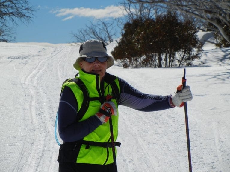
Thursday 26 Jan 2017. Day 9. Skate skied up the Lake McGillivray trail to about 200m above the junction with Black Bear. We had not been on skates for many years and I was amazed at how well we did and how far we got. The blokes in the pix at page top are skating. We look just like that – not! (Note the aggressive weight shift on the bloke close to the camera. He has just stepped off his left ski, committing his weight to his right ski and is about to straighten that right leg, pushing his right hip forward and to the right. The right ski will glide for a few metres before he steps onto the left ski and repeats the process to the left. The photo is taken on a flattish bit near the top of Holy Cow looking towards Top Of The World. The two sets of parallel tracks to either side of the skaters are the classic tracks.) Skating is certainly much more energetic than classic – I had to stop about every 15 skates (cf 50 on classics). But that covers about the same distance because each skate goes so much further than a classic stride.

I’m very impressed at how well we did – better control and much more able to stand on the gliding skating ski and let it do its bit. A few things helped enormously in the prep. These were:
Cross Country Ski Technique: Improve your glide
Cross Country Ski Technique: Forward body lean
ZHealth: improve balance
I’m extremely impressed with ZHealth – that such a simple thing as moving your nose from side to side while watching a single point can have such an enormous effect on improving balance and movement.
One thing we noticed on our return was that only one part of our quads (Rectus Femoris) was warm when we returned – the rest were quite cold. So that was the main muscle used. Unlike classic where the main muscles are the lower abs and back. Australia Day is getting a bit of a bravo today – walking past our window, a good Ozzie yob in singlet, shorts and thongs walking through the snow on his way to the pub. Too shocked to get a photo – sorry.

Friday 27 Jan 2017. Day 10. Skate skied all the way along the Lake McGillivray trail – so a repeat of yesterday plus about 1.2km. It is uphill all the way out and hence downhill all the way back. Nothing steep just a constant-ish gradient. Arrived back so exhausted I can hardly move. I did keep my heart rate to less that 150BPM but I spent too long (2:23hours) in zone 3 (ie 80%-90% of max heart rate). Almost 2,000 kcals for the day. Out for 3hours.

Saturday 28 Jan 2017. Day 11. Skate skied from the top of Morrissey – down Holy F Cow, down Great Grey and Vista. Just on 2:30hours. That makes 14 hours and 8,000 kcals for the week. Fairly exhausted and we may have overdone it. I can hardly move.

Sunday 29 Jan 2017. Day 12. Day off. A walk through the village for a coffee, a bun and a chat, food supplies, new xc-ski pants. Watched re-play of the Aust Open tennis mens final. A sunny day. Skype call back to Wagga. Helen walked through the upper village with its million dollar mansions.

Monday 30 Jan 2017. Day 13. Cold. -11ºC at the top of Morrissey with a 13 kmh wind. Classic skied from the top of Morrissey down Holy F Cow (which had not been groomed and was covered in crap, mostly snow that had been blown off trees), along Moose (which is a delight), up Whisky Jack (also very good), down Blue Grouse (down is certainly correct), down Vista and back along the Valley trail to the village, then skied up to the ski room of the hotel – first time for that and for several of those runs.

Holy Cow was very difficult with quite a lot of debris on the track – those little pine cones are a bit of a curse as are some of the leaves. I had three falls and Helen had one when a ski suddenly stopped sliding. A hot tub. Exhausted. Most muscles groups are on strike. 3:15hours out and almost 1,900 kcals. A huge day.

Tuesday 31 Jan 2017. Day 14. Cold today. -18ºC in the village with a 14kmh wind. Classic skied Cotton Tail, up Black Bear and Lake McGillivray trail to Moose, along Moose, down Great Grey, Vista and Valley trail back to the Village. Pizza for lunch. We did not use the hot tub and I think as a result were quite cold during the afternoon after the 2 1/2 hours in quite cold conditions regardless of how hard we had worked. The temp in the hotel rooms is a steady 25ºC.

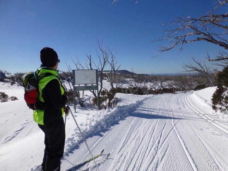
The pix left is of the bottom of Screech Owl (a backcountry run that runs off Holy Cow and comes out on Great Grey). The first many times I saw this sign (you might need to zoom) it was obscured by snow and I was certain it was describing the Best Ski Trail in the world. The reality of ‘best skied downhill’ is much more mundane.