I am Mont Ventoux

by | Feb 21, 2013 | France, Road trips

I am a mountain in the Provence region of southern France.  As the name might suggest (venteux means windy in French), it can get windy at the summit, especially with the mistral; wind speeds as high as 320 km/h (200 mph) have been recorded.  The wind blows at 90+ km/h (56+ mph) 240 days a year. The road over the mountain is often closed due to high winds. Especially the “col de tempêtes” (“storm pass”) just before the summit, which is known for its strong winds.

Mont Ventoux has become legendary as the scene of one of the most gruelling climbs in the Tour de France bicycle race, which has ascended the mountain fourteen times since 1951. The followed trail mostly passes through Bédoin. Its fame as a scene of great Tour dramas has made it a magnet for cyclists around the world.  The race has finished at the summit 8 times and crossed the summit another 6 times.

The climb by bike from Bédoin to Mont Ventoux is one of the toughest in professional cycling.  The average gradient for the total climb is 7.43%, based on a horizontal distance of 21,765 metres and an ascent height of 1,617 metres.  Four kilometers have an average gradient above 10% and another five kilometers an average gradient above 9%.

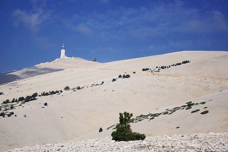
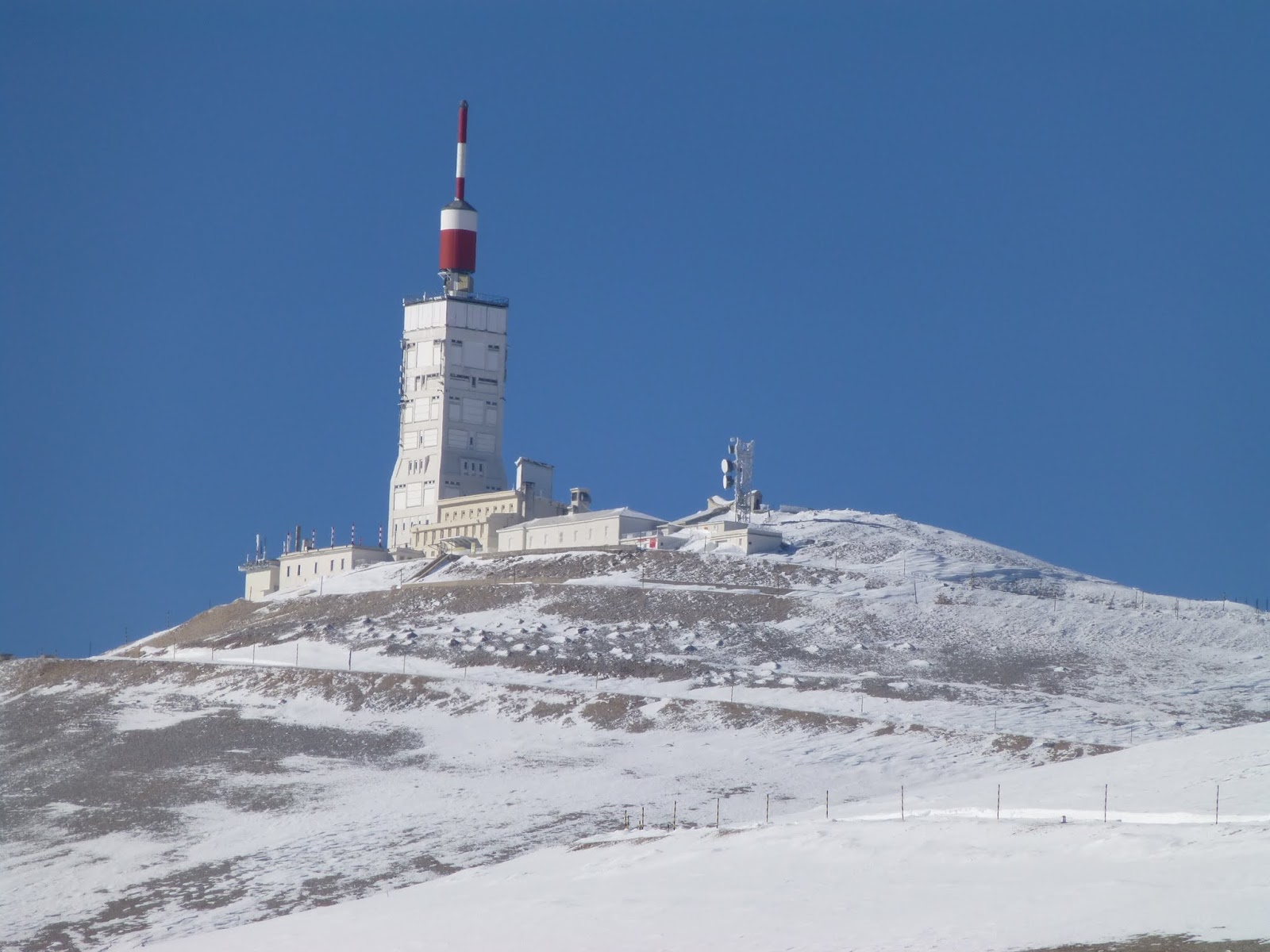
Mont Ventoux, although geologically part of the Alps, is often considered to be separate from them, due to the lack of mountains of a similar height nearby. I stand alone to the north of the Luberon range, separated by the Monts de Vaucluse, and just to the east of the Dentelles de Montmirail, my foothills.  The top of the mountain is bare limestone without vegetation or trees, which makes the mountain’s barren peak appear from a distance to be snow-capped all year round (my snow cover actually lasts from December to April).  My isolated position overlooking the valley of the Rhône ensures that I dominate the entire region and can be seen from many miles away on a clear day. The view from the top is correspondingly superb.

Shield Shrimp

When it rains across Australia’s vast inland region, temporary pools crop up all over the arid ground, giving life to a strange desert crustacean known as the shield shrimp (Triops australiensis).

Named after the formidable carapace that shields its head and upper body, T. australiensis can grow up to 7.6 cm long, and it uses its long, segmented tail and mass of 60 or so legs to propel itself through shallow water.

It also breathes through these legs – its sub-class Branchiopoda means ‘gill-legged’ – and in the females these legs bear ovisacs for carrying their tiny eggs.

Several pix in the Photo Gallery and a movie.

Acacia peuce

A rare and endangered plant. The tree grows up to 15 to 18 metres (49 to 59 ft) high, with short horizontal branches and pendulous branchlets covered in needle-like phyllodes adapted for the arid dry climate. It has a distinctive habit more similar to a sheoak or a conifer.

Although speculated to have been widespread across central Australia during wetter climates 400,000 years ago, the population is now mostly restricted to three sites, separated by the encroaching Simpson Desert. In the Northern Territory, the species is restricted to the Mac Clark (Acacia peuce) Conservation Reserve which is surrounded by a pastoral lease, Andado Station. The other two sites are near Boulia and Birdsville in Queensland. The tree is found in open arid plains that usually receive less than 150 millimetres (5.9 in) of rain per annum. They grow on shallow sand aprons overlaying gibber or clay slopes and plains and between longitudinal dunes or on alluvial flats between ephemeral watercourses.


Owen Springs Reserve on Hugh River

Owen Springs was a station on the Hugh River. The Hugh River flows into the Finke (when it actually flows). Both cut through the Western MacDonnell Ranges. The image above shows Owen Springs Reserve as a dot at lower right. The river it is next to is the Hugh. Hermannsburg, our next town, is near middle left edge. Hermannsburg is almost on the Finke River. You can see both Hugh and Finke Rivers cutting through sections of MacDonnell Ranges.

Palm Valley

Palm Valley is within the Finke Gorge National Park southwest of Alice Springs. Palm Valley has a smallish population of Red Cabbage Palms (Livistona mariae). The nearest related species is 850 kilometres away in Katherine NT. The average rainfall for Palm Valley is just 200 mm per year. Small pockets of semi-permanent spring-fed pools allow the unique flora and fauna (desert fish, shield shrimps tadpoles and frogs) to survive.

It had been assumed that the cabbage palms were remnants of a prehistoric time when the climate supported tropical rainforest in what is now the arid inland of Australia. Genetic analysis published in 2012 determined that Livistona mariae at Palm Valley is actually the same species as Livistona rigida from samples collected near Katherine and Mount Isa, both around 1,000 kilometres (620 mi) away. It is now thought that aboriginal people brought the palms to here from Mataranka.

Mound Springs

Mound Springs occur around the Western edge of the Great Artesian Basin and represent a natural discharge of Artesian water that was captured many hundreds of kilometers away from rain falling along the Great Dividing Range and New Guinea. This article provides details. Dalhousie is an excellent example of a mound spring.

Great Artesian Basin map Great Artesian Basin diagram