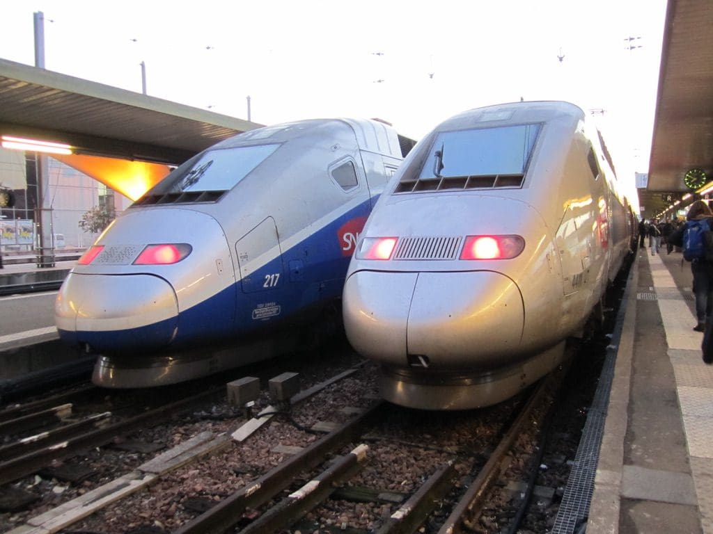
I am a TGV – a very fast train
I am TGV – a very fast train
The TGV (French: Train à Grande Vitesse, meaning high-speed train) is France’s high-speed rail service, operated by SNCF Voyages, the long-distance rail branch of SNCF, the French national rail operator.

TGV was developed during the 1970s by GEC-Alsthom (now Alstom) and SNCF. Although originally designed to be powered by gas turbines, the TGV prototypes evolved into electric trains with the petrol crisis of 1973. Following the inaugural TGV service between Paris and Lyon in 1981, the TGV network, centred on Paris, has expanded to connect cities across France and in adjacent countries.
A TGV test train set the record for the fastest wheeled train, reaching 574.8 km/h (357.2 mph) on 3 April 2007. As of mid 2011, scheduled TGV trains operate at the highest speeds in conventional train service in the world, regularly reaching 320 km/h (200 mph) on the “LGV Est”.
 The success of the first line led to an expansion of the network, with new lines built in the south, west, north and east of the country. Eager to emulate the success of the French network, neighbouring countries such as Belgium, Italy, Spain and Germany built their own high-speed lines.
In 2007, SNCF generated profits of €1.1 billion (approximately US$1.75 billion or £875 million) driven largely by higher margins on the TGV network.
On 28 November 2003 the TGV network carried its one-billionth passenger, second only to the Shinkansen’s five billionth passenger in 2000. The two-billion mark was reached in 2010.

The newest high-speed lines allow speeds of up to 320 km/h (199 mph) in normal operation. Originally, LGVs were defined as lines permitting speeds greater than 200 km/h (124 mph); this guideline was subsequently revised to 250 km/h (155 mph). Like most high-speed trains in Europe, TGVs also run on conventional track (lignes classiques), at the normal maximum safe speed for those lines, up to a maximum of 220 km/h (137 mph). This allows them to reach secondary destinations or city centres without building new tracks all the way to the station, reducing costs compared to magnetic levitation trains or high-speed networks with a different gauge than the surrounding conventional network (as in Japan or Spain).

TGV track construction is similar to that of normal railway lines, but with a few key differences. The radii of curves are larger so that trains can traverse them at higher speeds without increasing the centripetal acceleration felt by passengers. The radii of LGV curves have historically been greater than 4 km (2.5 mi). New lines have minimum radii of 7 km (4.3 mi) to allow for future increases in speed.
Track alignment is more precise than on normal railway lines and ballast is deeper. LGV track is anchored by more sleepers per kilometre than normal and all are made of concrete. Use of continuously welded rails instead of shorter, jointed rails yields a comfortable ride at high speed, without the “clickety-clack” vibrations induced by rail joints.
Because TGVs on LGVs travel too fast for their drivers to see and react to traditional lineside signals, an automated system called TVM, “Transmission Voie-Machine” or track-to-train transmission, is used for signalling. Information is transmitted to trains by electrical pulses sent through the rails, providing speed, target speed, and stop/go indications directly to the driver via dashboard-mounted instruments. There are safeguards that can safely stop the train in the event of driver error.
The line is divided into signal blocks of about 1500 m (≈1 mile) with the boundaries marked by blue boards with a yellow triangle. Dashboard instruments show the maximum permitted speed for the train’s current block and a target speed based on the profile of the line ahead. The maximum permitted speed is based on factors such as the proximity of trains ahead, junction placement, speed restrictions, the top speed of the train. Because trains cannot usually stop within one signal block, drivers are alerted to slow gradually several blocks before a required stop.