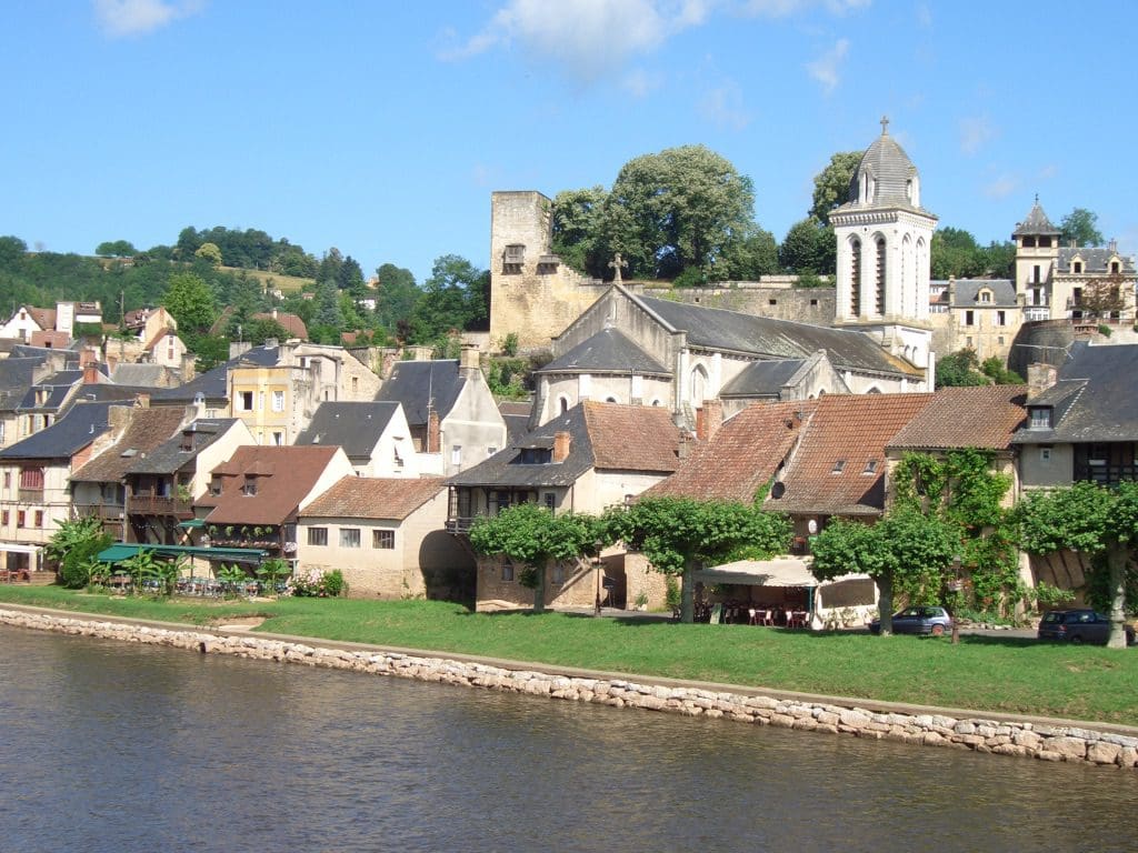
Dordogne
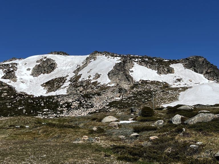
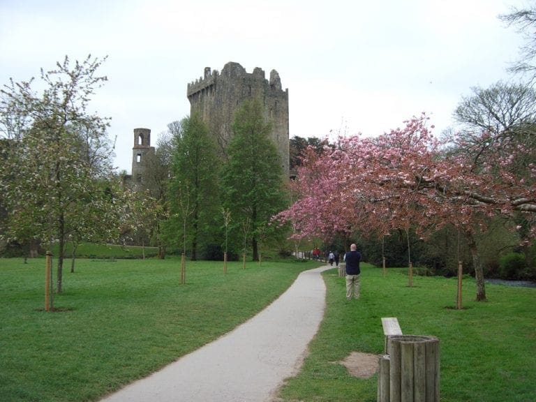
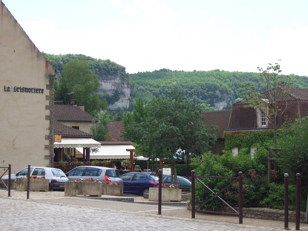
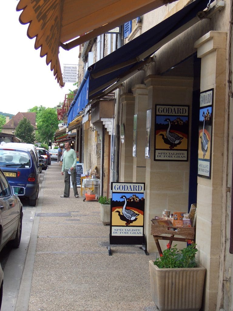
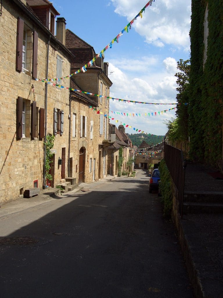
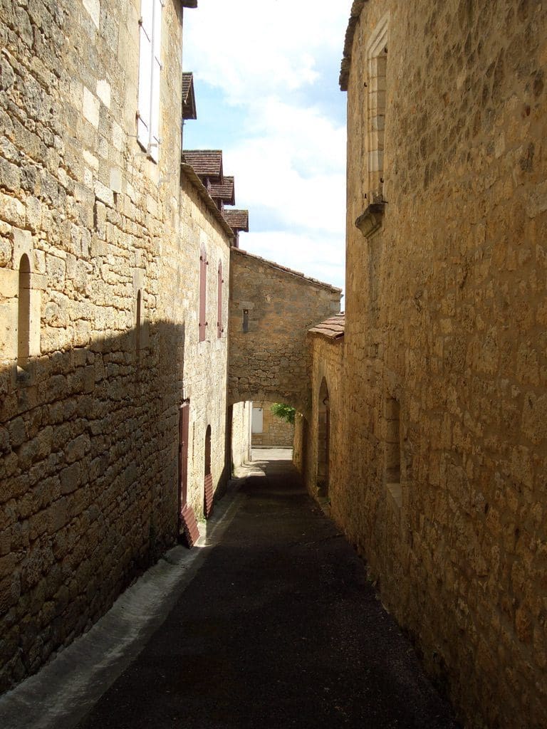
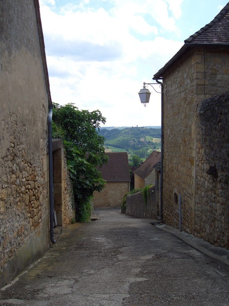
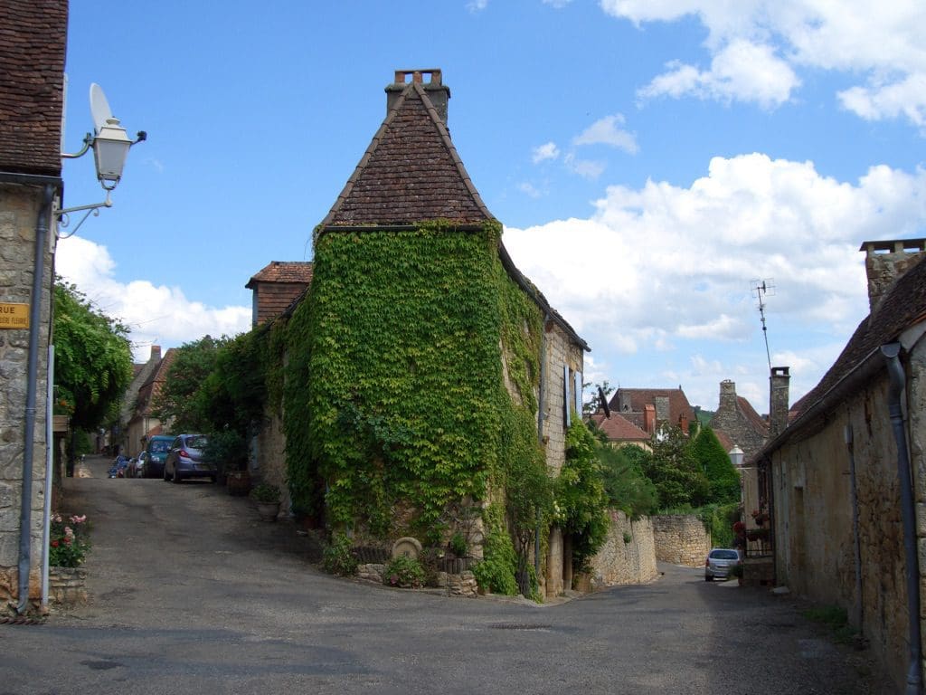
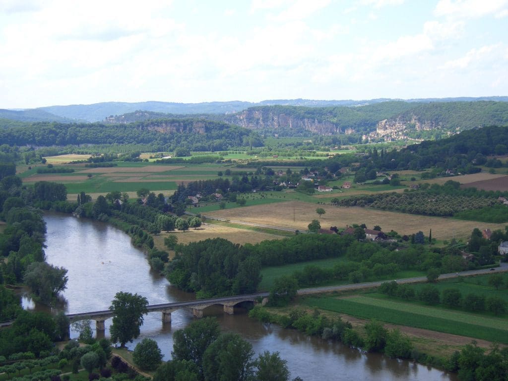
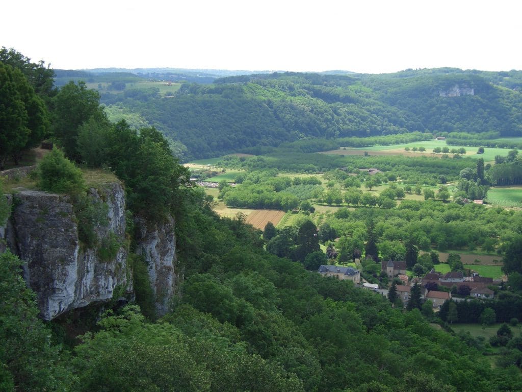
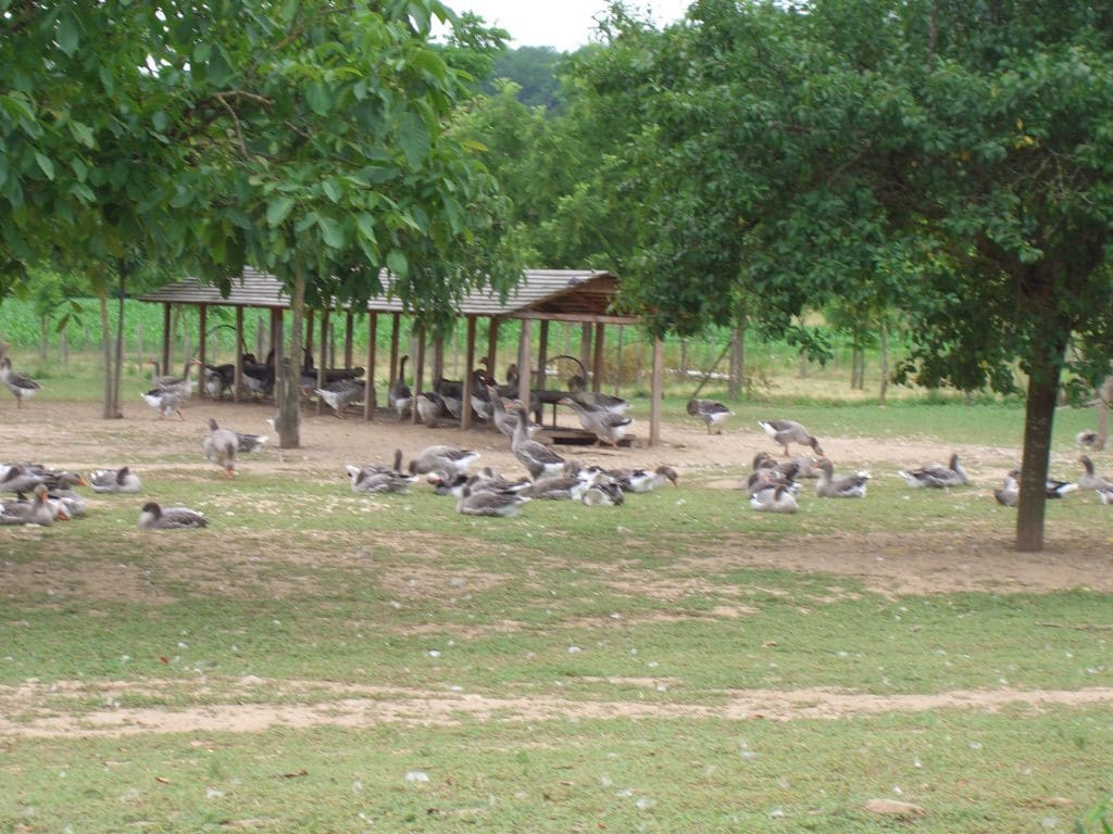
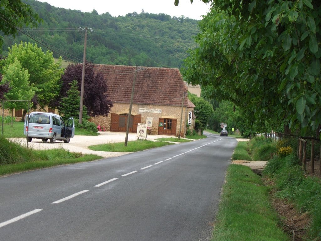
16/6 Welcome to Perigord noir – a region that specialises in truffles, walnuts, strawberries, mushrooms and fois grass – the real stuff – there are huge flocks of geese and ducks in the farm yards. It is part of the Dordogne. (For Dordogne slide show, click here.) The area is a plateau that has been eroded by ice and water over time. The hill tops are covered in fairly low and dense deciduous forests – many oaks for the truffles. The river valleys are incredibly rich farm land growing all sorts of crops in small paddocks, while the slopes are used for dairy production. Fruit trees are starting to dot the farm yards – plums, cherries, figs, apples, pears and reasonably big paddocks of walnut trees – few vines in selected areas. The buildings are made of local stone which takes on a light rusty-beige colour. These contrast with the verdant green crops and trees. Every farm house has some fruit trees as well as its own fairly large vege patch. Many signs to farms selling specialities. Many of the valleys are lined with steep limestone/sandstone cliffs and overhangs.
Lunch was again an adventure. Both started with fois grass. Extremely mild flavour and a very creamy texture – nothing like pate. With all these geese/ducks being killed for their livers, the regional cuisine specialises in what is left. Geoff had goose breast in a mustard sauce while Helen had a cassoulet with goose, saucisson (cross between sausage and salami) and white beans. Of course this was helped down with a small bottle of rose and preceded by a couple of aperitif. Both decided it was a very civilised way to spend a couple of hours in the middle of the day.
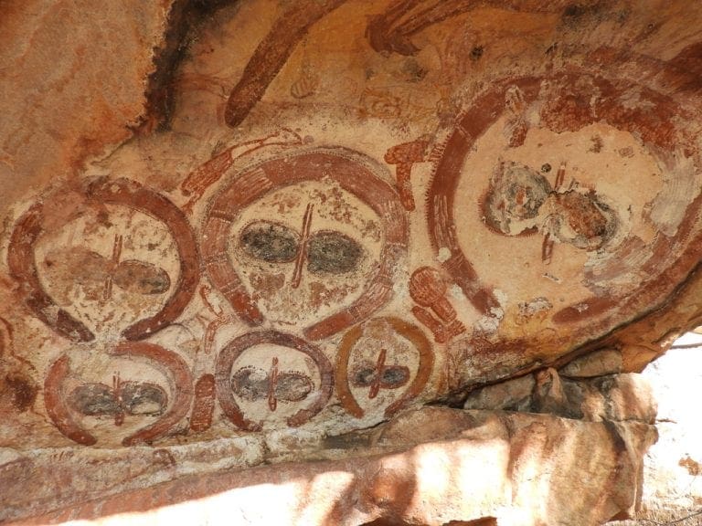
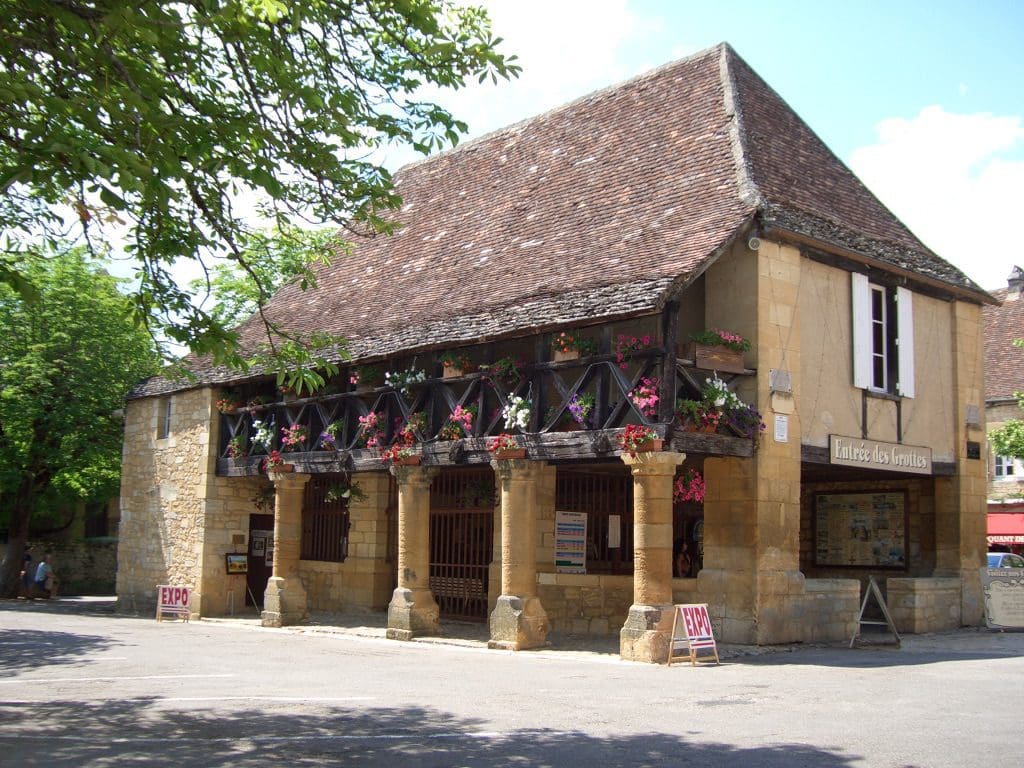
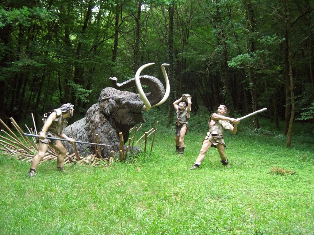
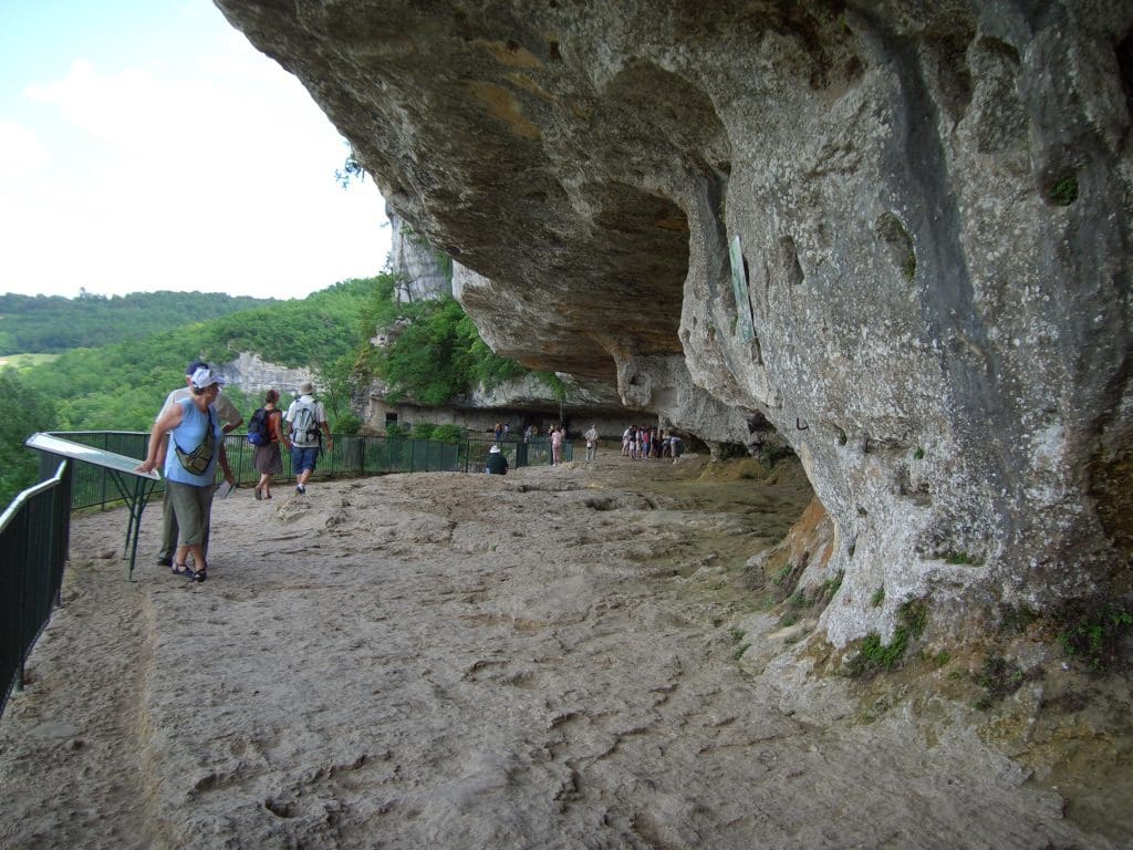
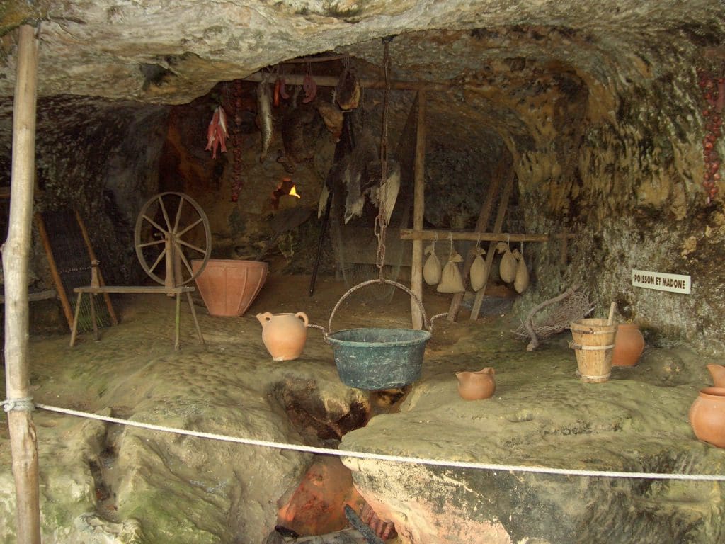
The region also contains some of the earliest archaeological site of mankind. The previously mentioned cliffs have provided excellent shelter for human habitation for the past 400 thousand years and the region is dotted with digs and caves that contain very early paintings and artifacts. They have a particularly good record of the past 40 thousand years – this far back has precise dates with C14 dating etc. We spent the morning in a museum housing some of the local finds. They tried to put them to a time line and show the introduction and making of tools and artifacts. Some very good videos of making and using stone tools. To make a small stone carving, first make your stone tools to the right size, sharpness, pointedness, etc. They had videos of making stone axes and knives, bone and antler knife, spear tip and harpoon (difficult to attach to the shaft). The museum was in a modern building (2004) but the laboratories and old museum were housed in a building that was built into one of these cliff overhangs. One of the most important digs in the area – Les Eyzies- was 50m along the cliff line. The Vezere valley is so important to archaeology that many of the periods were named after the villages in which the remains were first found e.g. Moustier, La Madelaine. These are all within a few kilometres from where we are sitting.
This area, with its archaeological finds going back 400,000 years must be very confronting to creationists. How can one deal with evidence of human habitation extending back so far when someone has calculated that the earth began 6000 years ago (or whenever it is).
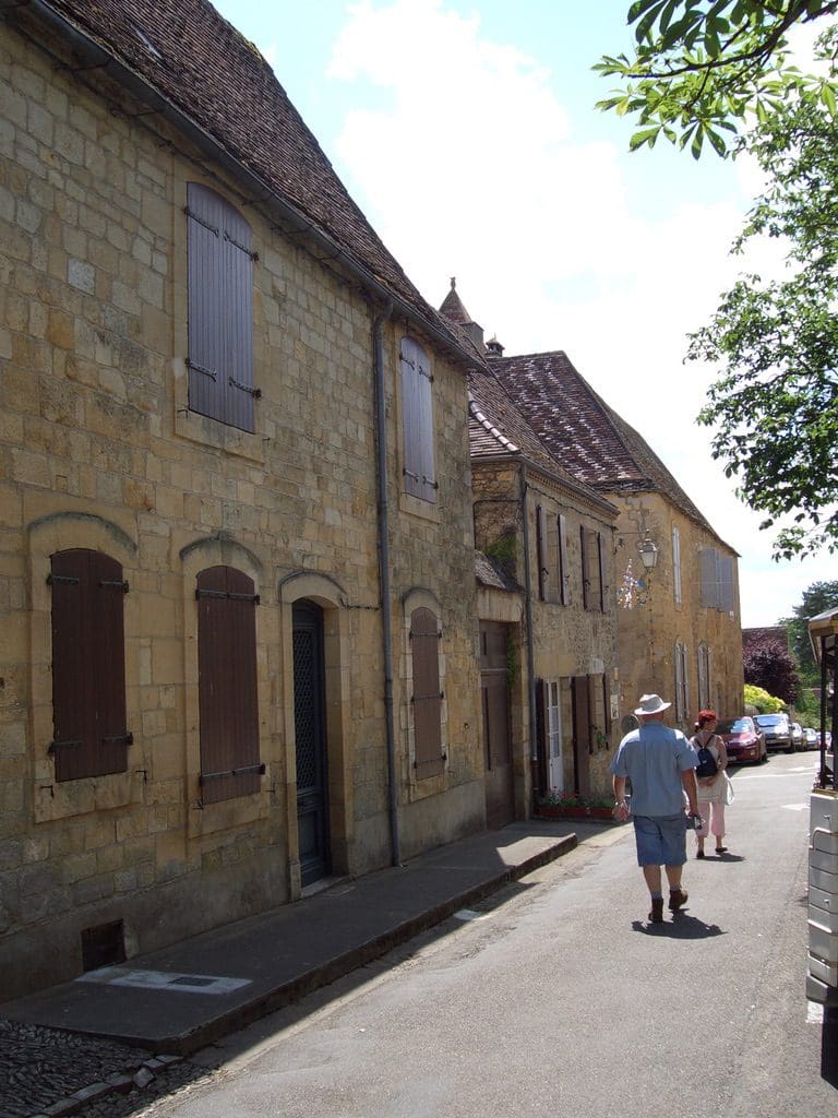
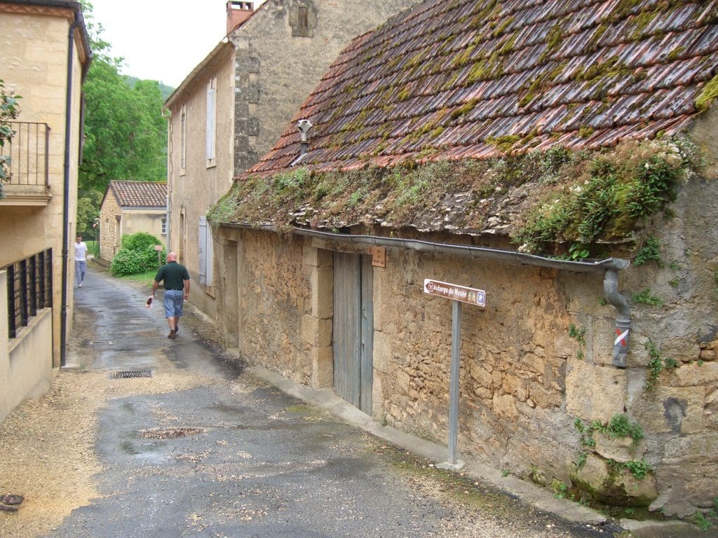
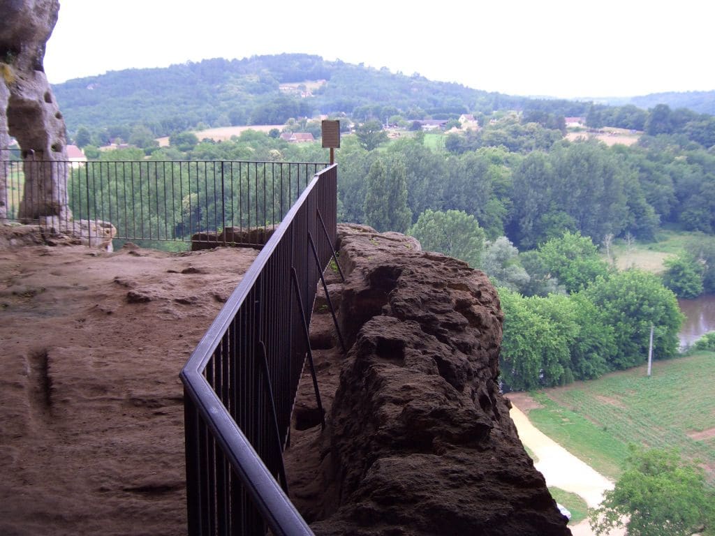
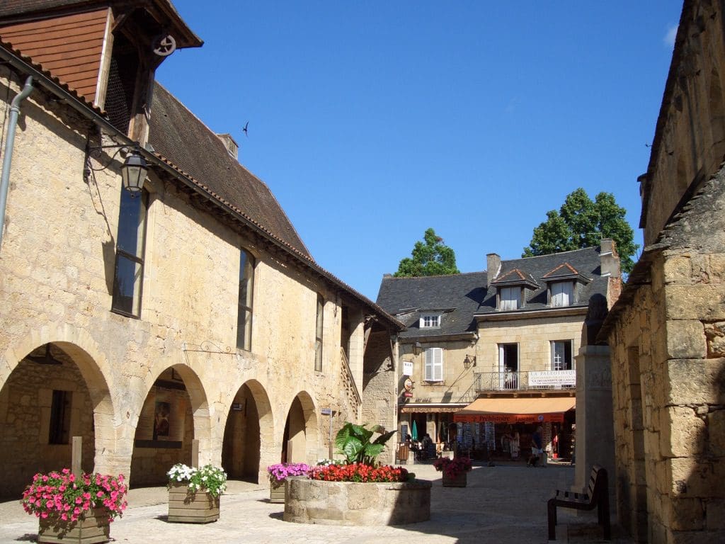
From there we went to Bastide de Domme, a hill top town (now with a population of about 1000) that was built in the 13th century and laid out with its streets in a rectangular grid (still a novelty in France) They were some of the first towns to have numbered houses – all the better to record for tax purposes. There are a series of these bastides in this area which were town/fortifications on what was, at the time, the division between the French and the English. They were also market towns and boasted some of the first covered markets in the central square. Domme is particularly well restored and is a fairy tale, picture book place – narrow cobbled streets, high walls for fences, flower bedecked. You can walk around the walls or just spent a few hours sipping coffee or something stronger while seated at a café on top of the cliffs that overlook the Dordogne valley. The central area is lined with souvenir and eating shops waiting for the absolute mass of tourists that will descend in a few weeks during summer holidays. There is a huge bus, mobile home and car park outside the city walls. The gates will soon be closed to tourist vehicles.
17/6 Geoff’s birthday. We began with a visit to a prehistory park with many excellent dioramas to show the life of Neanderthals and Cro-Magnon man that lived here. Neanderthals lived from about 400,000 years ago to about 35,000 years ago. Then, they suddenly disappeared and were replaced by the Cro-Magnons (us really) who lived here till the Wurm ice age finished about 10,000 years ago, and who then spread out everywhere. They lived in permanent settlements in these cave/shelters and went on ‘camping’ expeditions to follow the reindeer that then lived locally. They also fished a lot – often using poison to kill lots of fish at a time – safer then trying to kill something big. They also left behind many paintings and carvings.
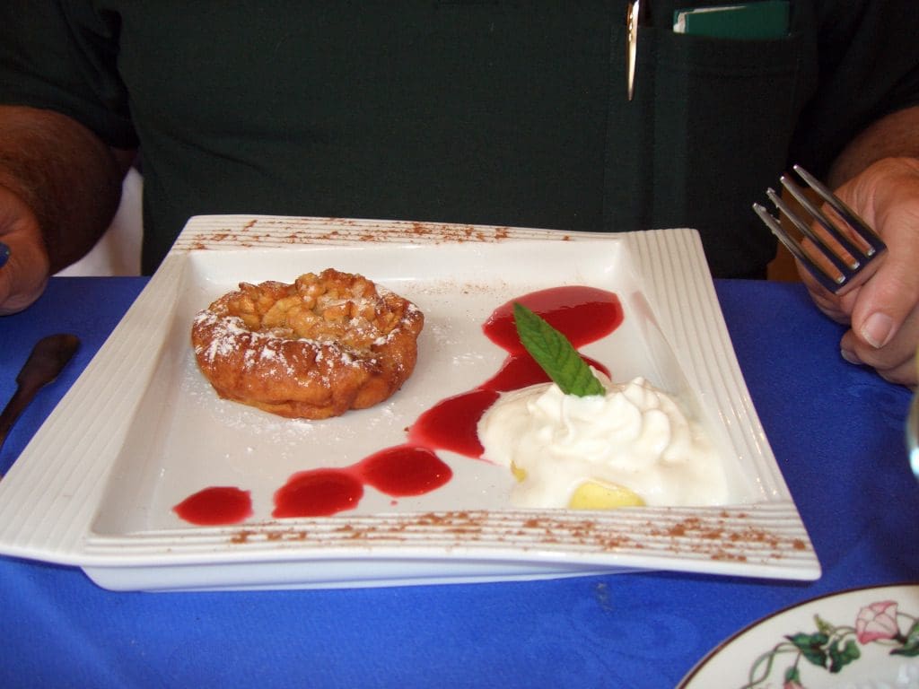
Then, lunch at a 2 star place (almost next door to where we were yesterday) – excellent. As usual, although the staff was very helpful, what arrived was a surprise. In typical style, Geoff ordered all prime numbers – in this case 1 for entrée, main and dessert. Just in case you are wondering – a mushroom ‘tart’, grilled duck with potato sautéed in goose fat, an apple light and fluffy thing, strawberry coulee (with a hint of mint – a local speciality) and cream. Another disaster for the derriere.
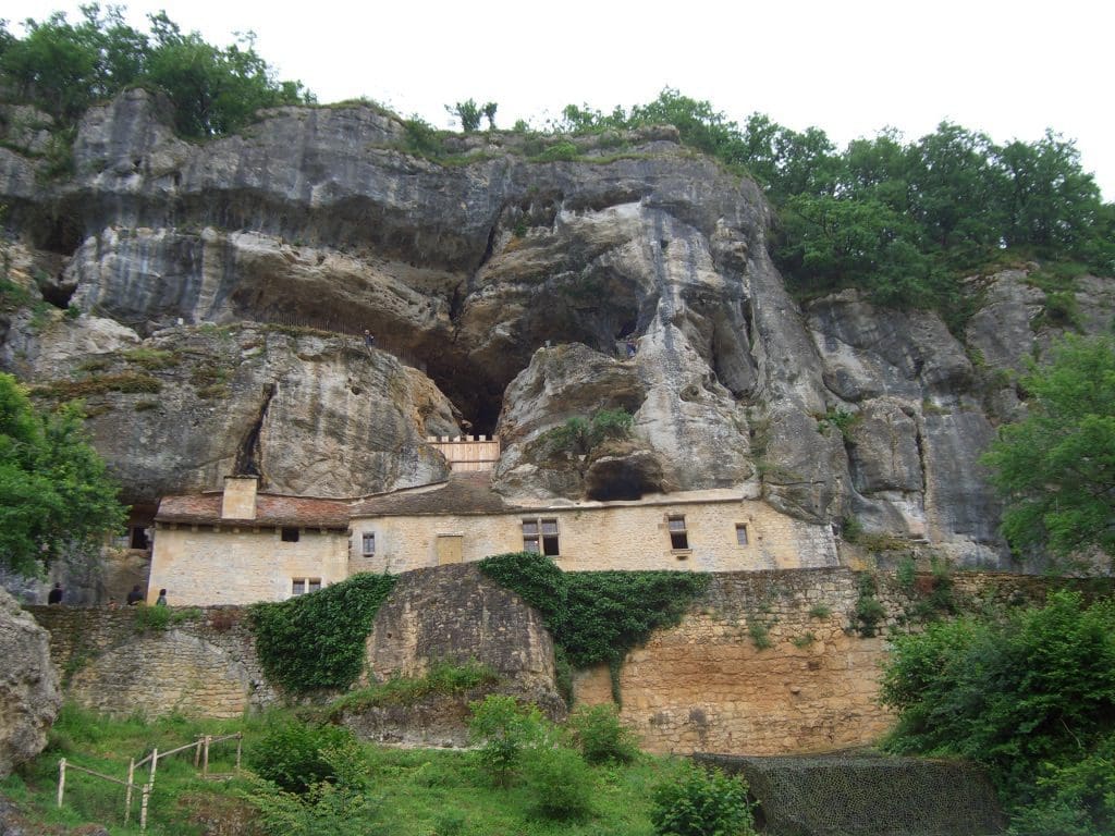
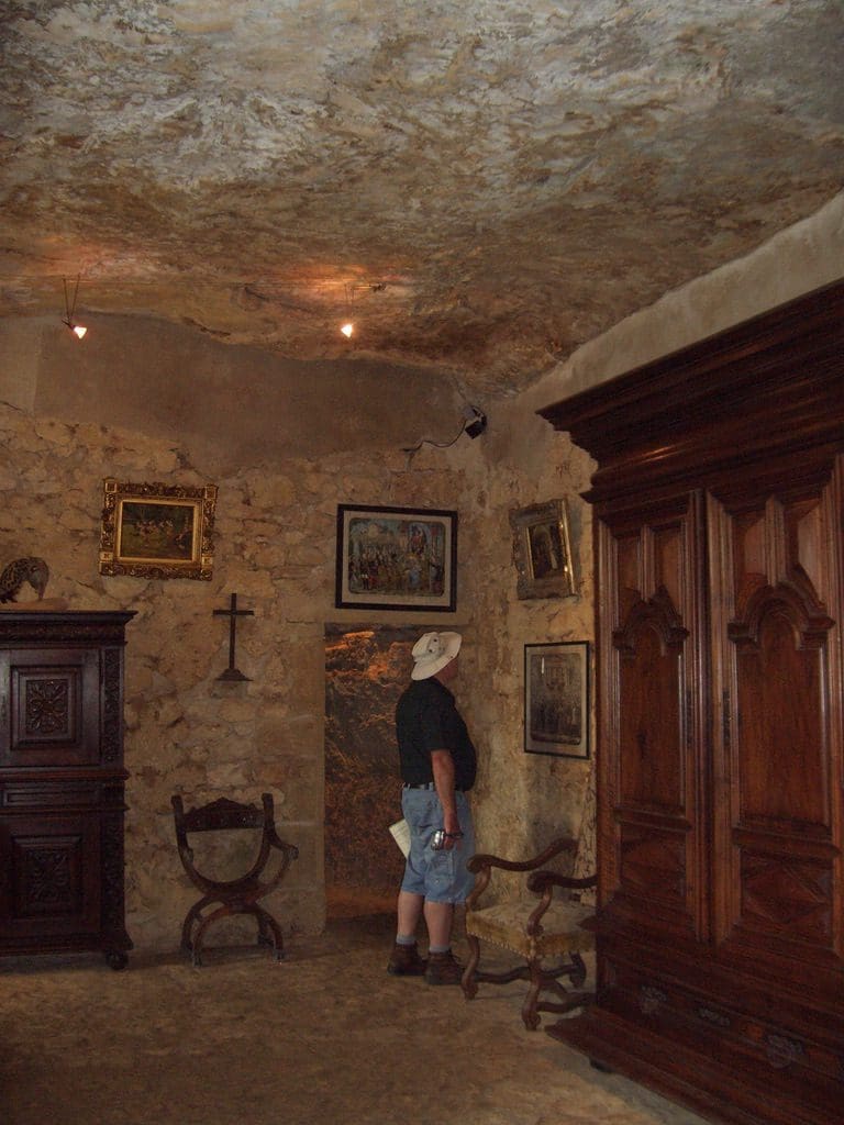
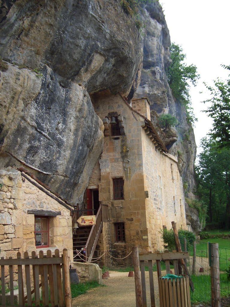
From there to Maison Forte de Reignac, a chateau built into a cliff face overlooking the Vezere valley. This place has been kept in the 1700 style, however, excavations of the site show that man lived in this cliff/cave thousands of years ago. An extremely beautiful place to live. From the outside, it looks as though there would be no room inside. However, it would have been (comparatively) very roomy. The view from the upper terrace was spectacular. However, … The counts who lived here in 1700s had a room set aside for ‘taking their rights’ on all newly married women. Also any girl who had been forced into service in the place. Very unpleasant chaps. But, we understand, a very common practice. There was also display of torture – about 70 or so torture devices with pictures and descriptions. From their very explicit display, it appears that the torture devices were mainly used as a method of punishment for infringement of the then laws – of the church or local landlord – from at least 1200s to 1700s. They were administered in the presence of a notary (to record), a magistrate and a surgeon (to stop the procedure if it got heavy handed or misapplied – the person was then healed and the procedure was correctly applied). These days, we tend to think of torture in association with extraction information, reigns of terror or just bloody mindedness. However, until 1700s, it was the penal system. They had few gaols or places to keep miscreants. Most punishments were administered in public, often with the whole village attending (especially if it was a very painful one involving a woman). There were several categories of implement: those meant to humiliate but not (greatly maim) eg stocks, and scolds masks, fiddles; those meant to maim, eg removing pieces of flesh or limbs, breaking bones, dislocating joints; those meant to kill (with varying degrees of extended pain), eg rack, wheel, impale, quartering, removing vital organs, beheading. Very disturbing. With penal reform in the 1700s (we now understand more of what that meant), miscreants were gaoled not maimed. This meant gaols were needed, and in England and France, when these got too crowded, transportation.
A few words about our present campground. It is full of English and Dutch. We have a brochure that advertises 50 flights a week from UK to Bergerac a smallish town nearby. Our neighbours, very friendly Scots, have come here for the last 4 years. They say that the English have been buying up this area of Dordogne. They, the Scots, have one of the biggest camper vans we have seen – 10 wheeler – and a small van/trailer that holds two large motorbikes. They may watch too much Billy Connolly. He, the neighbourly Scot, does not eat this French stuff and comes here with a freezer full of ‘proper food’. We think this is amazing, one of the food capitals of the world and bring your own food. The camp ground has its own restaurant. We have had a meal here but found it very anglicised – your basic steak, chips, and a lettuce leaf with not much flavour. It is booked out this evening and the most common drink on the tables is beer. Many of them seldom leave the grounds and spend much of their time sitting around the pool.
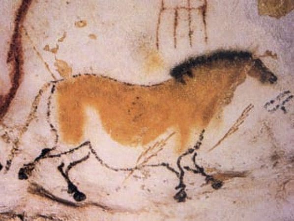
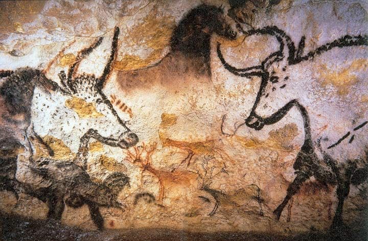
18/6 Today we went to Lascaux II, a replica of the incredible cave found in 1940. The paintings are large and amazing. Extremely sophisticated levels of artistic ability that is hard to believe. Where did they practice to get these skills? Were they done by one person or by many? They are extremely similar. As well as their complexity the amazing thing was their size – most more than 2 metres, with the big bull 18 feet from the tip of his horns to the end of his tail. They worked on a big canvas and used many of the bulges and dints in the cave walls and ceilings to accentuate the animals. The cave proper (painted originally 18,000 to 17,000 years ago) was closed in 1967 because the 1,500 tourists a day had caused a green fungal growth and a white calcium deposit to form on the painting’s surface. They made exact replica of the inside of the cave (6 years of sculpting) and then painted it (another 5 years). They opened Lascaux II in 1983. We were on the 11:50am ‘English’ tour. The Americans appeared to be demanding to see the original cave and paintings.
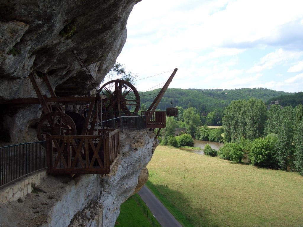
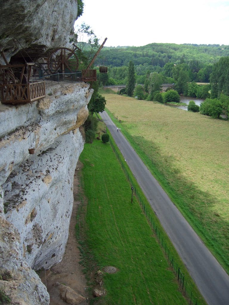
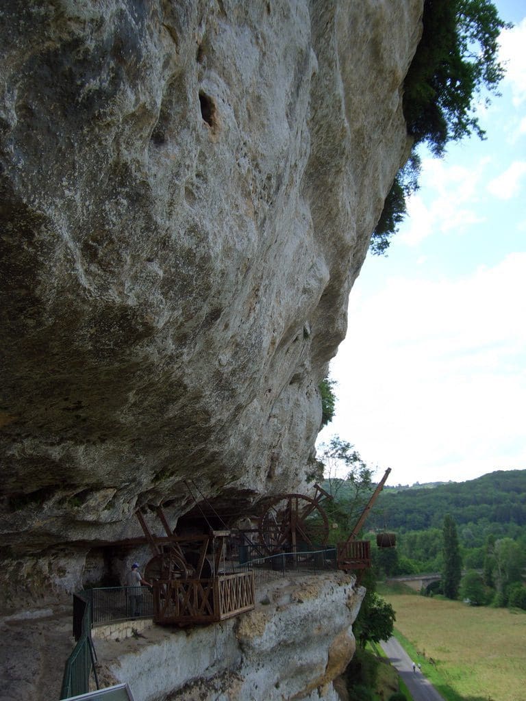
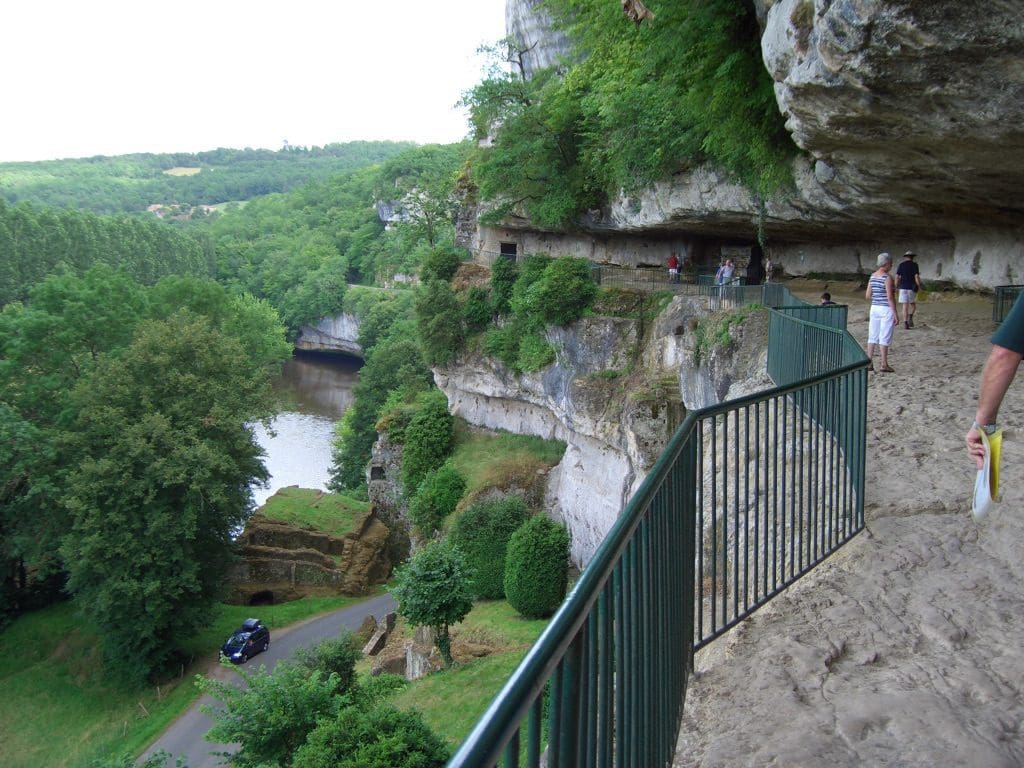
From there, after a bread and cheese lunch, we went to La Roque St Christophe, a UNESCO heritage site of a village built into the side of the cliff. It was occupied at least from 947. Then it was established as a fortified town, and was a stronghold in the hundred years war 1337-1453 and again against the English in the 1600s. A kilometre long and at least five levels of occupation – like a five story cliff town.