Kimberley Trip 2017 – week 11
We are on our way back. Marsupial Lion with broken leg having fallen down a sink hole in the limestone…
We are on our way back. Marsupial Lion with broken leg having fallen down a sink hole in the limestone…
We are now on our way back. The journey will take about 4 weeks. For the first week, we will…
This blog is of the second half of our 16 day Broome to Broome Gibb River Road trip with Kimberley…
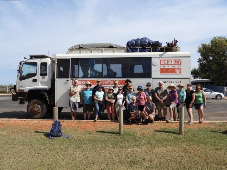
This post and the next describe the 16 day, 3,800km Gibb River Road trip with Kimberley Safari Tours. We had…
Middle Lagoon road, Cape Leveque Thursday 8 June 2017. Day 43. A day of doing not much. Had another good…
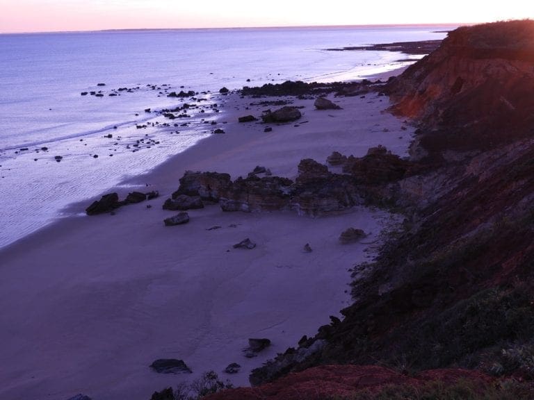
Thursday 1 June 2017. Day 36. Drove 220km to Kooljaman at Cape Leveque. First, into Broome for supplies and fuel…
Thursday 25 May 2017. Day 29. Drove about 200 km from Parrys Lagoon to Warmun (Turkey Creek) 17º1’S 128º13’E. We…
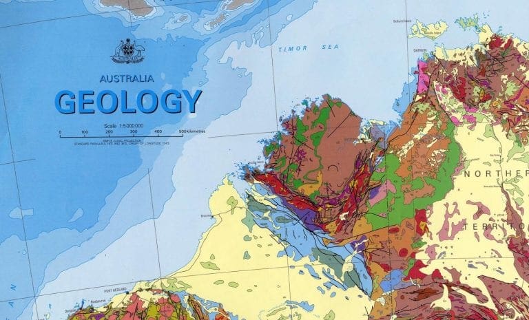
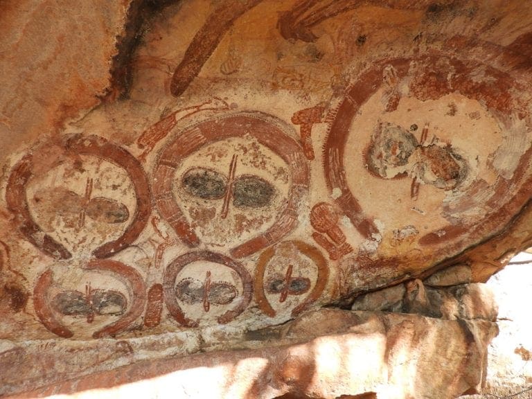
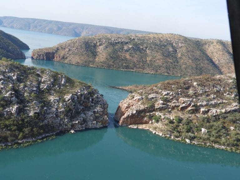
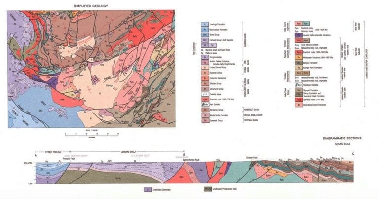
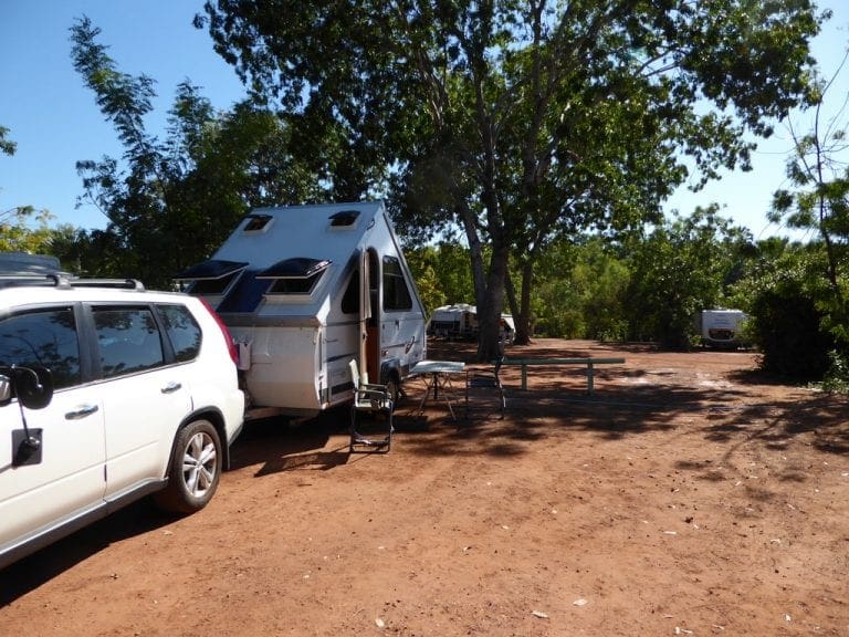
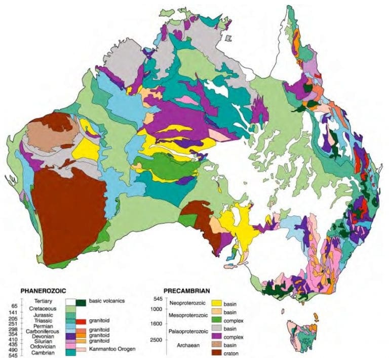
Geology of The Kimberley region Thursday 18 May 2017. Day 22. Drove just over 300km to Kununurra in Western Australia….
Thursday 11 May 2017. Day 15. Drove 160 km to Mataranka. The vegetation along the way gradually increased in size…
Thursday 4 May 2017. Day 8. We had a day tour to the Painted Desert with Wayne Borrett of Arid…
Thursday. 27 April 2017 Day 1. Drive from Wagga to Balranald. We are off. This Kimberley trip has been many…

When it rains across Australia’s vast inland region, temporary pools crop up all over the arid ground, giving life to a strange desert crustacean known as the shield shrimp (Triops australiensis).
Named after the formidable carapace that shields its head and upper body, T. australiensis can grow up to 7.6 cm long, and it uses its long, segmented tail and mass of 60 or so legs to propel itself through shallow water.
It also breathes through these legs – its sub-class Branchiopoda means ‘gill-legged’ – and in the females these legs bear ovisacs for carrying their tiny eggs.
Several pix in the Photo Gallery and a movie.

A rare and endangered plant. The tree grows up to 15 to 18 metres (49 to 59 ft) high, with short horizontal branches and pendulous branchlets covered in needle-like phyllodes adapted for the arid dry climate. It has a distinctive habit more similar to a sheoak or a conifer.
Although speculated to have been widespread across central Australia during wetter climates 400,000 years ago, the population is now mostly restricted to three sites, separated by the encroaching Simpson Desert. In the Northern Territory, the species is restricted to the Mac Clark (Acacia peuce) Conservation Reserve which is surrounded by a pastoral lease, Andado Station. The other two sites are near Boulia and Birdsville in Queensland. The tree is found in open arid plains that usually receive less than 150 millimetres (5.9 in) of rain per annum. They grow on shallow sand aprons overlaying gibber or clay slopes and plains and between longitudinal dunes or on alluvial flats between ephemeral watercourses.

Owen Springs was a station on the Hugh River. The Hugh River flows into the Finke (when it actually flows). Both cut through the Western MacDonnell Ranges. The image above shows Owen Springs Reserve as a dot at lower right. The river it is next to is the Hugh. Hermannsburg, our next town, is near middle left edge. Hermannsburg is almost on the Finke River. You can see both Hugh and Finke Rivers cutting through sections of MacDonnell Ranges.

Palm Valley is within the Finke Gorge National Park southwest of Alice Springs. Palm Valley has a smallish population of Red Cabbage Palms (Livistona mariae). The nearest related species is 850 kilometres away in Katherine NT. The average rainfall for Palm Valley is just 200 mm per year. Small pockets of semi-permanent spring-fed pools allow the unique flora and fauna (desert fish, shield shrimps tadpoles and frogs) to survive.
It had been assumed that the cabbage palms were remnants of a prehistoric time when the climate supported tropical rainforest in what is now the arid inland of Australia. Genetic analysis published in 2012 determined that Livistona mariae at Palm Valley is actually the same species as Livistona rigida from samples collected near Katherine and Mount Isa, both around 1,000 kilometres (620 mi) away. It is now thought that aboriginal people brought the palms to here from Mataranka.

Mound Springs occur around the Western edge of the Great Artesian Basin and represent a natural discharge of Artesian water that was captured many hundreds of kilometers away from rain falling along the Great Dividing Range and New Guinea. This article provides details. Dalhousie is an excellent example of a mound spring.

