Kimberley Trip – 2017 – week 4 – Kununurra & Parrys Lagoon
 |
| Geology of The Kimberley region |

Thursday 18 May 2017. Day 22. Drove just over 300km to Kununurra in Western Australia. We have made it to The Kimberley. The first 250km or so saw us gradually rise out of the Victoria River, past Timber Creek (famous for Durracks and looking like a nice town). The vegetation became much more interesting west from our campground last night: huge plains of melaleuca, followed by eucalypts, followed by melaleuca again. For a few ks Australian Pratincoles were along the road.

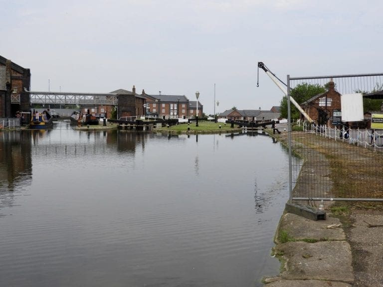
Boabs entered. At the border is a strict quarantine check, so we stopped just before it and ate as much fruit as we could. Packaged dry fruit is allowed as are store bought nuts (not in shells). We are at Kimberleyland Caravan Park at Kununurra (site 227) and it is a delight. We are (almost) on the shoreline of Lily Creek Lagoon with gentle zephyrs of breezes to cool us in the shade. An excellent spot.

Friday 19 May 2017. Day 23. Extended our stay at Kununurra to four nights. This is such a good park overlooking its Lagoon. Helen spent the morning catching up on the washing – a weekly chore for sheets and twice weekly for clothes. The water here is good, especially after the very chewy, tasty water at Victoria River. We appear to have stumbled into a major festival at Kununurra over this weekend, boat races, footy, street carnival and rodeo. Watch this space.

Yesterday, we had a short drive around Kununurra which is a bustling largish town centred around a very good shopping centre and health and welfare service centres. It is the provision of health and welfare services (mainly to a large aboriginal population) that is the main work of this town and Katherine and Alice Springs. Everything else about these towns flows from providing those services. Back on the east coast, with a much smaller aboriginal population (if any), we do not appreciate how much effort and resources are needed in these remote areas to care for the aboriginal population.

Saturday 20 May 2017. Day 24. Kununurra is rocking to its OrdValleyMuster. We went to the street market, visited a gallery (Artopia with an exhibition by local artist Jeanne Barnes who builds real diamonds into her paintings), visited Ivanhoe Cafe and then Ivanhoe crossing – which is permanently closed. When it had cooled down, at 5pm we went to the rodeo. Quite a crowd 3,000 people. We saw bulls and saddle broncs – no one stayed on a bull but most stayed on a horse. Obviously a big event with a lot of prep (graded road, parking, shute attendants and clowns).
 |
 |
 |
 |
| Ivanhoe R. crossing in flood | Lily Creek Lagoon sunrise | Lily Creek Lagoon sunset | Small freshwater crocodile |
 |
 |
 |
 |
| Green Pygmy Geese | Lily Creek Lagoon sunset | Very small freshwater croc | Lily Creek Lagoon sunrise |
 |
| Straw-necked Ibis |
The Kununurra van parks are full of vans going to or from ‘The Gibb” (as it is called). Some very expensive rigs. For example, the Kimberley Kamper next to us (which has never been on a dirt road) with its top of the range Prado, cost $200,000. That is a huge outlay on an asset that will spend most of its life rusting in a shed. The Gibb itself is something of a rite of passage, something to ‘do’, ‘tick off’ – or a ‘pissing competition’. Many vans just shake to pieces and have to be abandoned – and that is a stupid waste of a good van to the vagaries of chance, for no other purpose than macho posing.

Monday 22 May 2017. Day 26. A short drive west and then north to Parrys Lagoon which is just south of Wyndham. This is a bird watchers paradise but we may be a bit early in the season. The birds are still spread out after the big wet season this year and it is still hot. We have found a good patch of shade to put the van in, but still hot. We are at 15º35’S and 128º16’E. Last night we went to the outdoor picture gardens at Kununurra to see Flickerfest as part of OrdValleyMuster. Bring your own chairs, sort of like a drive in with out the cars. About 300 people turned up. (The Flickerfest began at Bondi as part of the Sydney Festival and has been making its way around Oz. This is its last stop.)
 |
| Kimberley Plateau with wetlands |
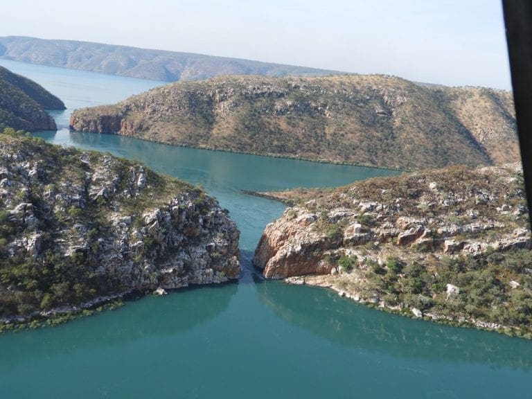
Driving from Kununurra to Parrys, we encountered our first look at the old (Carpentarian, PreCambrian) rocks that make up the East Kimberleys. Very prominent bedding that looks almost horizontal in places, yet in other places is almost vertical where it gets moved around by faults. It would be a good place to do a Structural Geology thesis.
 |
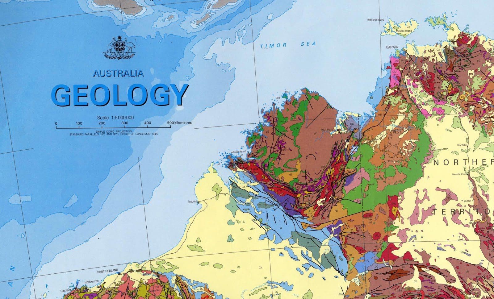
| Geological sections near Kununurra and Parrys Lagoon Purple in the top section is the Hart Dolerite (1,790 million years ago) intruding and pushing about Kimberley Group The lower section shows the flat Pentecost Sandstone and Kimberley Group being chopped up by faults. |

Tuesday 23 May 2017. Day 27. We got up at sunrise (5:40am) and tried to drive over to the nearby Narglu Lagoon but the road was too tough and we turned back at Telegraph Hill. However, we had some excellent birding on the way back: brown quail, pectoral finch, diamond dove. After breakfast and a chat to our neighbours who have been on the road for 12 years and easily find work as forklift drivers, we headed off to Wyndham. What a run down, collapsing little town and port.

The view from Five Rivers Lookout is excellent and we could easily see the five rivers that flow into Cambridge Gulf: Ord, King, Pentecost, Durack, Forrest. We had a morning tea and a very long chat at the Rusty Shed in Wyndham. Then to Narglu Lagoon and sat in the bird hide for 1 1/2 hours. Very good birding and and cool breeze.

We had a ‘Happy Hour’ at our van tonight: 10 people. One couple have just completed The Gibb west to east and their news is that all of the gorges and side trips in the western Gibb are closed with little chance of being opened within 2 months – despite the tourist offices and tour operators saying ‘things are open or will be in a few days’. ‘Very disappointed’ in their words.

Wednesday 24 May 2017. Day 28. Up at sunrise and out to the hide at Narglu Lagoon for 4+ hours. Same suspects as yesterday though we did see a whistling kite catch and consume quite a large water bird. We’ve found out a bit more about Parry Lagoon. In the last 5 years cane toads have swept through the area and killed many of the larger species of everything: long-necked tortoise, goannas, most snakes and pythons, many water birds, fish. The effect has been dramatic.

We were wondering why we are not seeing animals around the lagoons. They have been killed by cane toads. At night, the sound of the cane toads from a nearby lagoon is humungus. When the cane toads arrived they came as a wave: no toads one night, a carpet of toads the next. Went out for tea at the Parry Creek Farm. Every year, in the wet, the water rises on the property sometimes as high as the top of the reception desk. Every year, the owners go elsewhere for the wet. So, before the wet, everything is moved higher or taken out (generator set in shipping containers).

Then, when the water goes down, it all needs to be put back to tidy and clean again, and electrics redone. This is an enormous undertaking every year to make the place available. You would have to love it. Extremely practical people. Usually, the water just comes up and goes down with no current. Last year, there was a current, which kindy floated out their two empty 42,000 litre fresh water tanks and left them further downstream in the lagoon – yet to be retrieved.