Europe Trip 2018 – week 6 Scotland
 |
| Gretna Green marriage place |
Saturday 2 June 2018. Day 33. A day of mainly Motorway driving (sometimes through heavy rain) to south-western Scotland. Along the way we passed a few signs warning us of a ‘Yellow Warning for heavy rain’. We crossed the border at Gretna and, of course, we had to visit the famous smithy at Gretna Green where the smith was legally able to marry people ‘across the anvil’ – ie a whack of the hammer on the anvil proclaimed the usually ‘runaway marriage’. Still a popular place for marriages, but sadly now just a tourist trap.
 |
| Kings Arms Hotel Dalbeattie granite |
Tonight, we are at a B&B (found on Booking.com) at Dalbeattie in Dumfries and Galloway in south-west Scotland. Dalbeattie is famed for its granite industry. Many of the famous buildings and wharfs in London are built with Dalbeattie granite. Watermills powered sawmills, paper mills (paper from rags), granite polishing mills, bobbin making mills – all now disappeared. Although miles inland, Dalbeattie is on a narrow tidal river and tall ships were towed in here to load granite, paper, timber, bobbins, an important port. A very good museum. Geoff had a branch of ancestors who lived in Dalbeattie in 1800s. (No headstones.) An excellent meal at the local Kings Arms – one of the nicest pubs I’ve been in.
Sunday 3 June 2018. Day 34. A very leisurely start today. We sat and chatted with Barbara our very friendly landlady after breakfast. Today, we’ve driven up across the lumpy bit of Scotland that sticks out below Glasgow. Sheep, cows, forestry, hydro-power on small flat streams with small weirs giving only a couple of metres of head for the turbines. From what we saw here, one day, we can expect the entire Murray and Murrumbidgee Rivers to have small sets of turbines every few kilometres. We headed for the small village of Kilbarchan (now a dormitory village for Glasgow) which in its heyday had 800 handlooms producing woollen tartan, plaid and paisley. One cottage named the “Weavers Cottage” built in 1723 has been conserved by the National Trust for Scotland. They have one original old handloom still in operation which has an original hand powered flying shuttle. Each pair of looms would have needed about 5 people (usually a family) to keep them running – two weavers (men and women), someone filling bobbins (pirns), someone winding warps, a roustabout/apprentice keeping all the equipment working and sweeping up. Multi-skilling would be essential. Each week or so, a wholesaler/customer would arrive with a bucket full of dyed thread and the pattern to be woven and expect to take away last week’s order – a roll of woven tartan or plaid. A chest of draws had hundreds of tartan pattern samples (like swatches) from which customers could choose. A very good weaver’s museum.

The only disappointment was that they did not know how to set up or use the old loom which has not been used for 5 years, since it was last set up. We think that this is the usual problem with most of the museums that we see. Old volunteers run them – often very capably. But when they die, their knowledge is lost. At the wonderful Arkwright’s Museum in the Derwent Valley, the excellent demonstrations were done by two machine engineers in their 70s. They were wondering (as do we) what happens to that demonstration of knowledge when they die. At Dalbeattie, the collection that has become the Dalbeattie Museum is lovingly curated by a group of old men – oldest 93, youngest 63. What happens to that collection in a few years. The Kilbarchan Weavers Cottage has at least handed the building and contents over to the Scottish National Trust. But, the knowledge of how to use the equipment is already lost.
Tonight, we are at the southern end of Loch Lomond in the village of Balloch in the Valhalla Guest House.
 |
| Good reflections and colours |
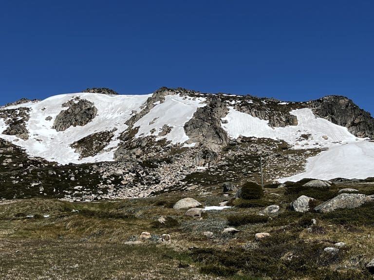
Monday 4 June 2018. Day 35. Today, we drove along the edge of Loch Lomond then followed a few spectacular u-shaped glens carved out by glaciers (including Glen Coe of notorious massacre – with MacDonalds ‘put to the sword’ by dastardly Campbells) until we arrived at Fort William – at the western end of the Caledonian Canal system canals, locks and lochs. We visited the West Highland Museum. From there drove to Fort Augustus at the western end of Loch Ness. We are at the excellent Lorien Guest House overlooking the swing bridge at the end of the Loch. We can see Nessie waving her tail from our widow.
 |
| An original and old tartan pattern with vegetable dyes |
Tartans. This area is awash with gift shops selling ‘clan tartans’ with much fuss made about ‘original tartans’. I understand that the colour of tartans originally depended entirely on what plants grew locally. All original dye colours came from local ingredients – usually plants. Most families would have woven their own fabric until 1800, or even 1850. Initially, patterns were simply different checked-cloth patterns, chosen by the weaver’s preference—in the same way as people today choose what colours and patterns they like in their clothing. Clans identified themselves more by a sprig of plant than with a tartan pattern.
 |
| Modern tartan colours synthetic dyes |
It was not until the mid-nineteenth century that many patterns were created and artificially associated with Scottish clans. All this got a kick along with chemical dyes and the Victorians’ need for order. Many ‘tartans’ were designed by Albert – Vickie’s hubby. Now, many patterns are copyrighted and several organisations proscribe and prescribe who can wear what patterns – eg, unless your father was a McFella you cannot wear McFella tartan pattern and you can only wear the McFella pattern.
 |
| Staircase of locks heading west Caledonian Canal Fort Augustus |
Caledonian Canal connects east and west coast of Scotland by linking a series of long lochs along the Great Glen. Built for a number of reasons – not least to provide work to keep Highland Scots from emigrating. Begun in 1803 and finished in 1822. Unfortunately, it was designed and built for sailing ships. By the time it was finished, those had been replaced by bigger steam ships – which did not fit. Also, the Napoleonic Wars had finished and shipping no longer needed to use inland waterways to avoid the French; and 32-gun naval ships no longer needed a quick path from one side of the island to the other – as well as being superseded by big ironclad ships – which would not fit. This was a canal that sounded like a good idea at the time. Now, it still functions in that small boats use it. Its main use is as a tourism destination.

Tuesday 5 June 2018. Day 36. Drove to Applecross. We drove briefly over the bridge to Skye for a coffee before returning to the ‘mainland’ and following a one-lane road around the coast and then over a significant pass (Bealach na Ba) to the west coast at Applecross which looks towards the Isle of Skye – a beautiful location on a sunny day. At this time of year, the road mainly carries tourists. When I say ‘one-lane road’ I do mean just wide enough for one car with ‘passing places’ every few hundred metres – which would be quite sufficient if the tourists knew how to give way to oncoming traffic. Aggressively charging through the ‘passing places’ was common, thereby forcing on-coming cars to reverse.

Applecross is a beautiful spot and we are lucky enough to have sunny weather to enjoy it. We are here for two nights at ‘Cul-an-Dun’. Although Applecross is a popular tourist destination, there is not much here – a pub (which offers accommodation), a very few very small cottages along the shoreline and a few cottages strung out along the shore. Where and how do kids go to school? Locally (10 students) for the first years, then, boarding during school days at nearby Plockton.
Wednesday 6 June 2018. Day 37. A day off at Applecross. A short walk and a visit to the Applecross Heritage Centre which seeks to document the lives of people who lived here – subsistence, vikings, subsistence, highland clearances, subsistence.
Highland Clearances. These came about because of greed and a change in clan governance after the failed uprising in 1745. Before then, a clans’s chief’s power and prestige came from the number of fighting men he could muster for battle. This required a close and caring relationship on both sides in a self-sufficient barter economy. In the crushed and pacified highlands after ’45, this relationship quickly disintegrated. Clan chiefs became landlords who quickly realised they could get more revenue from sheep than from looking after a bunch of tenants. Sheep replaced tenants. Crofters were forceable removed from property they may have ‘rented’ for generations. A favoured method of removal was to destroy the ‘croft’ by removing or smashing its roof beam. Anyone who aided the afflicted family had their roof smashed too. Result, a wave of emigrants and wealthier landlords.
Over the last few years, I’ve been helping Bruce McLennan with the Clan MacLennan genealogy project. Bruce is collecting birth, marriage and death records for MacLennans around the world. Many came from this part of Scotland. We’ve recently added a page of statistics to show by decade birth places in Scotland; Occupation; Life Expectation (Little change from a life expectancy of 70-80 years); Migration (where did they go to); age at marriage; number of kids; how they spread out across USA, Canada, Australia, NZ. Very interesting. Some of those pages take a while to load – data comes live from a database with 40,000 people.

Latitude. Applecross is beautiful on a sunny day looking out over the Inner Sound to Raasay and to Skye. This is close to as far north as we are going. Certainly, as far north as we will be with a view of the sun setting over water – at 10:15pm. We are 57.26ºN. To put that into perspective, Hobart is 42.88ºS and Oban, Stewart Island, NZ is 46.54ºS. Jasper, Alberta, Canada is 52.87ºN. We have been further north in 1973 to Nord Cap 71.17ºN where the sun does not set in high summer.
 |
| Bealach na Ba There is something about that line of hills disappearing in the background |
Thursday 7 June 2018. Day 38. Drove back to Loch Ness via Dingwall, Culloden Battlefield Museum and Inverness. We got away fairly early to avoid oncoming cars over the Bealach and that worked. Then, over to the east coast via a couple of glens. Estimates are that the ice here must have been at least a kilometre thick to have gouged these huge u-shaped valleys. The last ice retreated 27,000 to 13,500 years ago.
We spent a couple of hours at the Culloden Battlefield Museum. In 1745, Culloden was the site of the last hand-to-hand battle in Britain – known as ‘The 45’ or the Jacobite Rebellion. The story is something like this. In 1714, the last of the Stuarts, Queen Anne, died without any living children – always reason for a civil war.
 |
| A tartan plaid from Culloden |
One ambitious ‘pretender’ to the throne was Charles Edward Stuart – Bonnie Prince Charlie (son of a James hence ‘Jacobite‘ in Latin), who with the aid of the French, launched an invasion of Britain. Many Scots were waiting for this. In 1701, Scotland was essentially bankrupt and had been ‘forced’ into a ‘Union’ with Britain and been dissolved as a country. Unrest followed with a rebellion in 1717 – quashed. Now, Charlie had arrived and many willingly joined this new rebellion against the ‘auld enemy’ – many were forced to join. The English were also at war against the French and this rebellion was small beer compared to their troubles in mainland Europe – until Charlie and his Jacobites had charged south to Derby – three days from London. It turned out that Charlie was a lousy leader. The Jacobites retreated and were at the end of their resources when brought to a final, debacle of a battle at Culloden Moor which lasted less than an hour and saw the Jacobites routed with loss of about 2,000 killed. In the aftermath: Duke of Cumberland (leader of the English forces) butchered his way around Scotland killing and torturing any who might have had Jacobite sympathies and many who didn’t; Charlie fled back to France via Skye (you know the song); the Clan way-of-life disappeared; the Clans disappeared; Scotland disappeared; English protestantism replaced Scottish protestantism; the Highlands were ‘cleared’ of people who were replaced by sheep; thousands of Scots were forced to emigrate to America – many were slaves.
For the night, we are at our first hotel for the trip – Loch Ness Inn. To get us there from the Culloden Battlefield our SatNav had us drive through the centre of Inverness. Good fun. Loch Ness Inn is on a small dimple that juts into Loch Ness from its western bank nearby to the Nessie Centre. I think I got a glimpse of two blokes climbing into their midget submarine with a mechanical ‘Nessie’ on top for the benefit of tourists.
We are now back at the other end of the Great Glen and at the eastern end of the Caledonian Canal.
Friday 8 June 2018. Day 39. A long drive. We have now left what is classified as the West Highlands. The highlight of the day was to have been the Knockando Woollmill which is a recently restored and operating mill that, according to its website, allows you to see the mill in operation. No can do. We could see spinning mules in operation but not the weaving nor modern equipment. Disappointing. I’ll have to make do with their video above. However, I did learn something very interesting. Knockando is establishing itself as a commercial weaving company. To do this, it has to spin its own thread. To do that, it has had to restore an old spinning mule which it uses to spin a single ply wool thread – not doubled – which makes a very serviceable woollen tartan cloth. They have to spin their own. I have spent some time looking and I cannot buy such a single ply wool thread.
We accidentally joined what looked to be a tourist whiskey route with distilleries every few ks and Chivas Regal trucks roaring past. When we were here in the 1970s, it was extremely difficult to visit any whiskey distillery. Now, follow a sign-posted road.
Onwards through Banff (looks nothing like Banff in Canada) and on the North Sea. Then to New Pitsligo from where one branch of Geoff’s tree came. Flat farming country. But, now it is dying with nothing to hold the young, the village is now becoming abandoned – derelict house with caved in roofs.
We went out for a meal at a local Indian restaurant which was empty until one other person walked in – who we knew from birding days in Sydney 30 years ago. Very small world is it not?
Saturday 9 June 2018. Day 40. A two hour drive south. Yes, we have finally turned south. Applecross was the apogee and last night was about the same latitude. Tonight we are at Forfar. We have driven mainly through mixed farming country – grains, ‘taties, sheep, cattle and cows; plus a short drive along the east coast looking out over the North Sea. Quite a few wind turbines on land and out to sea – it gets a bit windy here. We drove past the ‘Angus Show Day’ which had a huge car park from which hundreds of people flowed with police directing traffic.
We are at a B&B at Forfar (pronounced without vowels). Forfar clearly was and still is, to some extent, a prosperous community – for a very long time a wealthy farming area and, for several hundred years, a centre for flax and linen weaving.
One of my grandfathers was a compositor, setting type for a newspaper. Along the way on this trip, we have discovered a few sayings in common usage that we owe to compositors: a collection of letters of the same font selected ready to set up a section of the newspaper was called a ‘sort’, it was a very grumpy compositor who ran out of letters and was ‘out of sorts‘; letter were kept in huge cases, capital letters were in the top or ‘upper case‘ and small letters in the bottom or ‘lower case‘; words and sentences were arranged in a ‘stick’, a common error was to begin from ‘the wrong end of the stick‘ and so get a mixed up message; another common error was to select a ‘q’ instead of a ‘p’ – hence ‘mind your ps and qs‘.

Sunday 10 June 2018. Day 41. Glamis We said farewell to Bruce our delightful host from last night and drove the couple of kilometres to Glamis (pronounced without the ‘i’) Castle and the Strathmore Highland Games which got underway at 10:30am soon after we arrived. Imagine a large oval on which many events take place at the same time – running, cycling, Highland dancing, pipe bands, shot put, caber tossing, tug of war. Because we were there early, we got chairs on the boundary rope right at the start of the 90m sprint.
 |
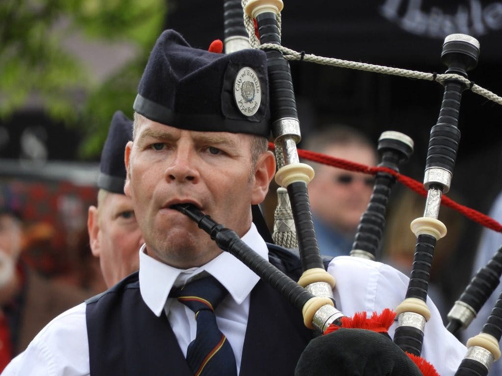
| Solo piper with judges under shelter |
Events began at 10:30 with a ‘solo piping’ event which ran all day and, as far as I could tell did not get beyond the first session – the Piobairechd – which looked to involve each piper playing the same piece which took about 20 minutes for each player while he/she paced veeeery slooowly around a very small platform. This kept up all day in their very tiny part of the field. Also at 10:30, the Junior Heavies began – teenage boys (14-16) trying their hand at shot put, heavy weight, caber, etc. Some will be good. At 11:30, Highland dancing began on a raised and covered platform – this also kept up all day with much leaping and obeying specific rules.
 |
| Winning tug-of-war team |
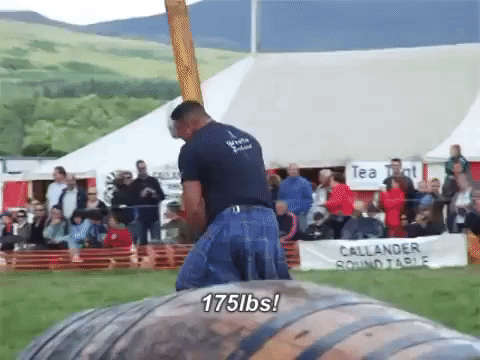
At noon, a ceremony with pipe bands and clan chief to say – ‘I declare these games open’. Then, the track and cycling events began as did the heavies: ten big blokes with kilts flying who had three goes each at shot put (16 lbs then 22 lbs), then throw a 28 lbs weight for distance, then throw a 16 lbs hammer (weight on the end of a pole), then a 22 lbs hammer, then a 56 lbs for height, then toss a caber. While this was going on, the circular grass track was used by runners and cyclists doing warmups, heats and finals of different lengths and pipe bands marching to compete.
 |
| Rain does not stop a tug-of-war |
The half of the enclosed area that the heavies were not using, was used for 90 metre sprint then a tug-of-war: four teams of eight, best of three against each of the other three teams. This usually involved straining but no movement for quite long chunks of time before suddenly it was over in a few seconds. And the dancers kept dancing and the solo pipers kept piping. Surrounding the field were a string of stalls selling food & knick knacks. Between the stalls and the boundary rope, a crowd of a few of thousand people traipsing around buying and watching events. Outside the ring of stalls, pipe bands and solo pipers playing and warming up.

All went very well, until at about 3 pm, a sudden heavy storm drove the crowd away, paused the heavies but not the tug-of-war which stayed solidly in place in the midst of its finals. We left and so did not see the weight for height or the caber. We did see the juniors toss the caber and it looked difficult. The tricky bit was to keep the caber balanced vertical so you could toss it. A toss means that the end you are holding must travel an arch and land facing directly away from you. One of the juniors could do it and three times achieved a magical 12 o’clock score.
We think that these ‘highland games’ events are close to their end for lack of competitors. All the runners competed in all the events as did the heavies, and all the cyclists. Although many were locals, many also were on the circuit of ‘games’ and competed against each other in these same events every weekend during summer.
We drove to Alva near Sterling where we will be for the next few days.