France Road Trip – week 6 – St-Jean-Pied-de-Port

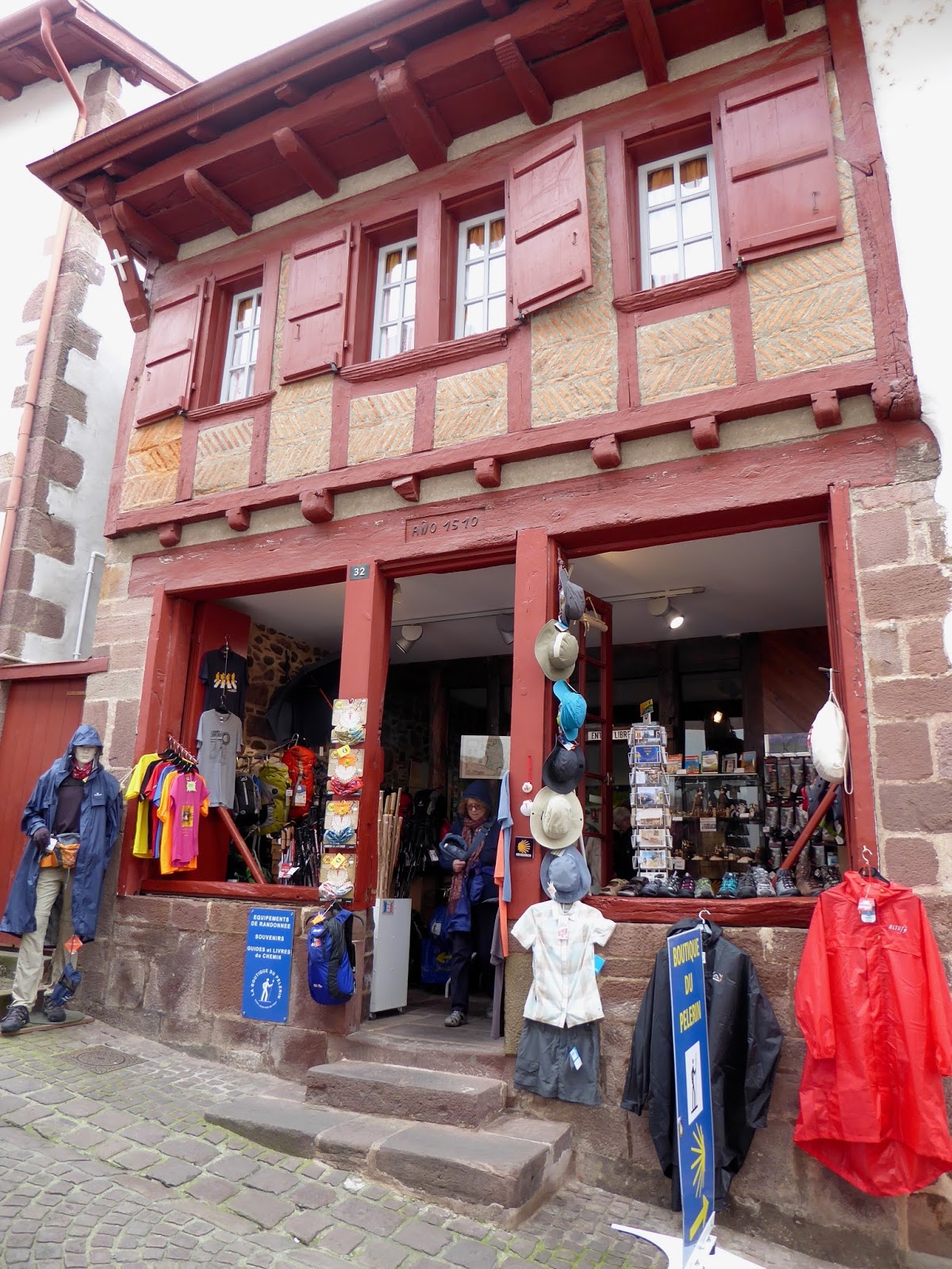
Saturday 14 May 2016. Day 37. Drove 200km from Arreau to our new apartment at St-Jean-Pied-de-Port. St Jean PdP is a major staging post for the Camino de Santiago (or Santiago de Compostela) a large network of ancient pilgrim routes that extend across Europe to Santiago. The most popular route begins here at St Jean PdP and goes 780 km to Santiago. Flat walking and staying at little ‘hotels’ along the way. Light trekking but many many days involved. A big deal for many and many are in the village – either beginning or part way there. Our little house is just south of the old town (10 mins walk) in an area of separate houses with lawn and gardens – quite a change from the wall-to-wall living we have had to now. We are in what might have been a granny-flat. Very pleasant.

We are in Basque Country. The Basque are another group that dispute the country borders they have ended up with. The Basque have their own language (that is akin to no other European language) and have ended up with part of their population in Spain and the rest in France. The Spanish Basque have been quite aggressive at seeking independence – ETA bombed quite a bit in the 1970s. We notice that the local Basque speak three languages fluently – Basque, French and Spanish. Lunch in the old town at Restaurant Oillarburu – extremely good.

Sunday 15 May. Day 38. A walk around the ramparts of the town. It was a fortified town from about 700 through to 1814. Many remakes of the walls and fortifications. It appears they were quite successful at defending this major low passage across the Pyrenees. The fort just needed to be good enough to protect a garrison that could come out and harass any invading force and run back to cover if challenged. The fort itself needed to be able to withstand a small siege – mainly be a pain in the arse. It did withstand a 21 day siege – which was a fair bit of pain.
Monday 16 May. Day 39. We were misled by signs saying that the market was on today. Not so. Maybe tomorrow. We walked around the old fortified town watching the large groups of tourists (up to about 50 in a group). Some of the buildings have been around for a while – 1510 is the oldest we found. Many in the early 1700s. I think the history goes a bit like this. From pre-historic times there was a pilgrimage from northern/Central Europe/France to the place that was to become Santiago. That pilgrimage passed through St Jean PdP as the only low pass across the Pyrenees. Christianity claimed the pilgrimage and changed a few names. A fort was built at St Jean PdP in about 770 by a Spanish King Sancho to protect the frontier. St Jean PdP increased in popularity as a good stop before Spain. The population of the town increased. The fort got bigger to protect a bigger town.

The town got bigger because of the fort. The town expanded beyond the fort and across the river to the fort’s south. There is really just one long street that makes up the main part of the old town. This comes down the hill through the fort, through the bottom gate, across the river, through the extended old town, through the last fortified gate and onwards to Spain & Compestella de Santigo. This is the ‘pilgrims way’ with hostels, eating places, water fountains all along the cobbled street.

For lunch in St Jean PdP and in the rest of France – arrive on the stroke of noon. If the restaurant is popular, it will fill up quickly and you will miss out on a seat. Here, in St Jean PdP by 12:300, there are groups of six walking from restaurant to restaurant hoping for a place and being turned away. We’ve eaten twice at the small Restaurant Oillarburu just inside the Porte de Navvare gate. Good Bastque food and most places taken by locals.

Tuesday 17 May. Day 40. A rare sunny day. We drove to the sea-side at St-Jean-de-Luz. Quite a difficult drive that felt like we we going against the grain. What chaos at the coast. We did actually see the sea but chose to immediately do a u-turn (much to the delight of the GPS which has been suggesting/requesting/demanding ‘where possible, do a u-turn’ for several days). The strip of building along the coast is quite narrow (maybe just a kilometre) but very cluttered with roads, cars and traffic. Sky and sea looked to be the same grey colour.

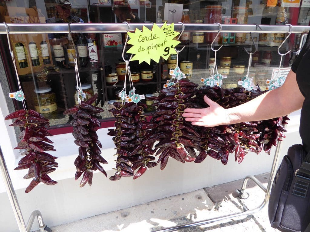
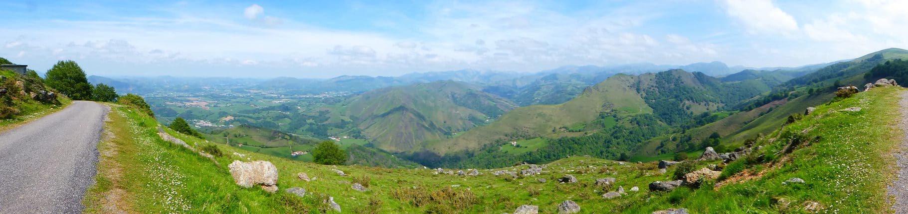
From there, we went inland to Espelette a small tourist town famous for its chilies. Brown bunches of drying chilies hung from the white houses with red shutters – an almost uniform building code in Espelette if not all of Basque Country. A very good meal at another large restaurant that was turning people away by 12:20. A leisurely lunch and a drive back to St Jean PdP. Still sunny so we drove up a small part of the Camino de Compestella – actually the Route Napoleon (that Napopeon took to get into Spain for Peninsula Wars following an old Roman road).

This is a very narrow winding road – just wide enough for one car with a sheer drop on one side. I did not like it at all. We were going to check out an easy-walk shown on a map from the Tourist Info. The walk might have been easy (we did not get that far) but the road to it was not easy. Back home to recover. Still sunny. We are getting a bit cabin fevered after days of cold and rain.

Wednesday 18 May. Day 41. Numbered walk 18 Ascarat in the Tourist Info walks guide. From the nearby village of Ascarat a steep climb up through Irouleguy vineyards and down through an oak forest. The Irouleguy vineyards are on very steep hills. Hay fever.

Friday 20 May. Day 43. Left St Jean PdP – the cold and wet got too much for us. Drove 3 1/2 hours to Saintes. Mainly on motorways at 130 km/hr. Staying at a very nice old hotel ‘Souveniers de Familles’ near the railway station. Saintes is a delight and a grand surprise. A very old town with a Roman Arc de Triumph built in AD 18 for Germanicus. Saintes was a staging point on the road to Lyon. The town has a beautiful old park and riverside. Saintes is getting ready for a big gig in a few days time.
 |
| La Garonne River catchment (not small) |