We have come down to Jindabyne for an extended stay (we hope). For those joining us a bit later on this journey, we have a van/cabin at a Jindabyne Van park that we have had since 2000. An excellent spot by the lake. Very well contained and easy to live in. Cosy in winter. Beautiful in summer.
Prep. We had about 6 weeks to get fit after our road trip to north Queensland. Although I had done 100 lunges and a 2 min 30 sec plank (almost) every day on the road trip, we needed better strength and aerobic fitness. We did get to the gym about 5-6 days a weeks. I did a strength/balance routine 3 days a weeks (usually 6 exercises repeated for 4 sets – total time about 1 hour and exerting 650-700Cal.). The main change his year was the High Intensity Interval Training HiiT – 20 seconds flat out on a bike three times in a session repeated three times a weeks. That 3 minutes of HiiT a week has vastly increased my fitness – as measured by my Polar Heart Rate Monitor FT80.
We drove down on Thursday 3 July 2014 – a very full packed car. A very uneventful trip – just long. We’ve brought Neeka (our cat) with us and she did very well on the way down. She spent 2 hours on the passengers lap, but she prefers to travel in her cage – where she can relax and sleep. The van is in fairly good condition – just needed a bit of raking old fallen leaves.
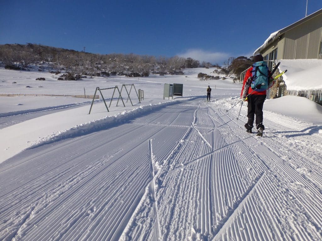
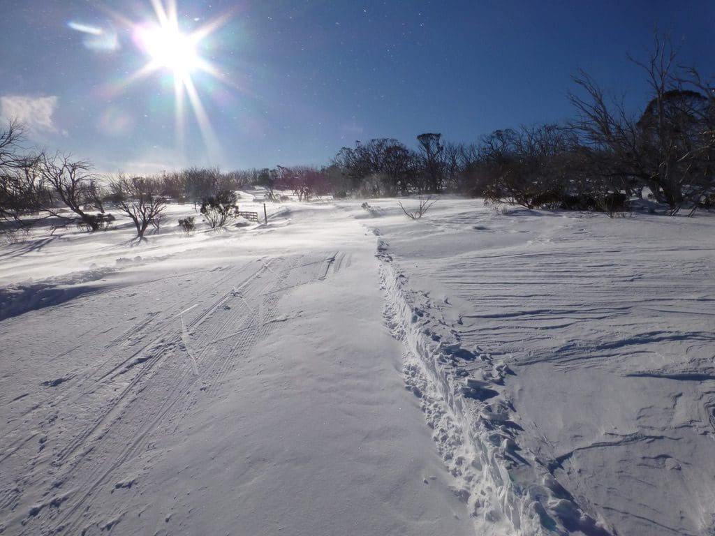
From Nordic Centre across beginning of tracks Sprint Loop foreground Valley Trail Main Trail
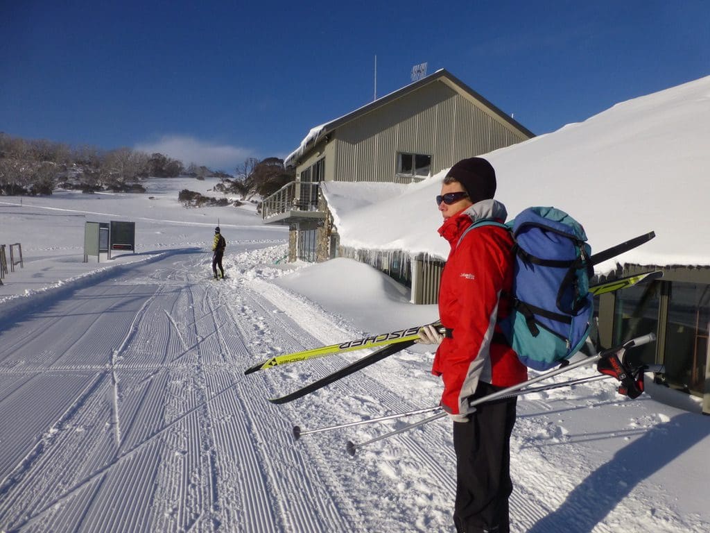
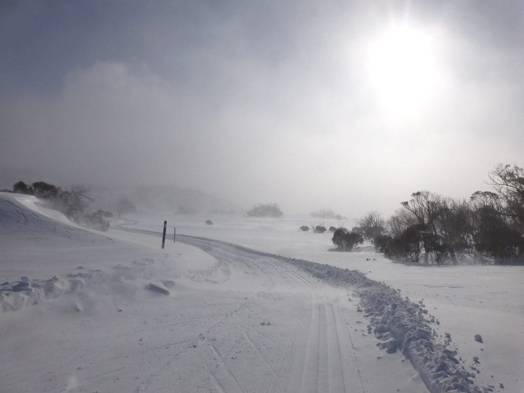
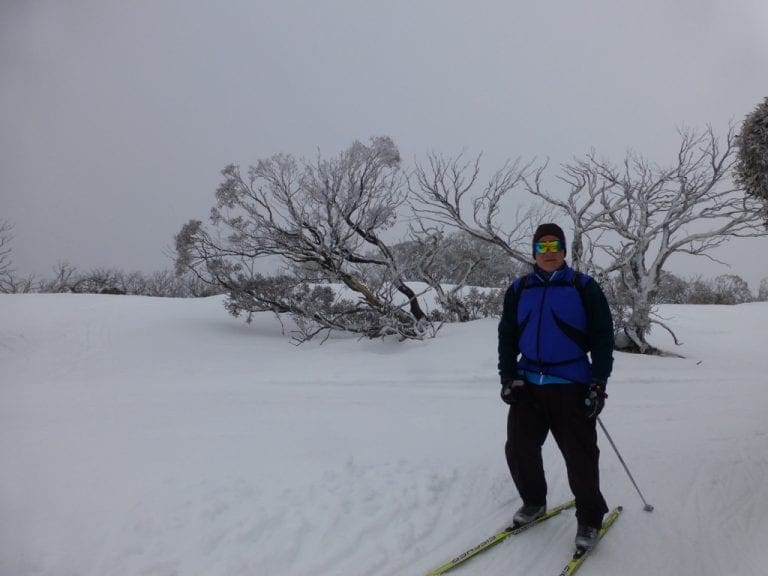
Friday 4 Jul 2014. Classic skied the 5km track. Very good snow cover. Good depth, well groomed and packed. Very windy with wind blown snow that had formed dunes (up to about 1/2 metre high) across the tracks. We took it very easy and just tried to get around without falling. Visibility poor. Skiing difficult.
–
–
–
–
–
–
–
–
–
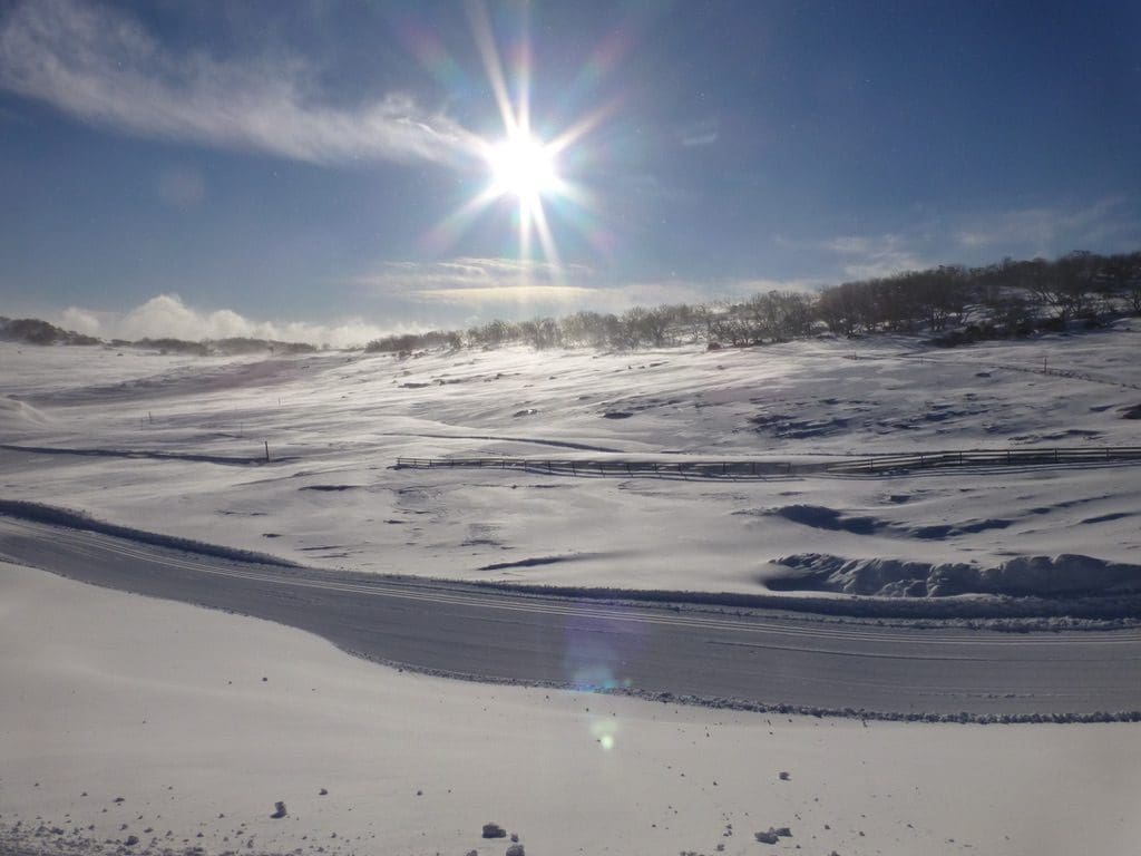
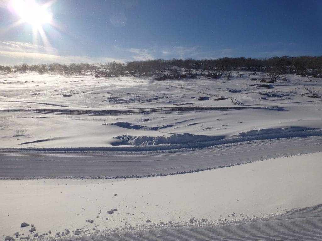
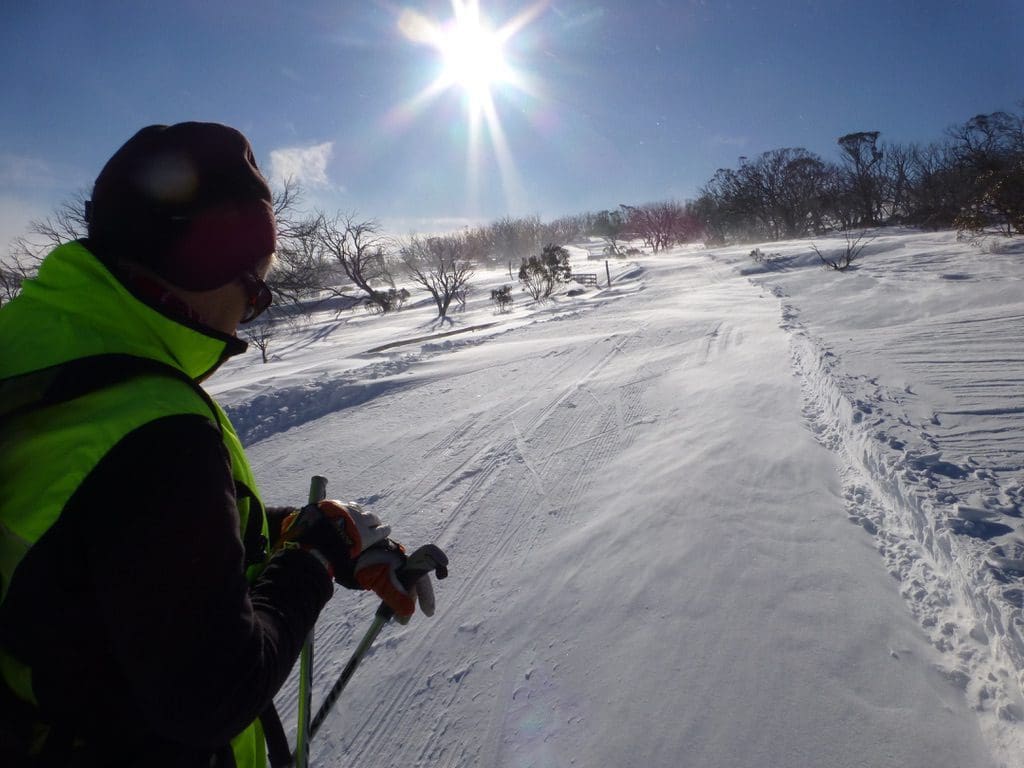
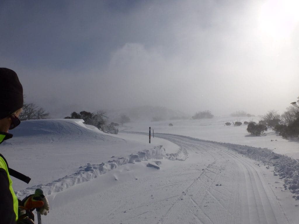
Main Trail with drifting snow
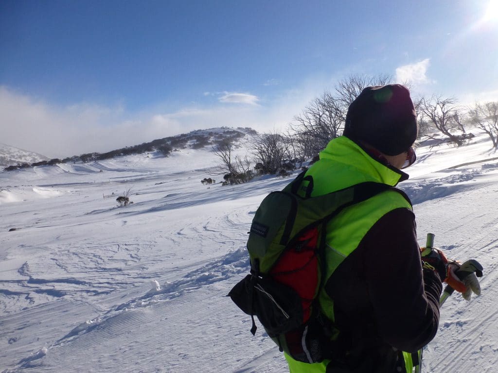
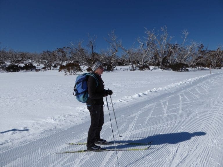
Saturday 5 July 2014. An early start to avoid the crowds. We left Jindabyne at about 7:30. Gentle snow falling vertically at Perisher. I think that is the first time I’ve seen that. Usually, our Australian snow comes in horizontally beating you on the side of the head – attacking your eyes and face. Quite cold (-2C). We classic skied the 7.5 km track and made it back to the shelter just minutes before the race started at 11am. Very pleasant indeed. (1,303Cal) The new snow was covering last night’s grooming to about 10cm. The wind had blown very small dunes over the track in places. That meant we could not use the grooming at all, however, we had a very good ski trying to remember what we had learnt last year and improve our technique. Excellent conditions. Beautiful snow. Often blue sky. We saw maybe 5-10 people on the tracks. The big surprise for the day was the huge line up of cars to get into the already full Perisher carpark when we left. The line was stationary and about 5km long – back to Wraggs Creek. School Holiday weekend – probably the biggest day of the year. Traffic and parking was very badly handled this year. In previous years, use was made of the the chain bays to park cars and people shuttled up in buses. Not this year. Woops.
Sunday 6 July 2014. This was to be a day off. While Helen was sorting out some of the inside of the van, I thought I would do a little light exercise by raking a few leaves from around the van. After an hour of good work, I contacted the van park to have my pile of leaves taken away (so they would not blow back). The new groundsman Dave arrived and together, we spent another 4 hours raking the rest of the leaves around our van and below the tennis court. Quite a big day really. (1,243Cal)
Monday 7 July 2014. Classic skied the 5 km track. (882Cal) Beautiful conditions. Very nice snow.
Tuesday 8 July 2014. Classic skied the 7.5 km track. (1,232Cal) It was quite warm yesterday and quite cold (well -2C) overnight, so the snow was crunchy and difficult this morning. We were expecting a clear sky. Cloudy, windy and a freezing cloud. Not at all pleasant. We did it though. I’ve been meaning to describe the 7.5 km track. Going clockwise. From the front of the Nordic Shelter, the track climbs steadily for about 800m to a crest. It runs flat with a small climb to where the ‘coach’s link’ heads off right. (This link is about 150m long and is a good shortcut.) The 7.5 track heads down in a long sweep to its lowest point (not too far from Smiggins). From here it will climb steadily for about 3km to its highest point. First, just after a steep pitch, the coach’s link comes back in from the right and 50m later the 2.5 km track peals off right. 250m further, the 10km track takes off (down) left and the 7.5 keeps climbing. 200m later, the 5km takes off right and we keep climbing for another 300m. We then run flattish (still up) for about 1km picking up the 10km coming back in until the porcupine link takes off left and we climb the steepest pitch to the high point of the track. At last a bit of down before climbing steading again to about the same height at the telecommunications tower. From here, we drop a big chunk of height as we ski down to pick up the 5km track coming in from our right. We then climb up a difficult (often icy) pitch before a gentle climb for about 500m. We sweep round in a gentle downhill (with a tricky turn at the southern most point) before the last little climb. All downhill from here. Three very nice sweeping gentle slopes each finishing with a slight rise. The last of these rises has a long run out before climbing (again) for about 300m before the last drop (with two tricky corners – the last of which sees the 2.5km track come back in). From that last corner, there is a long runout (500m long) that finishes just above the Nordic Shelter.
What do the tracks do in the distance they are away from the 7.5km? ‘Coaches Link’ runs flat. 2.5km runs flat for about 500m before dropping gently down. The 10km is a more difficult story that I will have to deal with another time. 5km runs flat for about 300m before dropping around a pair of difficult corners to a low point before a slog of a climb up past where the 7.5km comes in. This climb can be very icy and difficult and even treacherous if you are doing it the other way around. I think that it is the difficulty of this slope that is the reason we are advised to do the track clockwise.
Wednesday 8 Feb 2017. Day 22. -24ºC outside (feels like -29ºC). If the last two days were too cold to…
Shield Shrimp
When it rains across Australia’s vast inland region, temporary pools crop up all over the arid ground, giving life to a strange desert crustacean known as the shield shrimp (Triops australiensis).
Named after the formidable carapace that shields its head and upper body, T. australiensis can grow up to 7.6 cm long, and it uses its long, segmented tail and mass of 60 or so legs to propel itself through shallow water.
It also breathes through these legs – its sub-class Branchiopoda means ‘gill-legged’ – and in the females these legs bear ovisacs for carrying their tiny eggs.
Several pix in the Photo Gallery and a movie.
Acacia peuce
A rare and endangered plant. The tree grows up to 15 to 18 metres (49 to 59 ft) high, with short horizontal branches and pendulous branchlets covered in needle-like phyllodes adapted for the arid dry climate. It has a distinctive habit more similar to a sheoak or a conifer.
Although speculated to have been widespread across central Australia during wetter climates 400,000 years ago, the population is now mostly restricted to three sites, separated by the encroaching Simpson Desert. In the Northern Territory, the species is restricted to the Mac Clark (Acacia peuce) Conservation Reserve which is surrounded by a pastoral lease, Andado Station. The other two sites are near Boulia and Birdsville in Queensland. The tree is found in open arid plains that usually receive less than 150 millimetres (5.9 in) of rain per annum. They grow on shallow sand aprons overlaying gibber or clay slopes and plains and between longitudinal dunes or on alluvial flats between ephemeral watercourses.
Owen Springs Reserve on Hugh River
Owen Springs was a station on the Hugh River. The Hugh River flows into the Finke (when it actually flows). Both cut through the Western MacDonnell Ranges. The image above shows Owen Springs Reserve as a dot at lower right. The river it is next to is the Hugh. Hermannsburg, our next town, is near middle left edge. Hermannsburg is almost on the Finke River. You can see both Hugh and Finke Rivers cutting through sections of MacDonnell Ranges.
Palm Valley
Palm Valley is within the Finke Gorge National Park southwest of Alice Springs. Palm Valley has a smallish population of Red Cabbage Palms (Livistona mariae). The nearest related species is 850 kilometres away in Katherine NT. The average rainfall for Palm Valley is just 200 mm per year. Small pockets of semi-permanent spring-fed pools allow the unique flora and fauna (desert fish, shield shrimps tadpoles and frogs) to survive.
It had been assumed that the cabbage palms were remnants of a prehistoric time when the climate supported tropical rainforest in what is now the arid inland of Australia. Genetic analysis published in 2012 determined that Livistona mariae at Palm Valley is actually the same species as Livistona rigida from samples collected near Katherine and Mount Isa, both around 1,000 kilometres (620 mi) away. It is now thought that aboriginal people brought the palms to here from Mataranka.
Mound Springs
Mound Springs occur around the Western edge of the Great Artesian Basin and represent a natural discharge of Artesian water that was captured many hundreds of kilometers away from rain falling along the Great Dividing Range and New Guinea. This article provides details. Dalhousie is an excellent example of a mound spring.