Simpson Desert Trip June 2019 – Birdsville
Tuesday 25 June 2019 – Day 7
Arid Air were very helpful in organising a scenic flight in 4-seater Cessna 172 VH-CBV from Birdsville at 10:30 over Goyder Lagoon and Coongie Lakes and back to Birdsville. $1,190 for the two of us. Well worth the money – a real highlight. I had the front seat for ballast. We took almost 500 pictures between us and a couple of movies.
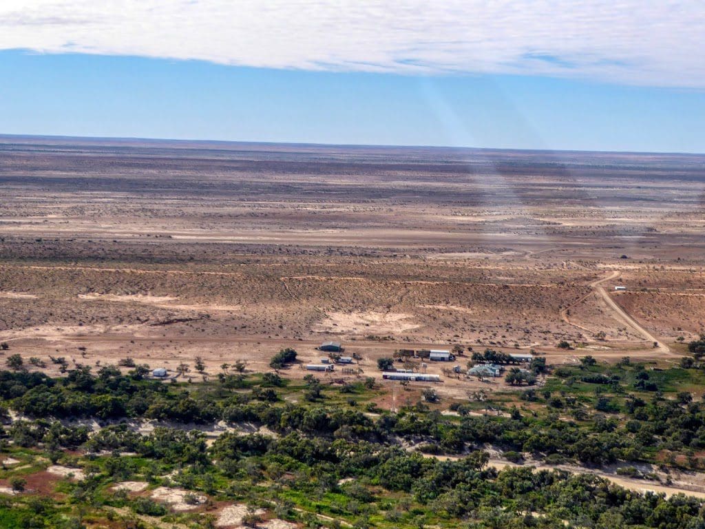
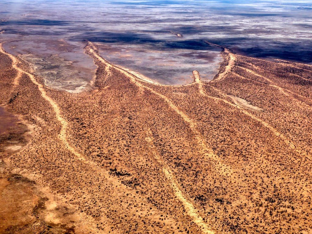
The flight first took us south along the Diamantina which is still coming down in its flood. It has wet a fair bit of country on either side of the ‘river’ itself. This recently wetted country has quickly developed a green cover – mainly short lived ‘forbes’ and some tallish grasses. On either side of the green band is bare ground with sand dunes to the west. Many small and large dry clay pans where the water did not reach in this small flood (which did not enter the town of Birdsville itself – as it has on many previous occasions).
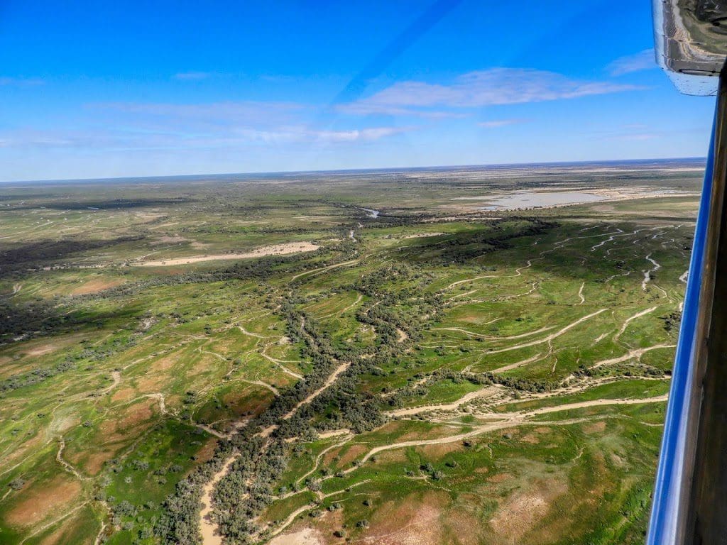
We flew at 700 feet along the Diamantina until the river suddenly splits into the hundreds of streamlets that make up Goyder Lagoon. We think that Goyder Lagoon is a lake that has been filled in by sediment carried down the Diamantina and the streamlets are running across the ‘delta’ that has now covers the lake.
About here we saw our only birds – a creche of pelicans. Goyder Lagoon looks like a great mass of green cut by slivers of silver – Everglades-like. We flew at 700 feet across Goyder Lagoon to where the Warburton flows out.
A slideshow of the first half of the flight is here.
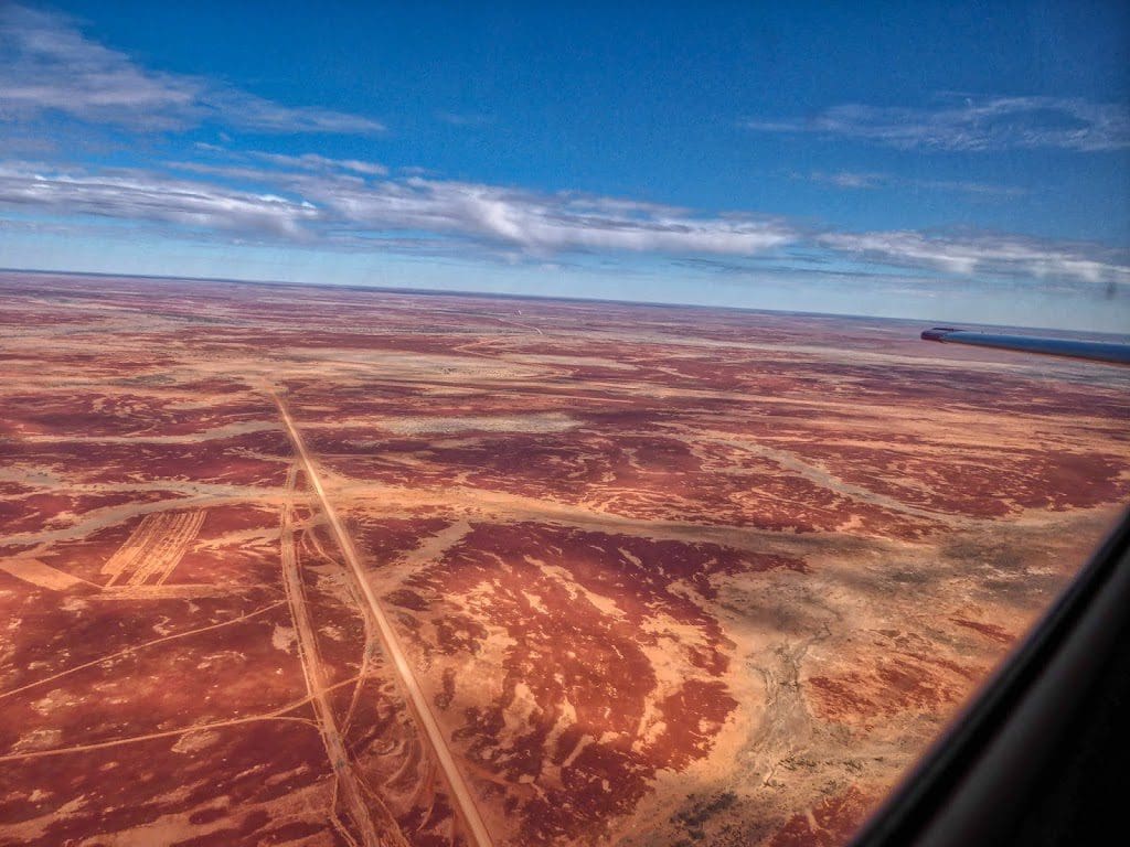
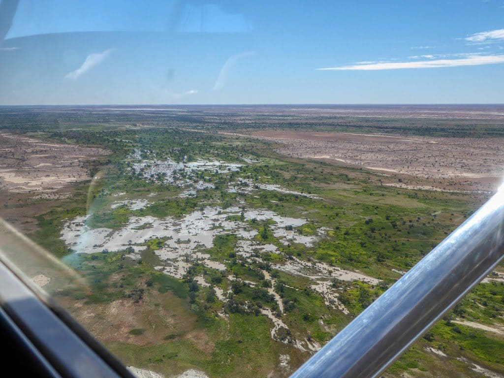
From there, we flew (at 1,700 feet) SE to Coongie Lakes. The path taken was along the junction between Sturt Stony Desert and Strzelecki Deserts. Sturt Stony Desert is brown gibber flats cut about by offshoots of the Diamantina floodplain – all devoid of vegetation.
Strzelecki Desert as dunes held in place by vegetation (cane grass and spinifex) in much the same way as the Simpson. At Coongie Lakes we came back down to 700 feet.
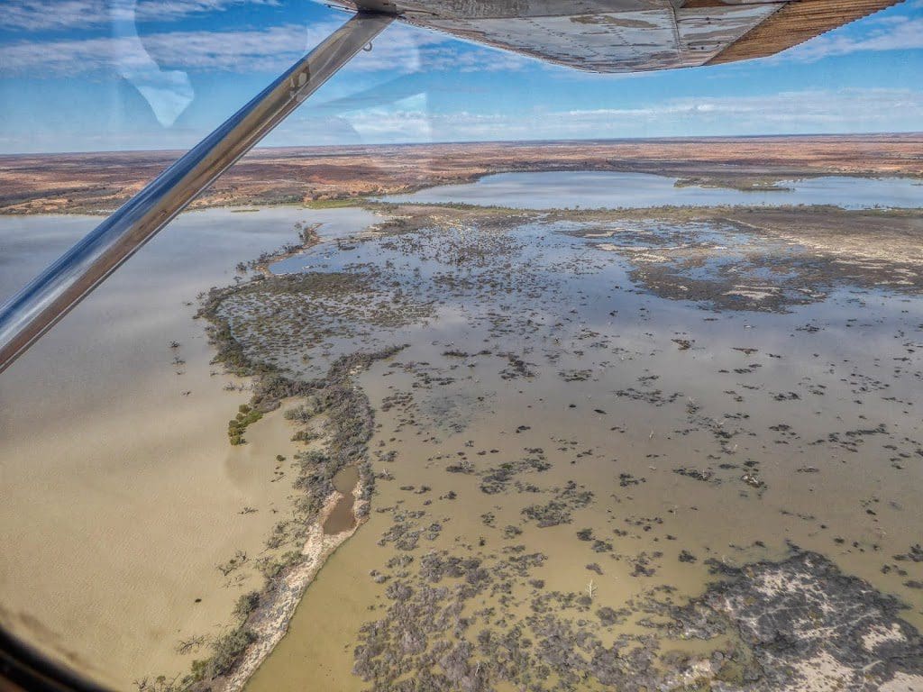
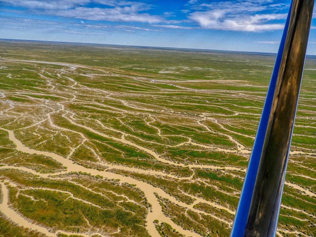
Coongie Lakes are immense expanses of shallow water and this year mark the extent of Cooper Creek’s flow down from Longreach. (The Diamantina, which starts at Winton, got more of Cyclone Trevor’s rain.)
No birds – maybe because no fish? Coongie Lakes are a ‘backwash’ lakes system for the Cooper which enters at their south. Hundreds of small waterways and complicated glints of silver below our path – a few cattle here and back at Goyder.
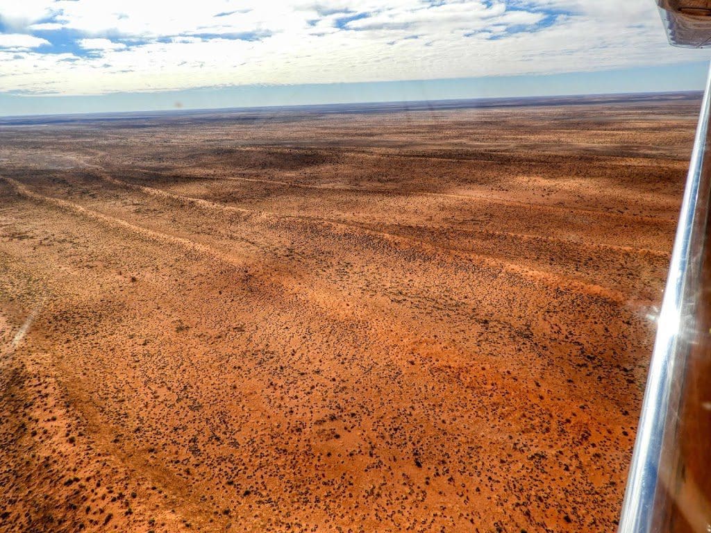
From here we flew NNW back to Birdsville at 700 feet. Almost no vegetation below us – except stabilising the occasional sand dune.
Empty claypans have no sign of salt in either of the two river systems, so the salt deposits that cause the salt in Lake Eyre is south of here. (Although some of the empty lakes we came across on the southern Simpson were saltpans, so the salt might be getting into Lake Eyre from the north rather than the east.)
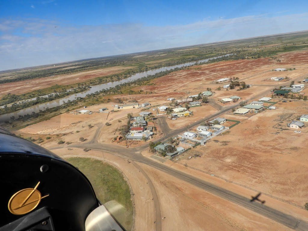
Back to Birdsville where we landed at 1:07 pm. (Interesting that two other aircraft gave their landing time as 1:07 pm, so with no control tower at Birdsville, there was a bit of negotiation in the air.)
A slideshow of the second half of the flight is here.
A short movie of the second part of the fight is here. (I included the landing to show how dry it is around Birdsville.)
After dinner tonight we joined Martin (a semi local) for a talk on the stars. Very general and very interesting. How to find south from the Southern Cross; rotation of the sky at night; what of the Southern Cross can be seen at various latitudes in Australia (Hobart v Melbourne v Sydney v Brisbane v Rockhampton); visible planets (Jupiter and Saturn); constellations (Scorpio, Leo, Libra, Sagitarius); emu in the sky. Martin is self taught from his own observations and tuning into what people are interested in. $15 per person and worth it. Recommended.
 |
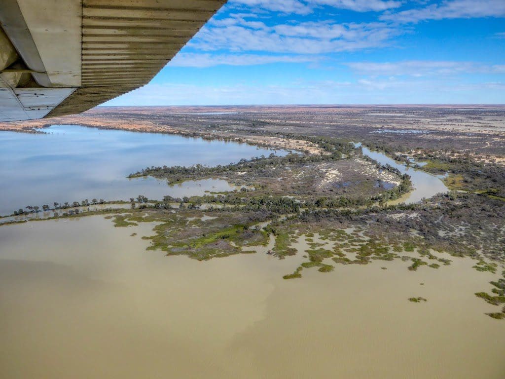
| Coongie Lakes with Cooper Creek entry Excellent photo by Helen. I like the light, reflections and ripples in the lake. |