France Road Trip – week 5 – Arreau

Saturday 7 May. Day 30. Two hour drive (mainly on Autoroutes) to Arreau which is in a deep valley about mid-way across the Pyrenees – still in France (just – Spain is just a few kms south). We are just south of Lourdes and Tarbes. This will be our smallest village on this trip – population about 800. We chose this small village because the Tour de France often passes through or near it. Just to the west is Col de Tourmalet and Col d’Aspin. Just to the east is Col de Peyresourde. All famous passes that the TdF uses almost every year.

We intend to drive up all of them. Our apartment for the week is the smallest for the trip – though Paris 1 comes close. It is really a ski-apartment used in winter because of the good skiing nearby. The village is on the junction of two fast, snow-fed streams. Many very old houses. One house was used by Louis XI in 1475.
 Sunday 8 May. Day 31. VE Day – Victory in Europe ceremonies in all towns and villages – two ceremonies in Arreau population 800 from where about 40 young men were killed in WWI. When Germany decided to ‘bleed France white’, it was surely felt in these small villages – which did not recover from the loss.

Sunday in France is a difficult time to buy fuel for a car. Small, local fuel stations switch to automatic – which is ok for locals but ordinary for us. Our chip/pin cards do not work in any of the automatic machines – toll booths, service stations. We were going to drive over the Col de Tormalet but being low on fuel, we tried to fill up first. We drove about 80 km following suggestions to fuel stations that were closed or automatic. We even tried an autoroute. No fuel. We came back to Arreau to wait for Monday when we hope the fuel stations will be open again. Spent some time watching a herd of goats and the goat dog.

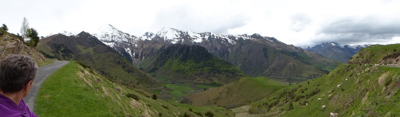
Monday 9 May. Day 32. Half-way. There is no doubt that we made a good choice to come to stay at Arreau because of the Tour de France. Arreau is in the middle of TdF Pyrenees country. Today, we drove a few of the spectacular roads that the Tour frequently takes around here. (Tomorrow we will do more of the same.) Today, we drove east over the Col de Peyresourde, that appears to get a turn most years, to Luchon (where we stayed last trip).
Peyresourde is a deceptive saddle in that the road runs along long valleys without many switchbacks – but the elevation gain is about 1,000 metres over a long slow grind. From Luchon, we drove to Superbagneres (a ski hill just south of Luchon with a cable-car from Luchon centre). This is a brute of a climb that has been used several times as a TdF stage finish.

Tuesday 10 May. Day 33. A huge day. We drove for about 6 hours in order to drive a few parts that the TdF does or has taken. First, a big loop on the autoroute to Tarbes and then down to Lourdes (with its multi-gallon containers of holy water, and packs of tourists) and on to Hautacam. A ski hill that has been used often (though not this year). This is a gruelling grind up about a 1,000m in places at 11%. Not much of a view from the top (and we could not work out where the race stage would finish).

Then, on to try to get up the Col de Tourmalet – route barre with snow. I would have to say that what we saw of Col de Tourmalet explains why they use it so often. First, it is one of the few passes that run east-west across the Pyrenees; second, it is another punishing climb that appears to go on forever at about 10% The Route Barre was at the base of a ski resort that went up to the Col. Even coming down from where we got to appeared to go on forever. From there, we went on to Cirque de Gavarnie, a famous French tourist spot.

We had a picnic lunch and walked about 30mins along the cirque trail. A popular walking spot.The cirque is spectacular – but the Canadian Rockies leave it for dead. A long 2 hour drive back to Arreau as we retraced our outward path via Lourdes and Tarbes.

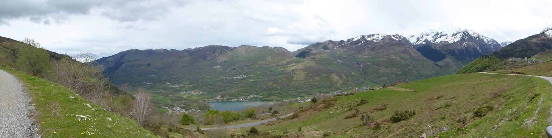
Wednesday 11 May. Day 34. Truncated. Thunderstorms forecast for 11am arrived on time. Quite wet for a while there. We drove up Col d’Aspin to Payolle (which is the end of this year’s stage 7). Then, on to climb up Col du Tourmalet from the east (They will come down here on stage 8 this year.) Route barre at La Mongie ski resort. (A huge resort that covered all the area of the Tourmalet – maybe 10 km long with many many chairs and cable lifts.) Back down the road to Peyolle and up the D113 road they will take over the Col de Ancizan down to St Lary.

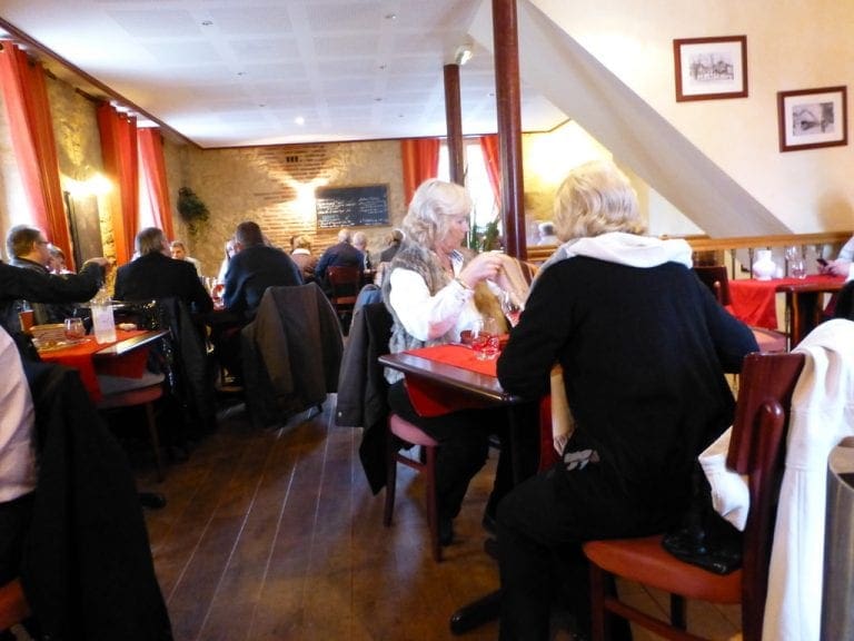
This D113 road is a doozy. Usually ridden the reverse to this year’s ride. This year’s descent down from the Col to the valley will be extremely difficult – very narrow, winding and steep. Heavy rain at the bottom. Back to Arreau for lunch at the Creperie Bretonne – gallettes. An excellent meal of a savoury crepe for the main and a buttery crepe for the dessert.

Thursday 12 May. Day 35. Sunny morning and rain in afternoon. We took advantage of the sun and drove another part of this year’s TdF stage 8 from near St-Lary-Sourlan to Azet and up over the Col Azet-Louron. This is going to be another great climb and descent that together with the other 3 climbs/descents will make stage 8 a punishing one. The descents will probably see the peloton regroup after the climbs but the sprinters will be dropped off in the climbs. Possibly a break-away will succeed.

But the day itself will be tough enough to exhaust many. It will be a good stage to stay up and watch. (They have clearly used this Col before and it is a more punishing climb when done the other way. This time, the descent will be difficult with narrow winding roads.) Great views from the top.

Arreau had its weekly market today. Much more relaxed than the efficient stalls-installed-by-7-no-chat Paris markets. Very friendly and laid back. Arreau is an excellent thriving village and has been a great choice for us to stay in. For lunch, we went back to the Ar Menez Creperie Bretonne where we ate yesterday. Excellent. No wifi here is proving a bit of a disaster. Even editing this blog is proving difficult.