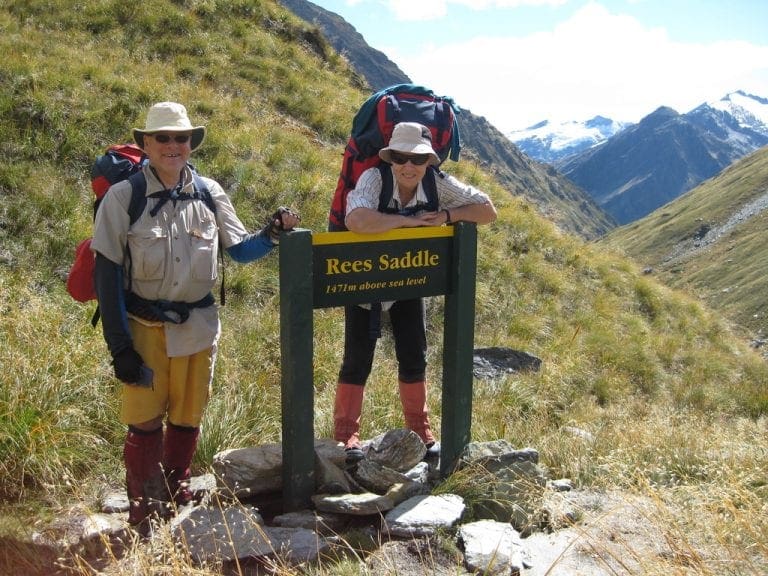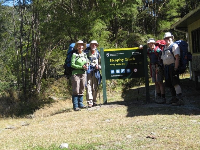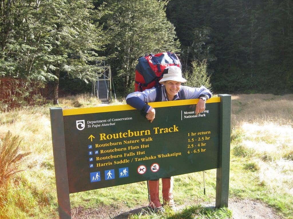
Routeburn Track New Zealand March 2011
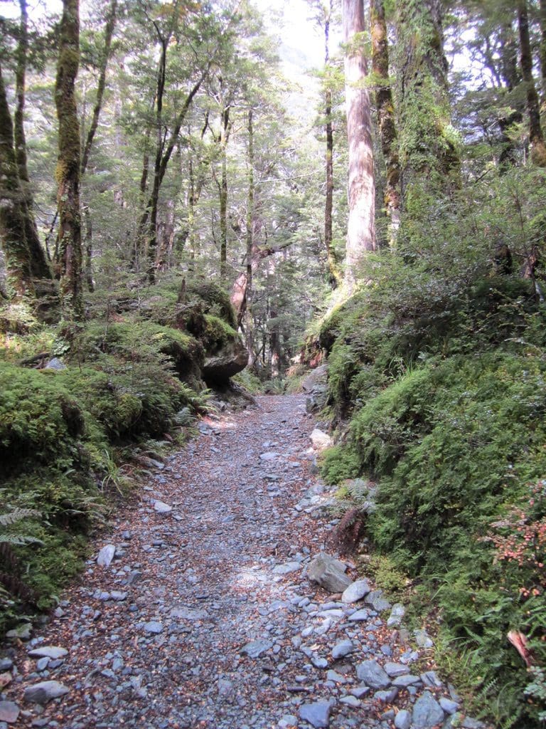
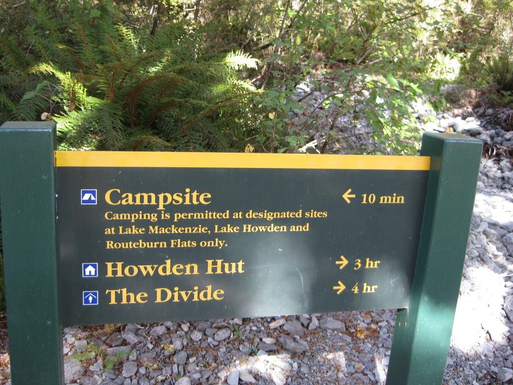
This will cover our Routeburn walk in March 2011. We have walked this NZ Great Walk before (2004). We are doing the same track again. It basically looks like this. Let off at the road end at Routeburn Shelter (458m) on a well-graded ‘walking track’ 6.5 km (1.5-2.5hrs) to Routeburn Flats (750m) (20 bunks) where we spend on night. The next is on ‘tramping tracks’ just 2.3km (1-1.5hrs) up to Routeburn Falls Hut (1,000m) (48 bunks) where we spend 2 nights. The next day is the biggie – 11.3km 4.5-6hrs the first part of which is up the Harris Saddle (1,255m) then down to Lake Mackenzie Hut (1,000m) (50 bunks) where we spend 2 nights. Then 8.6km (3-4hrs) to Lake Howden Hut (708m) (28 bunks) where we spend 1 night. Then catch the bus at The Divide (c 450m) (3.4km – 1-1.5hrs on a ‘walking track’ again) at 10.15am. After Rees-Dart, this should all be a bit of a cruise. Graded walking tracks, well marked, with bridges over creeks and boardwalk over bogs. (‘Walking tracks’ – translates as ‘trainers’ or ‘walking shoes’; ‘Tramping tracks’ means ‘tramping boots’; ‘Routes’ are poorly marked with cairns and poles, need to be able to wade through bogs and creeks. Most of the Rees-Dart is a ‘route’.) Bigger huts and more people. Gas provided in the huts. Cold running water and flush toilets. No showers. One shirt and one pair of socks will do it.
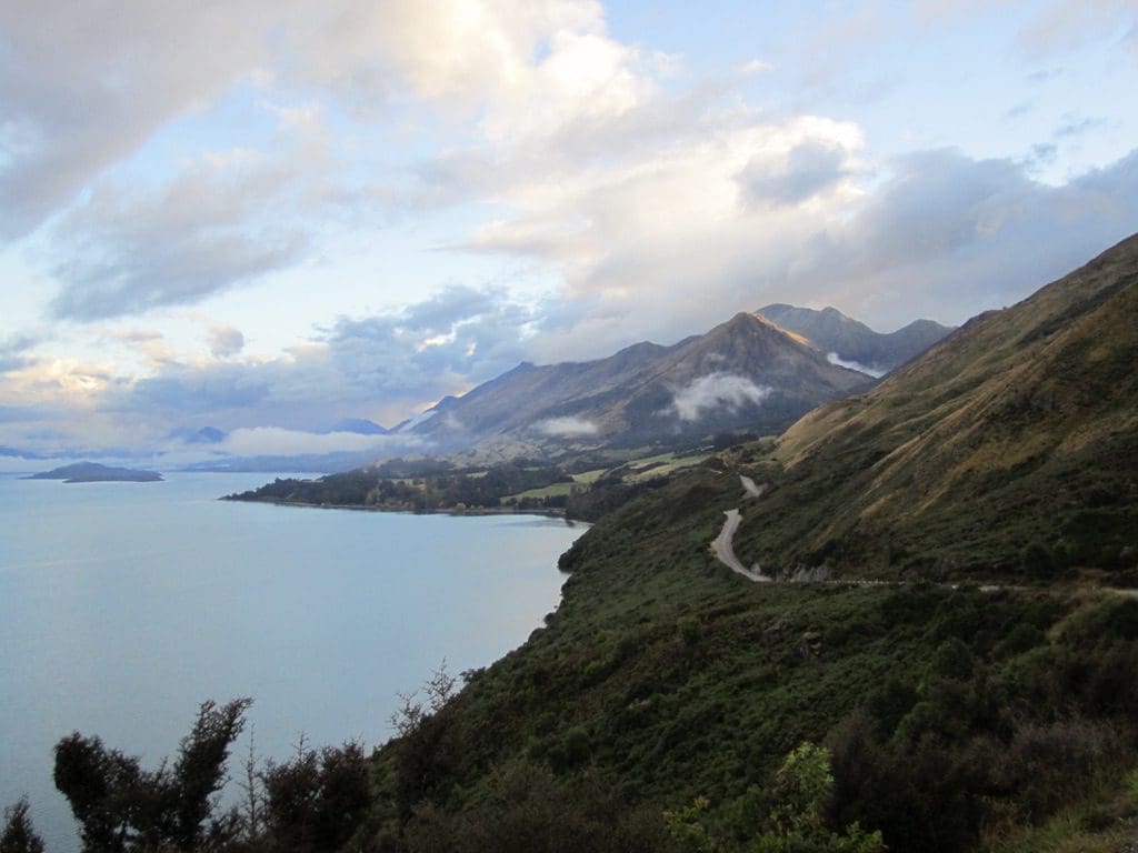
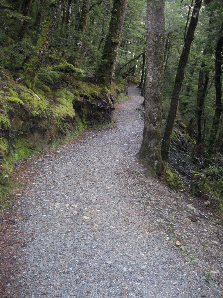
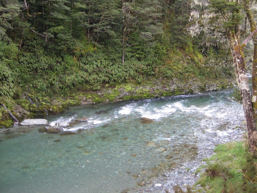

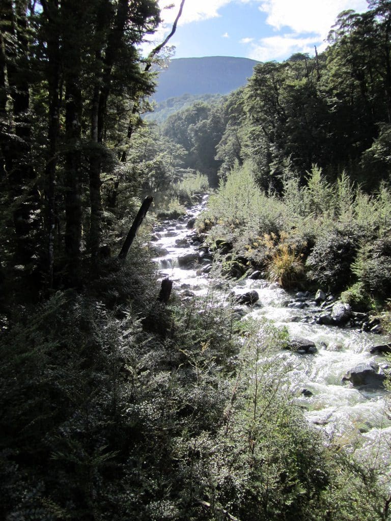
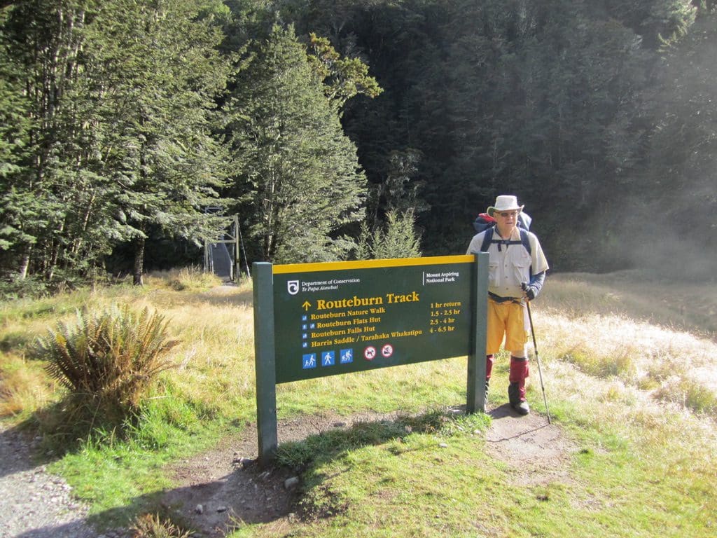
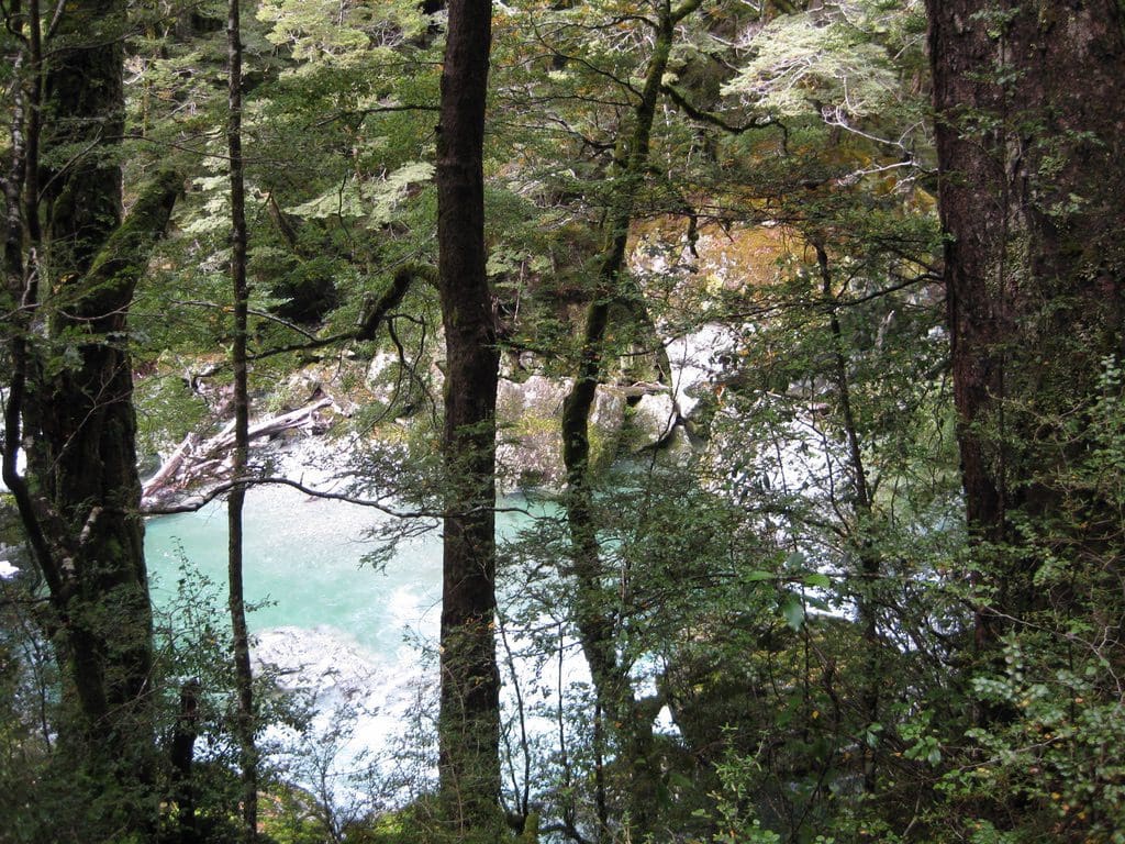
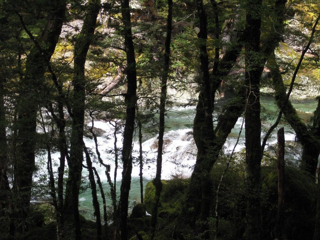
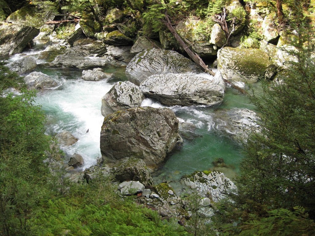
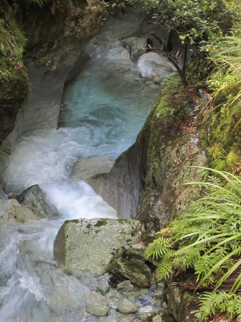
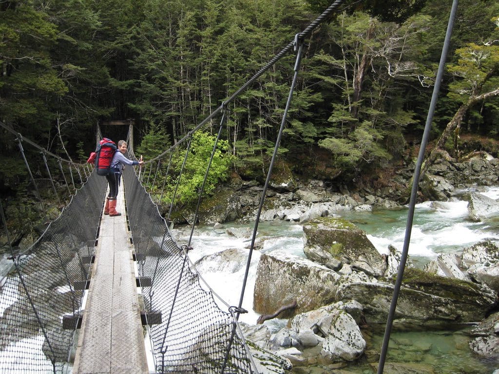
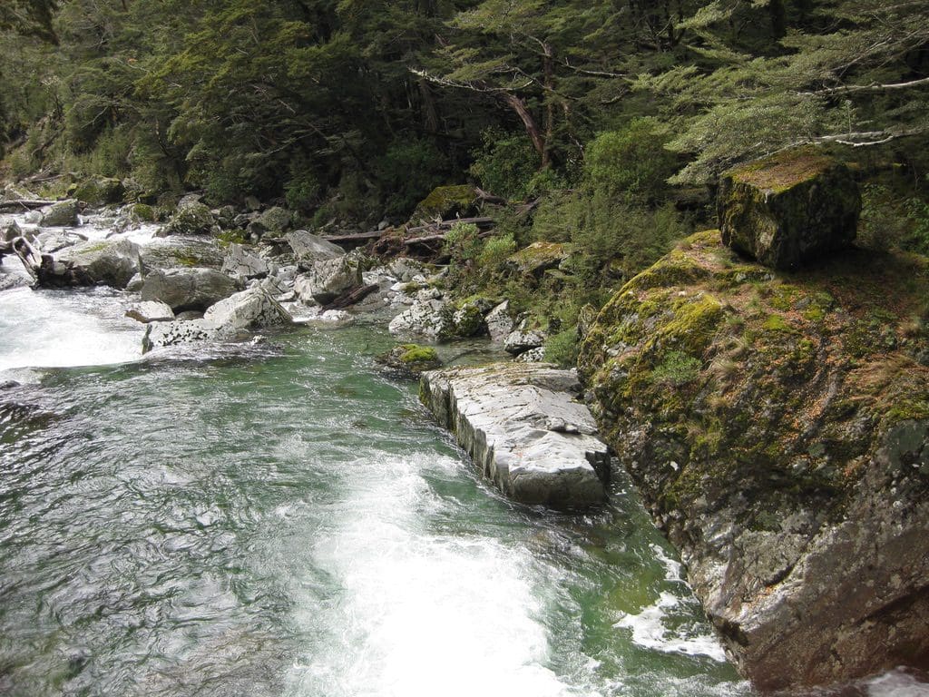
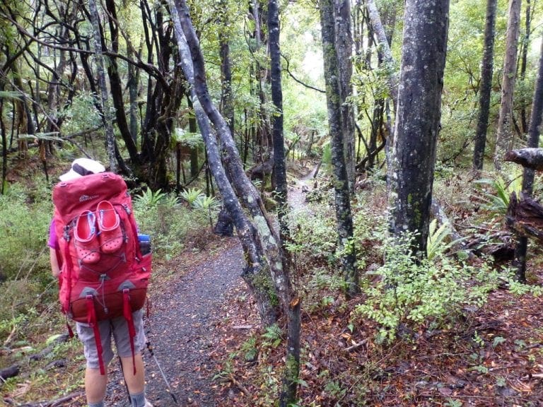
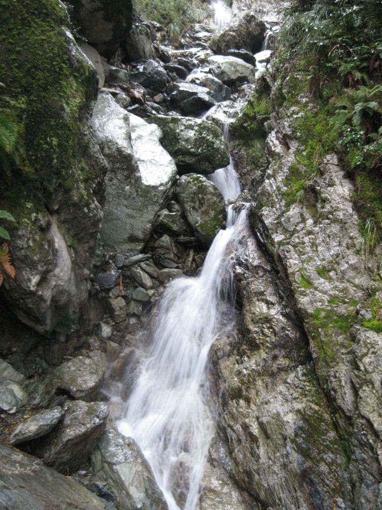
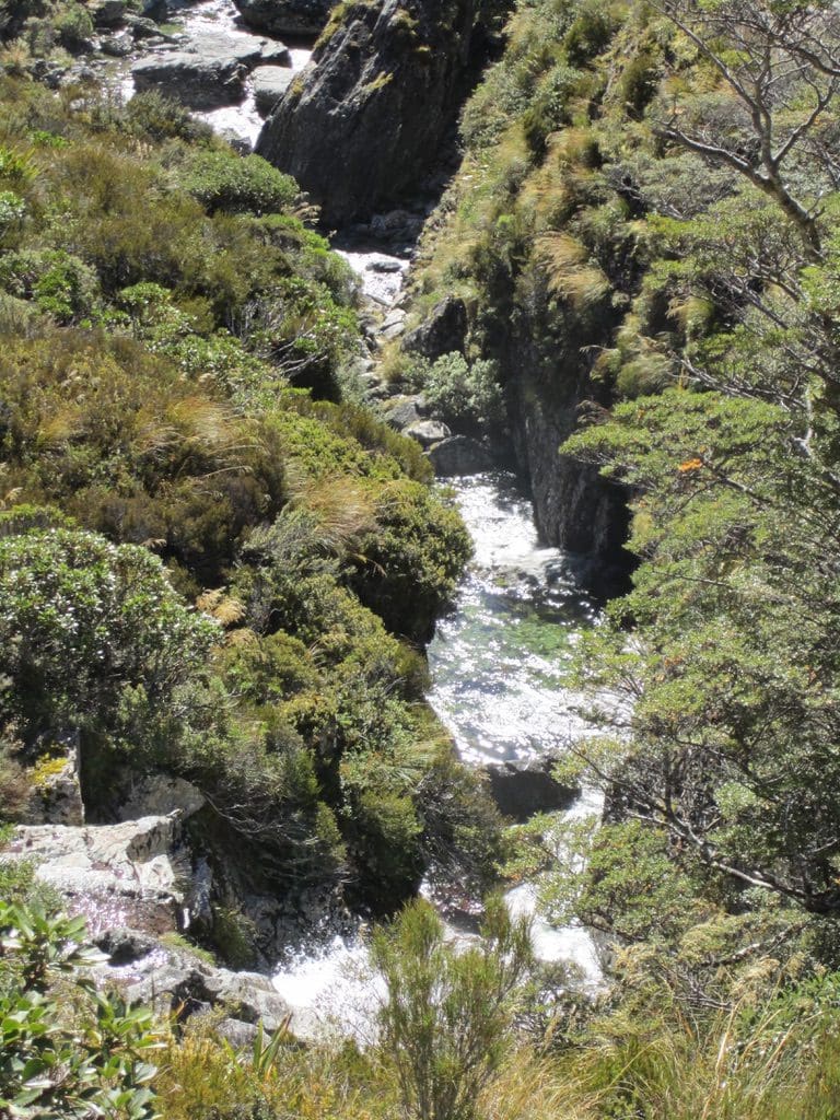
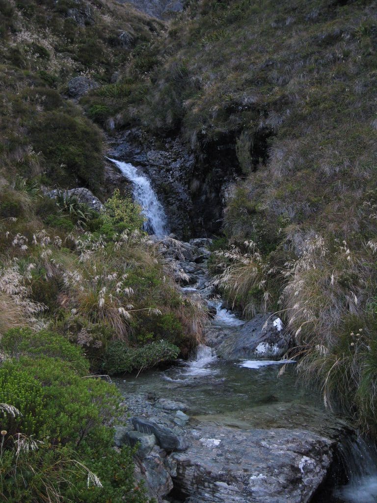
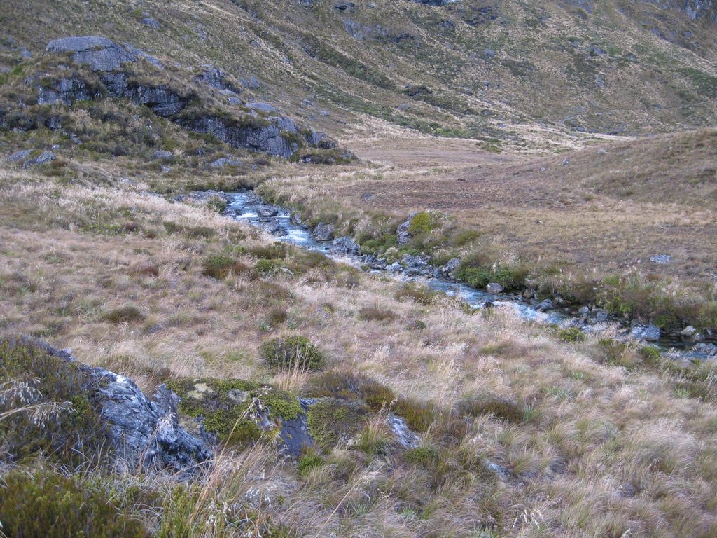
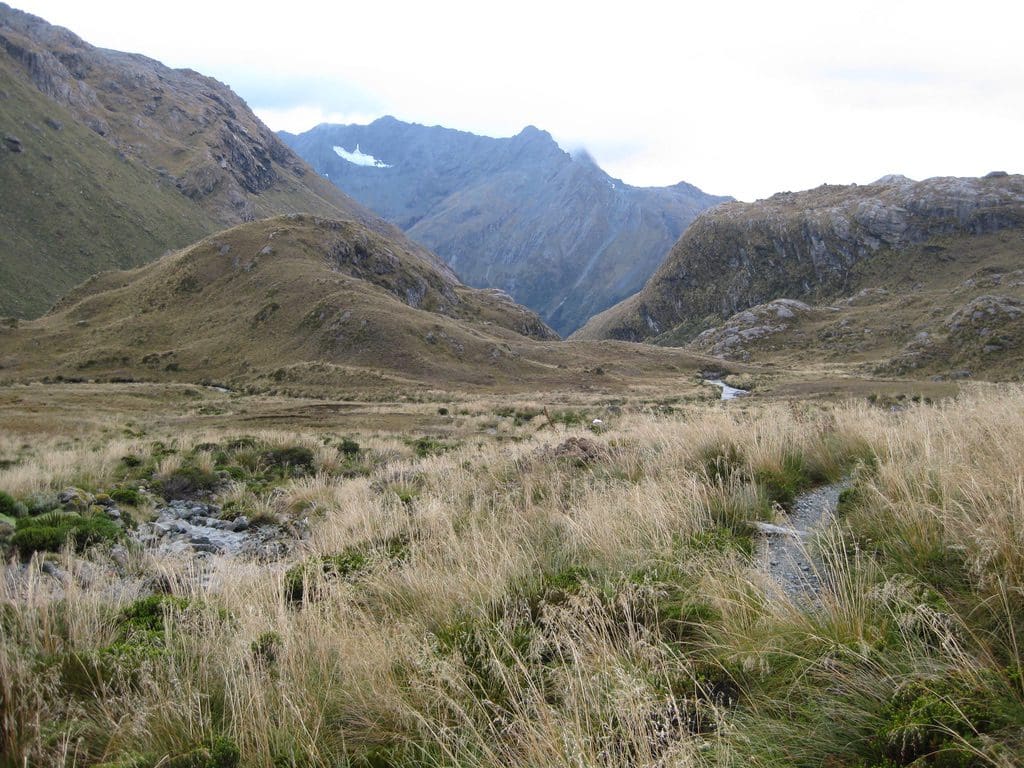
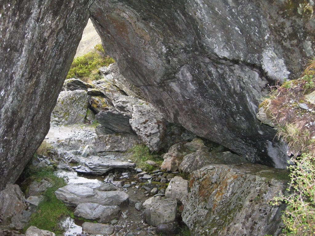
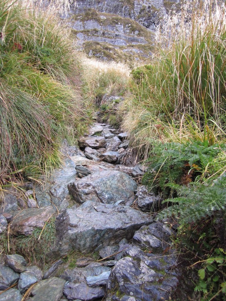
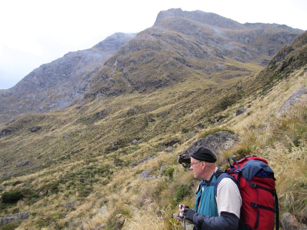
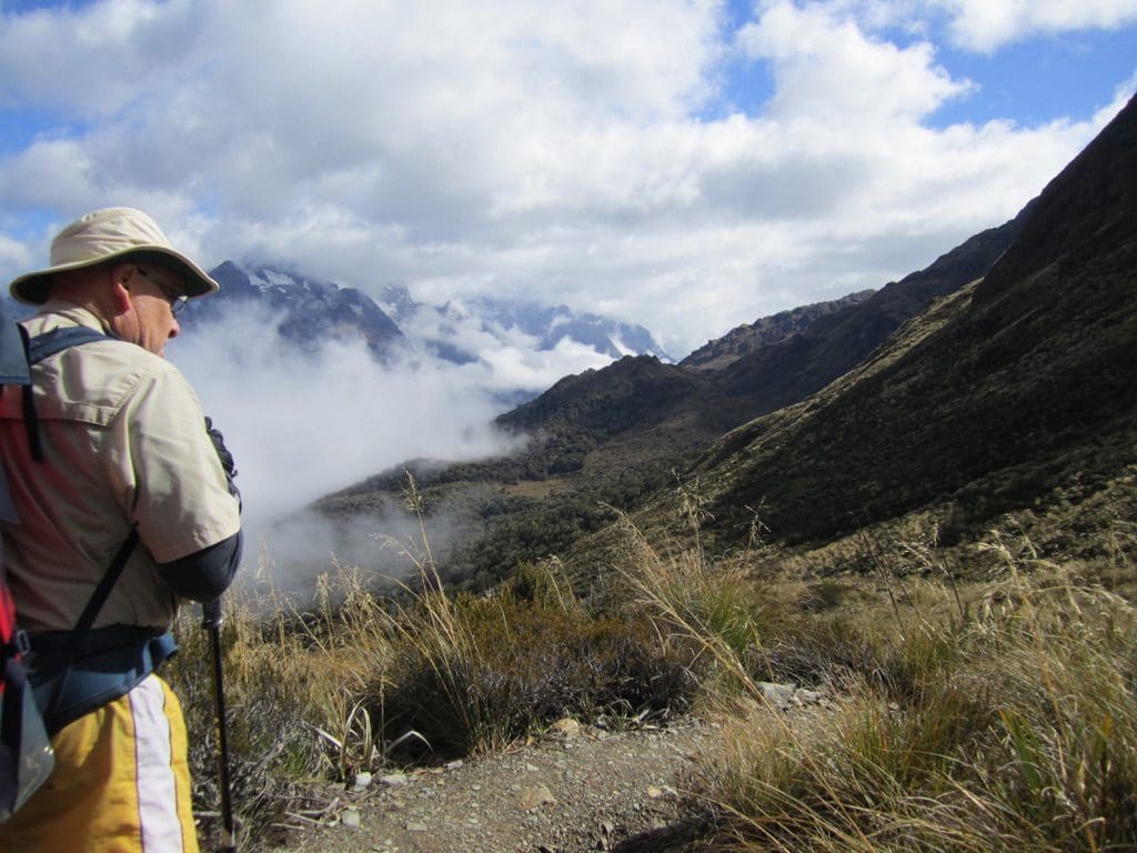
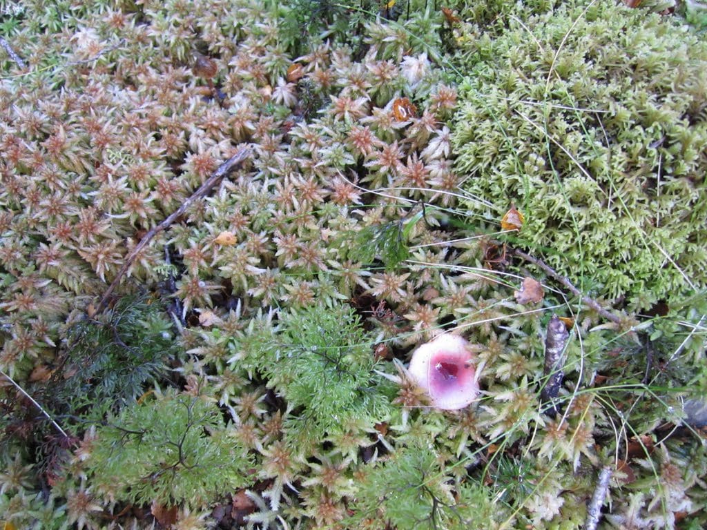
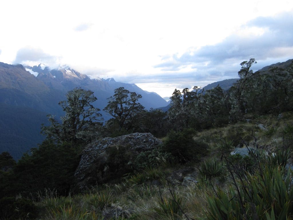
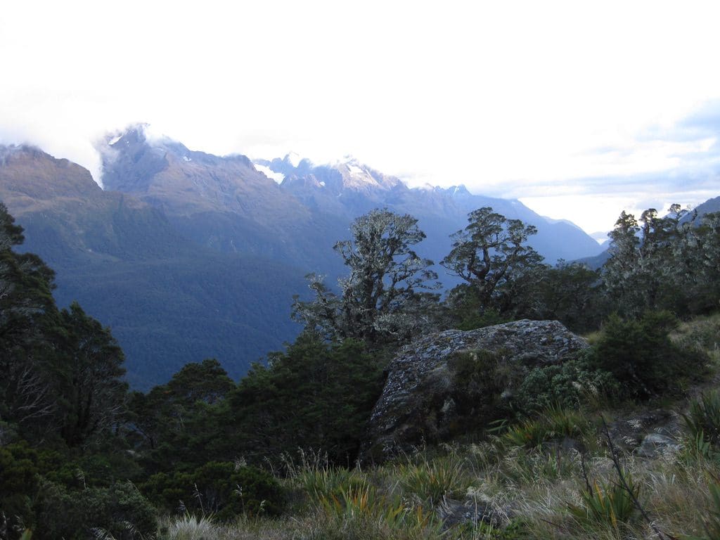
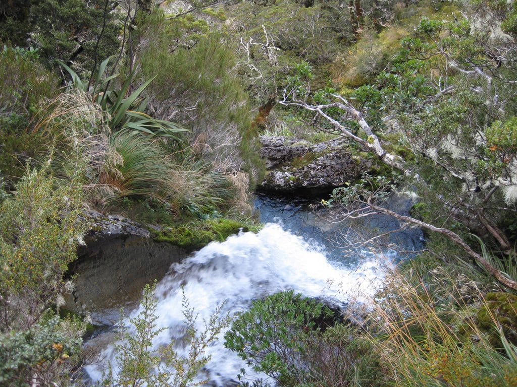
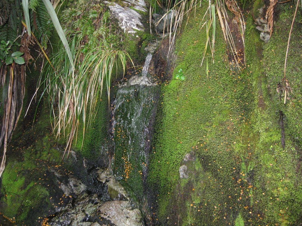
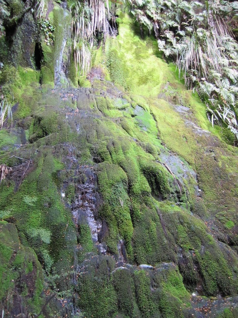
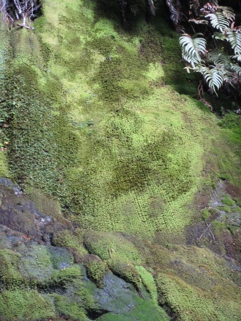
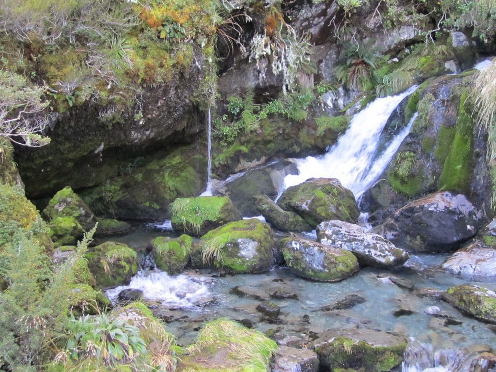
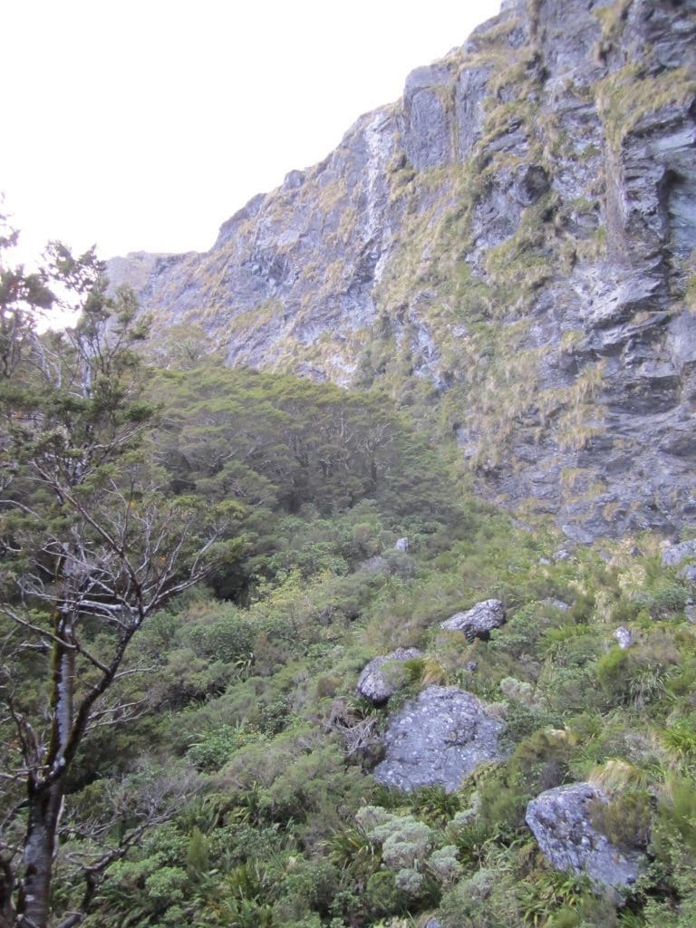
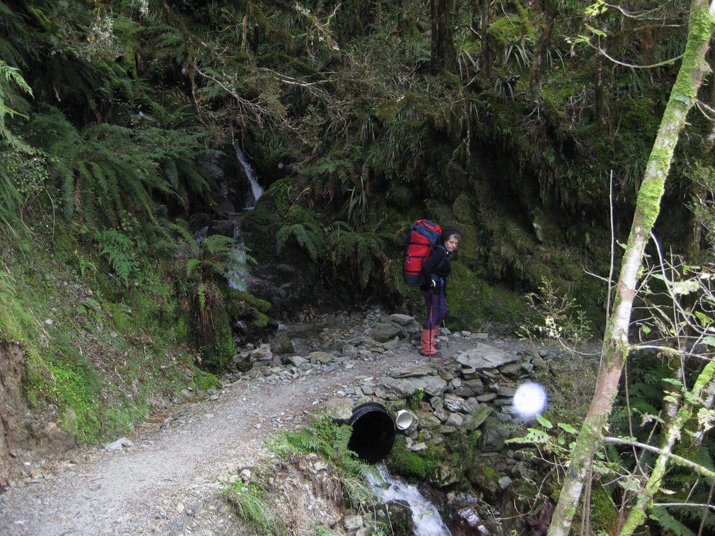
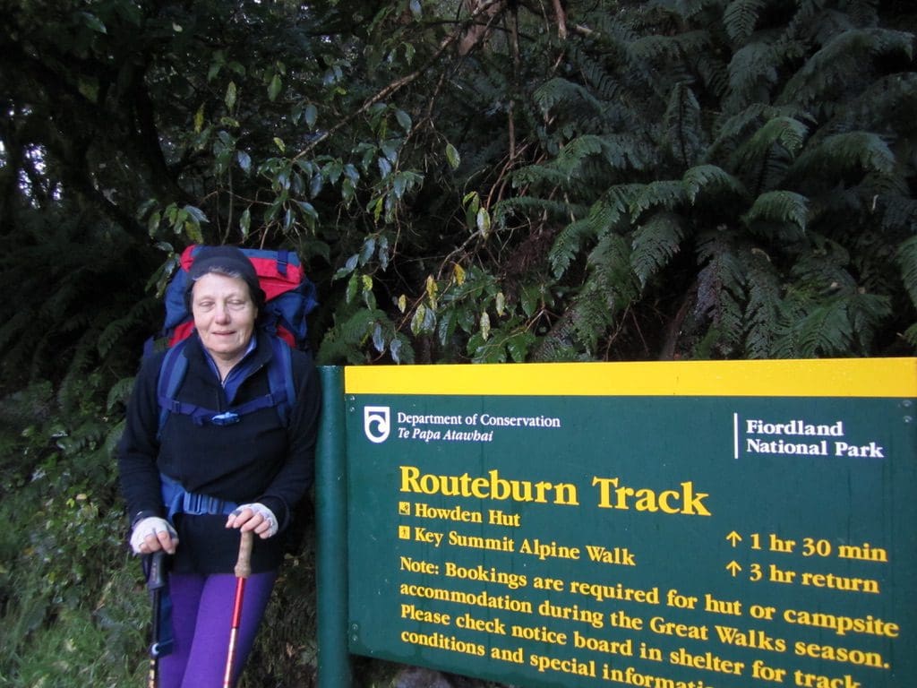
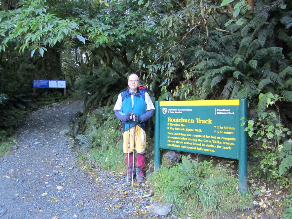
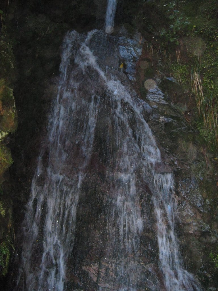
Mar 26 Saturday. At Routeburn Flats Hut (700m). The Routeburn Track from the Shelter to Routeburn Flats is magnificent: 1.5m wide, perfectly graded, no steps – you could take a wheelchair along it (up to Routeburn Flats it was part of a partly built, never completed road). We got up at 6 am to give us time to leave stuff in locked storage & walk down to Info&Track for our 8am pickup. Hung around at Glenorchy till 9:30am for a tramper who did not show. (More on him later.) Nine on the bus including a baby – yes, a baby! Left Routeburn Shelter (where the bus let us off) at 10:15am and arrived at the Flats Hut at 2pm (3 3/4 hrs including stops – 3 hrs walking time – not bad for us). Most of the climb is done in the first 3km as the track climbs to above a major fall in the Route Burn. (yes, we are following a creek called the Route Burn, hence the name.) After that climb, the track is mostly flat. A beautiful walk through beech forest almost all the way – mossy understory. Extremely good weather – mainly sunny & a bit cloudy. The only wind I felt was the down-draft close to a magnificent waterfall. I think there are more bridges than I remember from last time we did this walk (2004). There has been a lot of work to divert and control run-off water from heavy rain. I have to mention the riflemen. These little birds (especially one group of 3) were picking insects off the track from under out feet. Very hard not to walk on them – never seen anything like that before – such unafraid & trusting little birds – no tail, little balls of fluff.
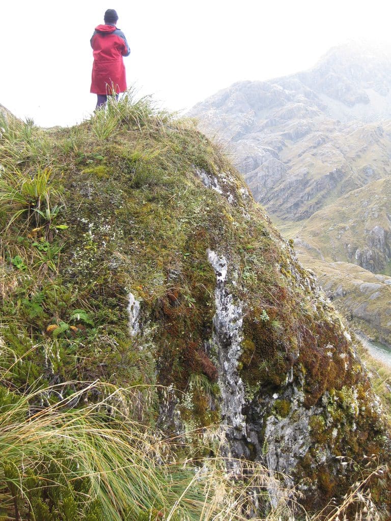
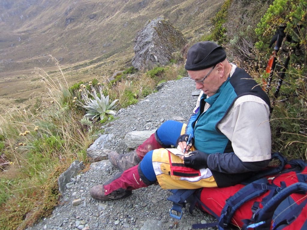
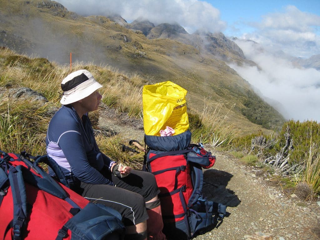
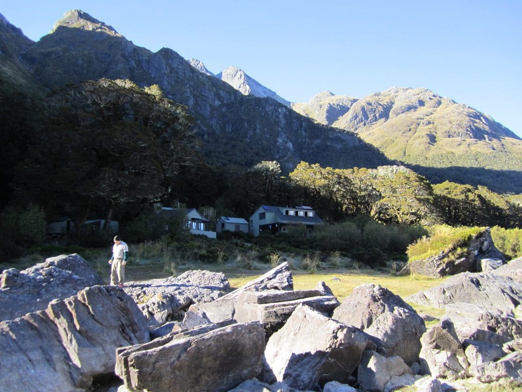
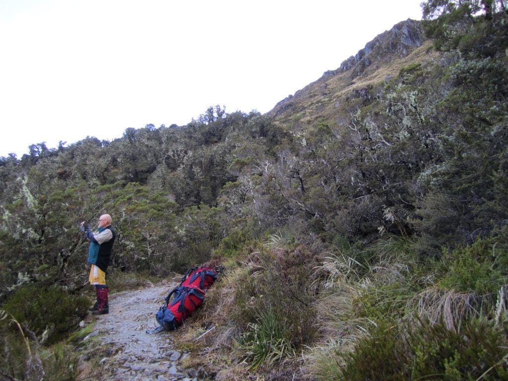
Ok, how did I go walking. I managed to get into a pattern where walking up was pretty good. Going down things is not so good. However, on the gently graded track nothing has been too difficult. About 1/2 way along (where we stopped for lunch) both quads we saying ‘enough’. The left one doing too much and the right one just beginning to work. Another night of rest, then up to the Falls Hut. I have to report that the new Icebreaker socks (thin ‘Hike’) are excellent – extremely good to walk in – high recommended. A bit more about Routeburn Flats hut. This hut is in one of the most spectacular locations – $100m views. One of my very favourite places (and most people on the Routeburn just walk by in their race to do the track in the least time possible – slow down and look!). Our ‘pack-offs’ every 35mins do give us time to look. I also stop for a few seconds every 100m to look around. Helen stops more often when her attention is drawn to a plant. I think it was my memory of the 4 marvellous huts on the Routeburn that led me to vote to walk this track again. Just north of Glenorchy (pop 200) is the tiny settlement of Paradise (pop not many). It shows a certain frame of mind to name somewhere on the edge of a world heritage listed wilderness with close to zero facilities – but truly spectacular scenery, a ‘Paradise’. (As we trudged our way up the hill today, a group of ‘guided’ walkers came down with ridiculously light packs (raincoat & clothes) and 2 runners jogged past, ipods plugged in ‘just look at you feet, Doris’, preparing for the Routeburn Challenge race in a couple of weeks.) Ate outside watching the storm clouds of a front devour the mountain. (We saw the first cirrus of the front at 9:30am this morning. Rain expected tomorrow morning.) Accompanied by Paradise shell-ducks in the stream, riflemen going over the trees and the odd sandfly. A long chat with the hut warden (Danielle) with much laughter. For a while it looked as though we would be the only people staying at RB Flats tonight. Two other people (who were expected at this hut) arrived just after 8pm. He did not have any equipment (‘where are the blankets and pillows’, ‘where are the pots and pans to cook with’). She had picked him up hitch-hiking and suggested he come on the track with her. No sleeping bag, no cooking pots. It is supposed to snow just up the hill from here tonight. What are these fools doing here? Arguing with the hut warden (who is trying to save their lives). The warden lent them a blanket (for which she got no thanks) and a pot. It turned out that the woman had just completed a course in mountain safety at Mt Cook. She then promptly brought a hitch-hiker into dangerous country with no equipment. We give her a ‘fail’ for mountain safety. She spent the evening bragging about all the times she has been rescued. Polish born American, extremely brainless and dangerous. (The next day, she demanded of the warden ‘where are the kiwi birds, I want to take their photograph’. The warden explained that kiwi are very rare and there are none on the Routeburn and just 1 on the Milford. Incredulous disbelief – no idea of the near extinction of the bird – accused the warden of making fun of her.)
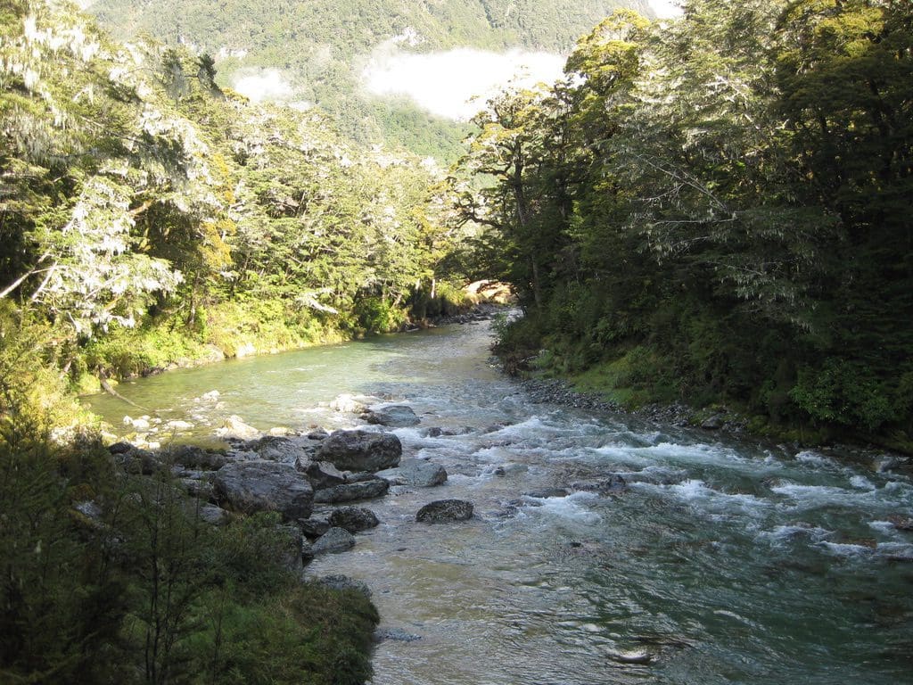
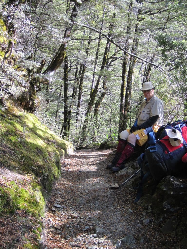
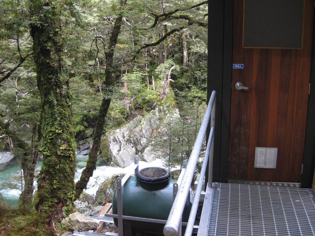
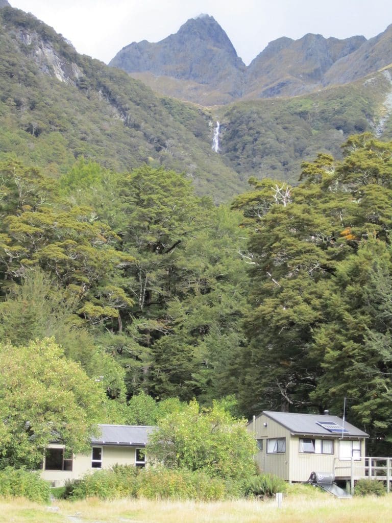
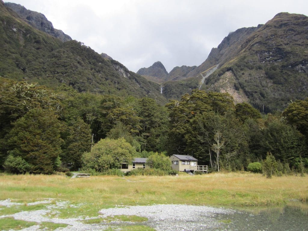
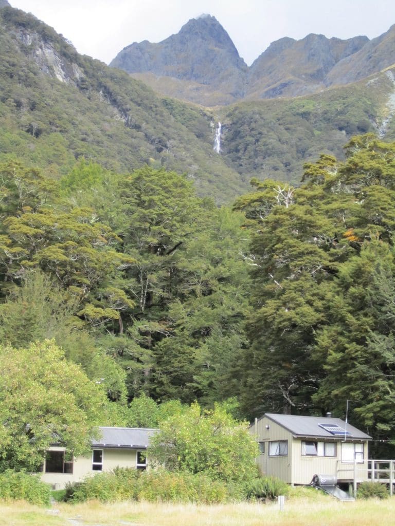
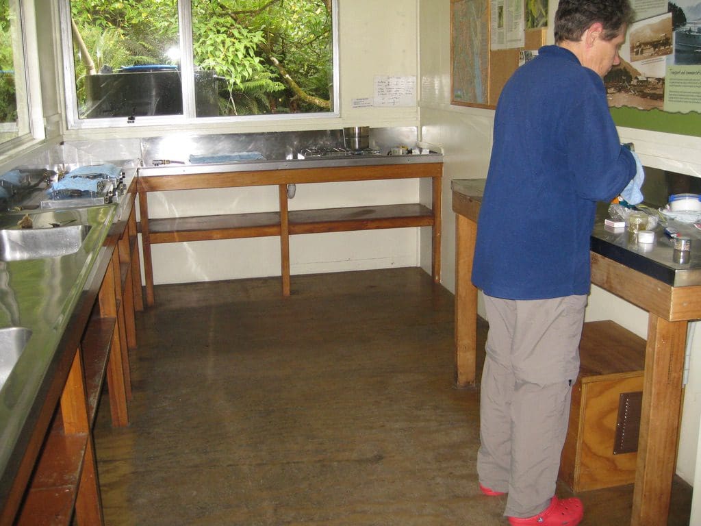
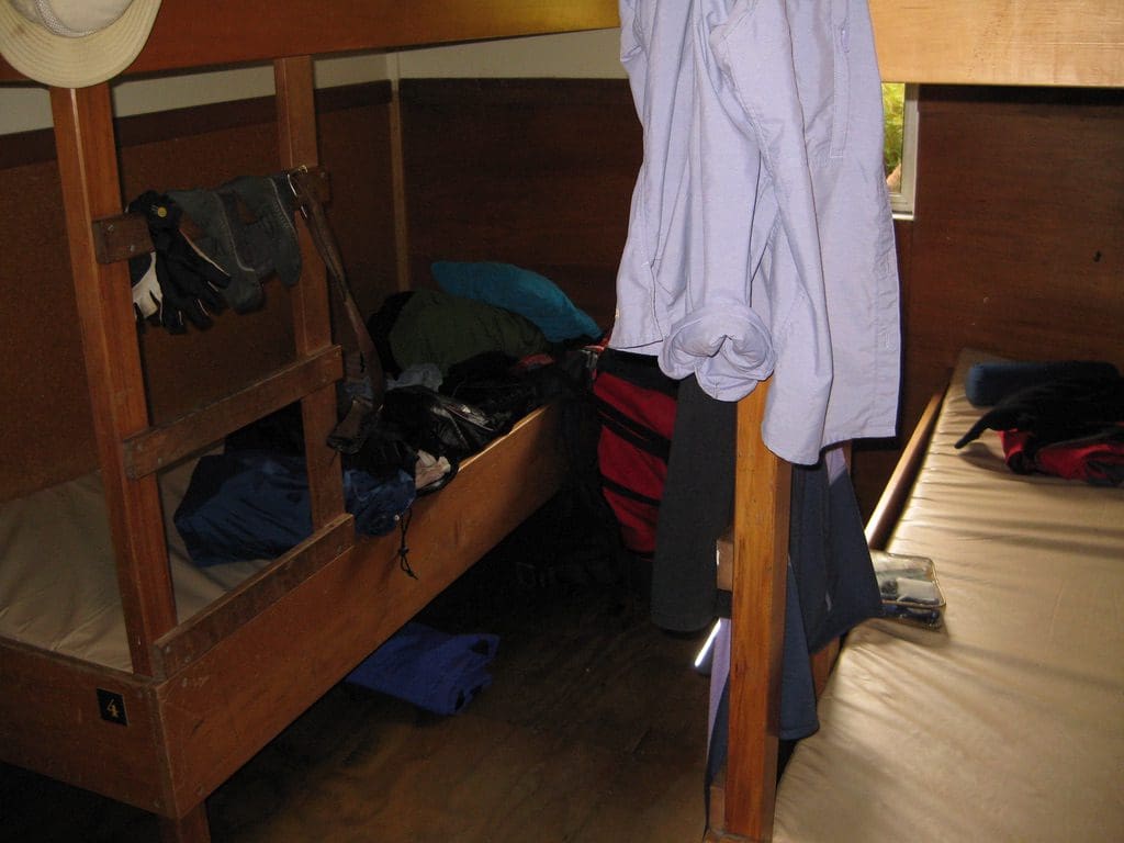
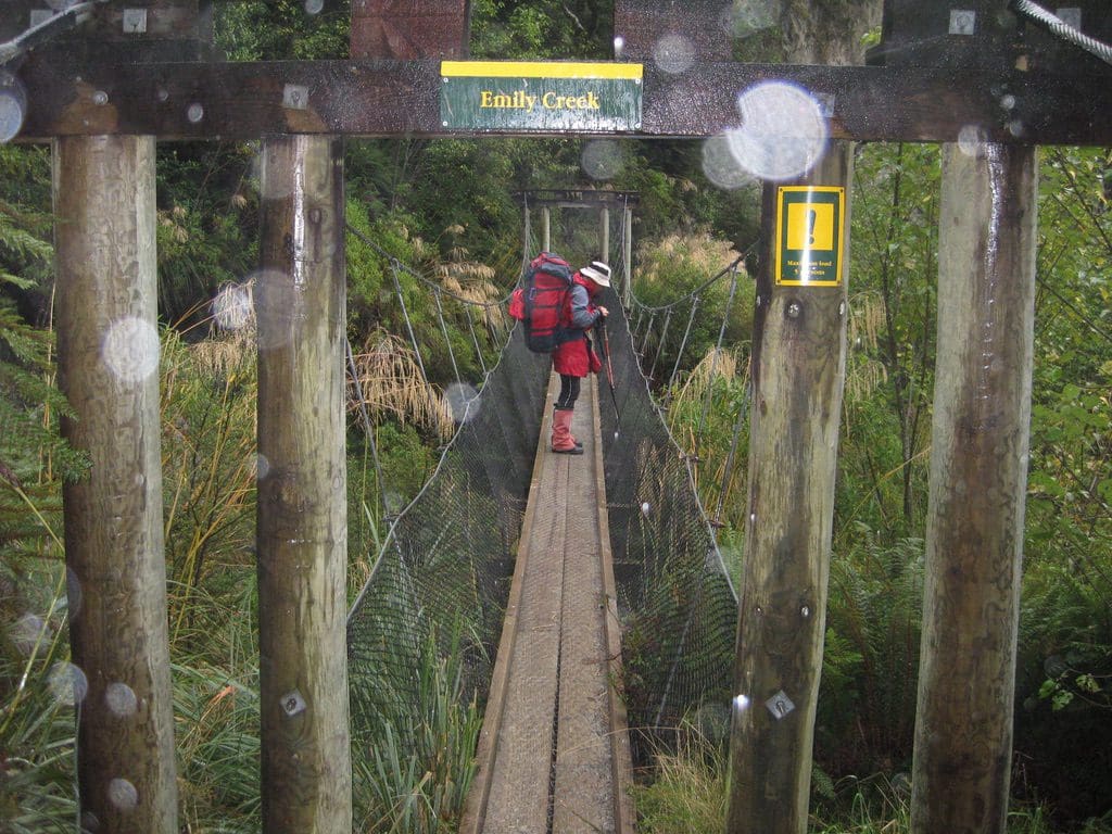
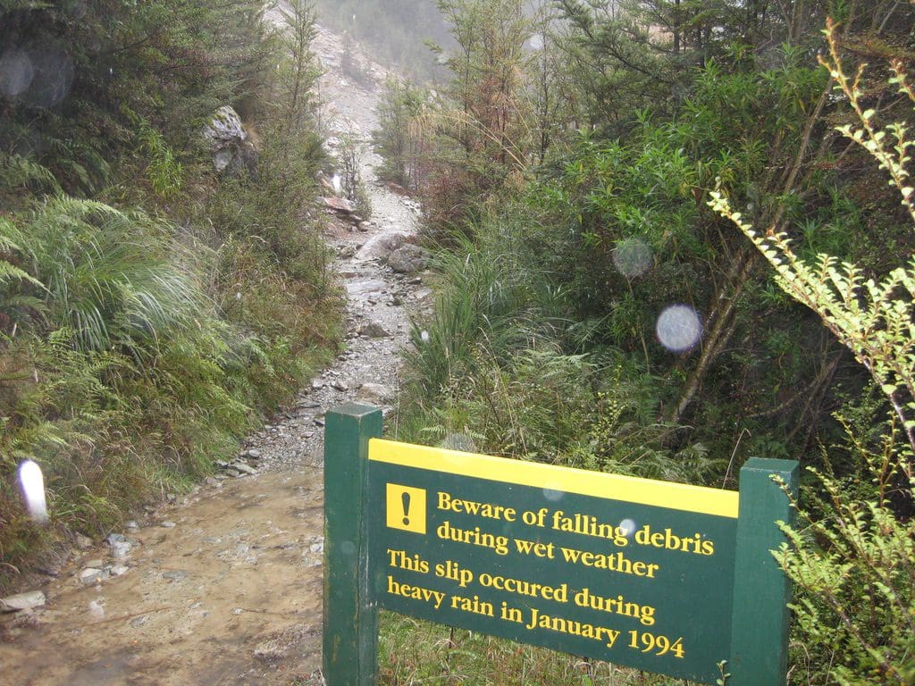
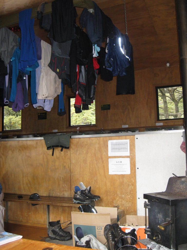
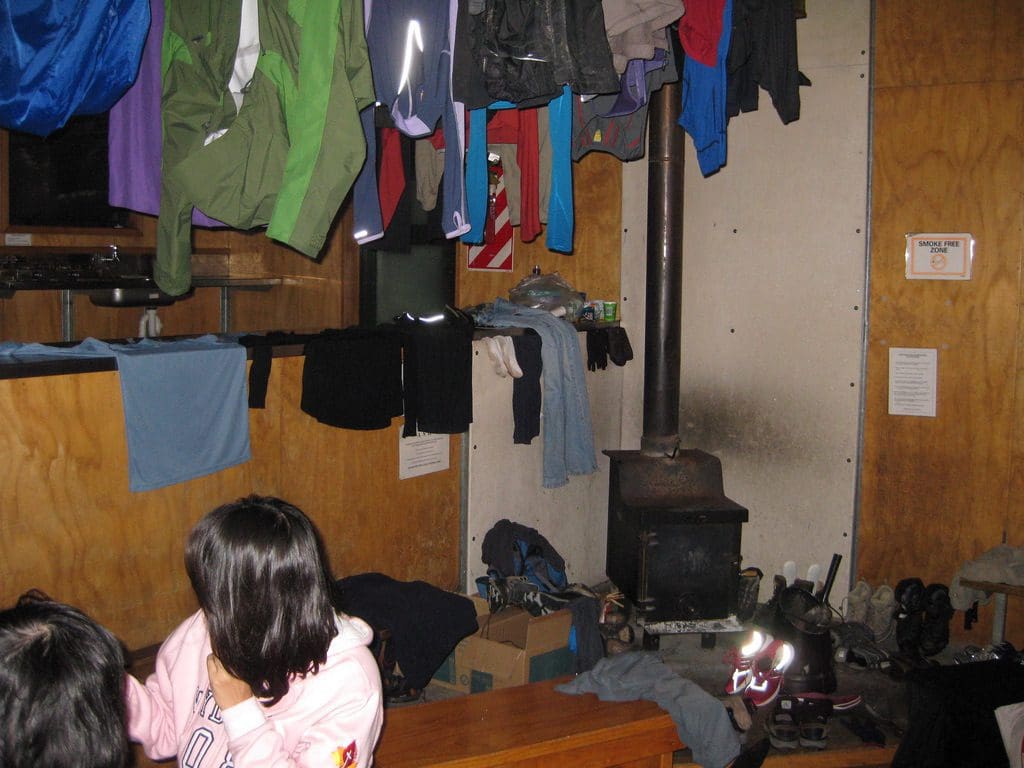
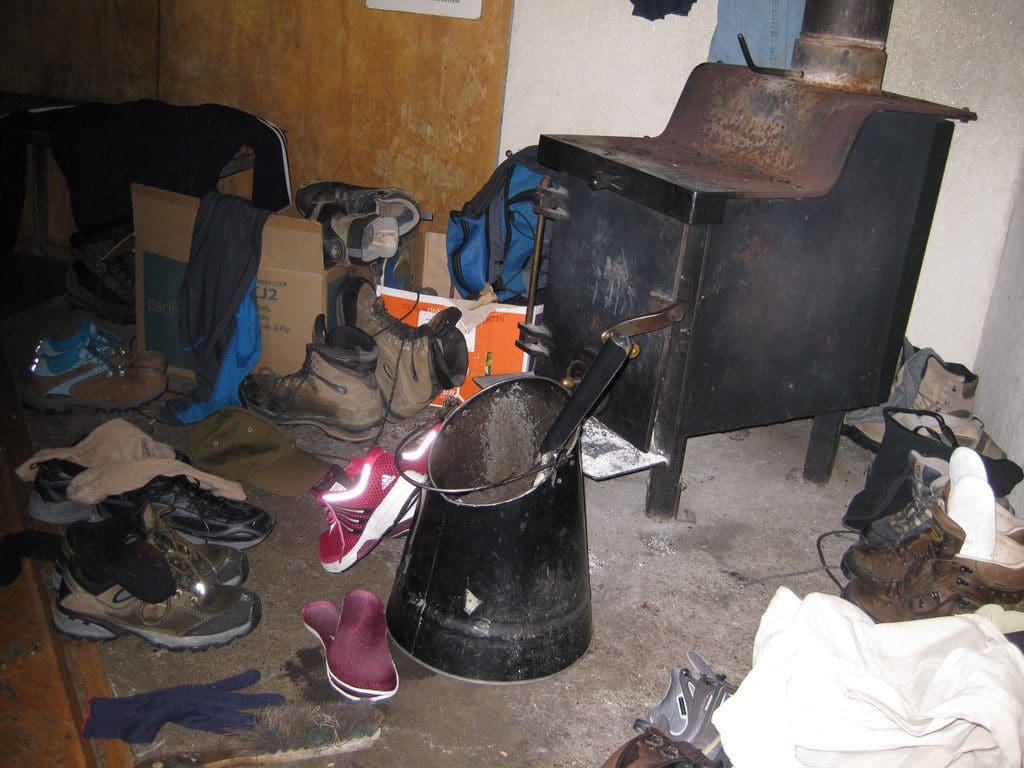
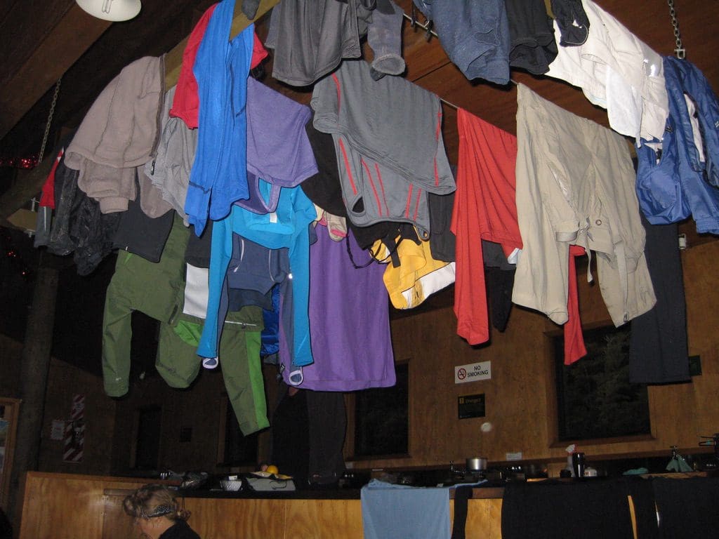
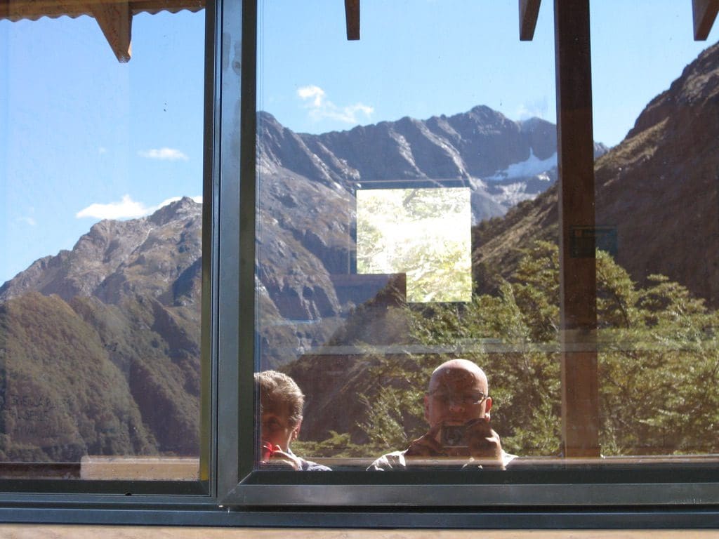
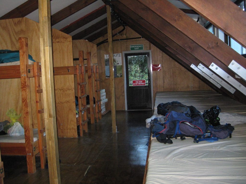
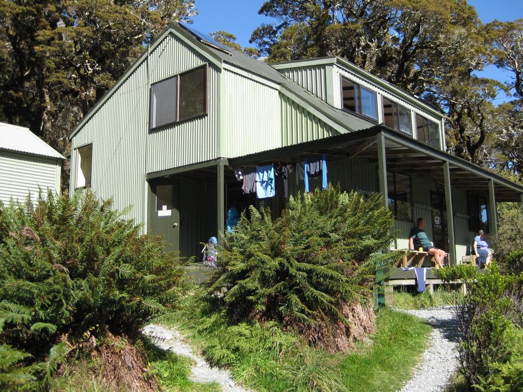
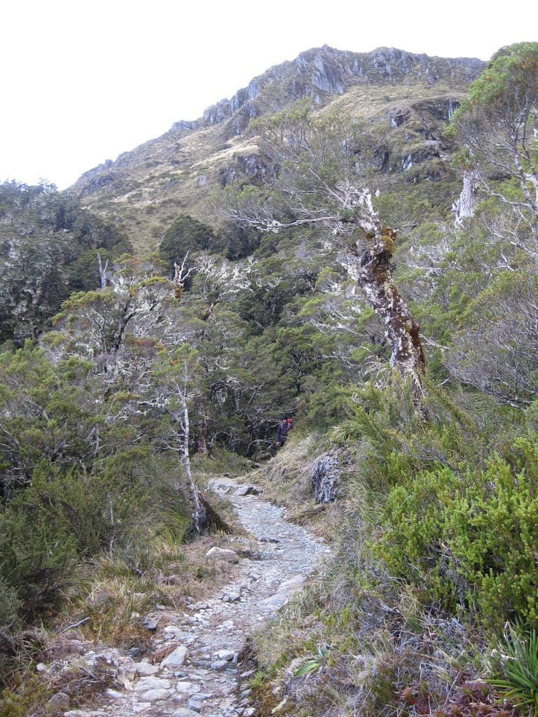
Mar 27 Sunday. At Routeburn Falls Hut (1,000m). This is a ‘pole’ hut built over the cliff next to Routeburn Falls. The most spectacular view. A busy hut with bunk space for 48. Very big kitchen (6 double burners and 6 sinks). (The hut for the guided walks – with its hot showers, cooked meals – is next to and uphill of this DOC hut.) We got away after another friendly chat with warden Danielle. A flock of Mohua (yellow-heads) going through the trees (they may roost/nest at the hut). The 300 m climb from the Flats to Falls over 2.3km took us 1.5 hours (right on the upper end of the posted 1 – 1.5 hours) not bad for a pair of old bastards. (I took the cheese and salami today which greatly helped Helen get up the hill. I am climbing quite well today – quads working well & no pain. Going down, not so good yet.) It began to rain just as we began to walk. At the first ‘pack-off’, it was heavy enough for raincoats and rained quite heavily at times. Three bridge crossings and just over half way, we crossed the site of the massive landslide which closed the track in Jan 1994 after 30+ days of very heavy rain. They called in the army to repair the track – closed for 2 months. The 2 fools from last night headed up to Harris Saddle in the rain and cloud to take photos, would you believe. What of? You can’t see anything. (We saw them come back down past the hut at 1pm – tragedy avoided.) The track up from Flats to Falls is still 1m wide but no longer suitable for wheelchairs. The wind came up and it got quite cold by mid afternoon, as bunches of wet, cold trampers arrived. (The Hut book here has John – the shearer who carried Helen’s pack up Rees Saddle – and Robert (farmer) – here on 17 Mar. John has written in the hut book ‘bucket list – done it!’. They had said they were going straight from Dart to Routeburn. The old buggers made it!) An English fellow (Dr Oliver R., retired research chemist who missed to bus in Glenorchy yesterday) turned up soon after we arrived (he had walked in from the shelter in 3 hours – way below the posted lower time) and raced around and lit the fire – needed as it got colder and wetter. The scuffles over space on the drying rack over the fire have been entertaining as late comers complain of being at the back & move other people’s gear (or crowd it out or bunch it up). This hut has memories from our last trip. There are 2 identical bunk rooms with 24 bunks in each – double decker rows. The toilets are a little further along. One bloke told a story of going to the toilet in the middle of the night & mistakenly going back to the wrong bunk room. (It is pitch black of course. I could not see my hand in front of my face.) He knew that he was in the 3rd bunk on the left from the door, bottom bunk. No torch. He felt his way in from the door, took off his clothes, stored them in the little space at the bed head and proceed to get into his bunk. A woman’s voice in alarm said ‘what do you think you are doing’. He had to retrieve his clothes and retreat to outside – reviewing the situation. Dr O. walks very fast. Tomorrow he walks to Howden (we take 2 days to do that). The next day he walks the Greenstone (we took 3 days to do that 6 years ago). The next day the Caples. He also travels very light – no change of clothes (even hut clothes) for Dr O.. No wonder he bounced around and lit the fire. He would have been very cold in his wet walking clothes. Three Indonesian women at the hut tonight. We seldom see Indonesian women out walking the tracks. We had the extremely good company of 2 NZ women from Christchurch – nurse and podiatrist. The warden’s hut talk at 7:30pm verbatim ‘if there is a fire get out’.
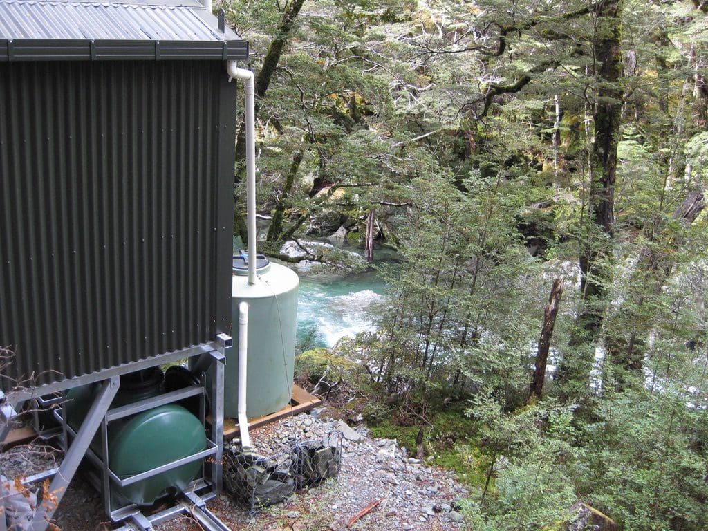
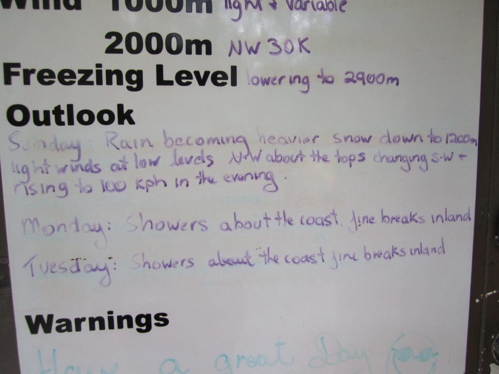
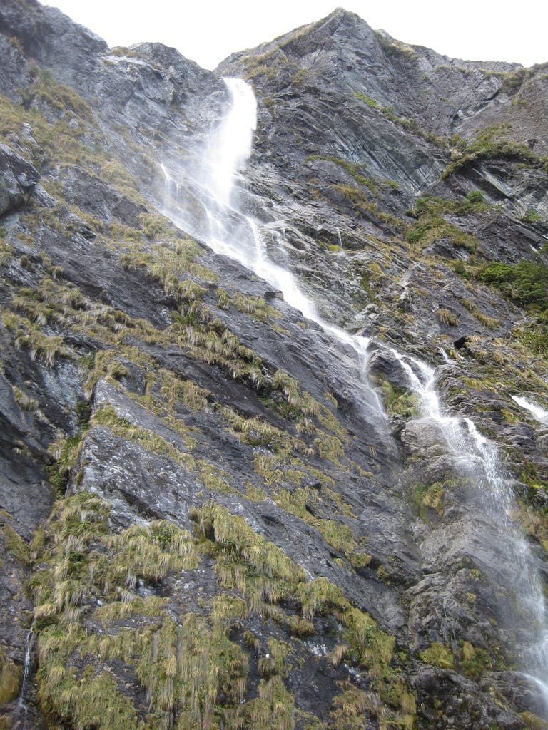
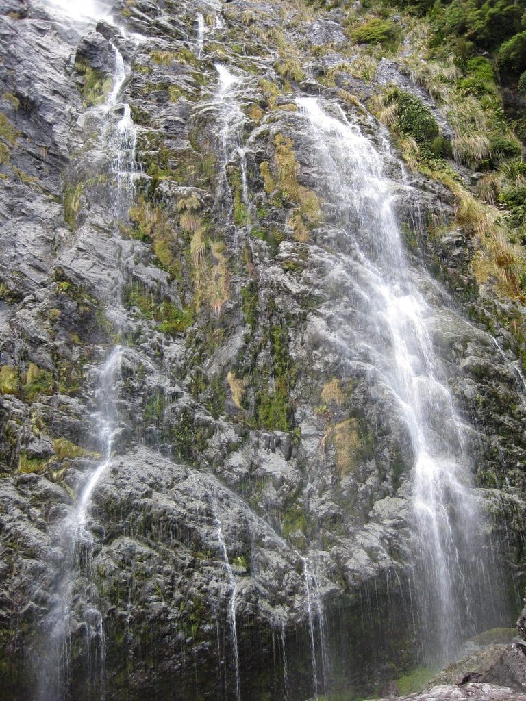
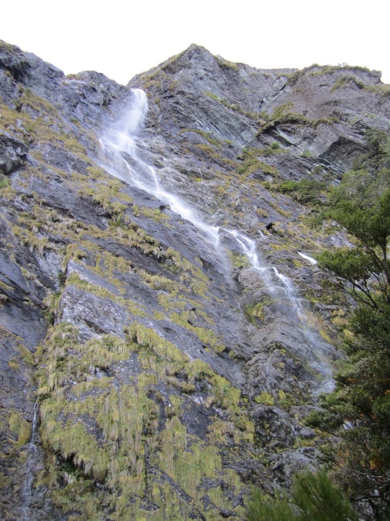
Mar 28 Monday. Day off at Routeburn Falls Hut. Woken to the sound of Dr O. leaving at 7am (before it is light to see) shortly after by someone (the child?) throwing up in the bunkroom. A beautiful, almost cloudless sky. Quite a change from the torrents of yesterday. Most walkers had left by 9:30am when the first cirrus clouds appeared. (Rain tomorrow?) We took a little day-walk up a little peak nearby recommended by warden Danielle. The walk took us up to what appears to be level with Harris Saddle (which we will do tomorrow). Lunch at the top with a fine view & sheltering from a cold wind. I had a very hard time coming down. The ‘walk-up’ part of the quad is working, but the ‘walk-down’ part feels like being stabbed by a red-hot poker in the back of the leg. Very slowly does it and very glad to be back at the hut. When we got back to the hut, Danielle had arrived to take over as warden and given it her characteristic clean. Routeburn Hut statistics. In 1994 (before the hut-booking system was introduced) the huts were crowded at 14k people nights per year. In 2007, with the booking system, they had 23k people nights. Falls/Flats Huts use 4,500 jumbo rolls of toilet paper; 24 * 45kg cylinders of LPG; 5,000 litres of ‘solid’ sewage pumped & flown out; 3,690 hut warden hours. Many day trippers to the hut today – walk in from Routeburn Shelter with a day pack for lunch and out again. A beautiful day walk. Just above Routeburn Falls hut, the tracks climbs up very steeply beside the Route Burn Falls. At the top of that rise the wind is compressed into a little saddle as it blows its way in from the west. The last time we were here, we watched a string of trampers grind their way up the climb in the rain with waterproof pack covers protecting their packs. As each one reached the wind tunnel, the pack cover was ripped off by the wind and blown down the Route Burn – one after another red, blue, yellow, orange, green – a string of parachutes. Trampers oblivious.
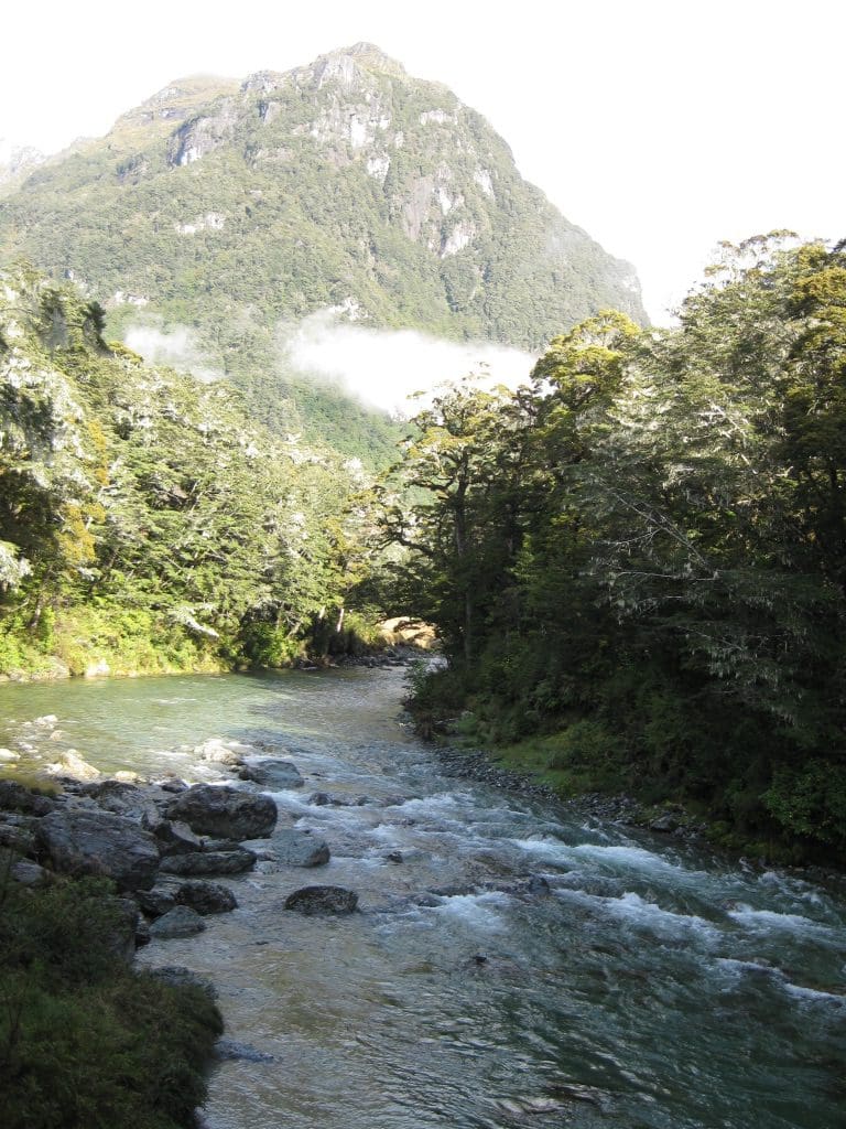
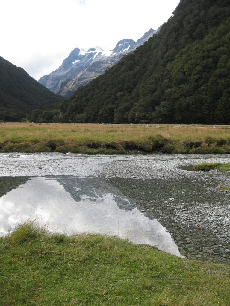
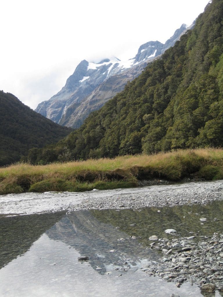
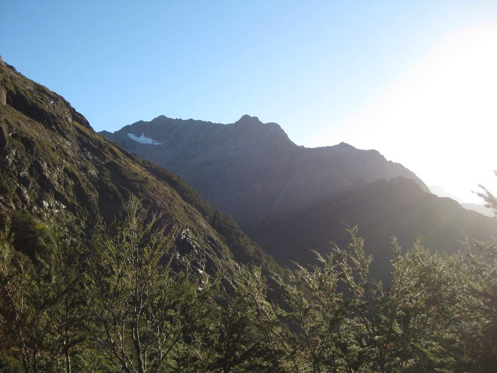
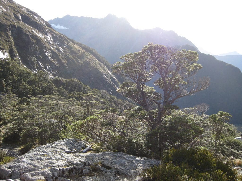
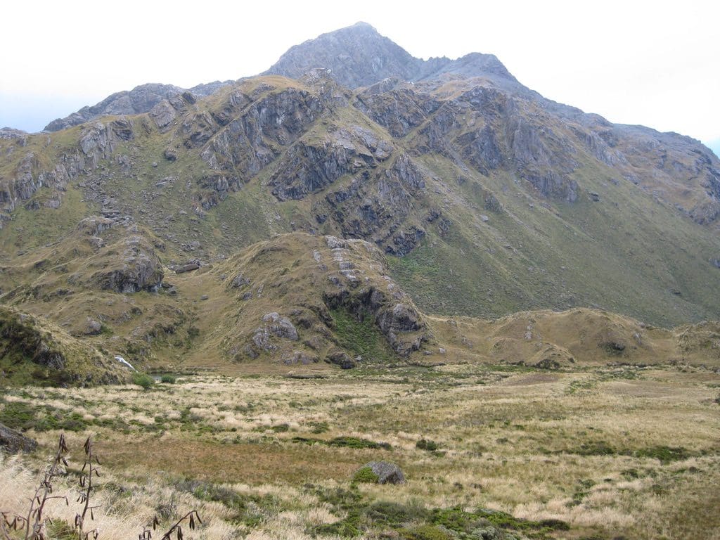
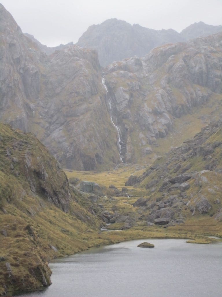
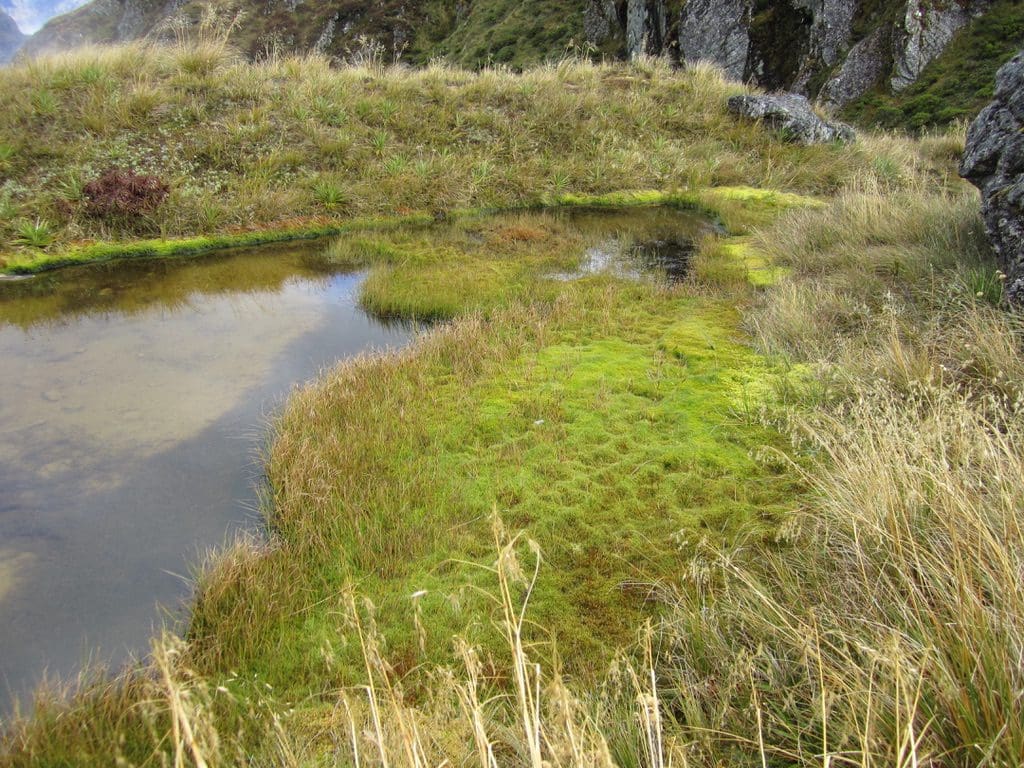
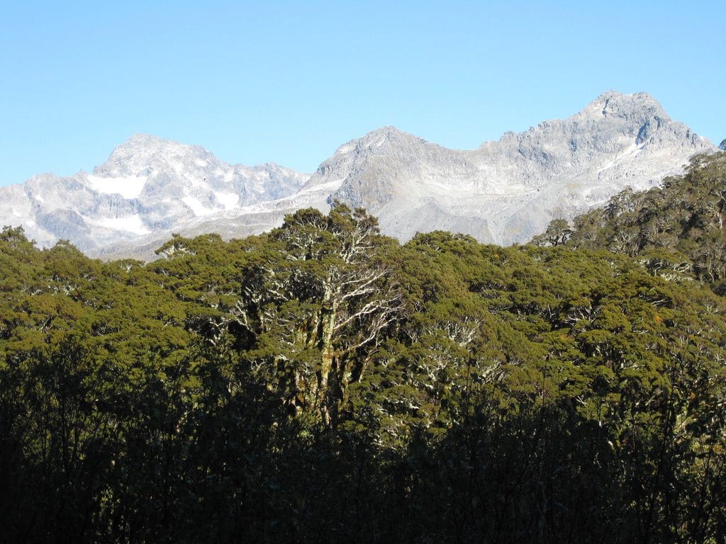
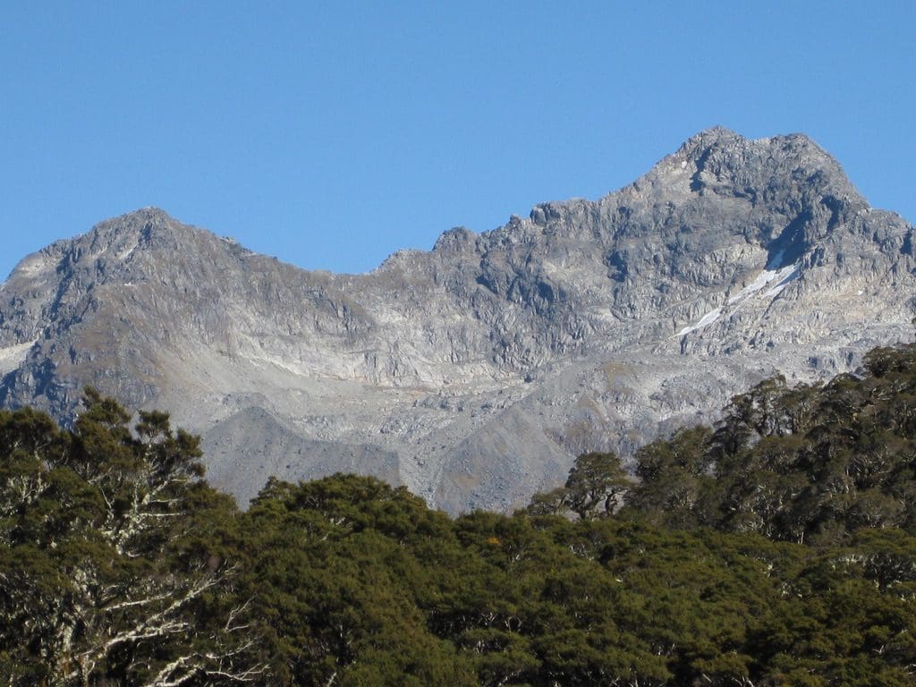
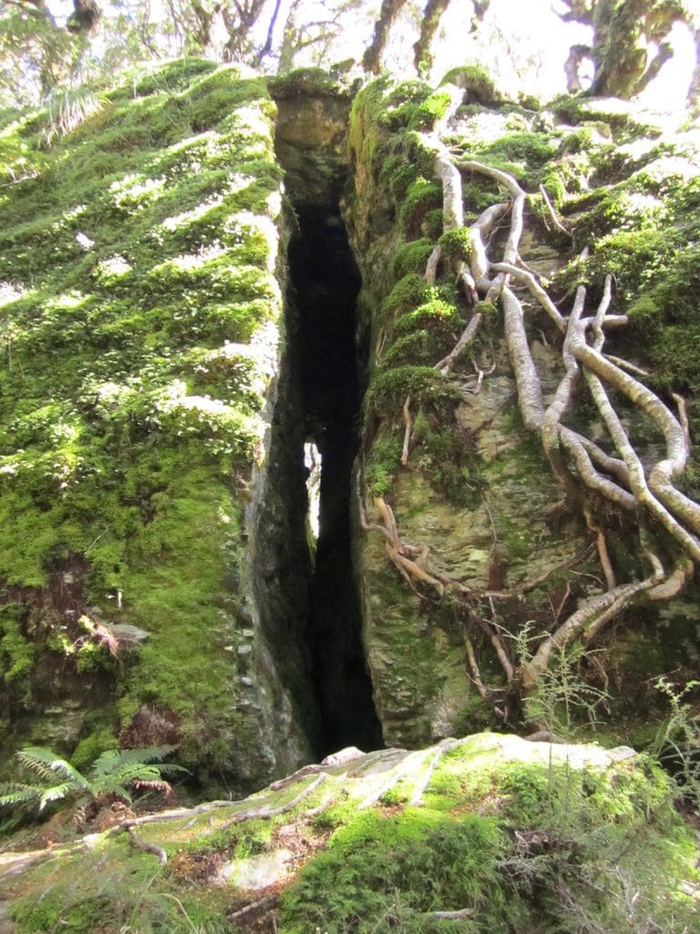
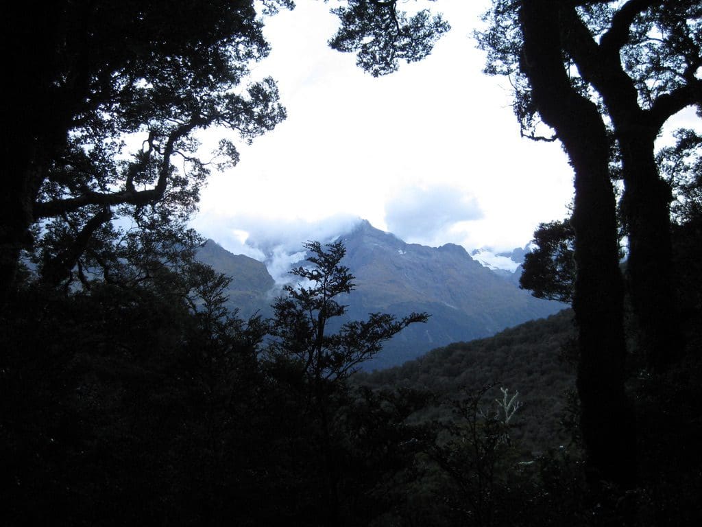
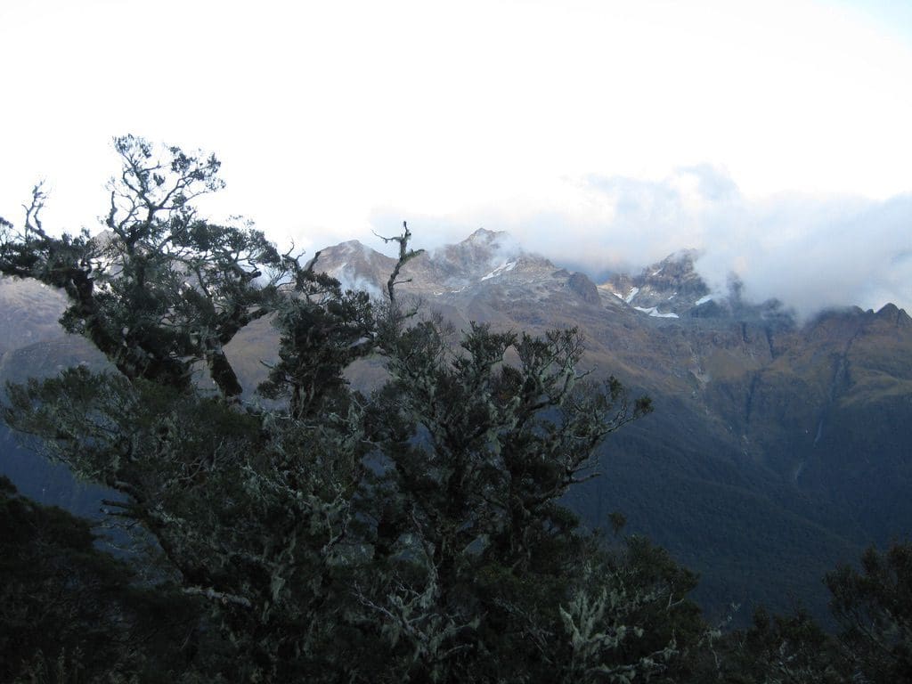
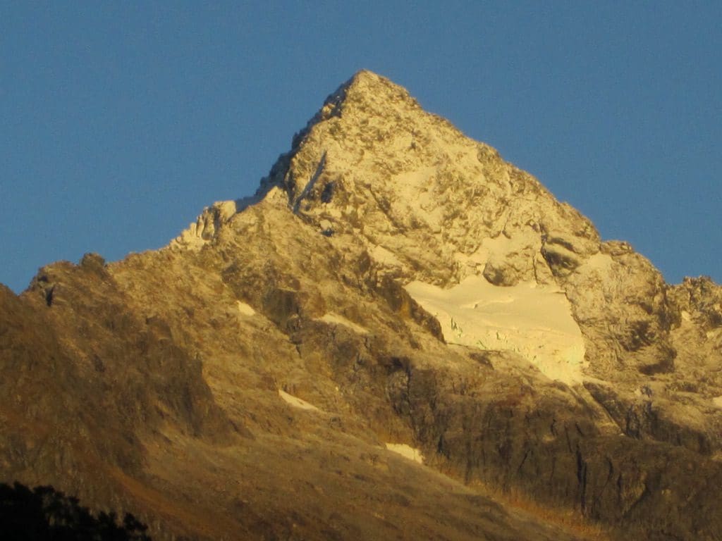
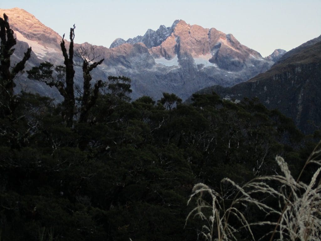
The tree line. Photos from Routeburn Falls Hut show a very distinct tree line at about the same height as the hut – horizontal except for avalanche paths. This is apparently the line above which the beech (Nothofagus solandri – Solander at it again) cannot germinate. Strange that the line is so sharp. (Absence of microclimate influence and recalcitrant trees.)
Dannielle’s hut talk was extensive & good – safety, etiquette (don’t rustle plastic pack liners in the bunk rooms, don’t shine torches in people’s faces, do clean up), weather, what to expect on the track, bird life. A good discussion with 2 Israeli girls and a Norwegian. Hut about half full again tonight. Japanese day walkers today have written in the hut book ‘in memory with Miyuki’. Tsunami victim?
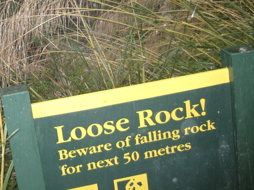
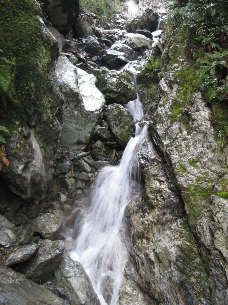
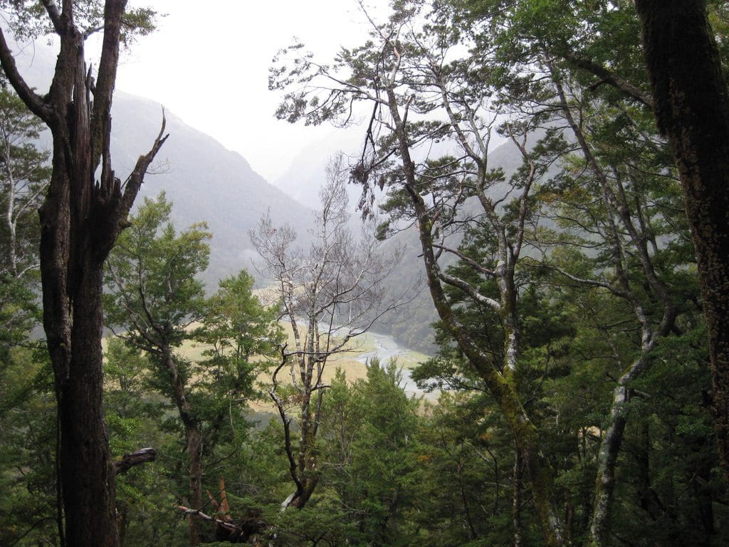
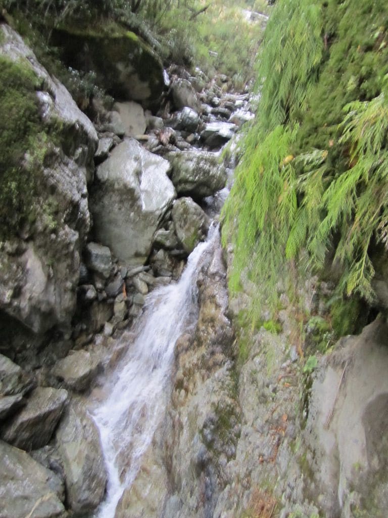
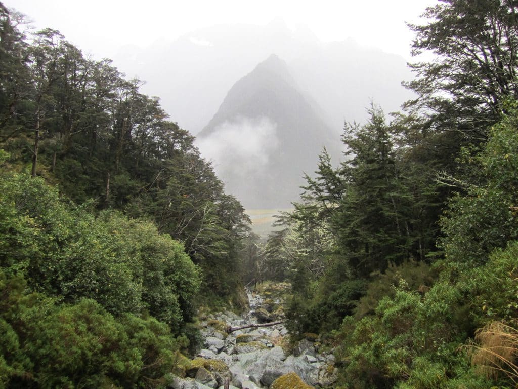
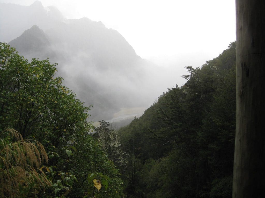
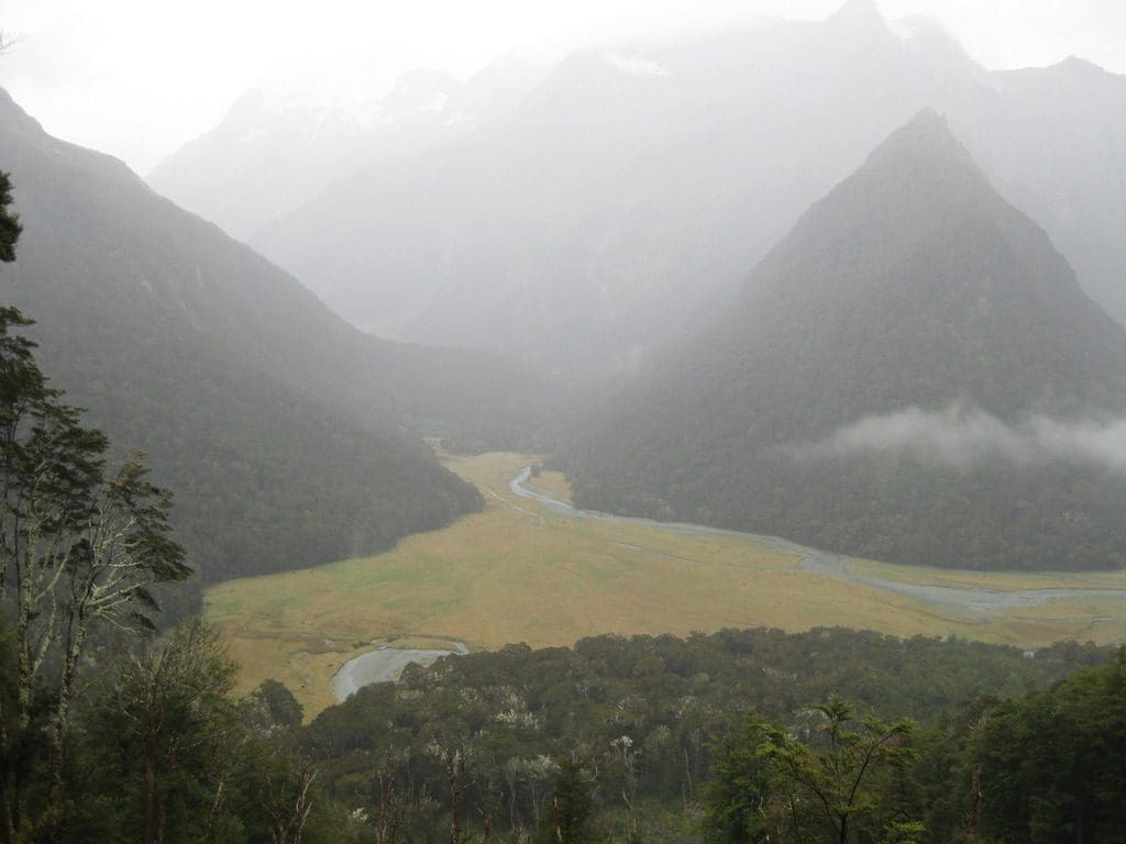
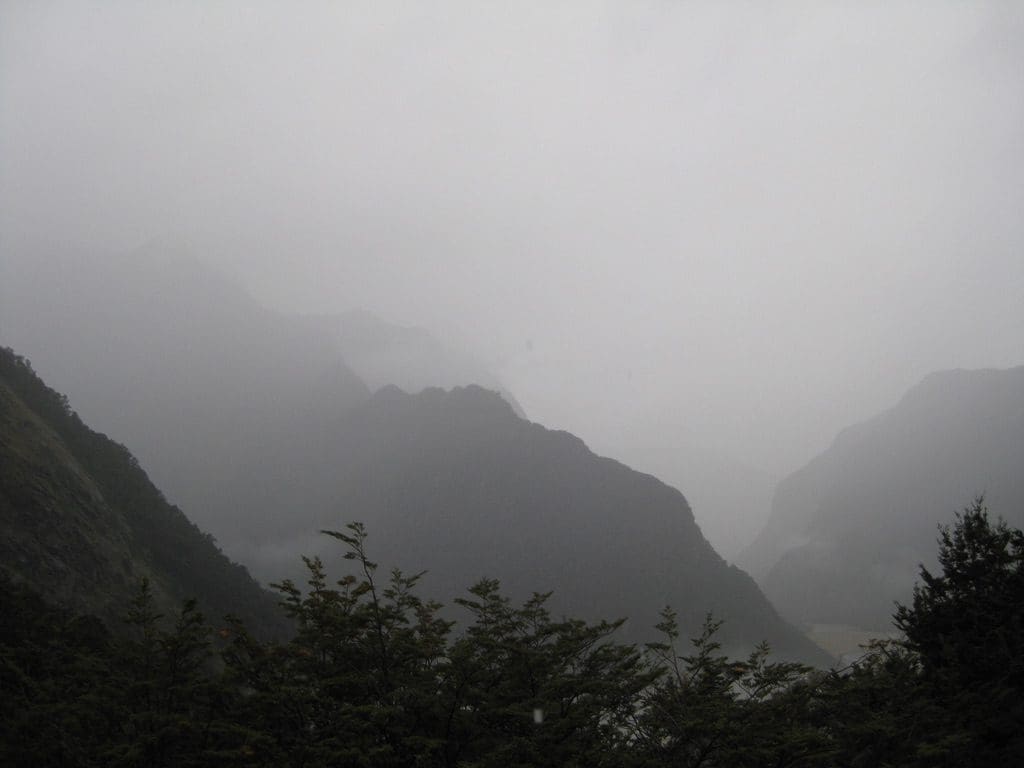
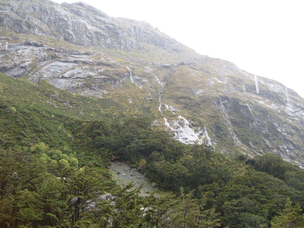
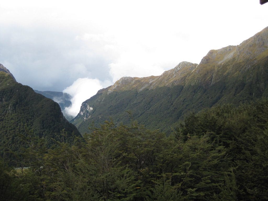
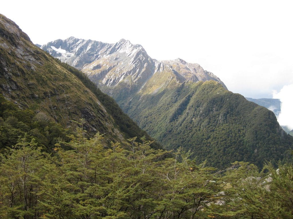
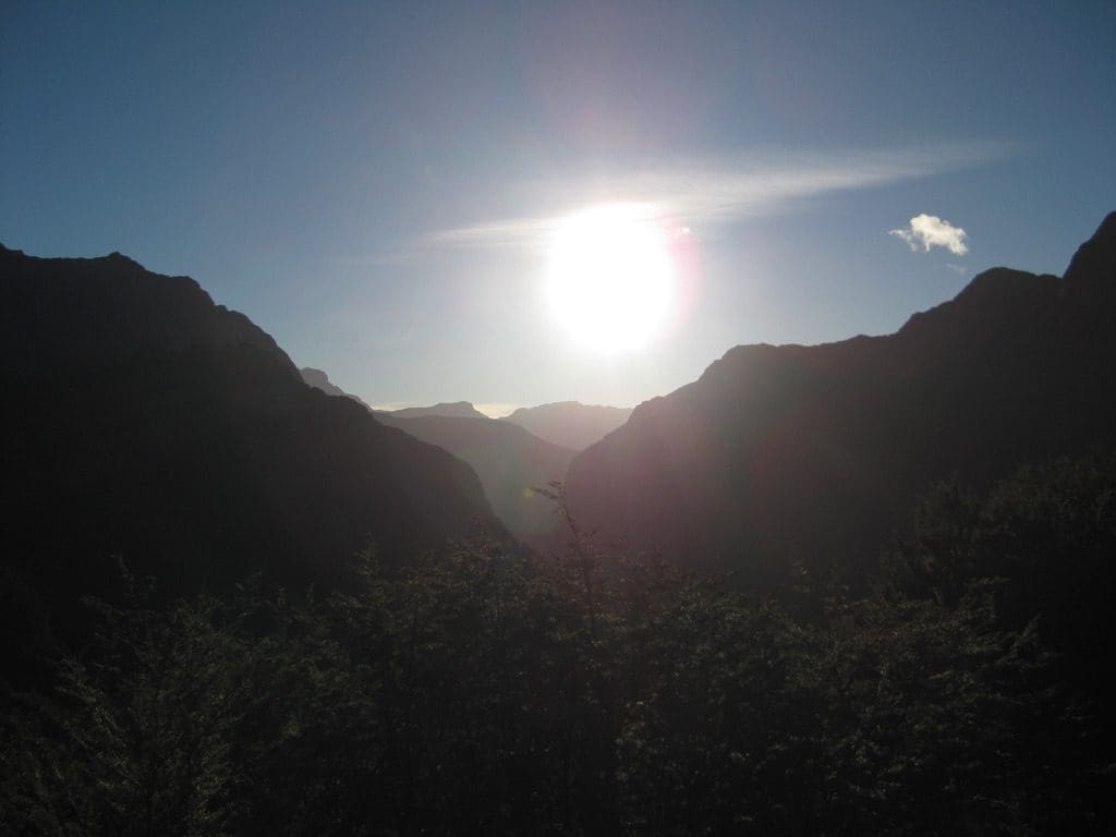
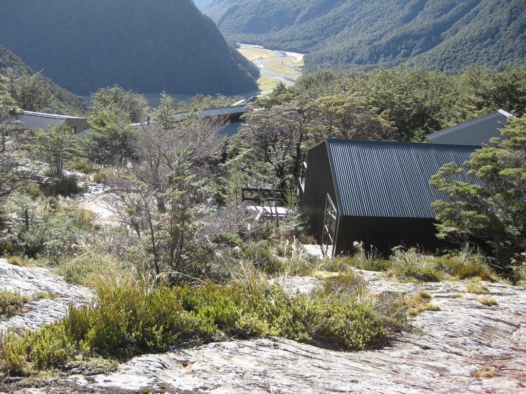
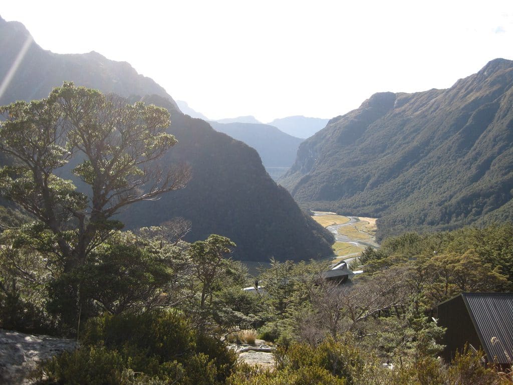
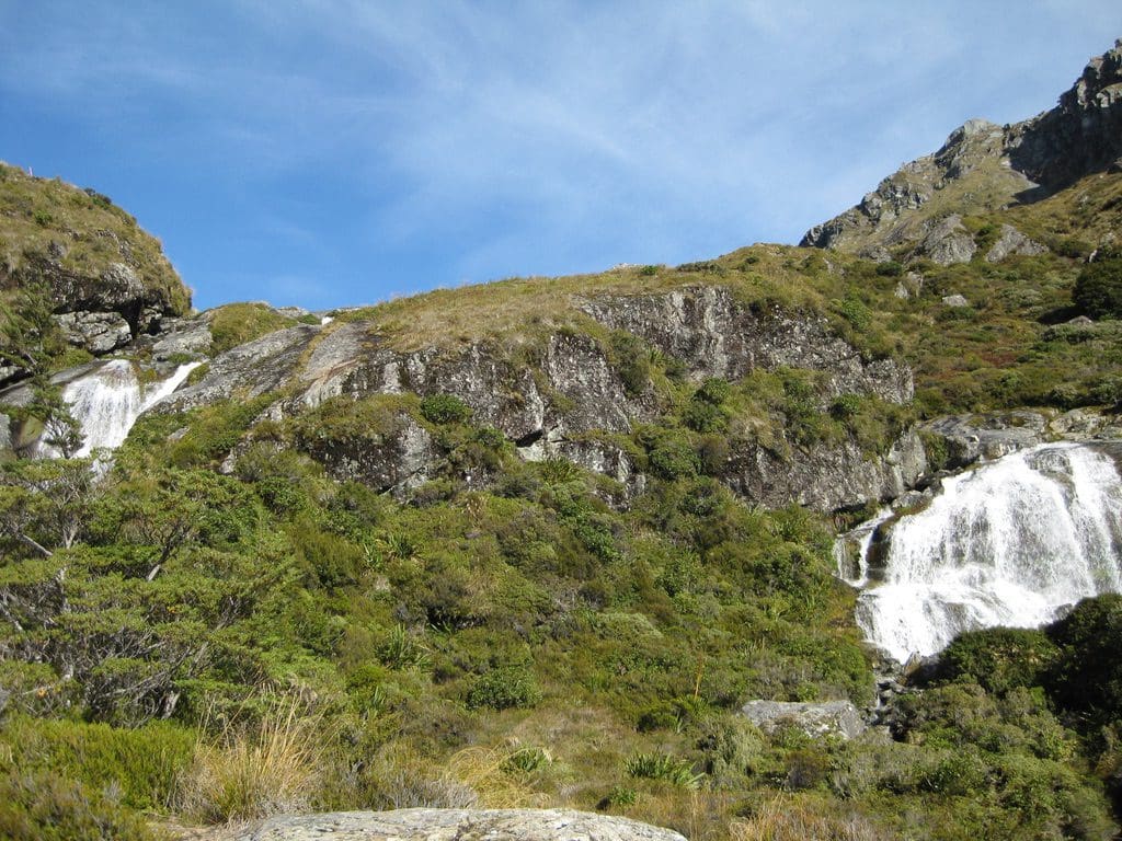
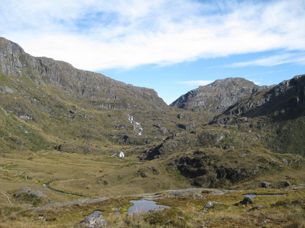
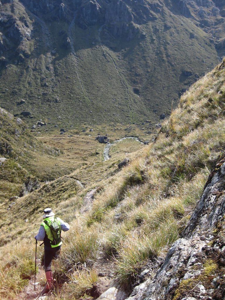
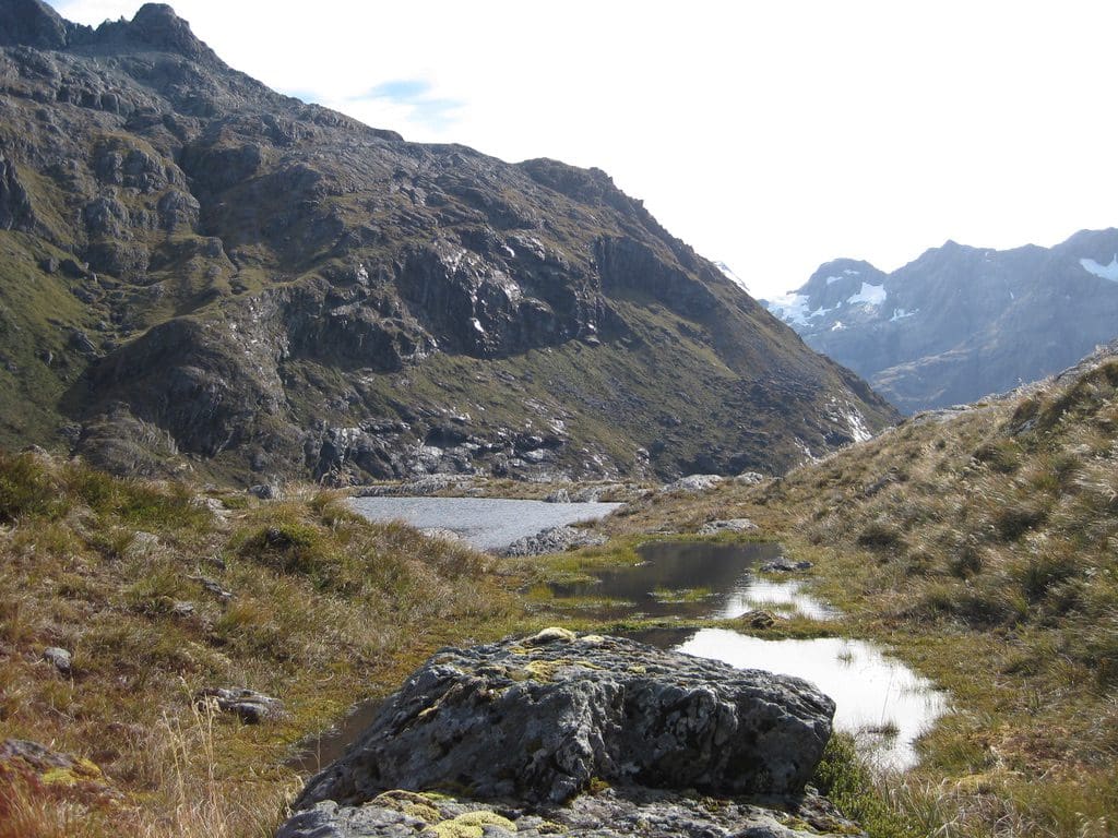
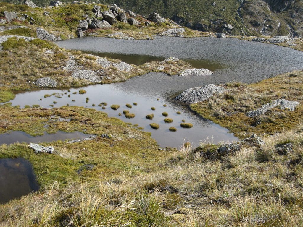
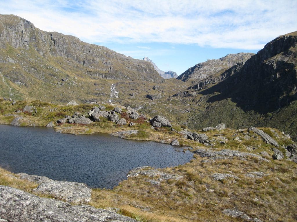
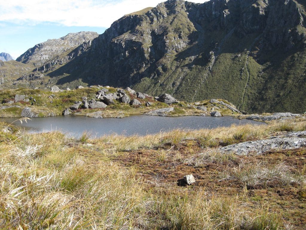
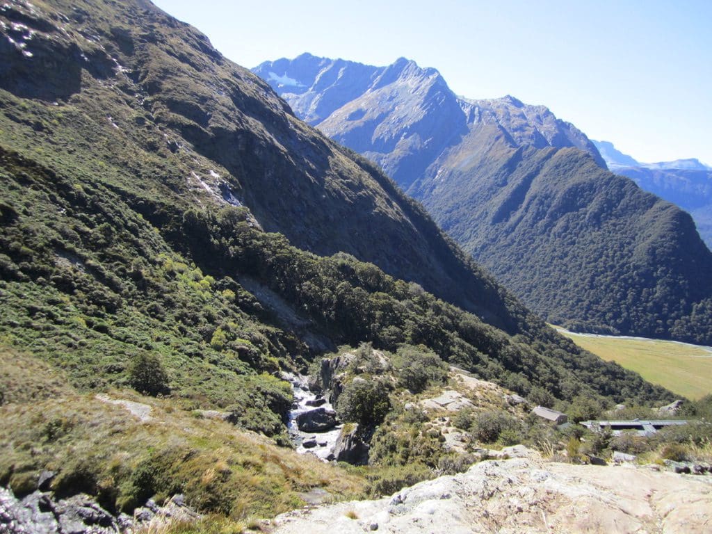

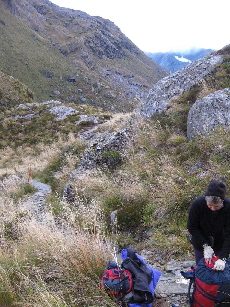
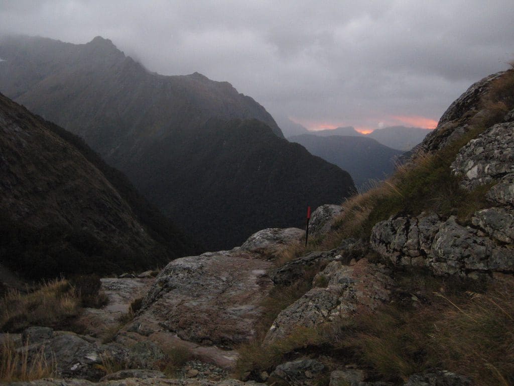
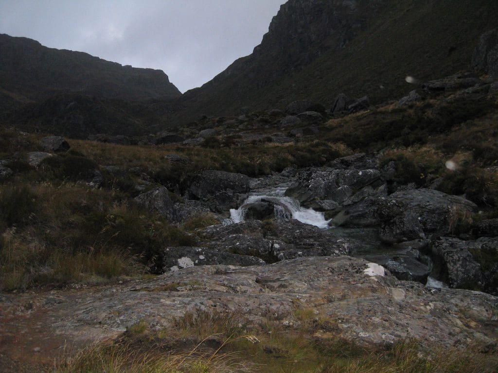

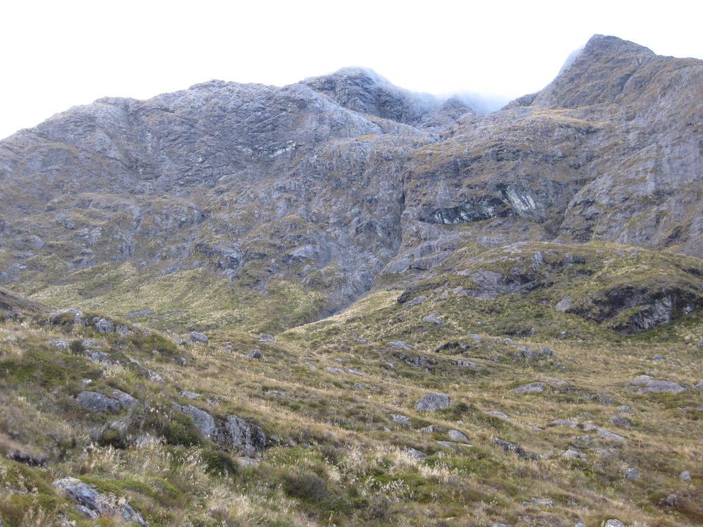
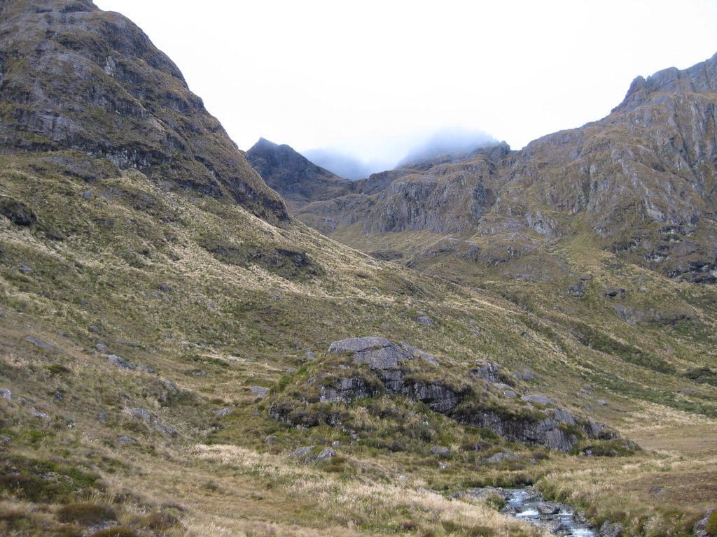
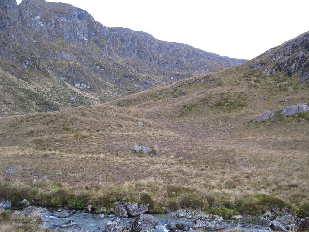
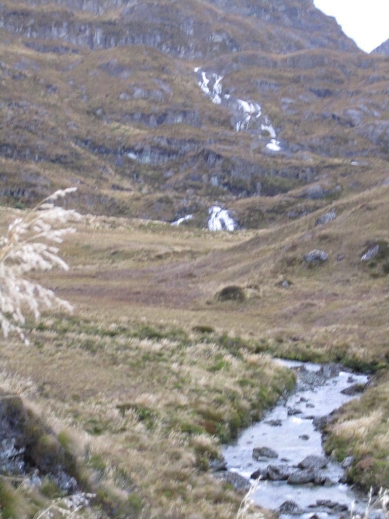
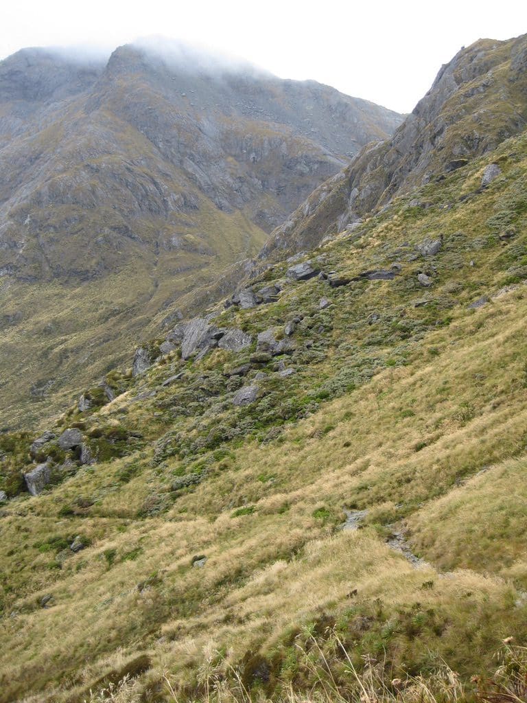
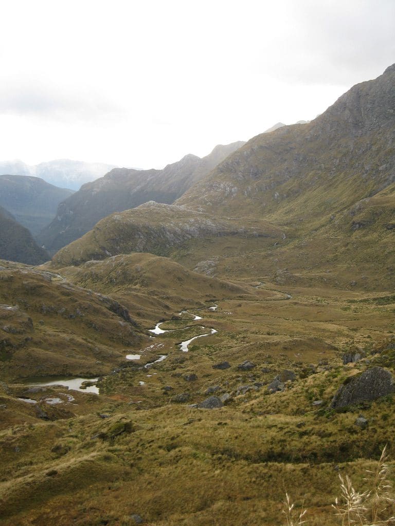
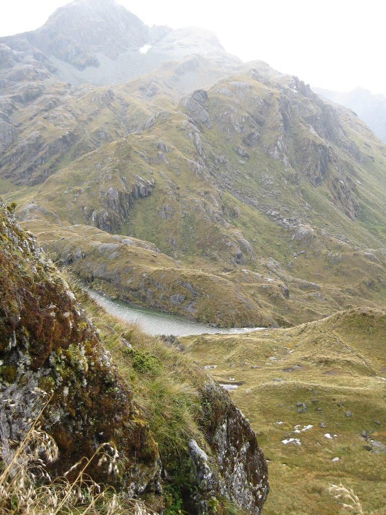
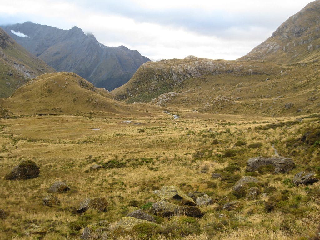
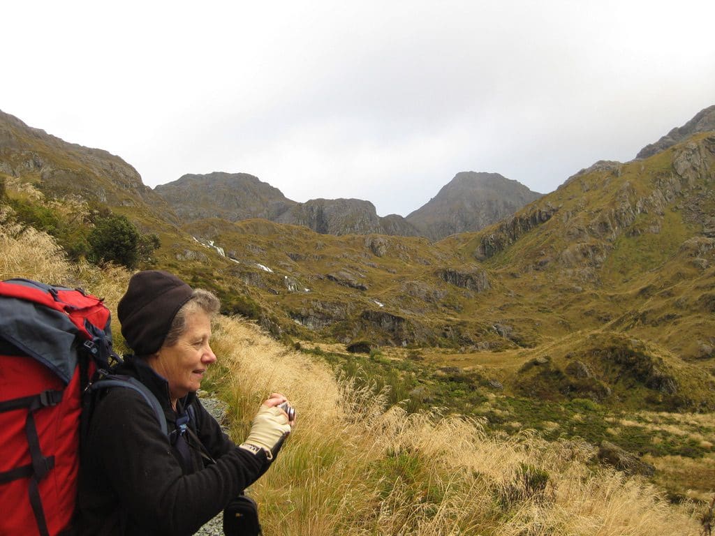
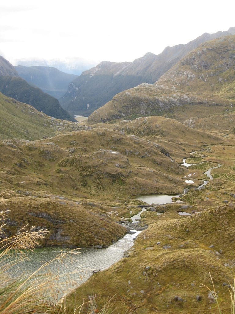
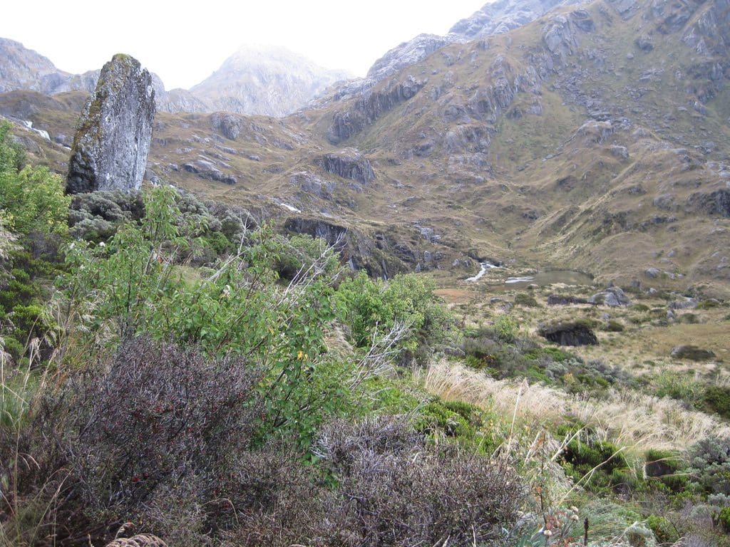
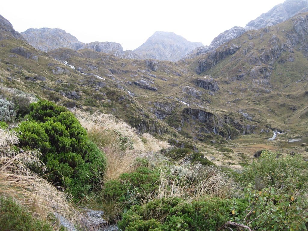
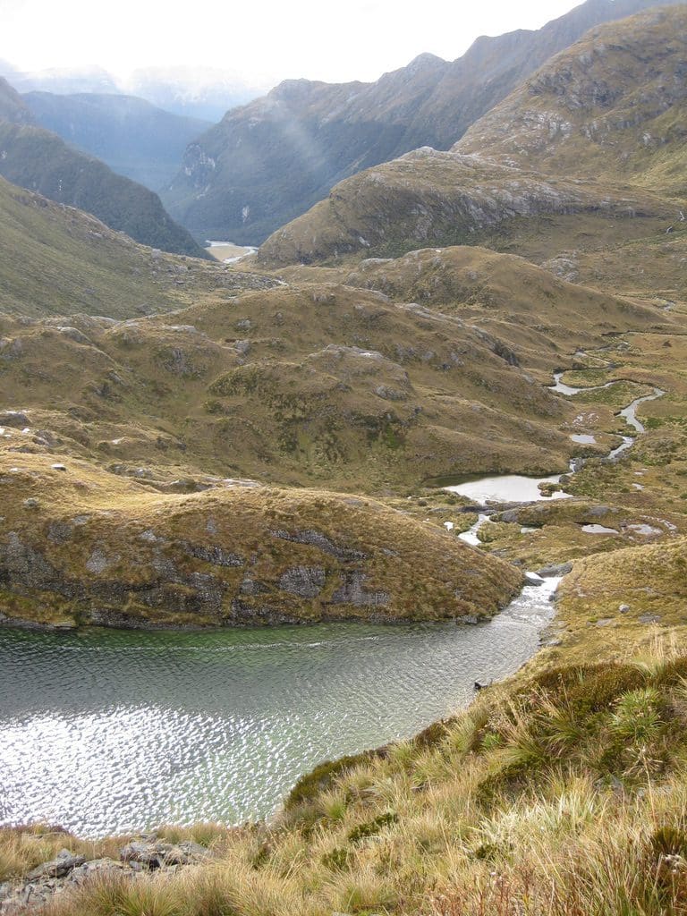


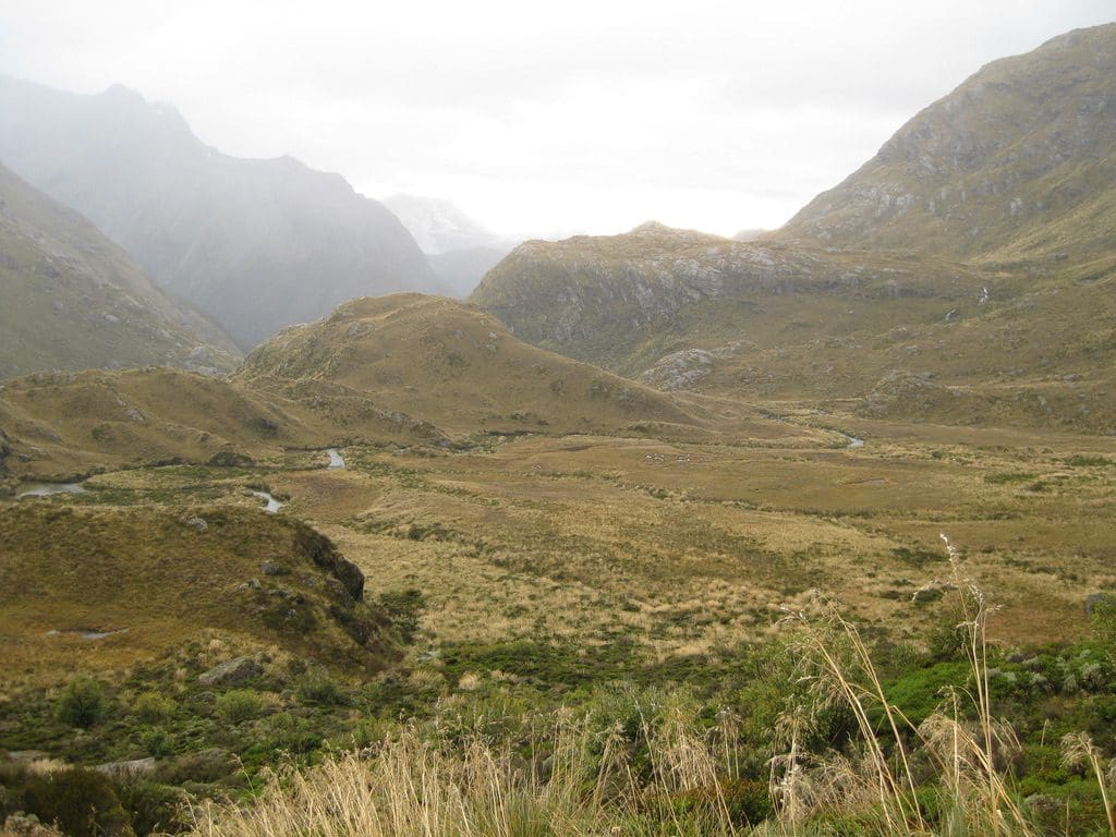

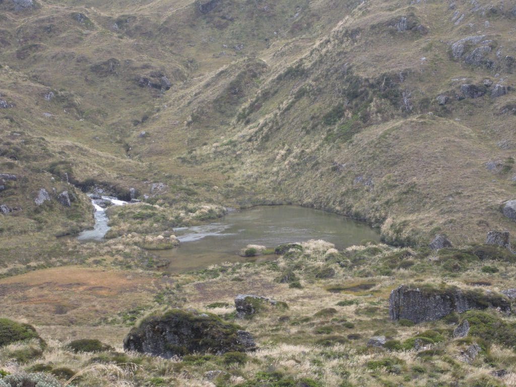
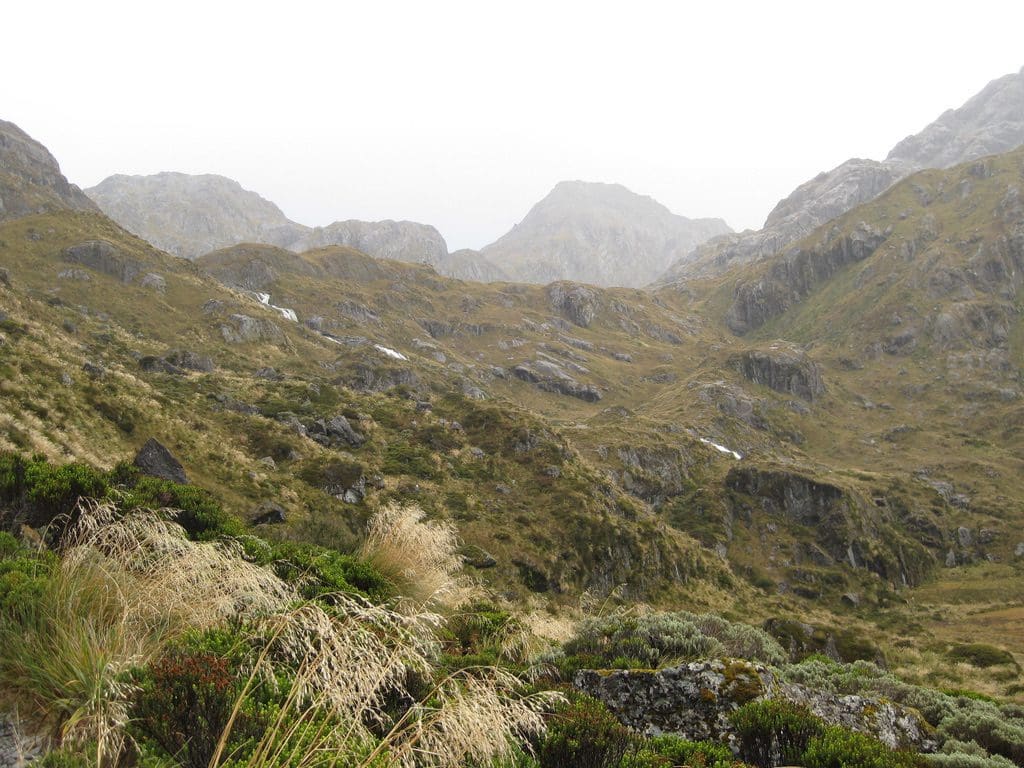
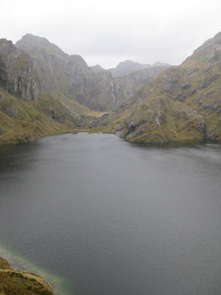
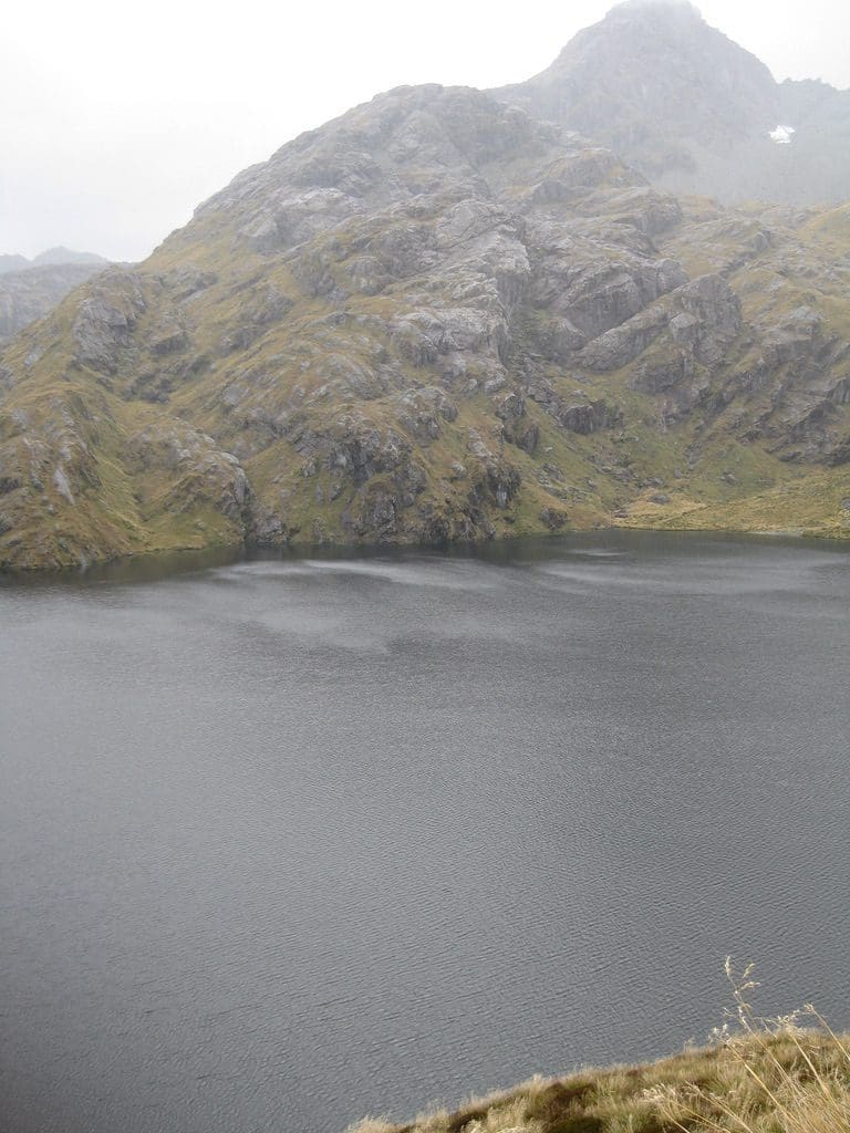

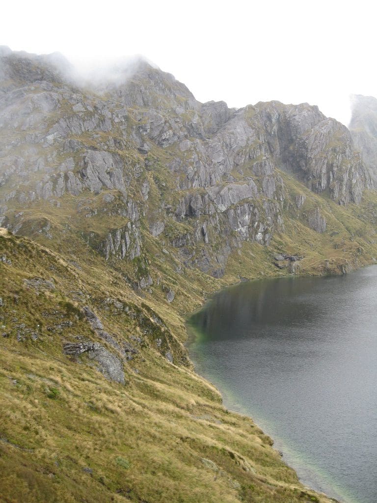
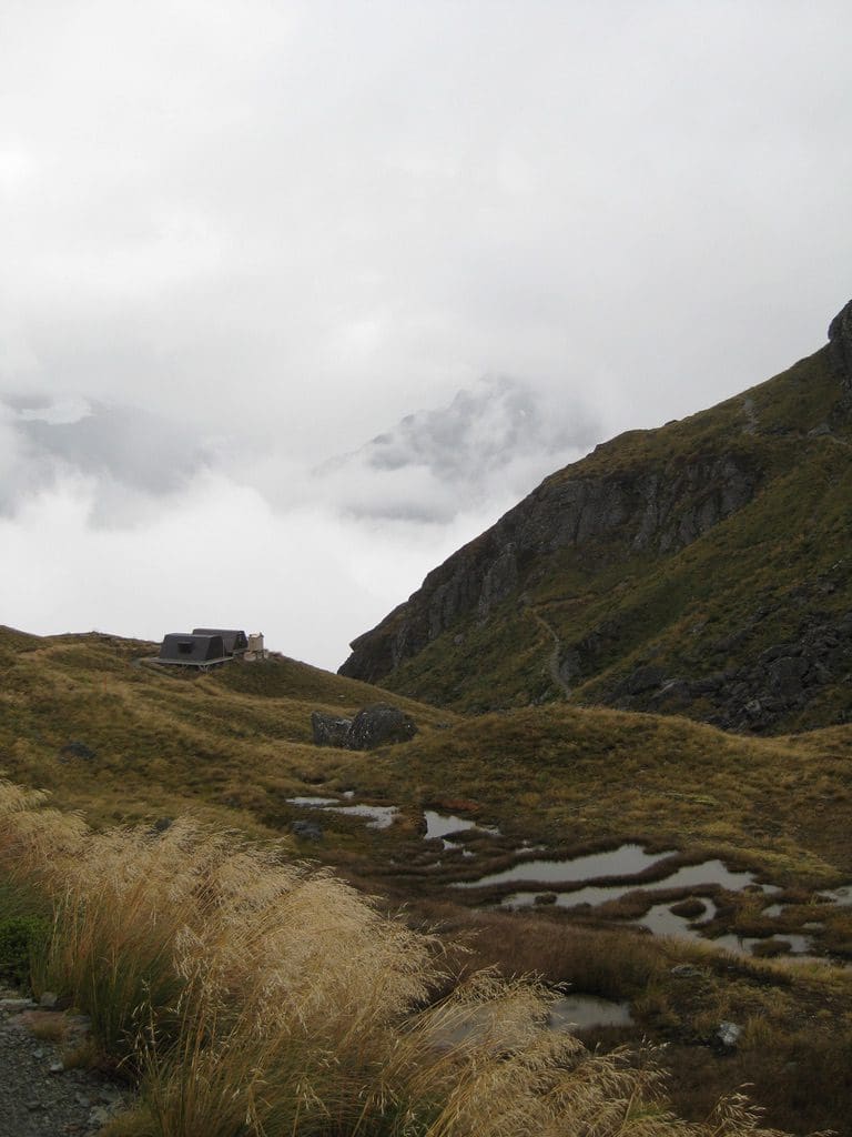
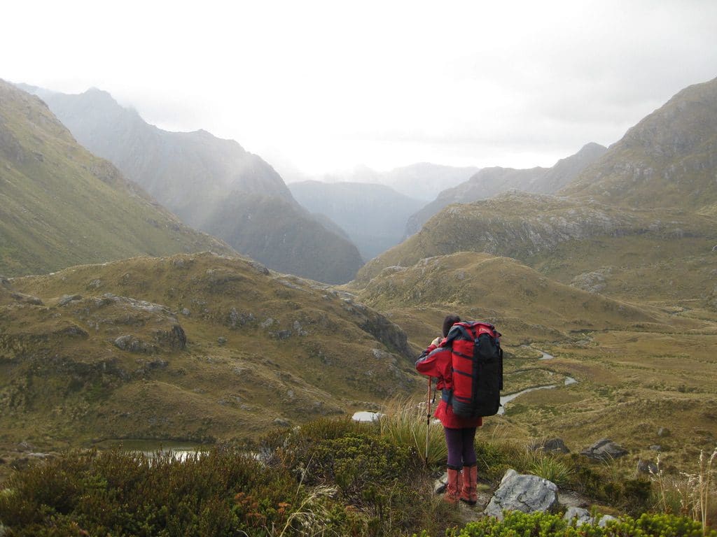
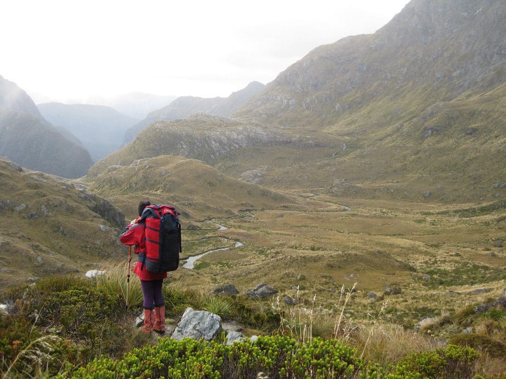
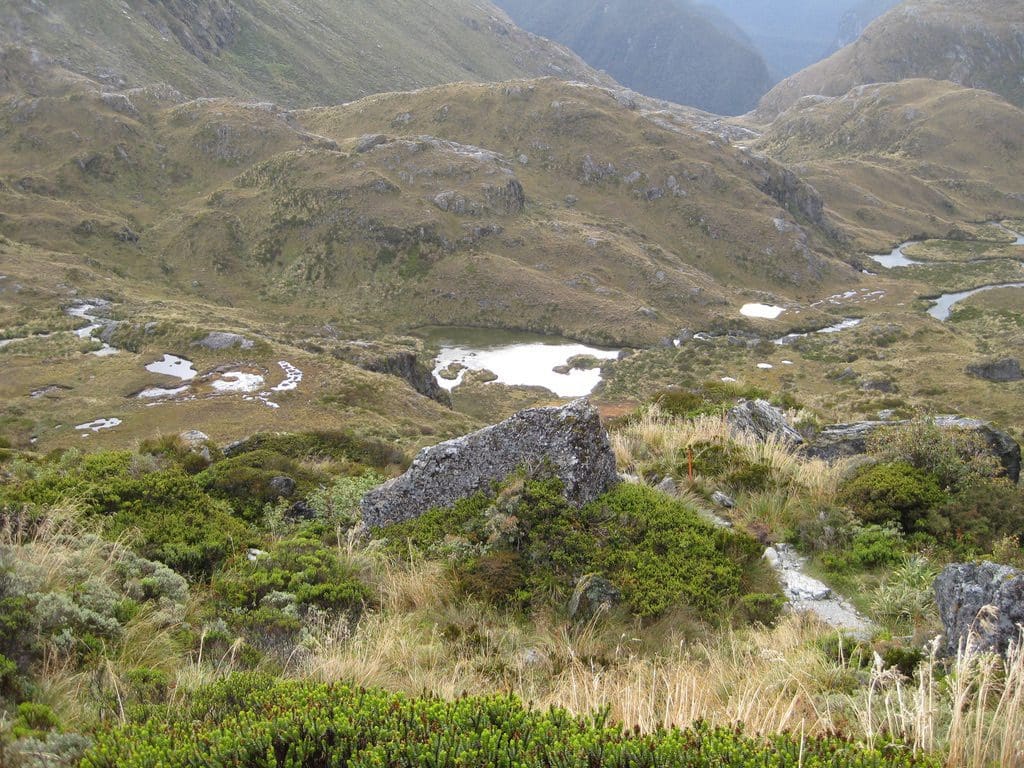
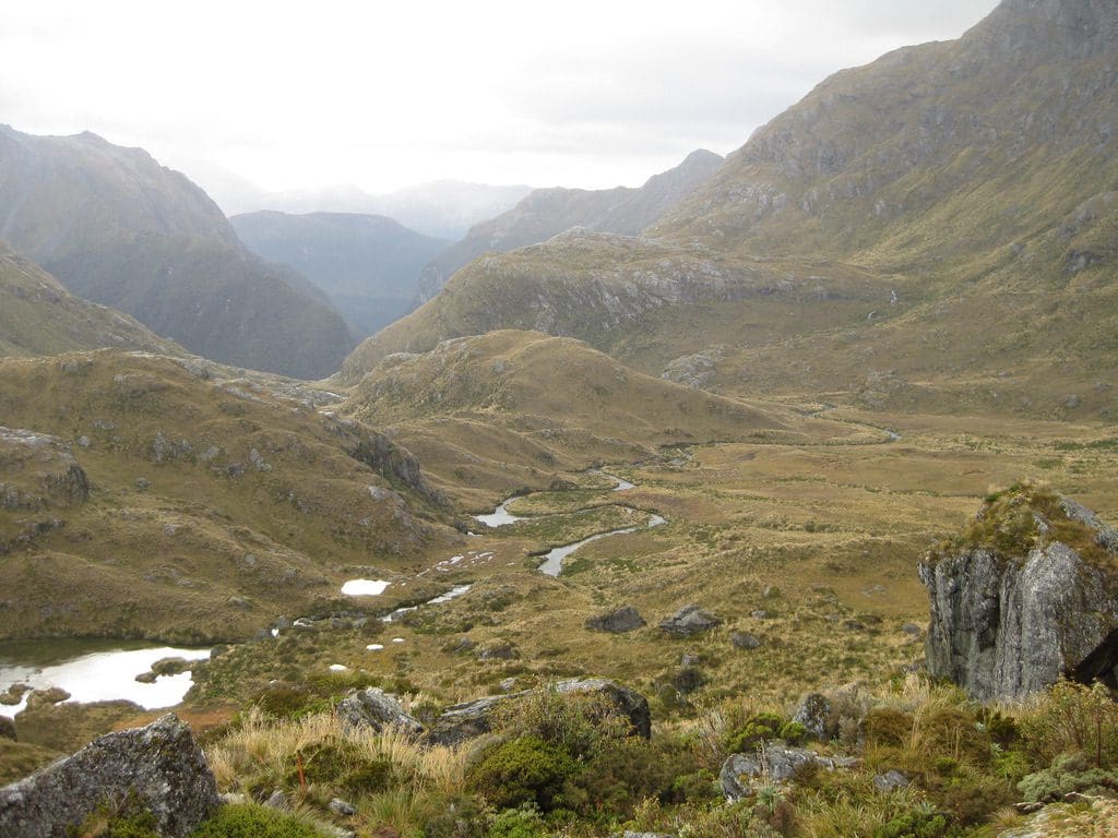

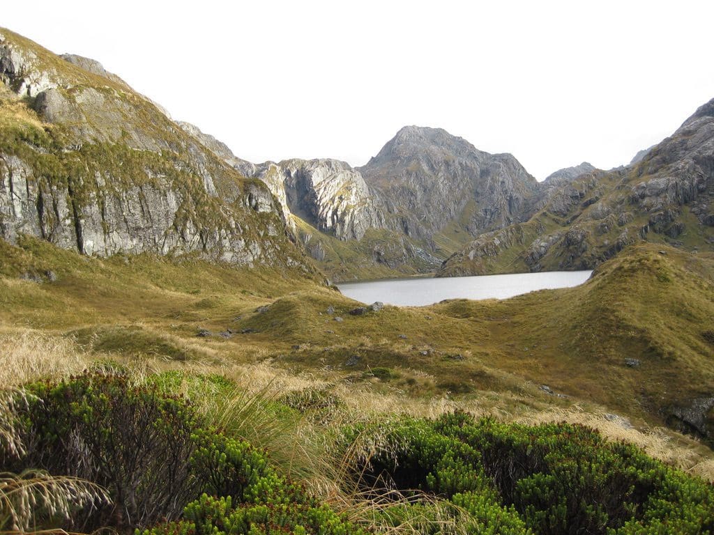
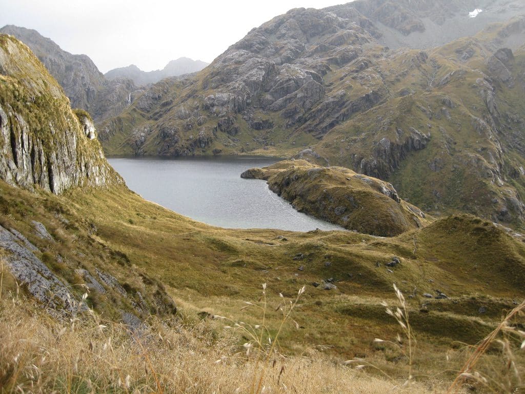
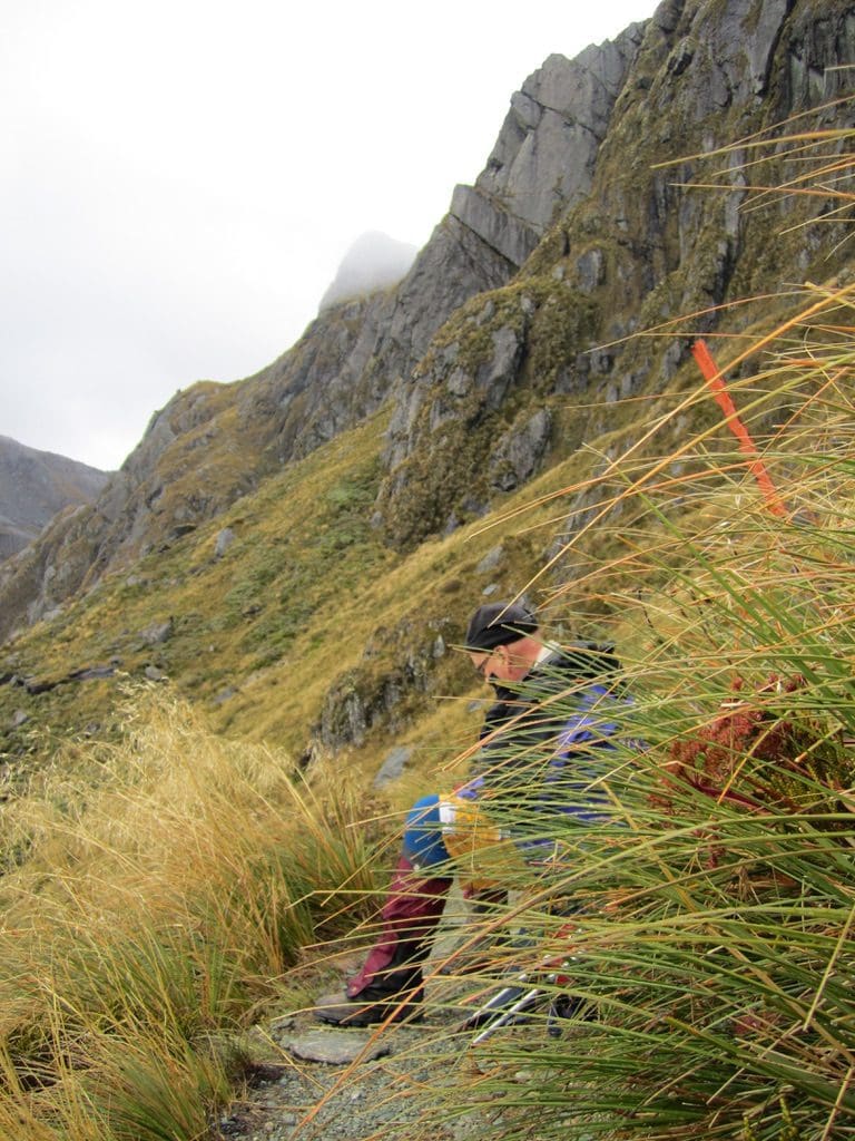
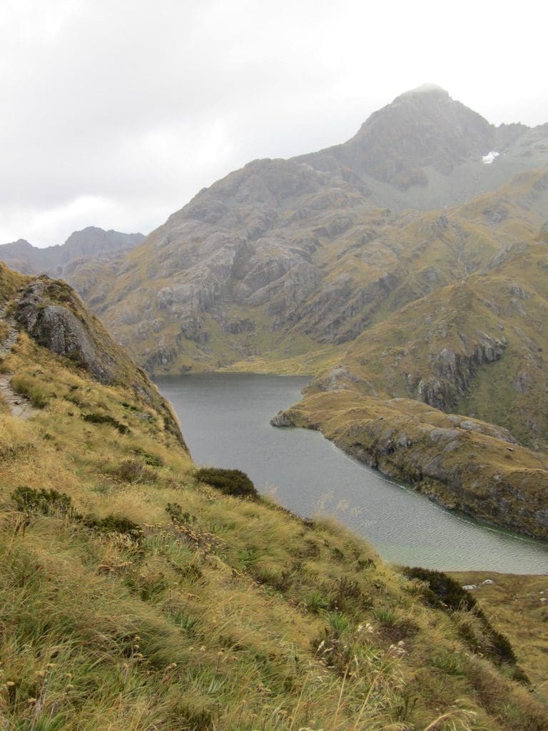
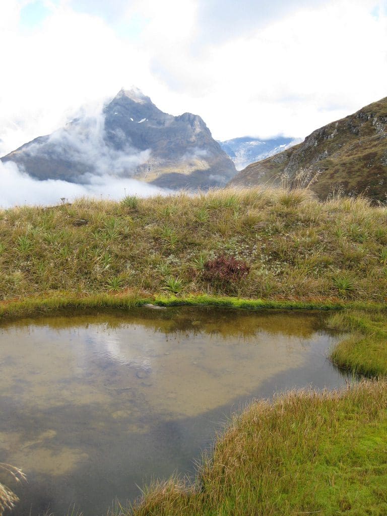
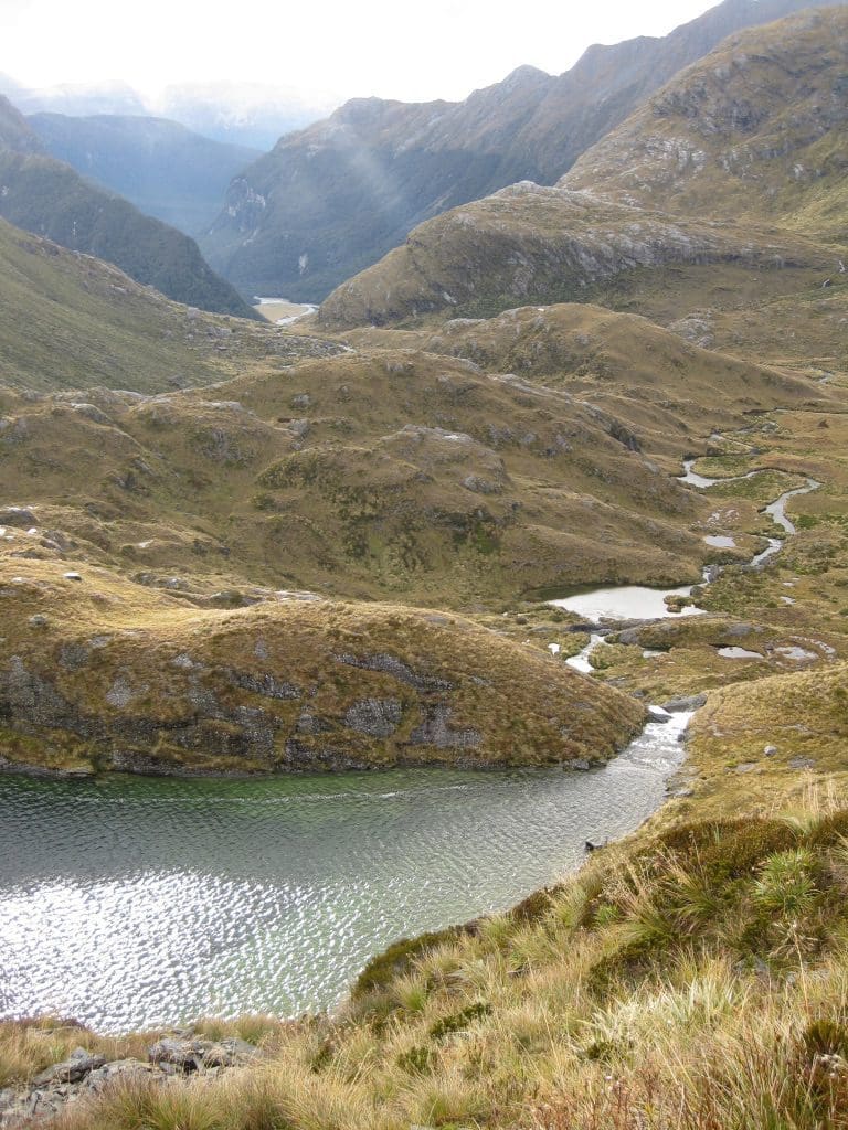
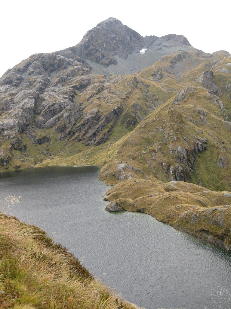
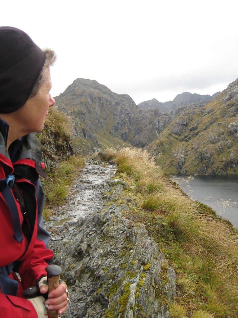
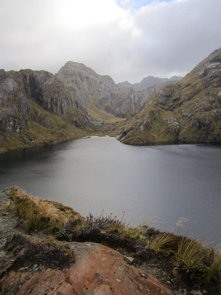
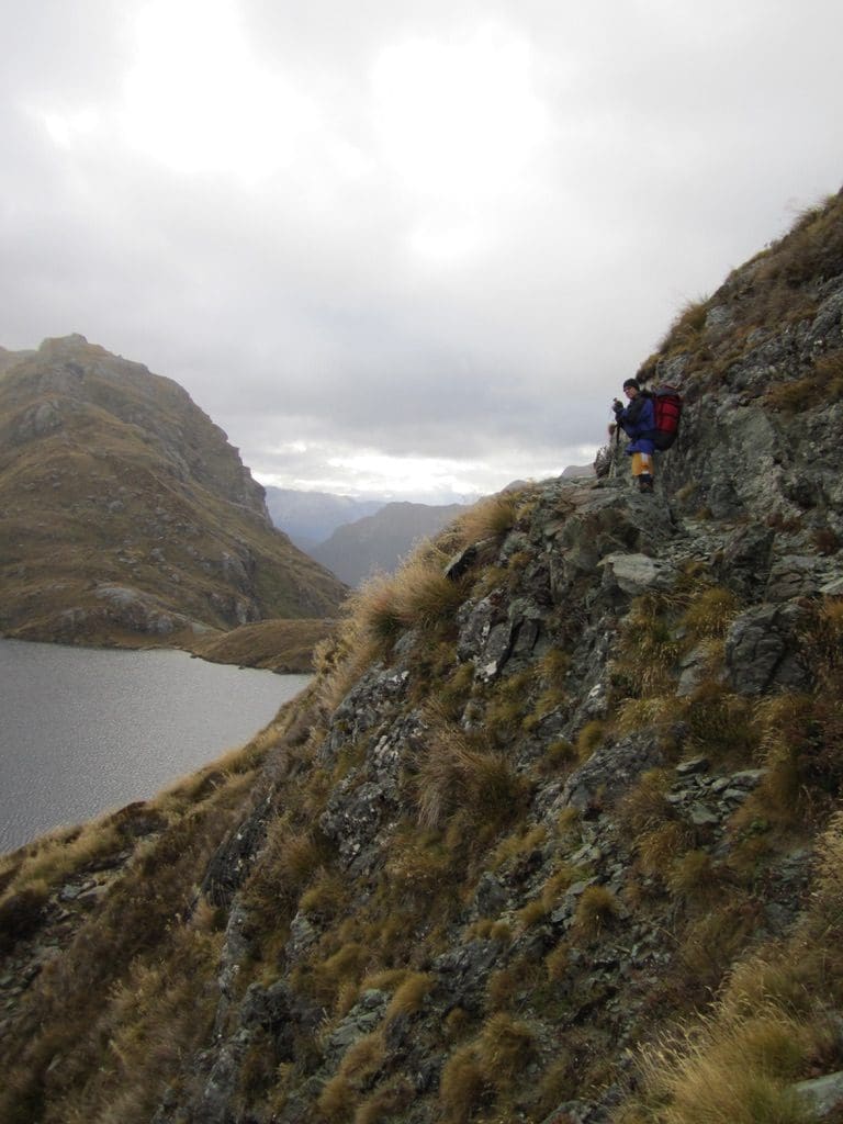
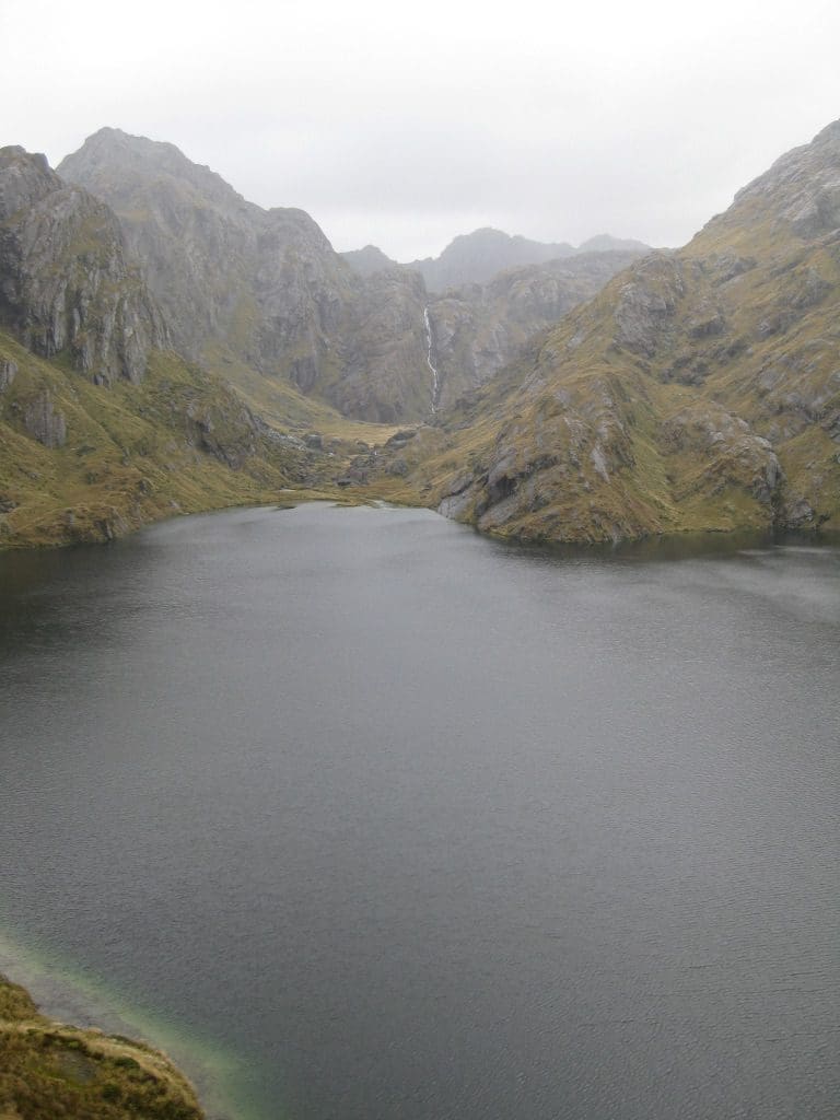
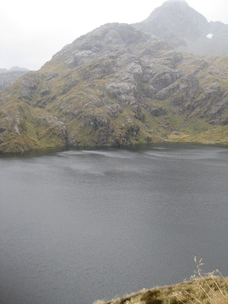

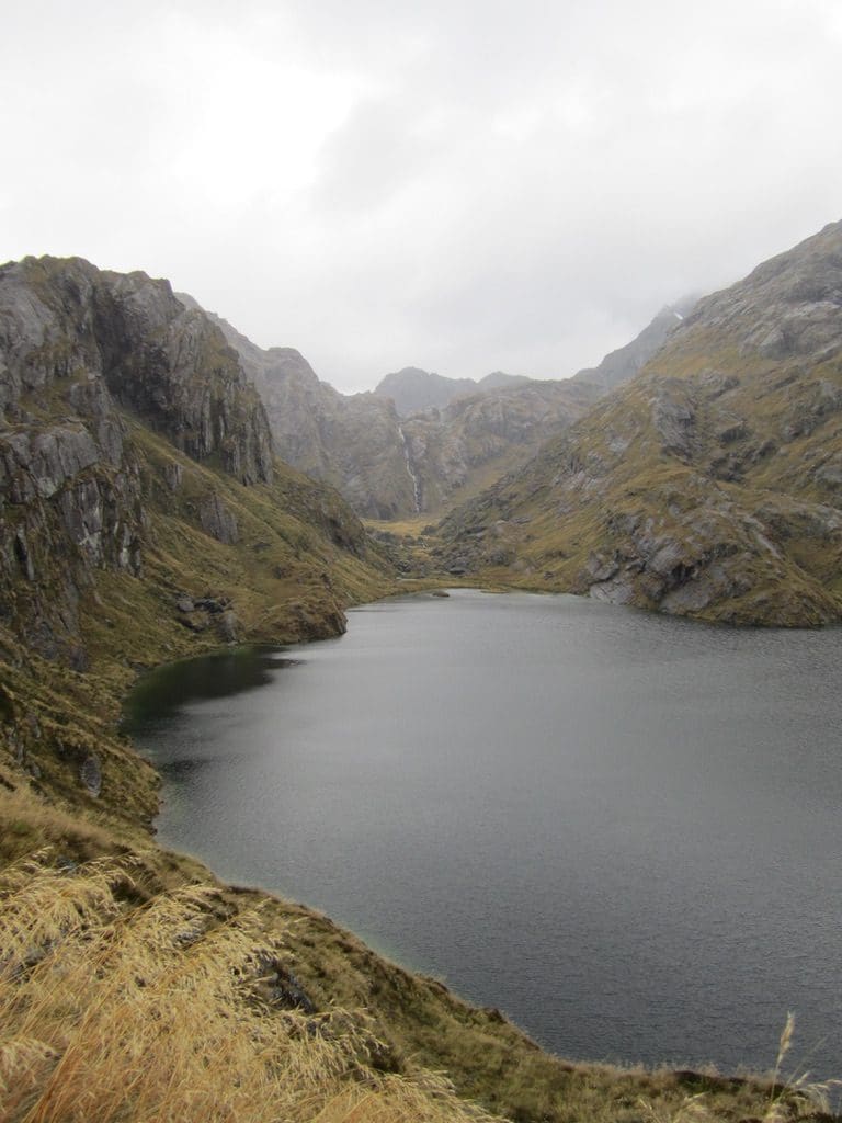
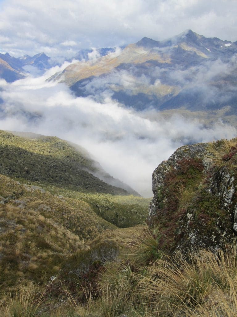
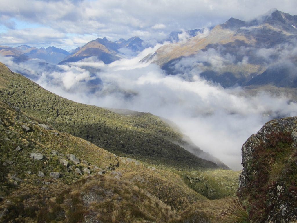
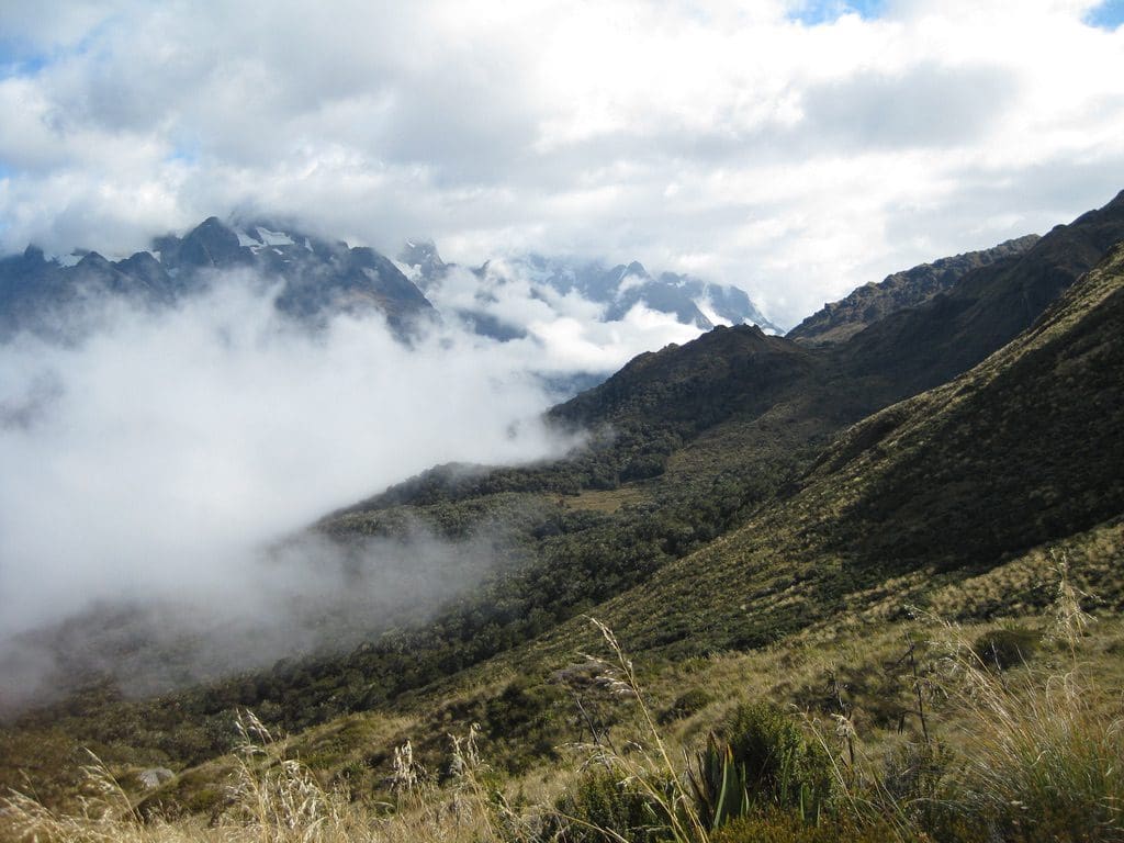
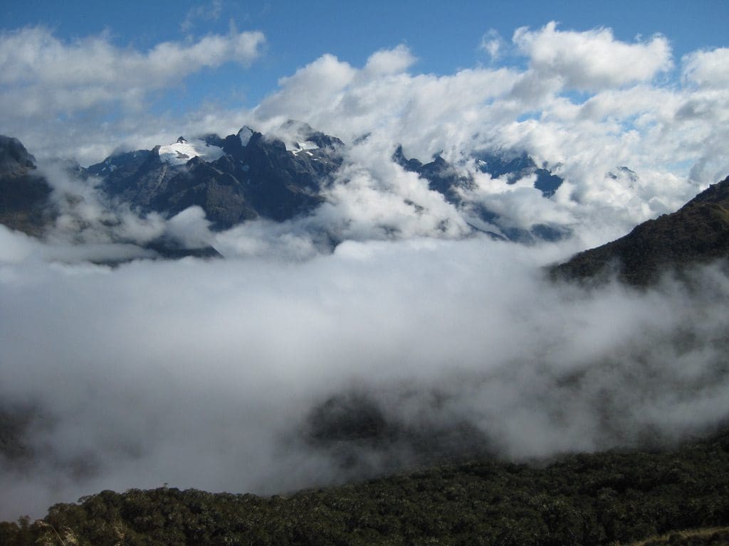
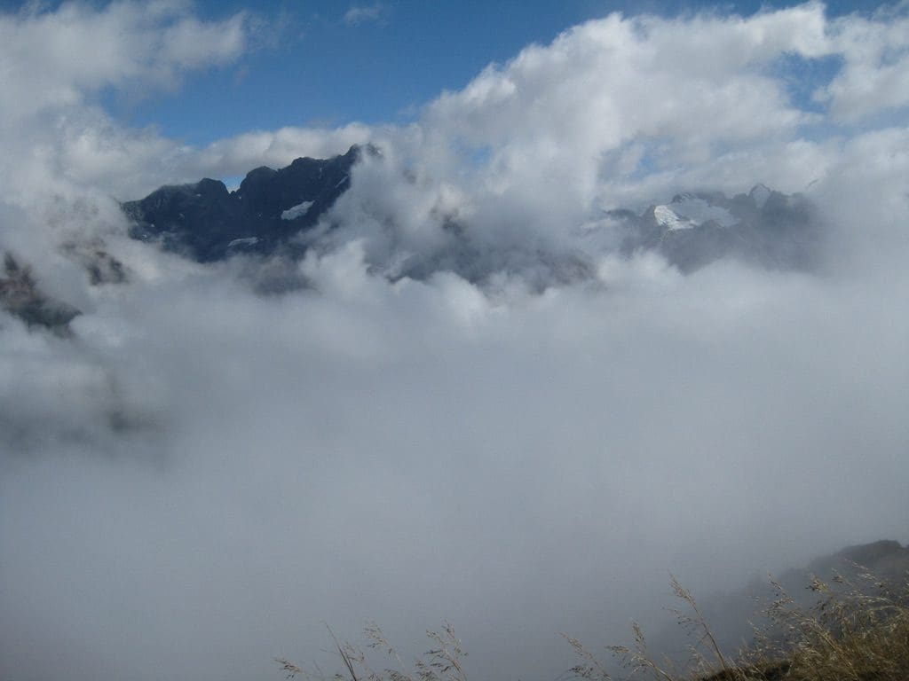
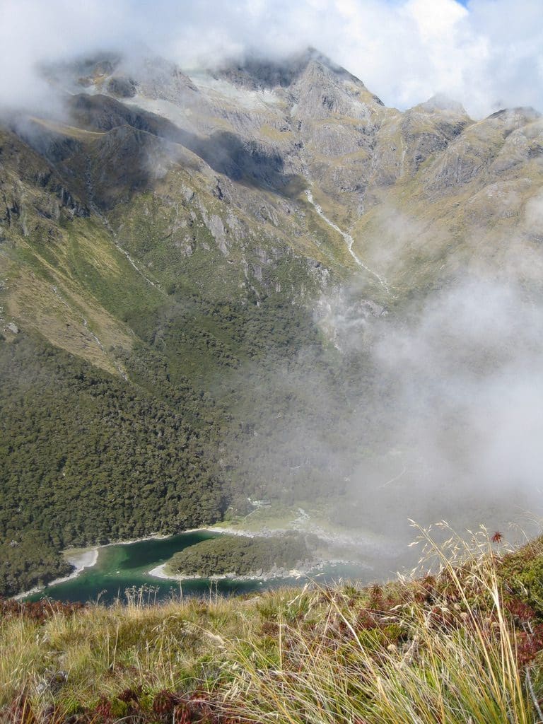

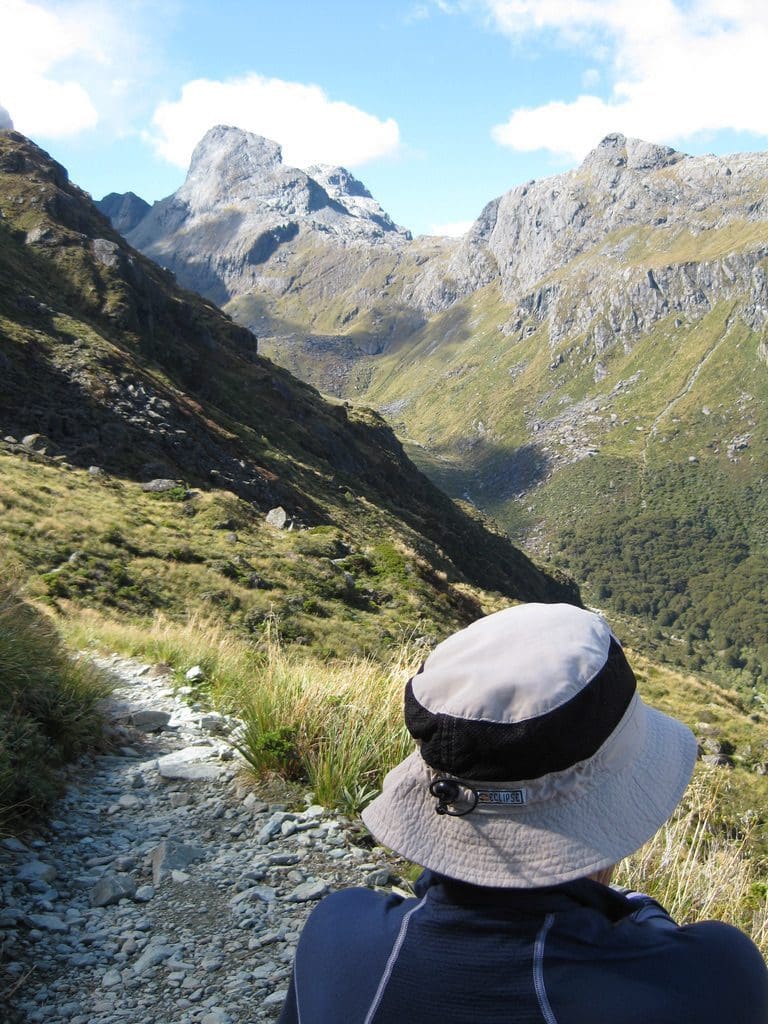
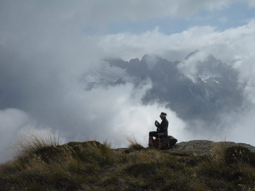
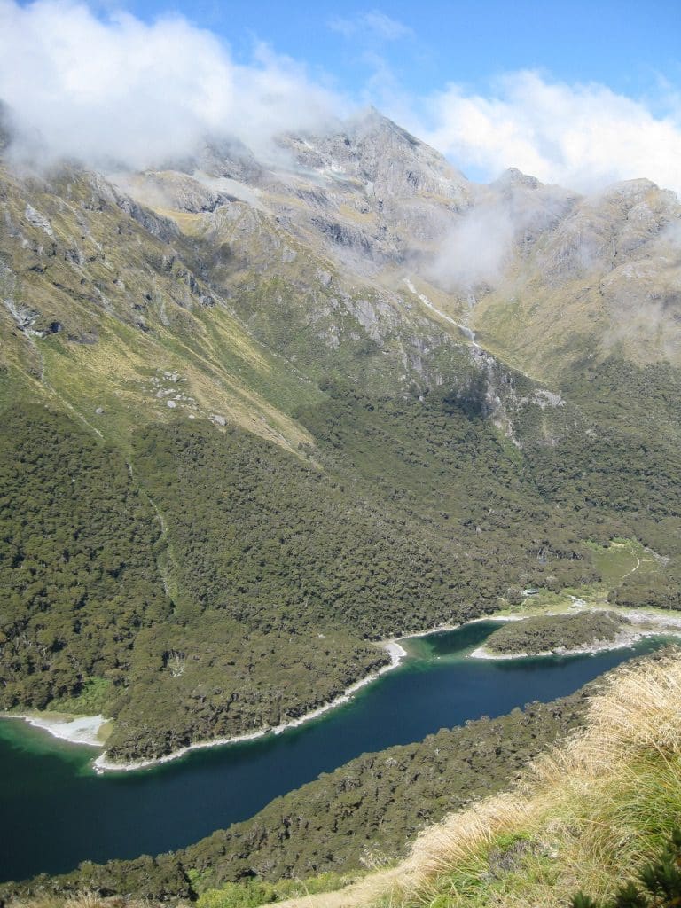
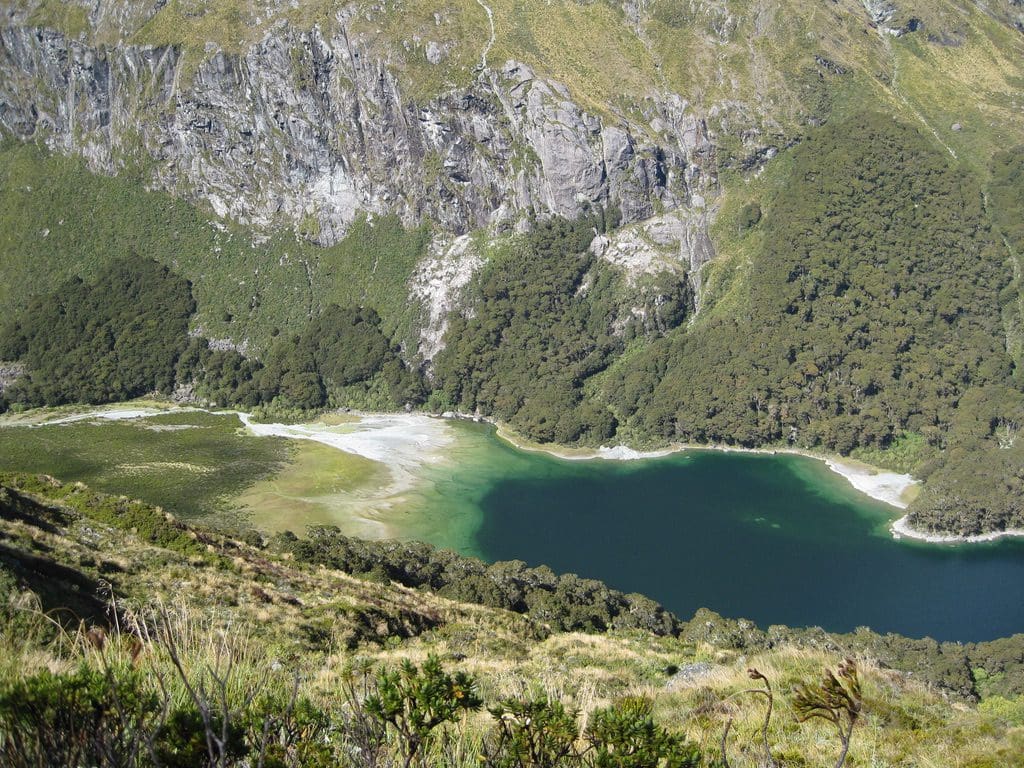

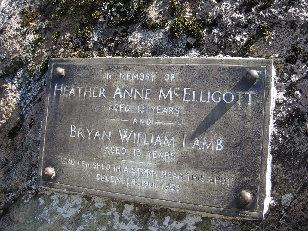
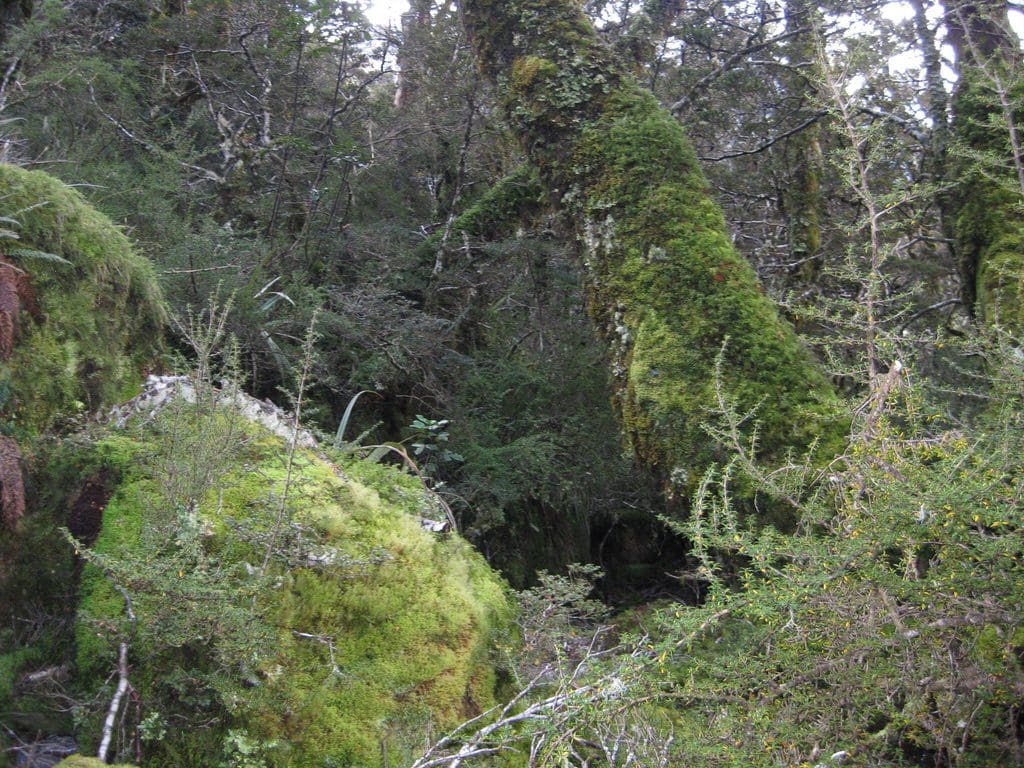

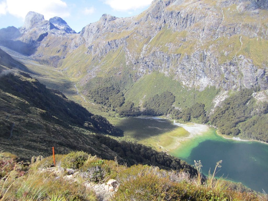
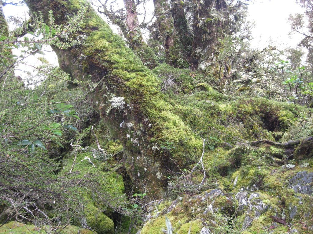
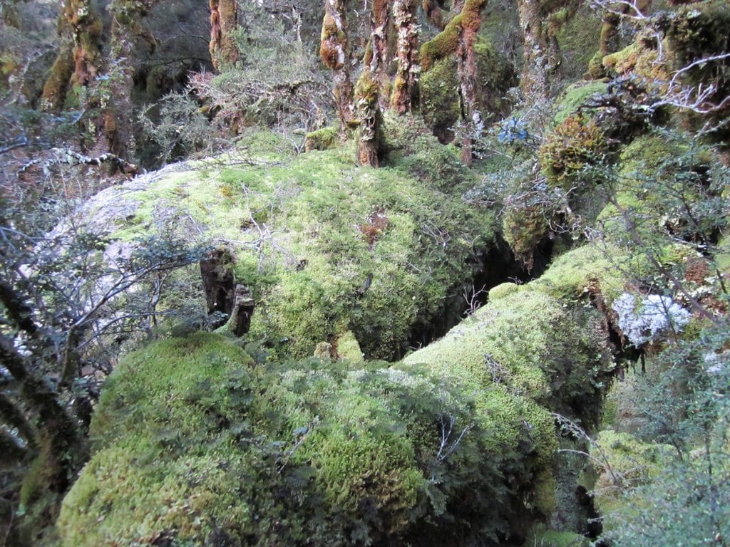
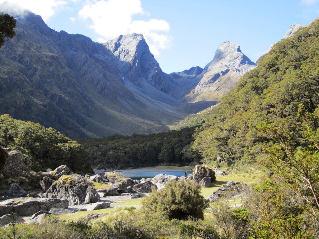
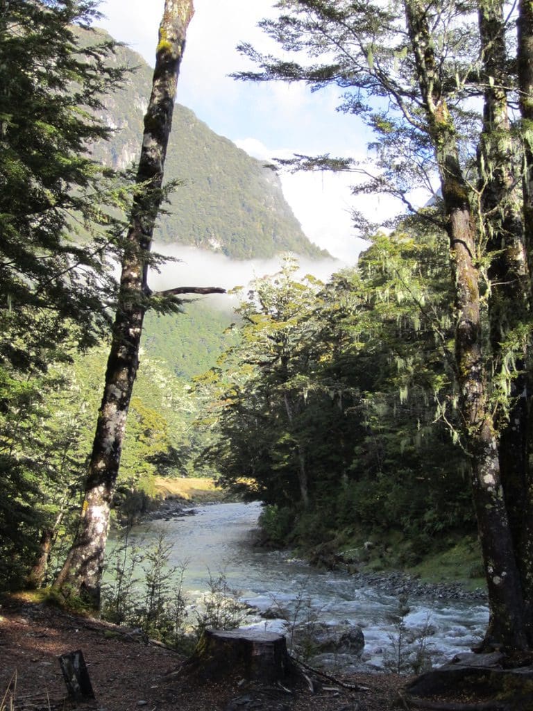
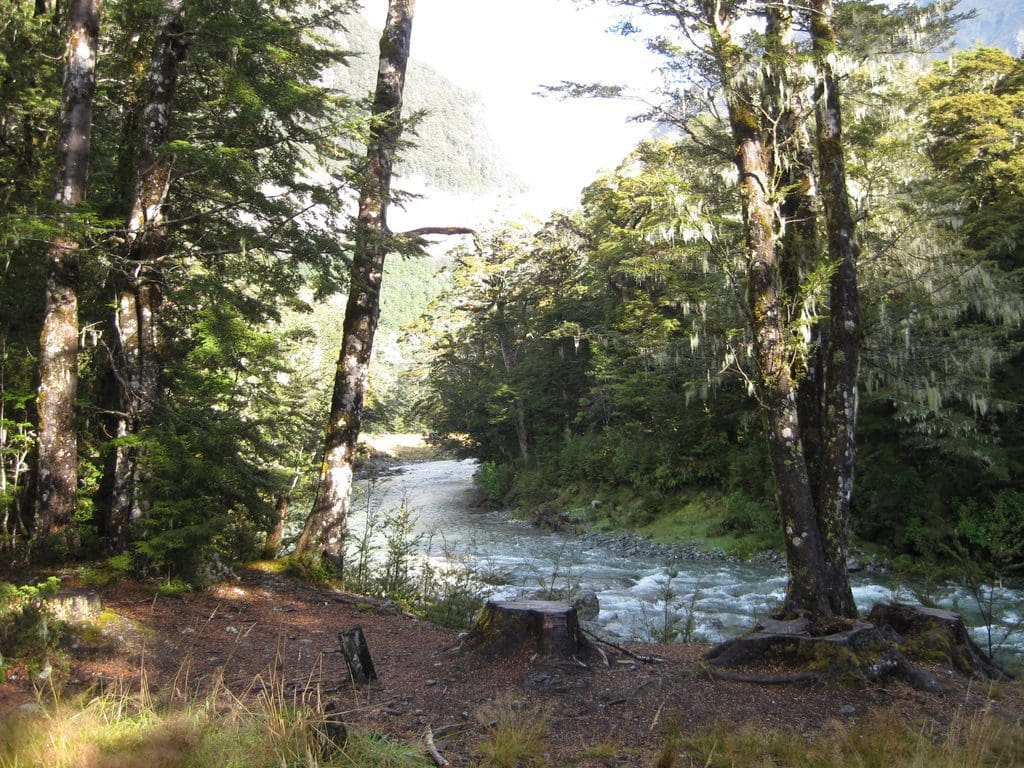
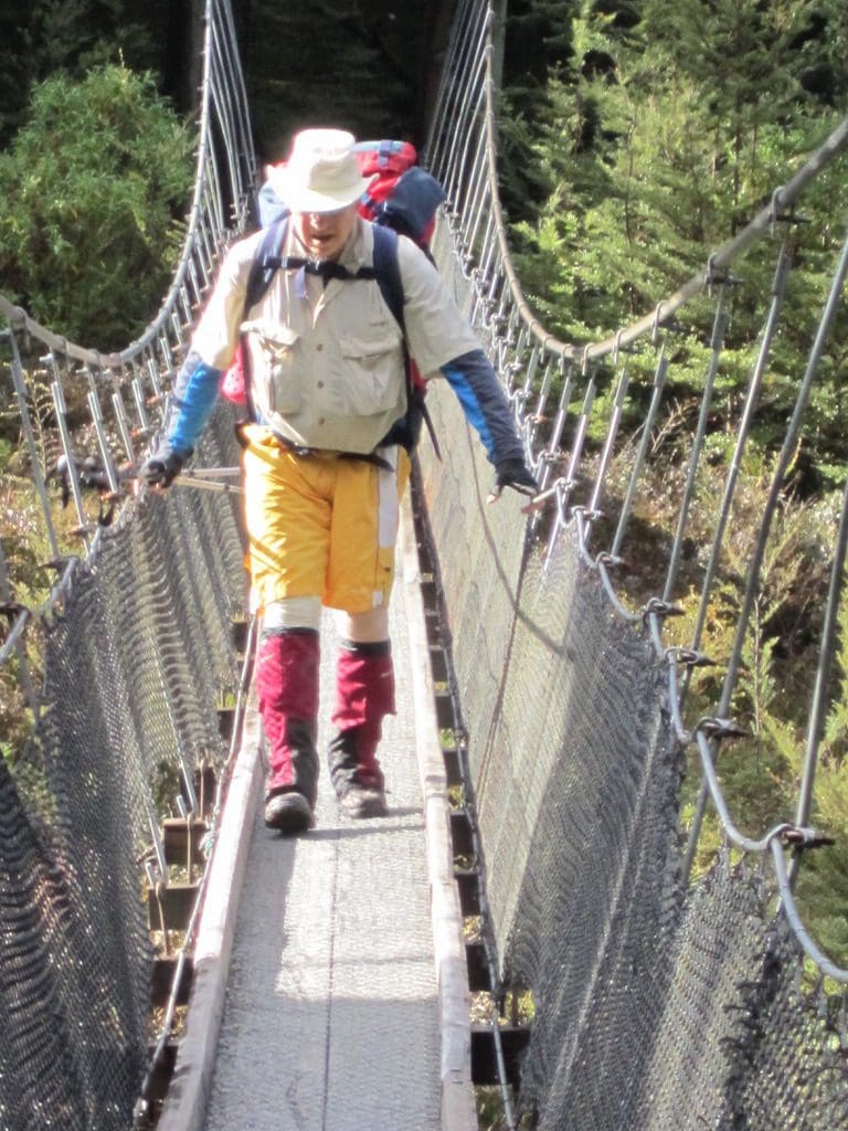
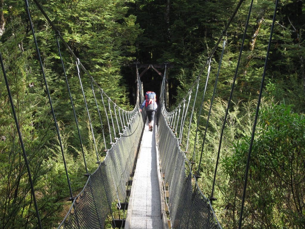
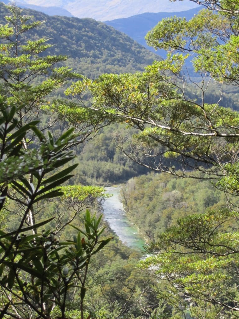
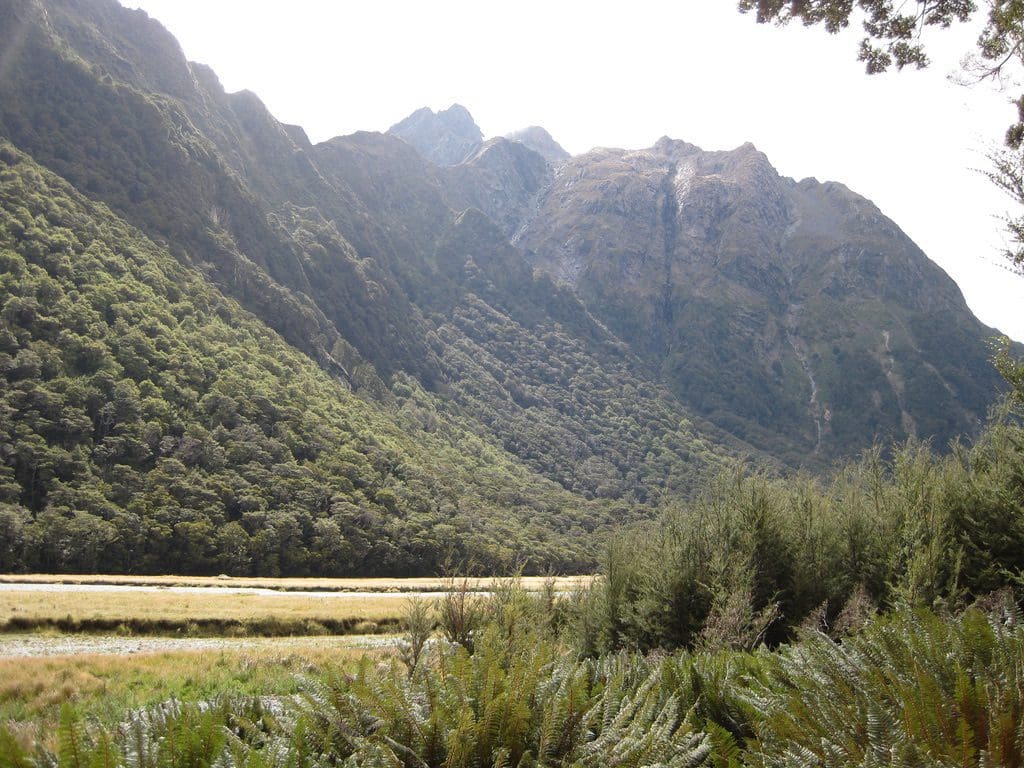
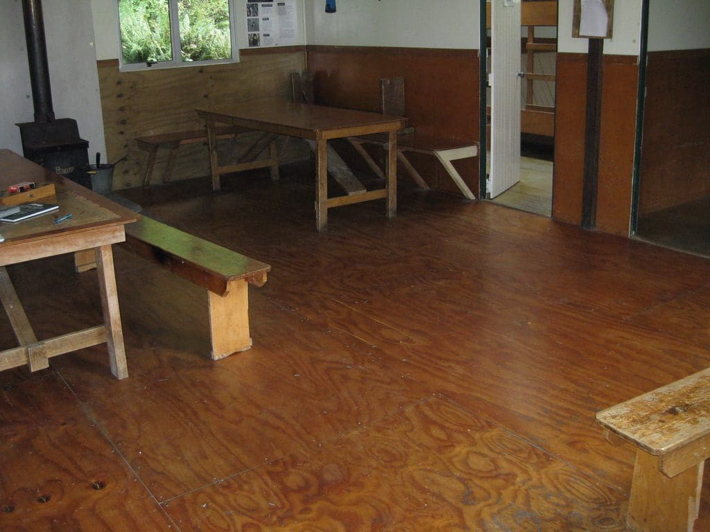
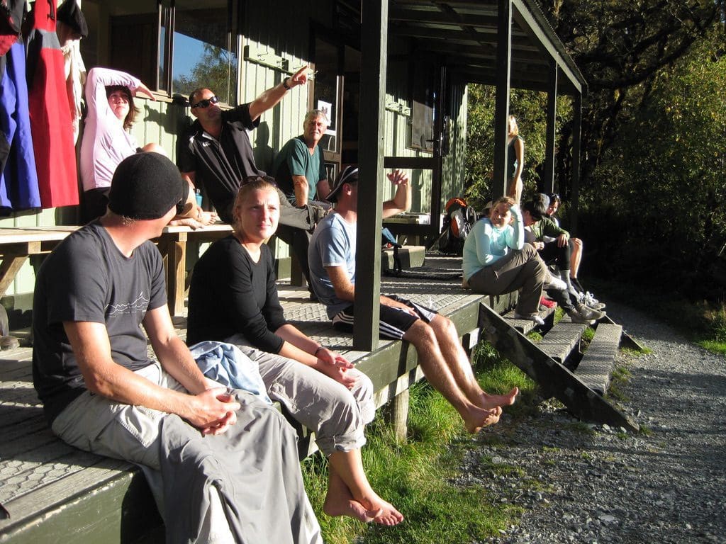
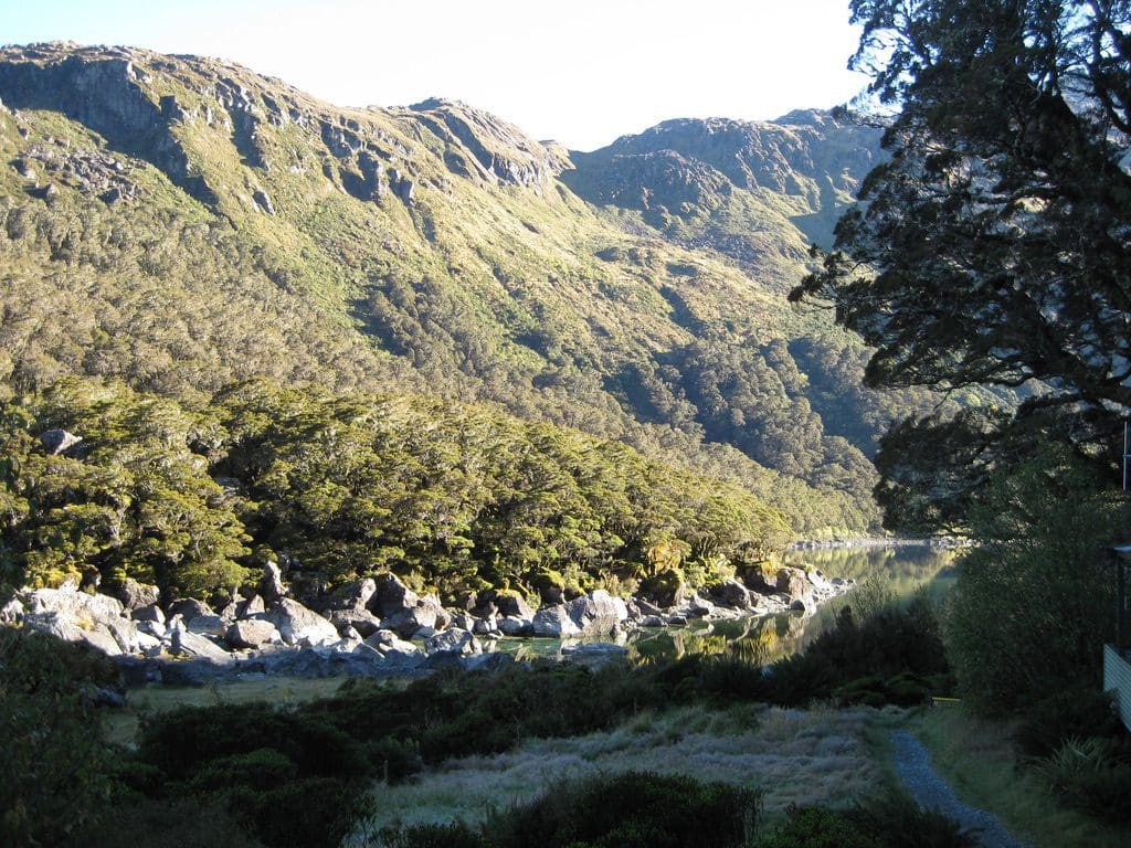
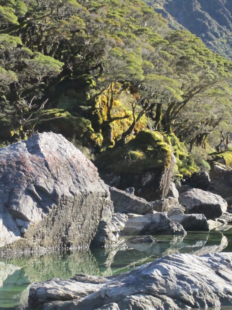
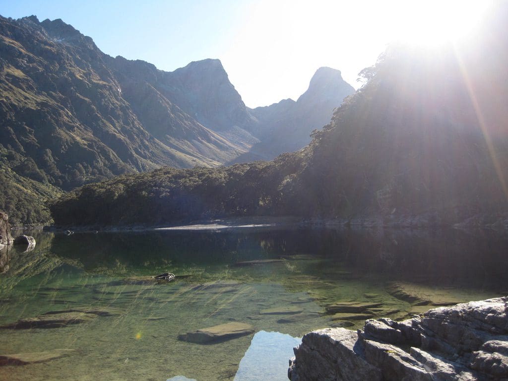
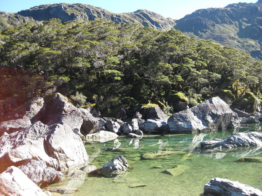
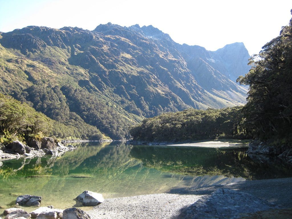
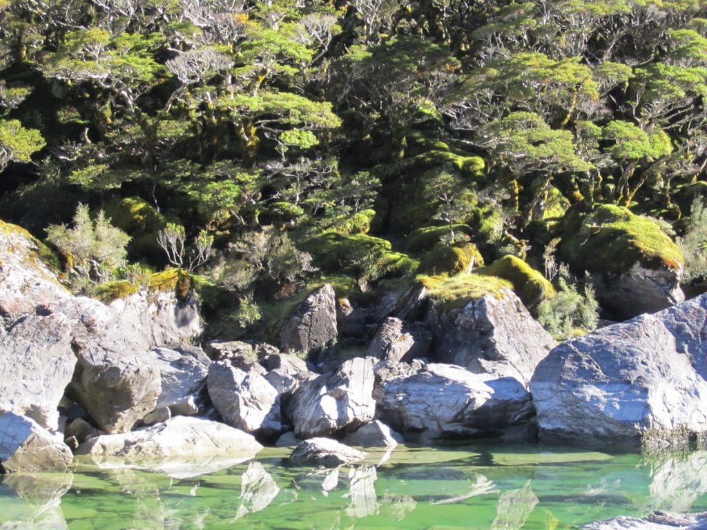
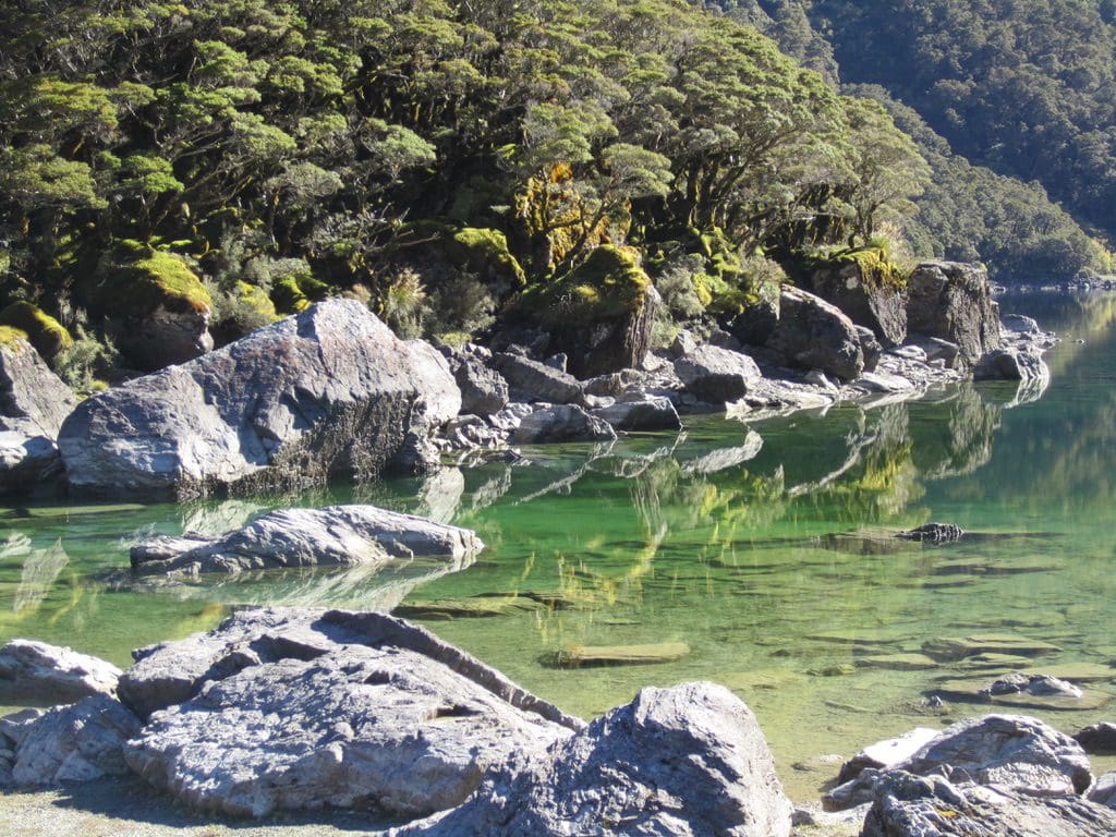
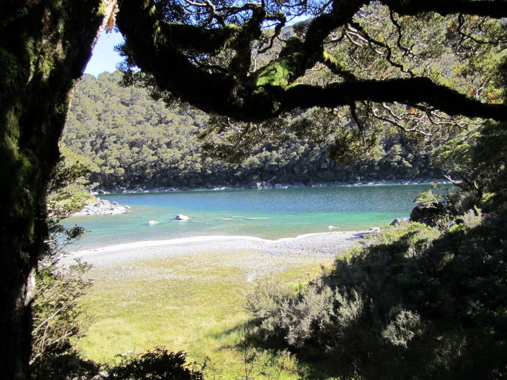
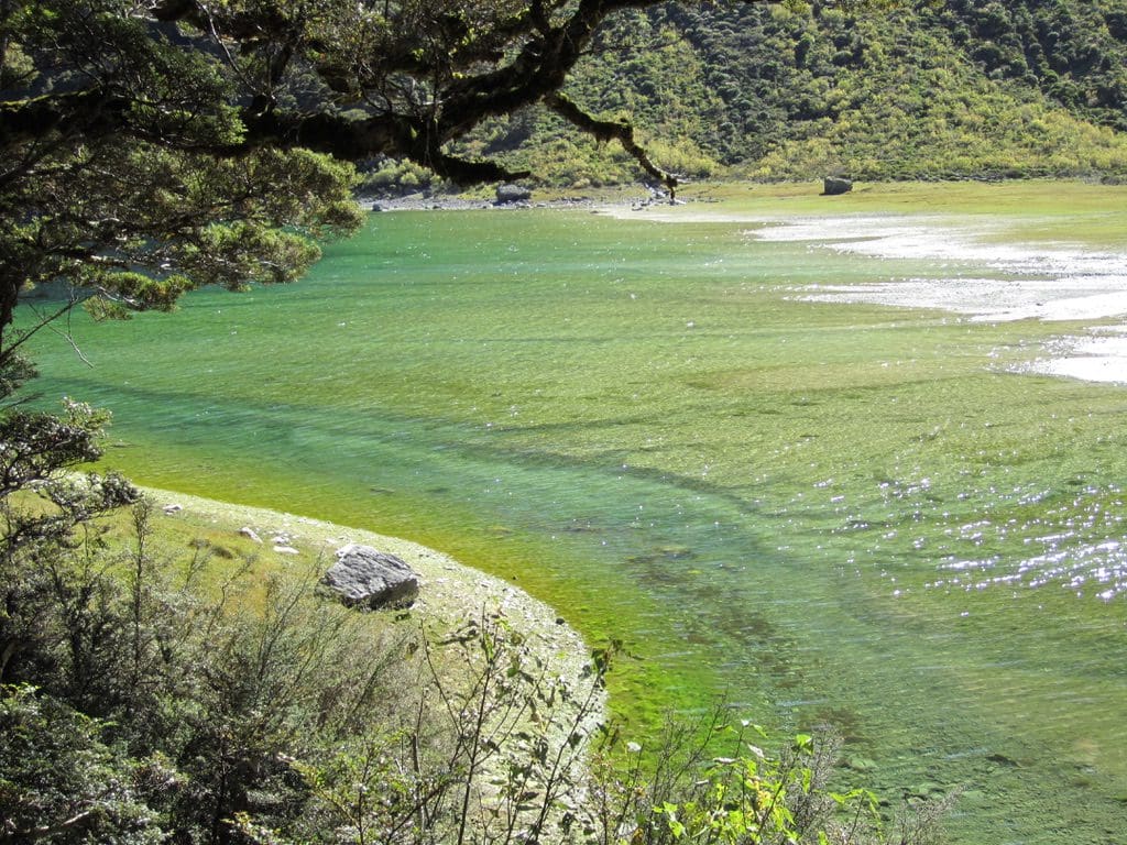
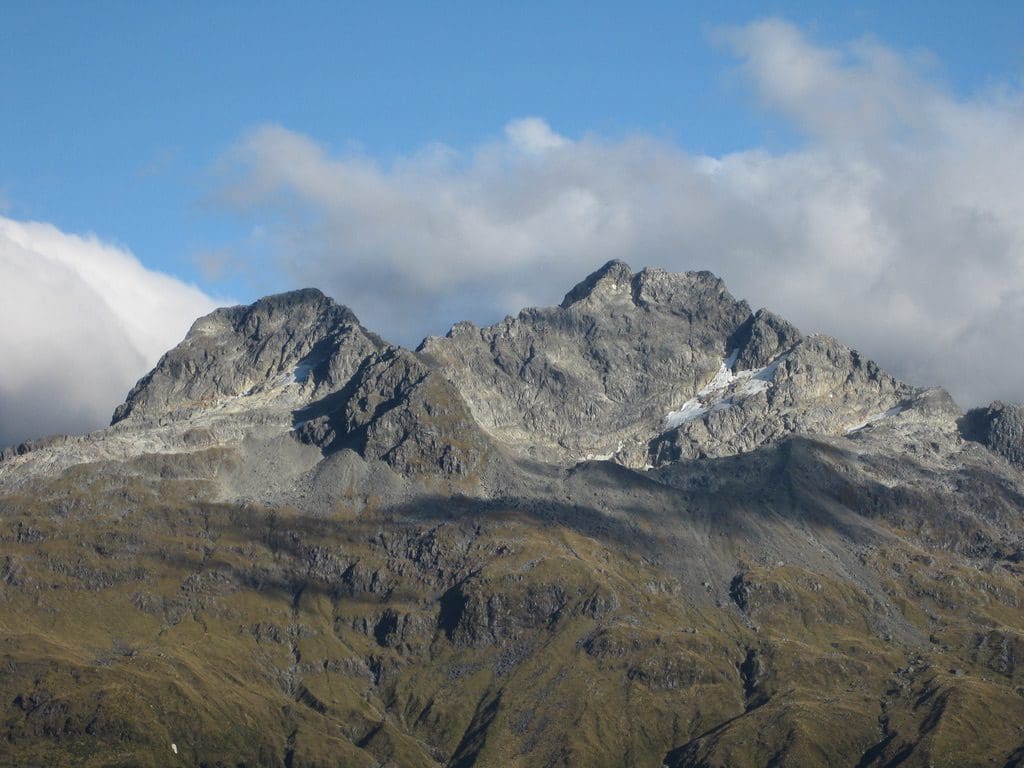
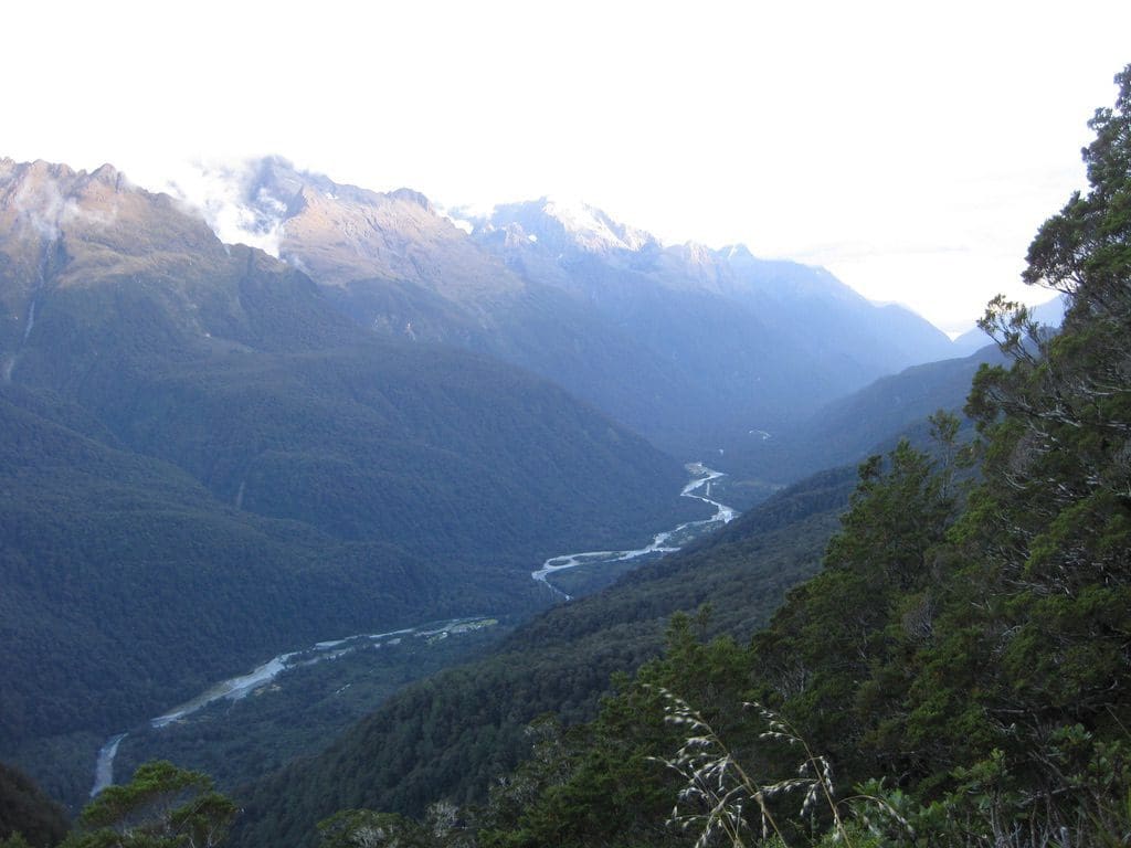
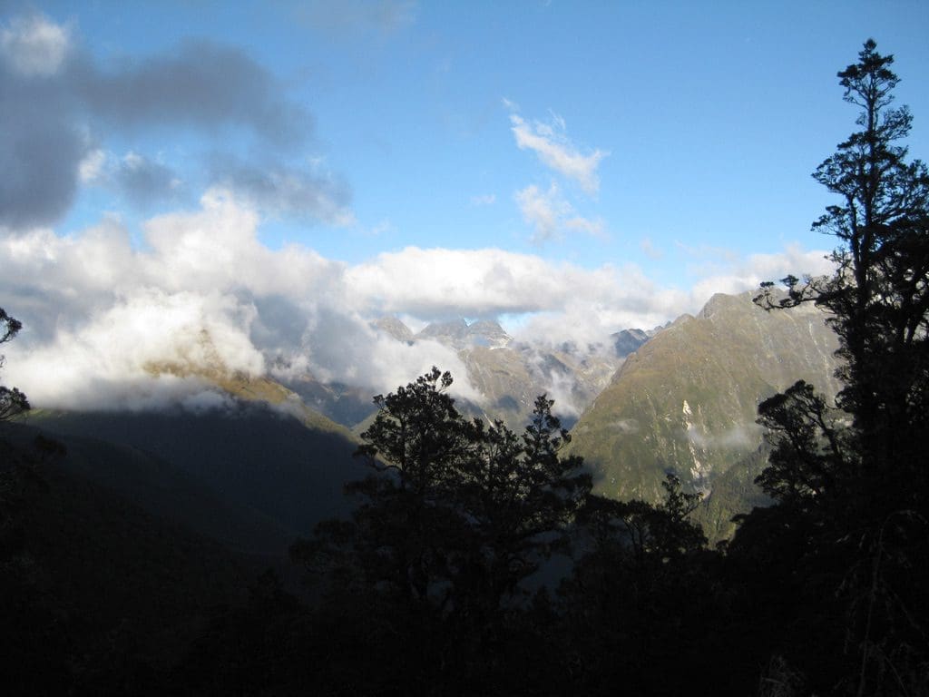
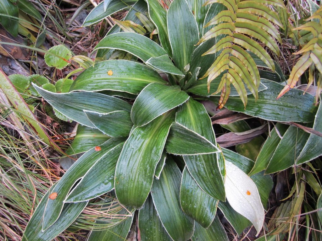
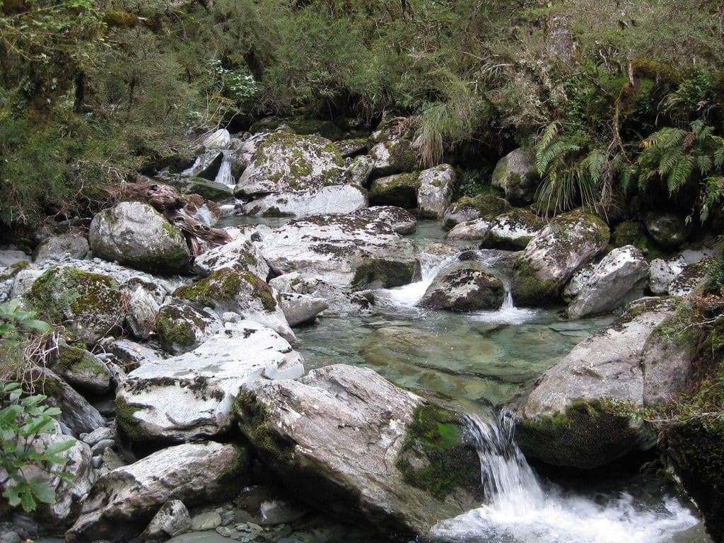
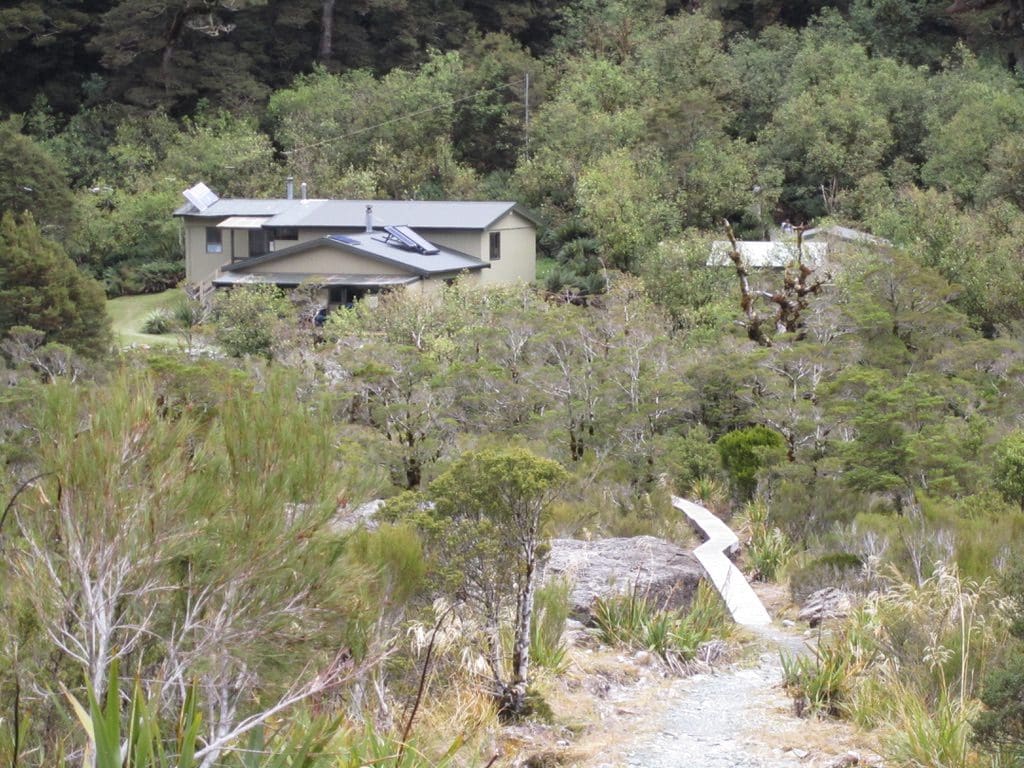
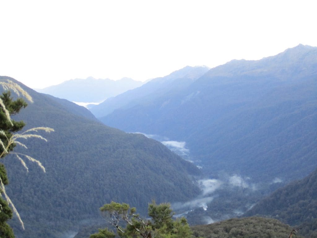
Mar 29 Tuesday, at Lake Mckenzie Hut (1,000m). Arrived a bit buggered. The hut is in a magnificent valley beside a deep-green lake. Today was our big day of walking 11.3km. We set off from Falls Hut (1,000m) at 7:45am – walking in raincoats and thermals because of a strong cold wind which stayed with us to the Saddle – worked our way up past Harris Lake (a hanging lake that you can’t see until you get above it) to Harris Saddle (1,255m) in 2 1/4 hours. 20 mins off to recover. The next part of the track skirts beside the Hollyford Valley (which was filled with cloud, so we only saw the bottom twice – but which put on a magnificent display with wisps of cloud rising, obscuring and revealing). (Over the Saddle, no wind & hot, off with raincoats & thermals.) Although the track does drop down from the saddle, it always felt like we were climbing. White berries that tasted like coconut ice. Just at the place marked on the map as Hollyford Lookout (from which we could not see the Hollyford because of low cloud), the track climbs steeply (75-100m) over a saddle. Suddenly, Lake Mckenzie is revealed 300m below and almost vertically down ‘How the f… do we get down there?’ The track makes a series of zig-zags down the open slope before entering the beech forest at about 1,150m. The moss in the beech forest is just amazing. (The sun gets off this east facing slope at about 3pm. The huge rainfall does the rest.) The track drops another 150m in zigzags down through the beech to the Hut. Very welcome to reach it. I’d taped my fingers up again today – still painful. The climb down was very difficult for my knees. I did find out very early in the day that – step down left, feet together, step down left, feet together – worked without pain. But step, step, step was a very poor choice. Balanced on my poles doing this, I think I look like our cat Zazu picking her way across a wet floor. We arrived at Lake Mckenzie Hut at 3:45pm – 8 hours elapsed time but 6 hours 20 mins of walking. Just a smidgen over their posted 4 1/2 – 6 hours. Not bad for a couple of old bastards – one with very buggered knees. Last time we were here, it rained all the way over that walk and we saw nothing but the track, water and mud. So, on our day off (which was a sunny day) we walked back up that zig-zag to the other side of Hollyford Lookout where there are a few tarns tucked in a hollow. Great lunch spot. That day, 2 paradise shell-ducks landed just near us. I’d never seen them before and called them ‘white-headed mountain geese’ much to the amusement of the warden. We’ve been down that zig-zag 3 times. About half way down (just about the trees) is a plaque to two school children who died of exposure at that stop in 1963 – within sight of the hut and a few metres from the shelter of the trees. A reminder of what unforgiving country this is – especially if you are poorly equipped and the weather turns cold and nasty. As trampers struggled in, we sat around on the sunny side of the hut until the sun disappeared at 6:30pm – 18 people sitting and chatting. Very communal. Possibly more chat than usual because most of us had been in Falls Hut last night and so knew each other and we had all shared the experience of the walk across. The Hut has 2 bunk rooms. We chose the one above the kitchen which has 12 bunks as 1 up, 1 down and 13 mats on a sleeping platform. The other hut has 25 mats as sleeping platforms. A plaque on the wall to an Israeli woman killed on the track about this time of year in 2008. Our hut warden here is the legendary Clive Rule who has been warden at this hut for 19 years. Gave an excellent hut talk of 45mins about track & history. (Clive also said that he will probably do just one more year – taking him to 20 years. Track maintenance (up to the top of Conical Hill above Harris Saddle/Shelter) each day; the 50 new faces each night; the stupid, argumentative, unprepared, complaining trampers; evacuations & deaths; changes to management structure (it was tracks, is now huts, bridges, infrastructure); poor support from management, have gradually become too much. The xmas feast, caber tossing and being a legend is beginning to be outweighed. A treasure that will be difficult to replace and they won’t know what they’ve lost till its gone.) At Harris Saddle, we crossed from Mt Aspiring National Park into Fiordland National Park. Many references to coming from ‘the dark side’. Clive has a little joke about a tramper who arrived at this hut with tickets for the Milford Track. ‘I thought it was a long walk, and wasn’t there something about a boat.’ Also, he will rent fishing gear and sell fishing licences – no fish in the lake. 7m of rain here each year – 255 days of rain sometimes up to 300ml/day. (Hut wardens here are said to say about the weather ‘if you can see the mountains, it is going to rain; if you can’t see the mountains, it is raining’.) Part way across today, a group of guided walkers passed us going the other way. Very rude people who shouldered us off the track. Of the 30 or so, only 3 stepped off to let us through and only 4 acknowledged our greetings.
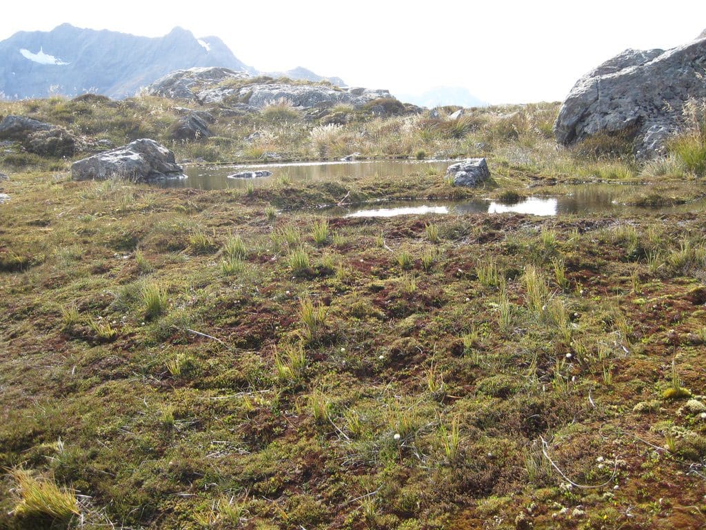
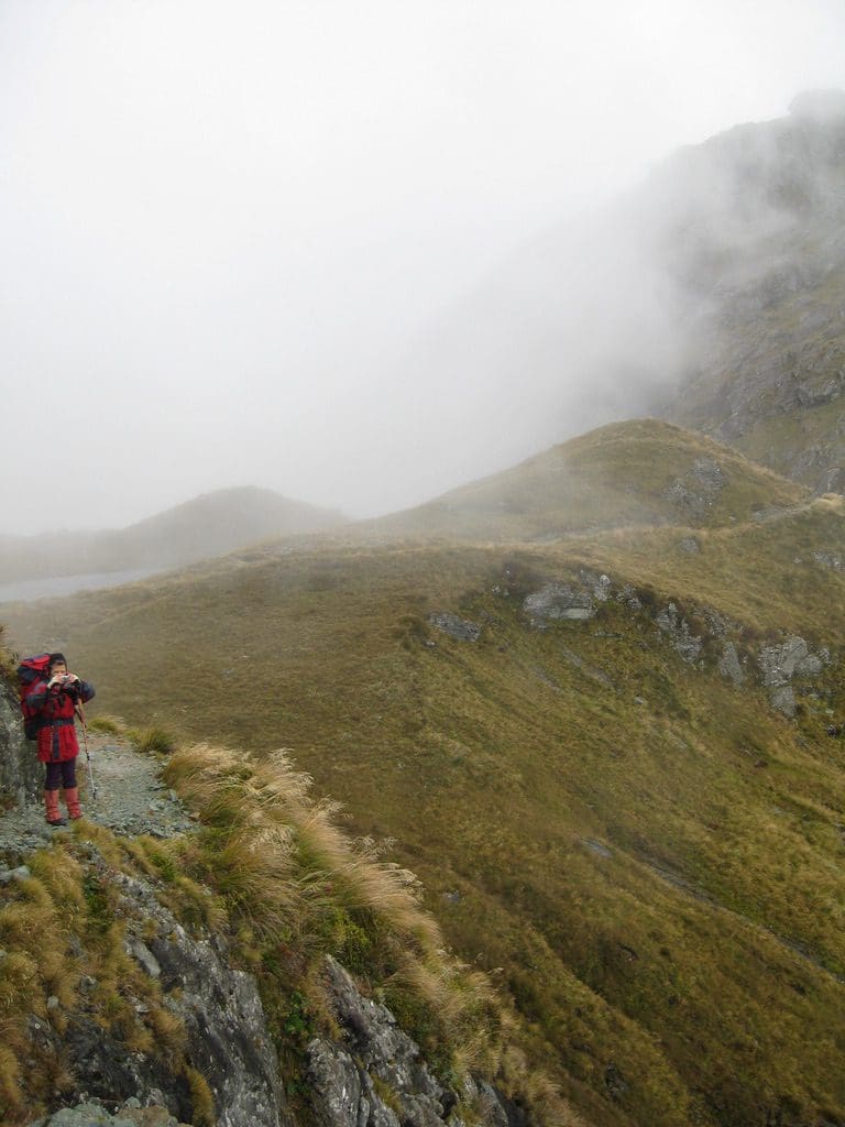
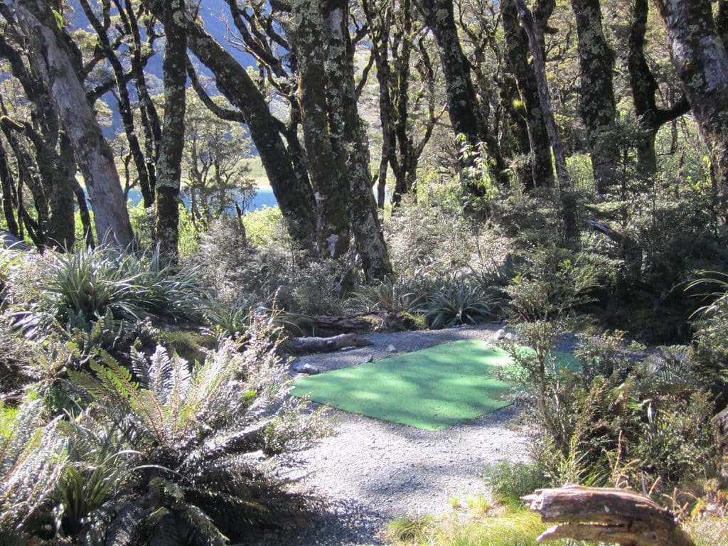
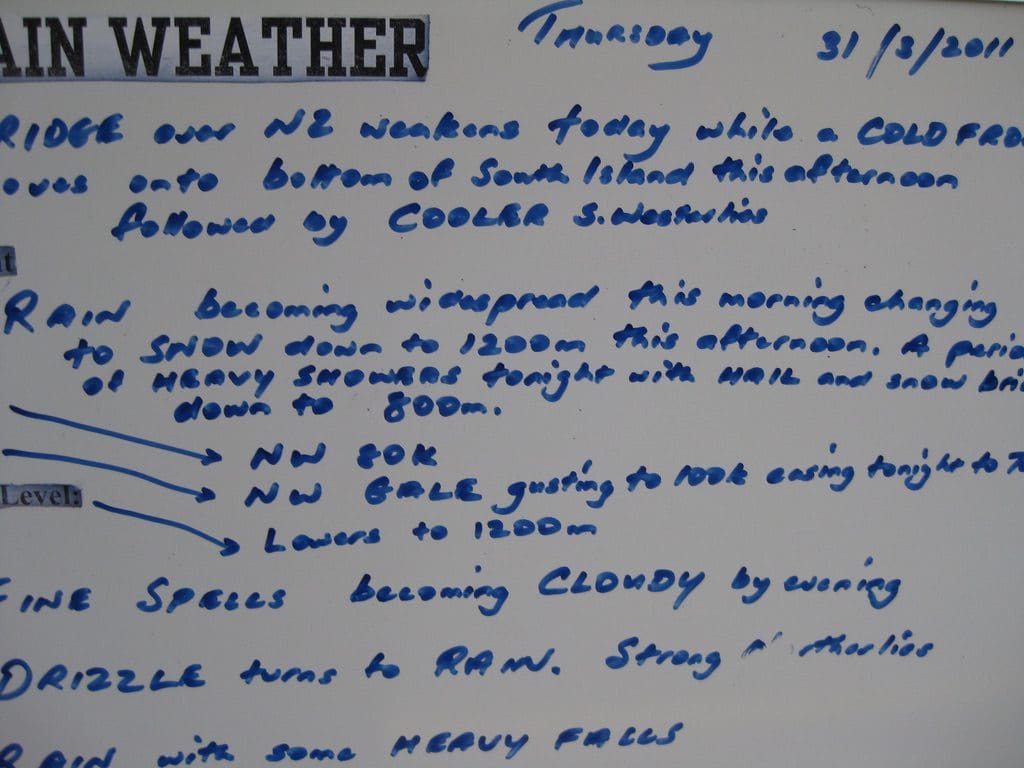
Mar 30 Wednesday. Day off at Lake Mckenzie Hut. A good night’s sleep. The young Japanese fellow in the next bunk gave a good lesson in getting up noiselessly for a piss and getting away in the dark – mice make more noise. Helen pointed out that last night we were the oldest in the hut by quite a margin. A beautiful sunny day – cloudless sky (until 1pm when the first trace of cirrus appeared). 3C on the hut veranda until the sun reached it at about 10:30am. (We went down to the sun at the Lake’s edge.) I basically sat around the hut all day; watching arrivals – first from Howden from about noon. My tranquility was thoroughly marred by the arrival of a loud, boastful hunter who regaled all with his stories of killing thousands of animals – loud obnoxious people, to be avoided. (We suspect that he is on the prowl for a place along the track to release goats; so that DOC will give him a permit to hunt them here.) The cloud began to roll in at 3:30pm – just as I thought it was hot enough to take off my thermal – by the time I had it off, it was so cold I had to put it on again. A good chat outside with 3 of the 4 kiwi group before we were driven in by the cold at 5:30pm – very different from the lounging around soaking up the sun that we did yesterday. During the afternoon, Helen went for a walk to Split Rock at the northern end of the Lake (which incidentally the hunters failed to find – ‘er, big rock with a split in it’, mustn’t have had a target on it). I stayed at the hut. Helen gave a good report of the campground (by the lake with astro-turf pads separated by ferns). This is our 5th night on the track. Five nights without news of the outside world. Whatever has happened out there has happened without our worrying about it. Surprising that! (When we were on the Rees-Dart, word gradually filtered along about the Japanese tsunami. Nothing of such magnitude being talked about this trip.) Hut lights – all the Huts on the Routeburn now have solar powered electric lights from 7pm-ish to 10pm. Quite an innovation since we were here in 2004. Many more in the Hut tonight – a bit over half full. Our bunk room is almost full. More isolated groups tonight – nowhere near as much chatter back & forth. Tomorrow, if the map is right (which would be a change), we climb up 150m, follow the 1,000m line for a while, then descend 500m to The Divide in 2 pitches (of about 250m each) over 2 days. I’m not looking forward to the descents. I hope that they are gentle but I bet they are not. Rain is forecast for tomorrow. With luck we will get most of the walk done before it settles in. We’ve had 2 fine days in a row in a place that has only 110 fine days a year – lucky!
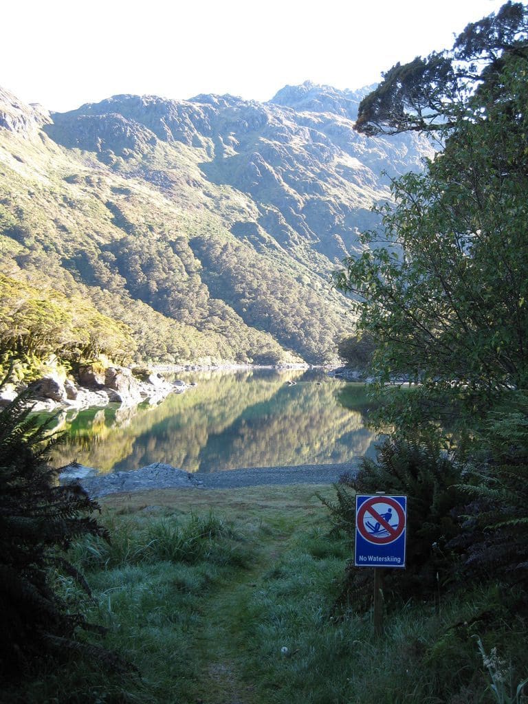
Clive gave a truly excellent talk tonight – a fine stand-up comedy routine. We had tears running down our faces. A story of a French woman who began the track from The Divide wheeling a Louis Vuitton suitcase. The wheels collapsed on the way up from Howden. ‘Do you have spare wheels?’ ‘Not for that particular model, madam.’ She lost the keys. ‘Do you have suitcase keys?’ He broke the locks of with an axe and tied the case back up with a rope (‘perhaps not suitable for Louis Vuitton’). She carried the suitcase over her shoulder all the way up & over. Clive turned it into a comedy. Another story of an inflatable boat carried up from The Divide and launched onto Lake Mckenzie (with the help of washing-up liquid) ‘we don’t get many boats launched here’, then carried up over Harris Saddle and launched onto Lake Harris (from where they needed to be rescued because they lost their oars), then carried back down to The Divide. The weather forecast is for ‘dry rain’ tomorrow in the afternoon. We won’t get ‘wet rain’ till the day after. Then, it will turn into ‘very wet rain’. A story about the number and type of rain coats he had been issued by DOC over 19 years – long, short, crumpled, clear. One thing in common – none were waterproof. In answer to a question about the ‘no waterskiing’ sign at the Lake edge, his answer was about the ‘slope’ of the Lake – ‘it’s currently level so you can’t ski, you can when the slope gets up a bit’. Return visitors – his friend has done the track 3 times and still not seen anything. A good hour of excellent comedy. Clive Rule, great value.

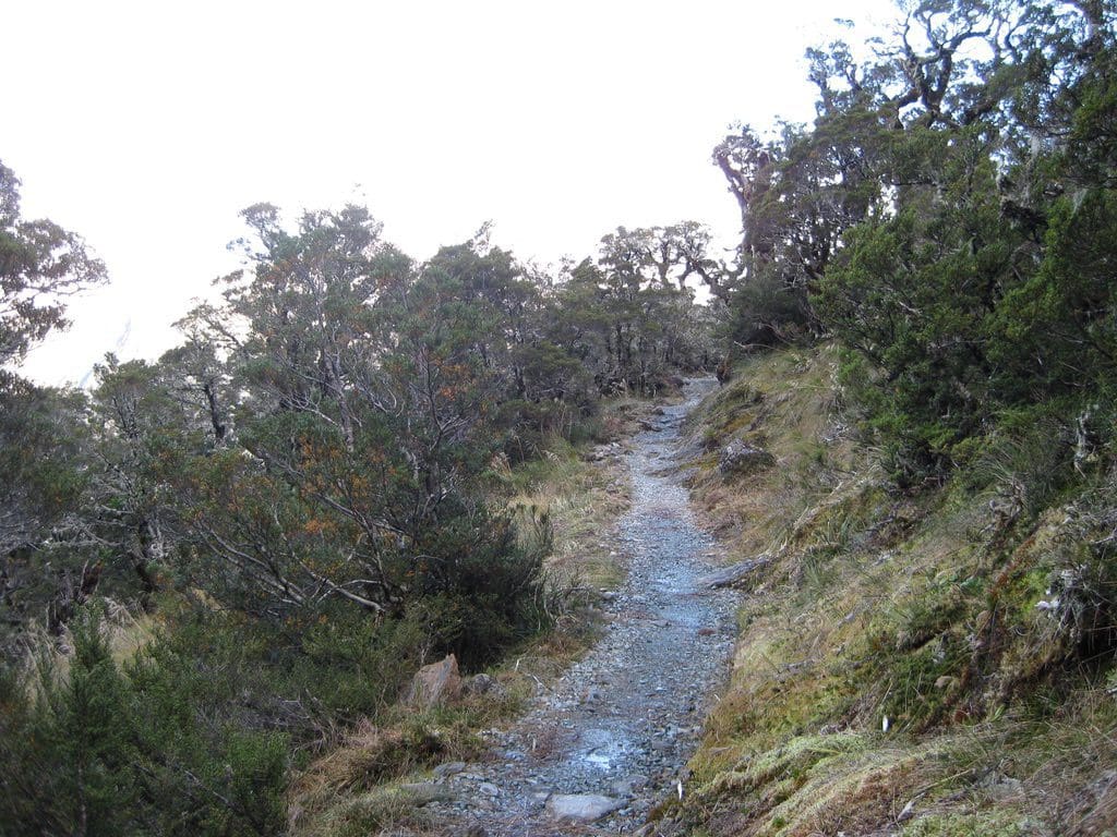
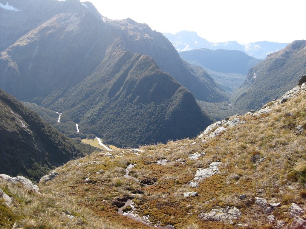
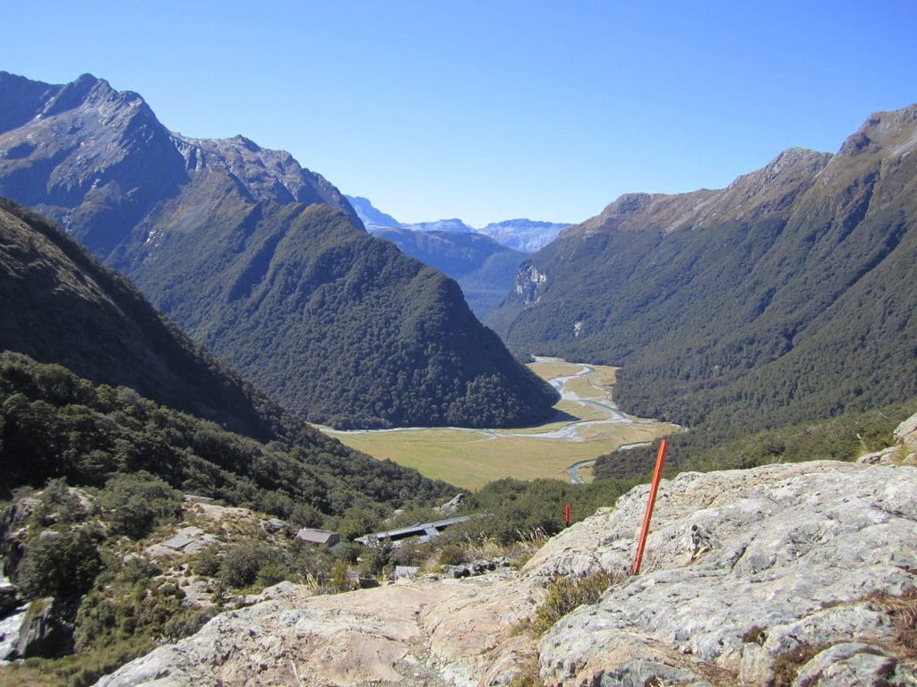
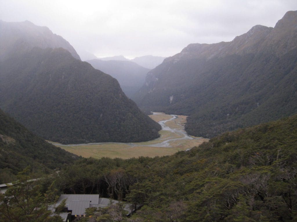
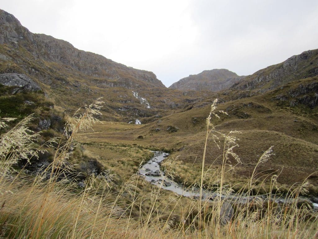
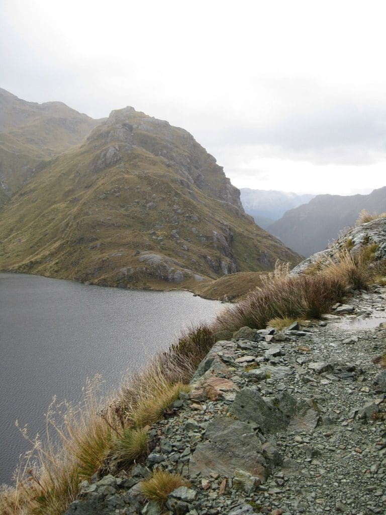
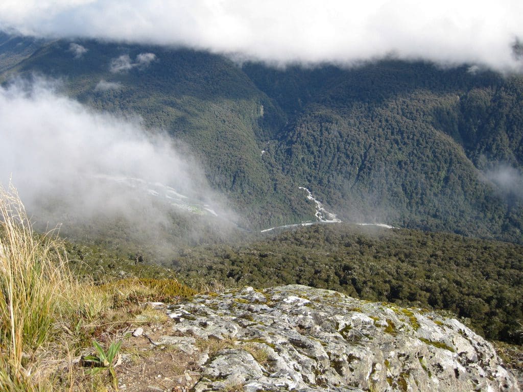
Mar 31 Thursday. Walk to Lake Howden Hut (708m). We had a delightful walk and arrived at the hut with the first gust of rain. Got away this morning at 7:45am. Most people were trying to get away early. First stirrings just after 6 am. Packs & sleeping bags packed in the kitchen – very considerate. The track climbs steeply through beech forest for about 200m after leaving Lake Mckenzie Hut, then contours around through an old avalanche zone with broken trees and ribbon-wood (The Orchard). Then, back into the beech for the descent of about 400m to the Hut – I felt every metre down. Fantastic moss in the forest. We took 4 hours of walking time. When we arrived at Howden Hut, it was cluttered with guided walkers occupying all the veranda and most of the table space. Rude. Anyway, get over it, Geoffrey. The last time we were here at Lake Howden Hut, when I stepped onto the veranda, a voice said ‘Hello, Geoff’. It was Neil who was my best man when we married and who I had not seen for about 25 years. A plaque on the wall to 2 people who died in the crash of a helicopter that took off from here in Jan 2004. In Jan 2004, we arrived at Howden just a couple of days after it disappeared. The warden here then had pleaded with the pilot not to take off because visibility was zero – ‘wait an hour’, ‘we have a boat to catch’ were the last words. The warden was extremely upset. We had seen the helicopters & fixed wing aircraft searching slowly into every crevice of the Hollyford looking for a green helicopter in a huge green forest. Never found.
So, what do I think of the Routeburn on our second walk. Is it worth doing twice. Absolutely, Definitely! My favourite walk. Why do I like to tramp with a heavy pack over several days? Being in wilderness is a huge influence (though I am not much fussed with views even if I do take lots of photos), carrying all food & clothing & being self-sufficient is certainly important as is the isolation (lack of contact or potential contact with the outside world – no phone, e-mail, internet). Possibly, the main reason is the very long moving meditation because walking on very uneven rocks & tracks needs extreme concentration. (I also count every step which for some reason is very relaxing.) (On the way down the zig-zag a couple of days ago, I found that I could not walk and talk at the same time – ‘don’t talk to me I’m walking’.) Being away from ‘the list’, phone and having to do stuff gets a big vote from everyone here at Howden. It is certainly the people we meet and the chats. We have had an excellent afternoon sitting around chatting with the rain beating down outside. It rained constantly all afternoon (that ‘dry rain’ Clive mentioned) sometimes quite hard.
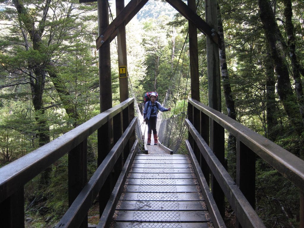
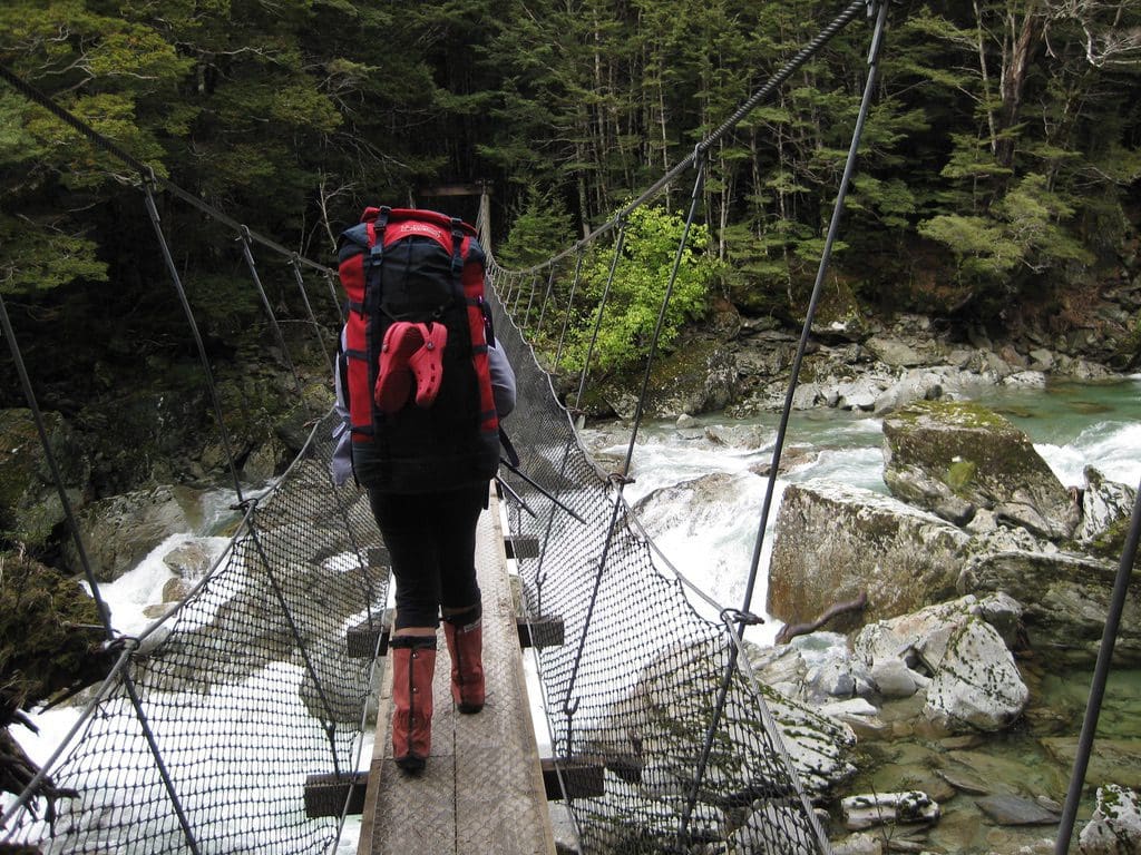
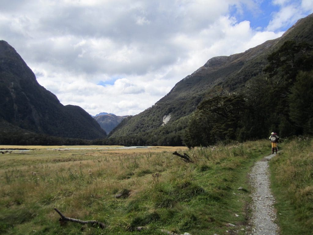
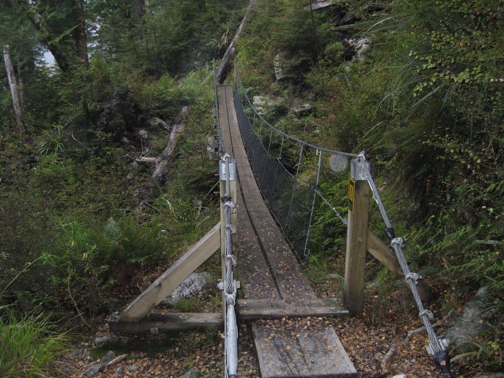
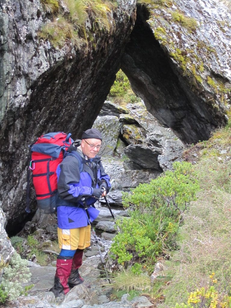
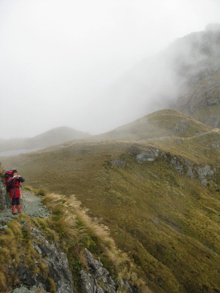
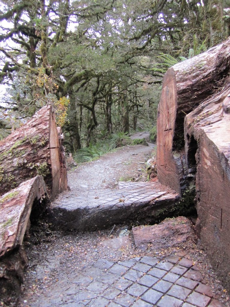
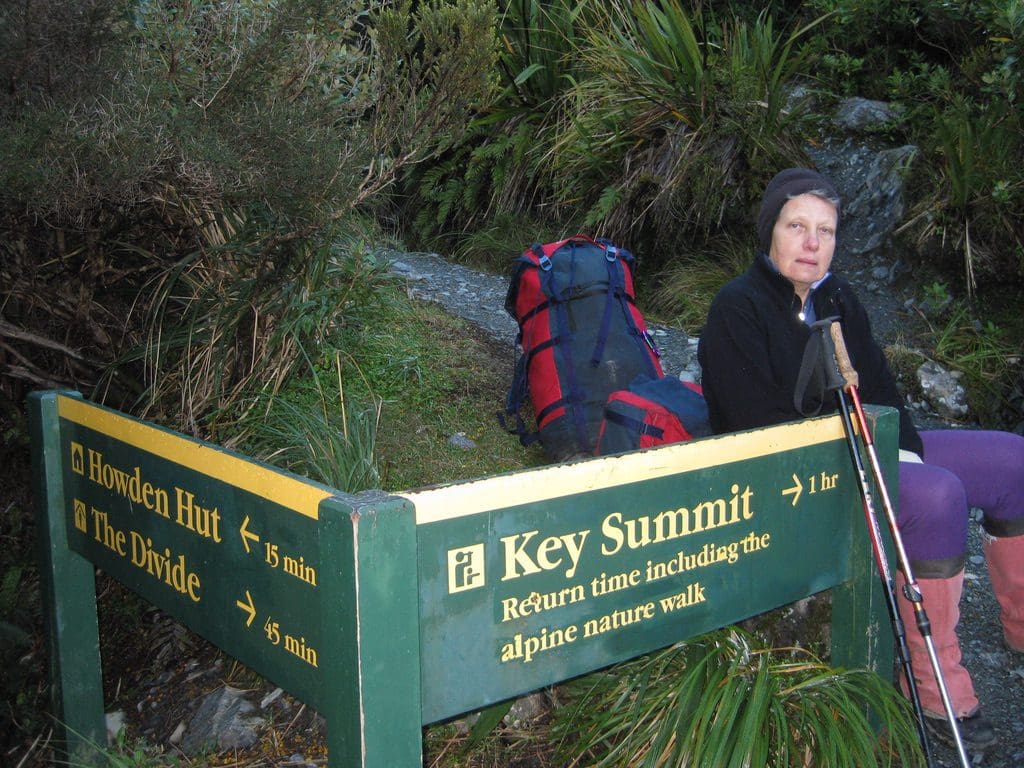
Tonight we have: us, 4 kiwis (Andy – cop, Craig – sales, Aaron – photographer aaronphoto.co.nz & Leithan – teacher who have been with us for 4 nights) & 2 South Africans. The Hut warden described bringing in the metal bridges – along this section, all look new. All have been helicoptered in and swung into place. From the contour map (which is hopeless), it looks like the track goes up 100m almost to the tree line, then descends 350m to the road at The Divide. I do not intend to climb up the side trip to Key Summit. Key Summit and Howden are both on (or very near) the NZ Alpine Fault.
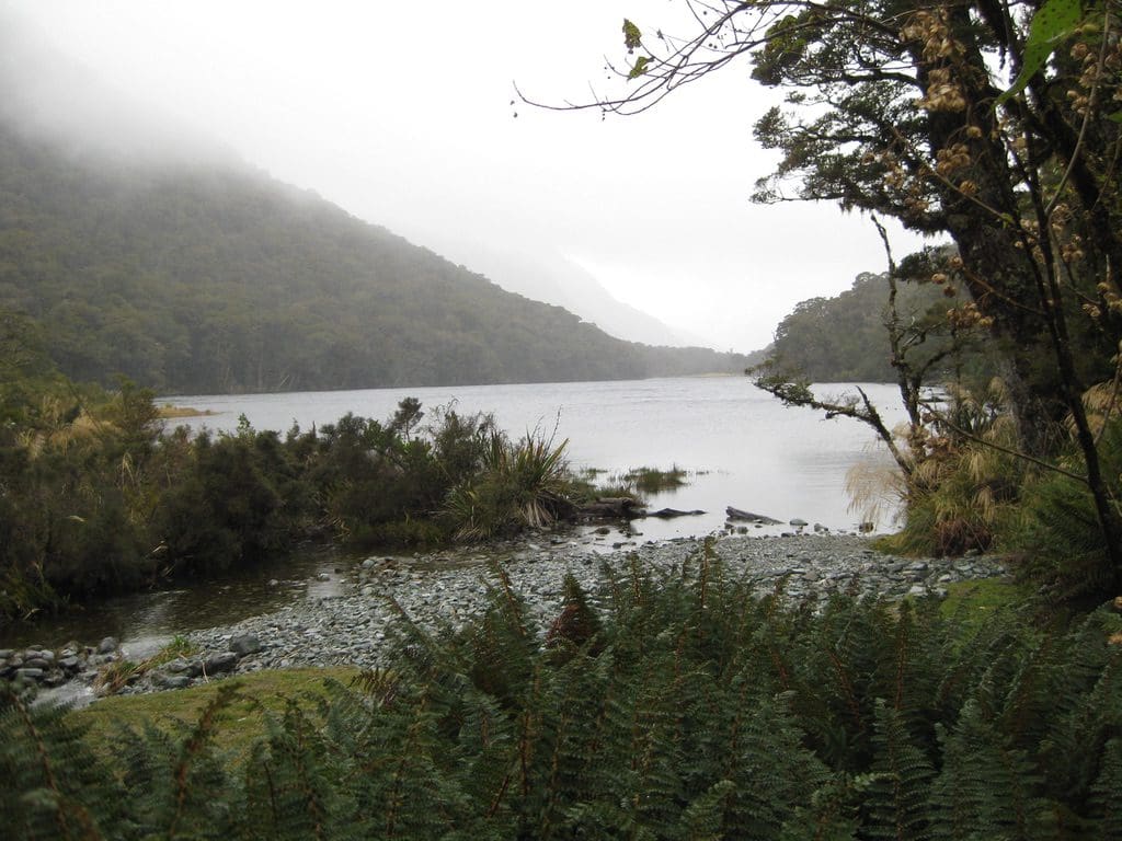
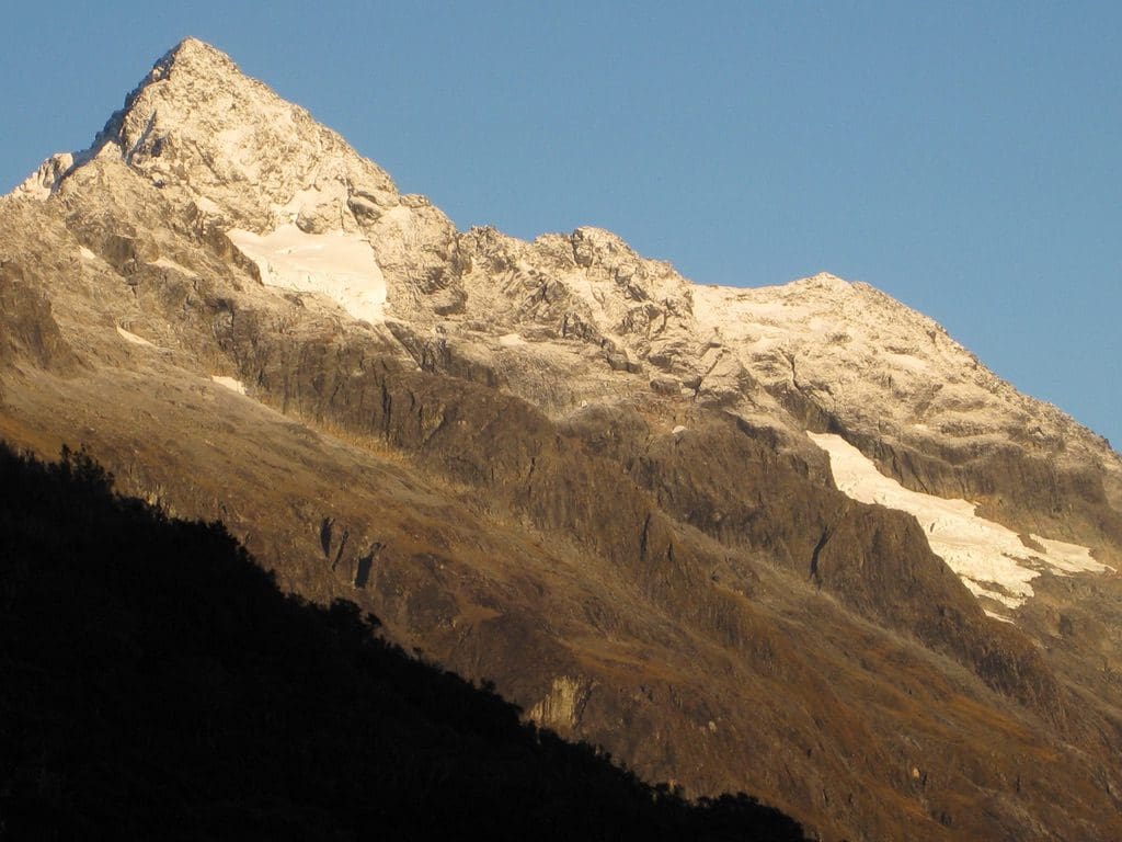
Apr 1 Fri Out! Walk to The Divide, caught the bus through to Queenstown. The rain had stopped about 6pm yesterday and we had a clear frosty night. Frost on the steps when we each got up for a piss during the night – and we all did – a very restless, sleepless hut last night. My alarm went at 6:30am and the 6 early starters were soon down in the kitchen eating breakfast and stuffing things into rattly plastic inner bags – quietly of course so as not to disturb the 2 late starters – who soon joined us anyway. We got underway at 7:45 and began the walk up to the pass beside Key Summit. (Key Summit is so named because it is the source of rivers that flow to 3 oceans – Great Southern, Pacific and Tasman Sea. It occurs to me that there must be a stop near Winton, Queensland that could make a similar claim – down the Darling system to the Great Southern, up to the Gulf of Carpentaria, west to Lake Ayre and maybe east to the Pacific.) We got to the pass fairly quickly and with such a clear day thought it was worth going at least part way up for views of the mountain – a slight dusting of snow on the top with the rain yesterday – stunning. (We’ve climbed Key Summit on previous trips and walked the little circuit – very well worth it. Not this time for us, despite the excellent day. Too concerned about the descent. We went up about 2/3 of the way this time.) Then to the descent – a beautiful graded track through a fantastic beech forest – no steps, probably suitable for wheelchairs – though steep-ish in parts. We finally reached The Divide at 9:45am – we could see the road below us for at least 45 mins – changed out of our walking clothes into hut clothes and waited for our bus. (The group of 4 kiwis arrived just after us having been up the Summit and taken their photos. A few minutes later, their car pulled up and 5 big blokes climbed in, with packs, and the car groaned away down the hill. It was a real pleasure to walk with them – a fantastic group of blokes.) Our TackNet bus arrived a few minutes later. This is one of the things I love about walking in NZ – you stumble out of the track after a 6-7 day tramp and waiting for you there is a bloke with a bus/car/boat with its engine running who says ‘are you Geoff & Helen’. Always amazes me. We have nothing like it in Oz. Certainly a huge feeling of accomplishment, completeness and disappointment at the end of the track. Mixtures of ‘oh no, its over’ and ‘we survived!’. The good thing is that the track is still there, ticking away – the trees, mountains, birds, lakes, ferns, mosses, huts. All there with other trampers seeing them or no-one seeing them. All there.
Very chatty driver and we were the only passengers, so a lively trip down to Te Anau. We slept most of the way from Te Anau back to Queenstown. Back to the world. People who wear headsets get stuck in their own little world. A woman on the bus had asked for a recommendation of a backpackers. When the driver came back to give her the info, she was bopping and la-la-ing along, oblivious. He tried three times. She ignored him. Finally, another great review for BBP Aspen Lodge Backpacker in Gorge Rd, Queenstown – extremely clean and well run. Scrubbed daily from top to bottom – I’ve watched it. There may not be a rock band playing next door at 2am (which would suit many of the young backpackers and may cause a lower rating) but that certainly suits me.