Kimberley trip – 2017 – Week1
Thursday. 27 April 2017 Day 1. Drive from Wagga to Balranald. We are off. This Kimberley trip has been many years in the planning with many false and failed starts. We are finally off – we hope. Freya is looking after our house and our beloved cat, Neeka. We decided the 5,100km drive would be too much for Neeka. That is right – 5,100km – each way. Today, we did just over 400km. Our plan is to do about 300 km each day, with many rest days and take about 30 days to drive up, 30 days to drive back and spend about 35 days in the Broome, Cape Laveque and Gibb River Road. We will be doing a tour on the Gibb River Road – after much discussion and deciding that we do not need to beat up our car and ourselves by doing it ourselves plus the tour will go to places that we could not get to ourselves with a petrol car. More on that later.
Tonight, we are at Balranald which is delightful. The town has certainly done a lot to make it welcoming with many signs about historic Balranald. In my planning, I had been thinking of free camping along the river here, but the weather has suddenly changed from lovely autumn to blowy cold winter. 4ºC this morning at Wagga and 17ºC with a strong cold wind when we arrived here this afternoon. A good sit around the campfire tonight chatting about where to go and what is good.
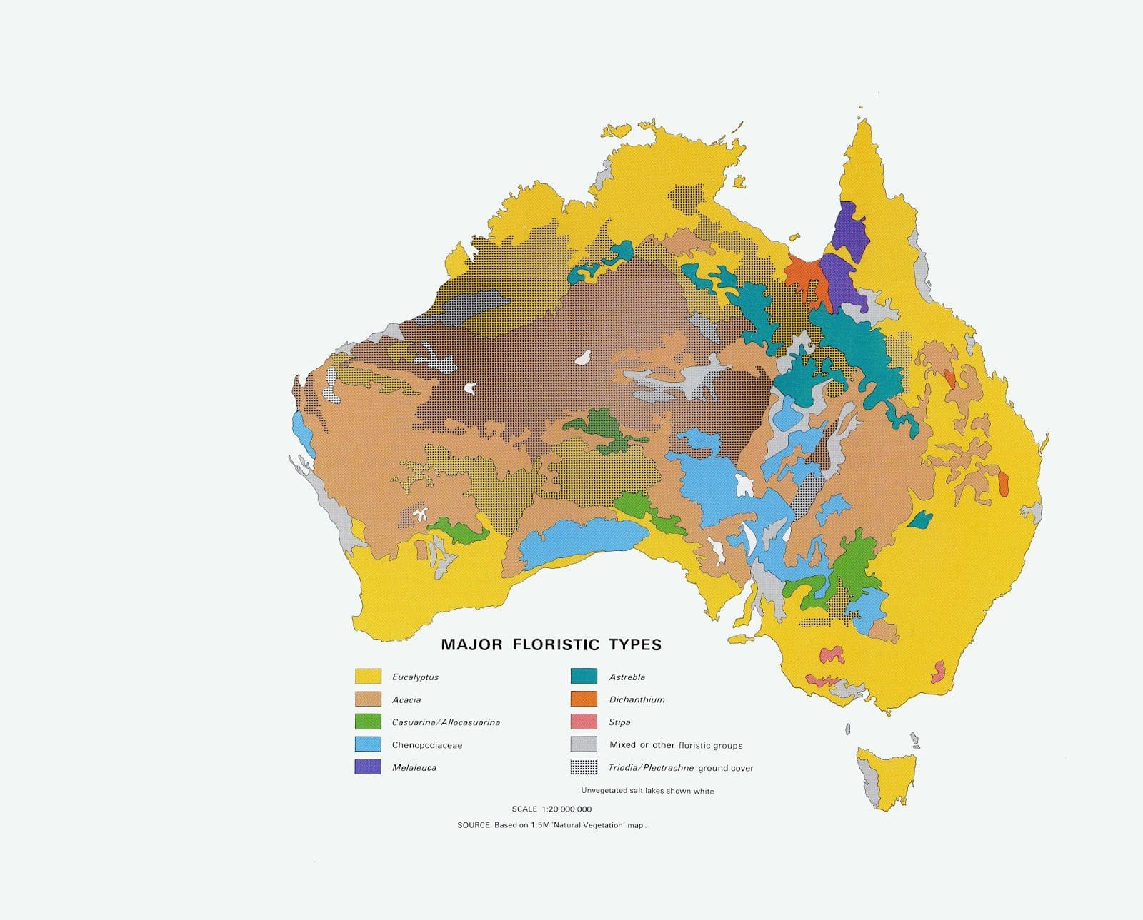
Friday. 28 April 2017. Day 2. Drive 400km from Balranald to Mildura to Renmark and then along the northern bank of the Murray River to Morgan – where we spend the night on the bank of the river where the Murray suddenly turns right (after heading west-north-west for hundreds of km) and heads south to its mouth. Very interesting and changing country all of the way. A huge change of vegetation after we crossed the Murrumbidgee at Balranald (and the Murrumbidgee headed south to join the Murray). The vegetation that had been constant since Wagga (and is the same vegetation belt that heads north to about the Carnarvon Range in central Queensland) suddenly disappears and is replaced by a spindly Casuarina and skinny eucalyptus that we haven’t seen before. After Renmark we followed the Goyder Highway that we think follows the Goyder Line which marked the limit of agricultural activity – 10 inches (250mm) of rain (average) per year. Optimistic. https://en.wikipedia.org/wiki/Goyder’s_Line
I have seen some discussion that with a warming world, Goyder’s Line is moving south. I would think that we have too little data to be able to tell. A very long term average is needed, not just a few years. Also, the Australian continent does a very good job at keeping rain from reaching very far inland. In winter, when rain mainly falls in South Australia, an enormous high pressure system sits over the continent and pushes rain bearing ‘fronts’ to go south. These fronts are the main rain systems for South Australia. A warming world would surely weaken the high over Australia and so let in more fronts and rain. Perhaps we do not know yet, but warm usually means more rain and cold usually means deserts and famine.

The right angle bend that the Murray River takes at Morgan is due to a band of very tough limestone that contains it from going north and forces it south. Morgan is close to 34ºS – ie about the same as Sydney on the East coast.
Morgan was once the largest, busiest inland port in Australia with 6 trains a day carrying goods (mainly wool) to sea ports in South Australia. We tend to have forgotten that Australia had a series of inland ‘ports’ on its big rivers – Bourke on the Darling; Echuca, Morgan and Murray Bridge on the Murray – with huge competition between them to get the traffic of wool. Before big diesel trucks rolling along black-top roads, water was the cheapest way to transport goods. Imagine the cost of pulling a heavily loaded dray with a bullock team making 5-10 km per day and taking months to get anywhere. Walking around the old wharf at Morgan (which was over 100m long and had river boats lined up for a kilometre to dock) and the old limestone buildings is like an outdoor museum.
http://www.murrayriver.com.au/paddleboats/river-boat-trail-morgan/

Just south of Port Augusta is a huge solar-powered tomato farm.
http://reneweconomy.com.au/world-first-solar-tower-powered-tomato-farm-opens-port-augusta-41643/
After lunch, we visited the Wadlata display in the centre of town – an interpretive history display covering geology, aboriginal stories, explorers, early settlement. Extremely good and worth the visit. I’ll have to get the camera out soon.
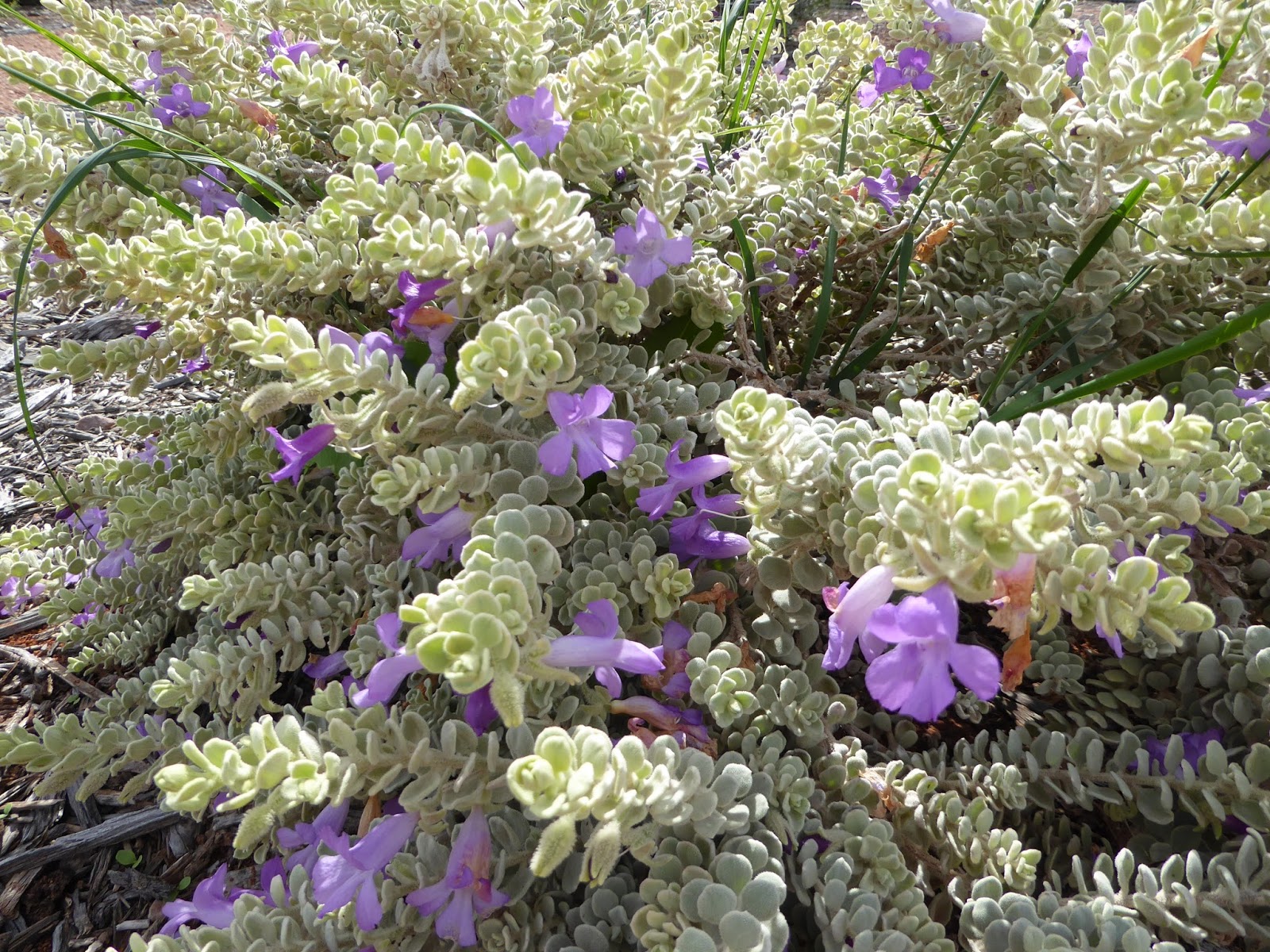
Sunday 30 April 2017. Day 4. A day off in Port Augusta. We had the morning at Australian Arid Lands Botanic Garden and wandered for 3 hours around the plantings that were begun in 1994. An extremely good collection of Australia’s 200 Eremophila species which are in every imaginable foliage type and colour, shape, structure and flower size and colour. One of the local acacia species (Acacia papyrocarpa, Western Myall) can live for up to 600 years old. Not bad for a shrub.

Also Chenopods – which we know as saltbush and samphire – has a very large number of species and are important arid country plants. Bird life: singing honeyeaters, spiny-cheeked honeyeaters, white-browed babblers and mulga parrots. The Arid Lands Botanic Garden is very good and well worth a visit. From there we headed back to town to fuel-up and food-up for the trip through the middle. As Helen says the whole long trip is made complicated by having to chuck out all fruit and veg at every border. The checkpoint into South Australia just west of Renmark is very thorough – the inside of all fridges, vans and cars is inspected thoroughly for fruit and veg. (We did get out lettuce back.) We have another check at the NT border and a very thorough check going into WA. Makes planning food tricky.
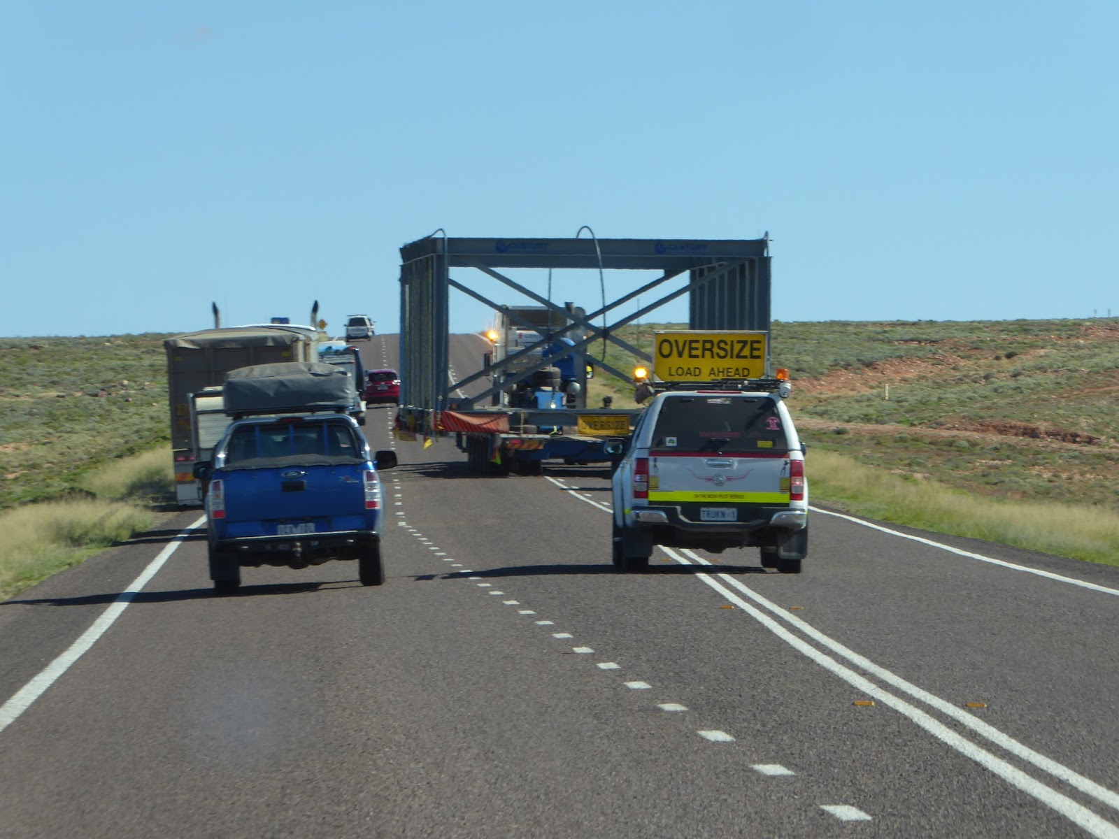 Monday 1 May 2017. Day 5. Drive 290km to Glendambo Roadhouse. Very straight roads with Chenopods (mainly samphire) as the tallest vegetation for most of the way. When shrubs were present, they were Acacia papyrocarpa (~pa-pie-ro-kar-pa) which grow to 3-4 metres. The lakes on either side of the road (which are usually dry) had water. Lake Hart is full. We called in at Woomera for a short look at the open air display of rockets, projectiles and aircraft that were tested at Woomera over the years. A real shame that Australia did not keep investing in the science, engineering and maths of rocketry.

We had the skill and then disbanded it. Now at the bare dirt campground of Glendambo – at 31ºS (about Tamworth in NSW). Not many in the campground, which is very run down and which we think would get very full at the height of the season. Spiny-cheeked honeyeaters. A cold front came through just after sunset – very cold, strong winds. Brrr.
Tuesday 2 May 2017. Day 6. Drive 250km to Coober Pedy. Straight and flat. Initially with low growing Acacias along the track (and the beginning of Dead Finish Acacia tetragonaphyllia). For the last 100 km or so, the tallest lifeforms were grasses and low growing Chenopods. We are at the Opal Inn Caravan Park near the centre of town – chosen because of warnings about theft from the vanparks on the edge of town. Water is very scarce in Coober Pedy. The town has its own desalination plant and sells water for $1 for 40 litres.

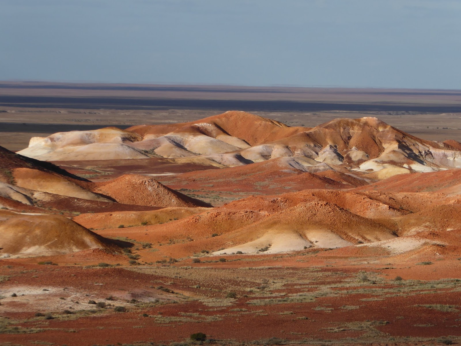
Tuesday afternoon, we went on a ‘Town and Breakaways Tour’ with Wayne of Arid Areas Tours. Excellent. After a tour around the highlights of the town including Fayes Underground House, Old Timers Mine, Serbian Church, Crocodile Harry’s, we drove out the the spectacular Breakaways. The Breakaways are heavily eroded mesas with hard silica tops that have formed an unusual landscape. Unusual enough to have formed the scenery of several movies: Mad Max, Red Planet.
Wednesday 3 May 2017. Day 7. Rest day at Coober Pedy. 29ºS (which is the same latitude at Ballina and Tenterfield and is windy). We did very little. A wander along the main street of Coober Pedy (which is lined with opal shops – unfortunately the designs are very old fashioned). Bought supplies at a very well stocked IGA. The town and surrounds are littered with the remains of old movie sets. I’ve downloaded a few geological maps – can’t help myself. 1,600km for the week.