Western Australia 2019 trip – week 4
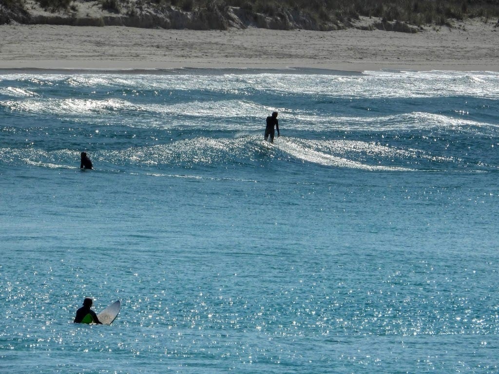
Tuesday 17 Sep 2019 Day 21. We drove 100 km to Albany – mainly through farm land (was dairy now beef). Along the way we stopped to look at Ocean Beach (near Denmark) which is an excellent surfing beach. As looks to be normal for these WA rivers, they don’t quite get to the sea and are blocked off by sand making a delightful pond where the river backs up behind a sand bar.
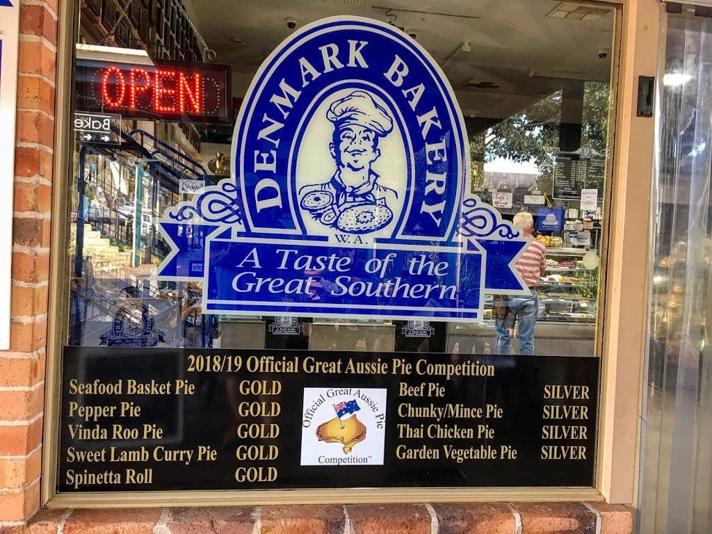
The find of the day was Denmark. Best bakery in WA (if not Australia). It certainly wins all the prizes. Good pies. We hung around there for a few hours.
We are now at the 1849 Albany backpackers. We have a small room and share shower/toilets with all. It looks a bit run down. Certainly after the excellent place we’ve had for the last few days. However, it is friendly and full of young people laughing. What more do you want.

Wednesday 18 Sep 2019 Day 22. We had a very slow start today and did little in the morning except walk to the Tourist Information and to the supermarket. A bit of exercise. In the afternoon, we headed for the ANZAC Memorial. Albany was the last Australian port for the departing ANZAC fleets in 1914, hence a significant memorial here. First, we went to the Desert Memorial for the Light Horse troops. Then to the ANZAC Memorial itself, where we had just paid up when there was a power cut – evacuate!
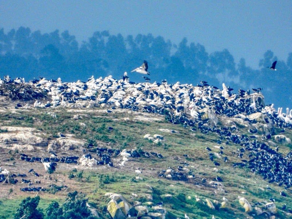
We went to look at Emu Point where we saw a pelican and straw-necked ibis rookery on a nearby island. If you look carefully. lower left is a small creche of young pelican and straw-necked ibises.
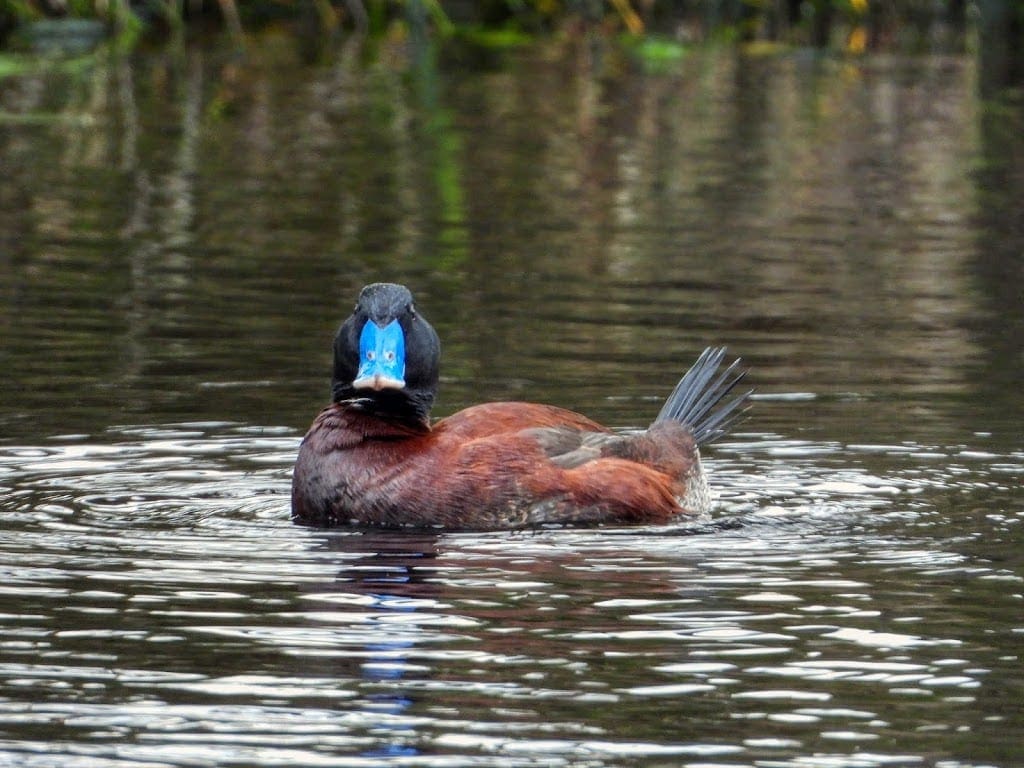
Then to nearby lake where we saw three blue-billed ducks. Is that bill not blue? How about that tail. A fair bit of drizzly rain and strong wind this afternoon.
_
Thursday 19 Sep 2019 Day 23. A day of wind. We went first to the ANZAC Memorial Museum to do the visit we missed yesterday. It is very well done with good use made of technology to tell the stories of individuals. I’ve now seen too many of these and just get upset at the waste of it all.
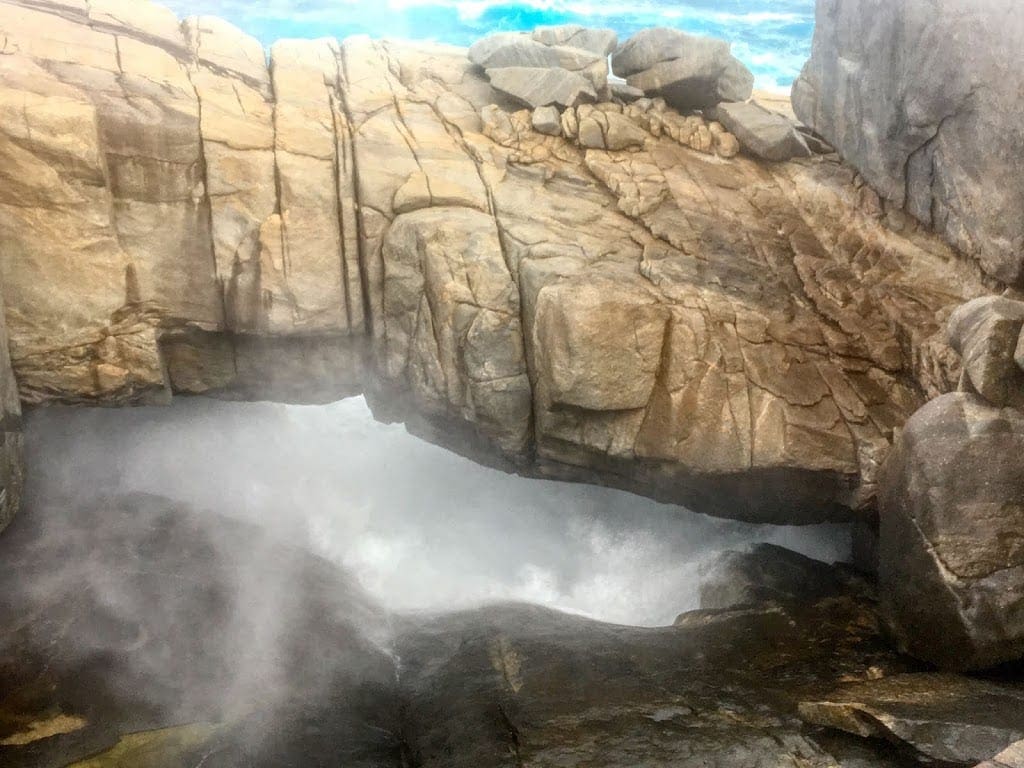
After a quick lunch, we headed off towards the Whale Museum and turned off to what was the excitement of the day – Natural Arch and The Gap. Did I mention that it is windy? Rain and hail arrived while we were watching huge waves crash at Natural Arch. We ran back to the car. Luckily I had not taken my camera, it would have been soaked. We were. And blasted with hail. (Pix with iPhone.)
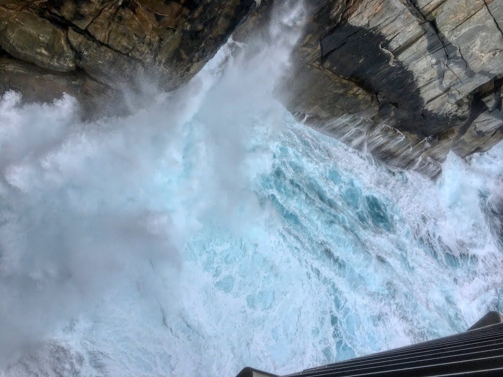
Ventured out again with a break in the rain to see The Gap. Huge waves were sending waterspouts from this feature. Did I say fucking windy? We were almost blown off the viewing platform and had difficulty getting back to the car. Excellent fun! He is not happy until he is wet, wind blown and hailed on. Delighted.
It’s been dusting with snow in the Stirling Ranges just north of us and I’m still silly enough to be running around in shorts.
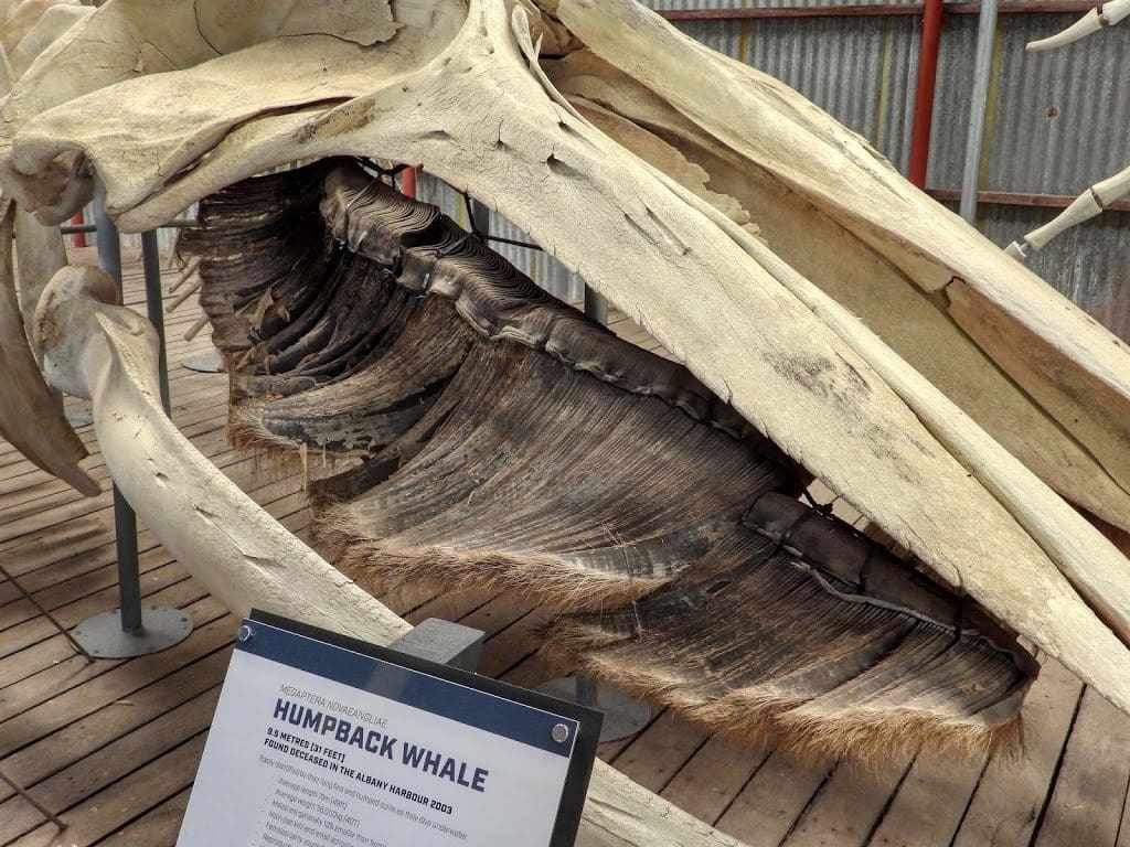
Then, to the Whale Museum for a tour. The tour was good, but it was a gruesome description. Hard not to throw up. I did not enjoy it at all. I kept likening what they were describing to the ovens at Auschwitz. Would we have such a museum to celebrate what the Nazis did there?
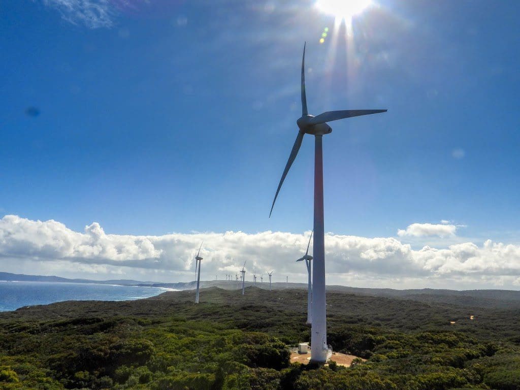
Friday 20 Sep 2019 Day 24. Our last day in Albany. More sunshine than yesterday. We ventured out to do a few of the walks around the wind farm – managed to get back to the car before the rain.
I know people complain about wind turbines ruining their lives. I was confident that I would not feel anything. As it turned out, I was adversely affected by the wind turbine – headache and ‘compressed head’ feeling. I took my hearing aids out and that feeling disappeared. Interesting.
I quite liked our 1849 Backpackers at Albany. A bit dive like, but the young community who live there is interesting. Many are employed in the town.
Saturday 21 Sep 2019 Day 25. We drove first to Porongurup National Park and walked up the track to the ‘Skyways’ walk; 4.4km 2 hours return. Fairly steep up and back and we certainly took longer than the 2 hours for the return. We had three heavy showers come through and give us a good drenching. Loved it. Nothing quite like walking up a track running with water.
However, we did get a bit too cold by the time we had got back. We made the mistake of eating our lunch in the ‘shelters’ near the car park. That got us properly cold.
We found a coffee and cake at a nearby winery Ironwood, which revived us.

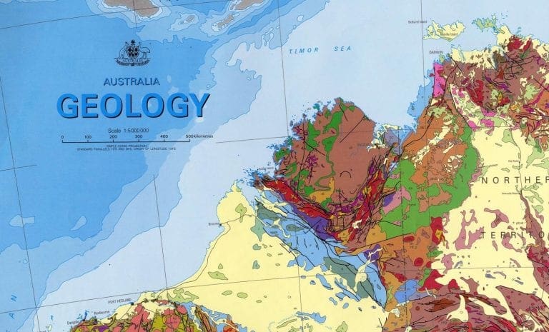
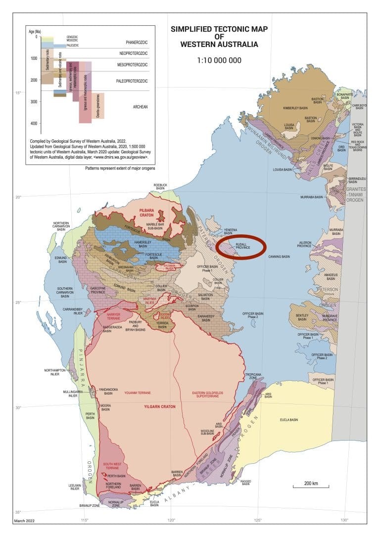
Porongurup is a large granite batholith the was part of a mountain building exercise on the southern edge of the Yilgarn Craton about 1.35 billion years ago.
On then to our accommodation for the next 5 nights. We are at Stirling Range Retreat. We expect that this will be something special with twice daily bird tours and daily plant tours. There should be enough for us. No wifi and only a very poor/non-existent phone signal. Make do.
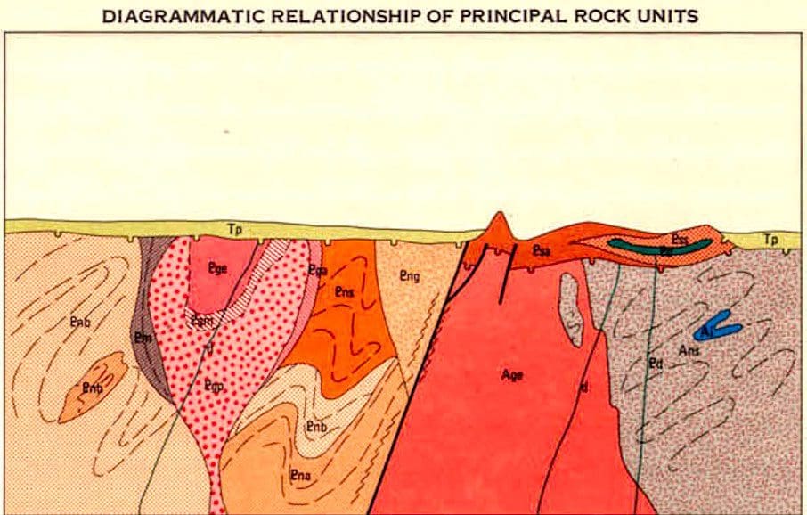
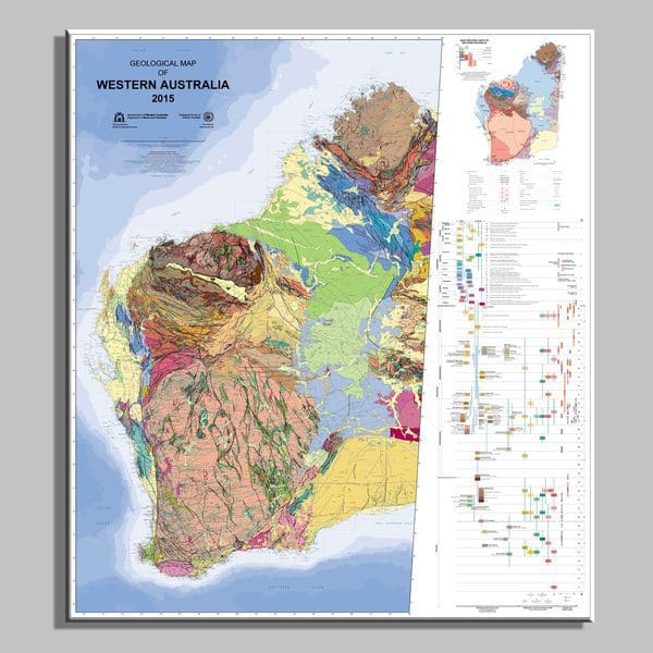
Porongurup is separated from the Stirling Range by only about 40km. The Stirling Range is even older at 1.5 billion years ago and was made when the Craton went over a bump about 1.1 billion years age. It is mainly sandstone deposited about 1.75 billion years ago in a basin (mainly removed) from an even older mountain building phase. Some to the sandstone, etc has been metamorphosed to give quartzite, slate, etc. In the geological section above, Porongurup is the pinky crossed blob on the left and Stirling is the large red chunk to the right with a big fault separating it from the rocks to the left. Almost everything covered by a Tertiary siltstone.
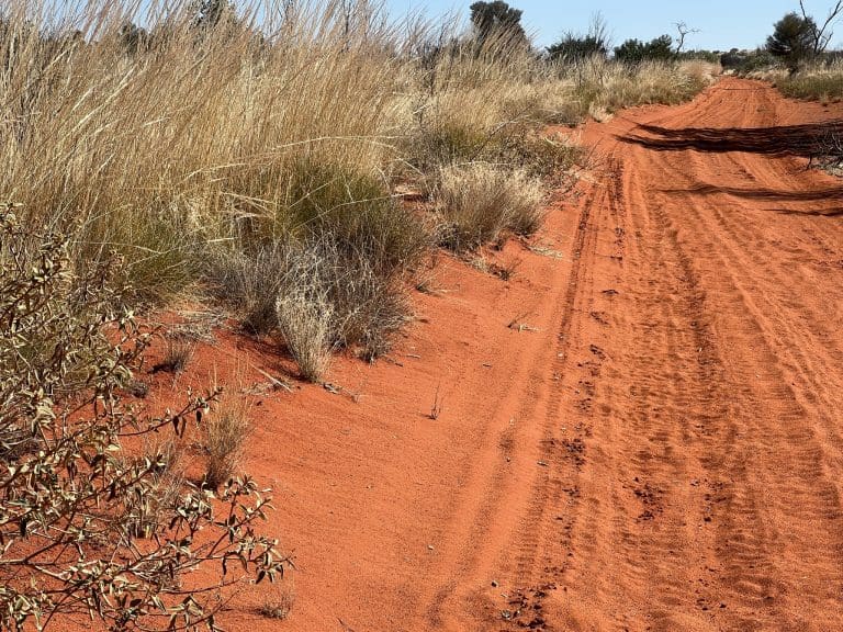
Immediately after leaving Porongurup, the vegetation changed from the wetter coastal to the much drier interior.
Sunday 22 Sep 2019 Day 26. Our first day at Stirling Range Retreat. This is a truly excellent place. This morning we went on the 8am bird walk – $20 each. This was an excellent walk. Pauline showed us the bird rich stops in this bird rich few hectares.
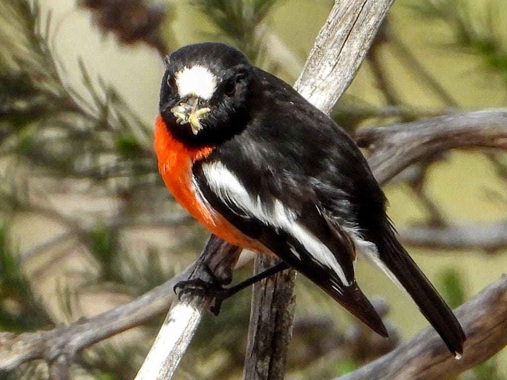
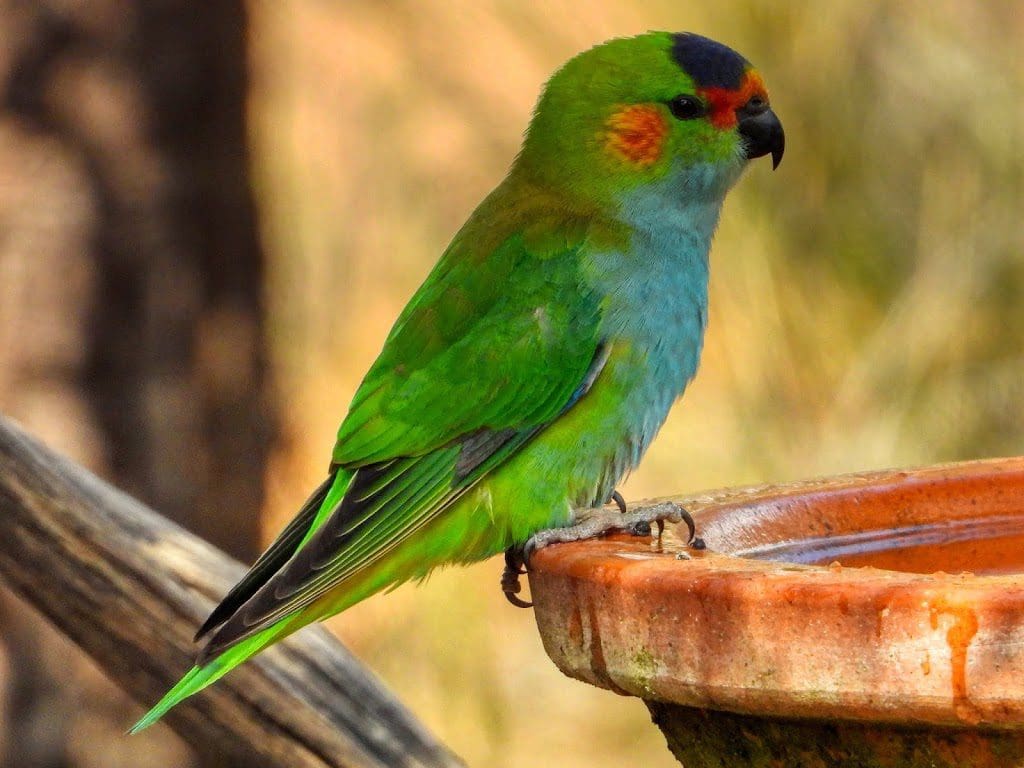
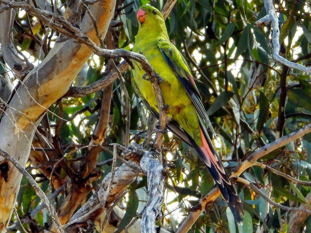
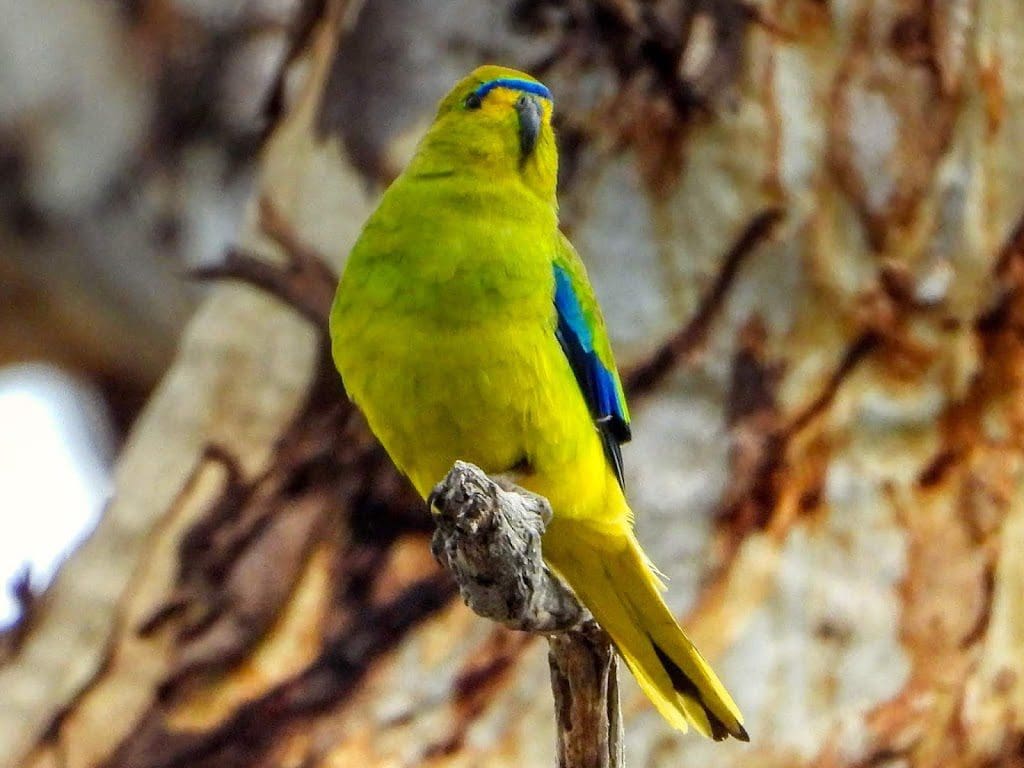
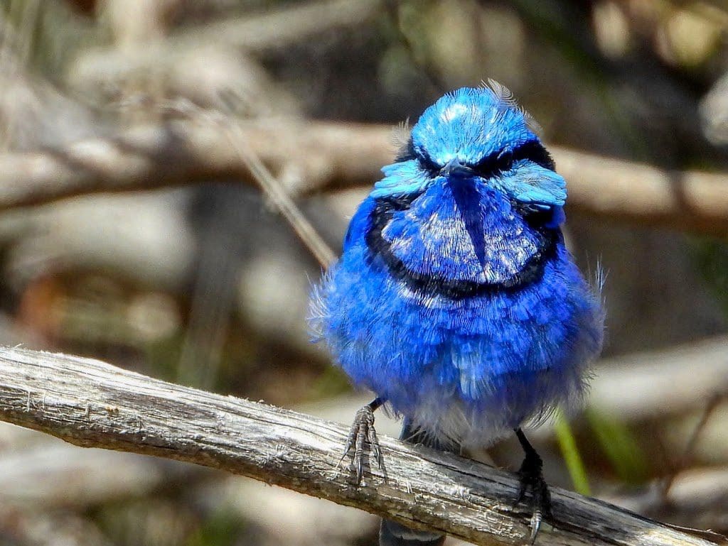
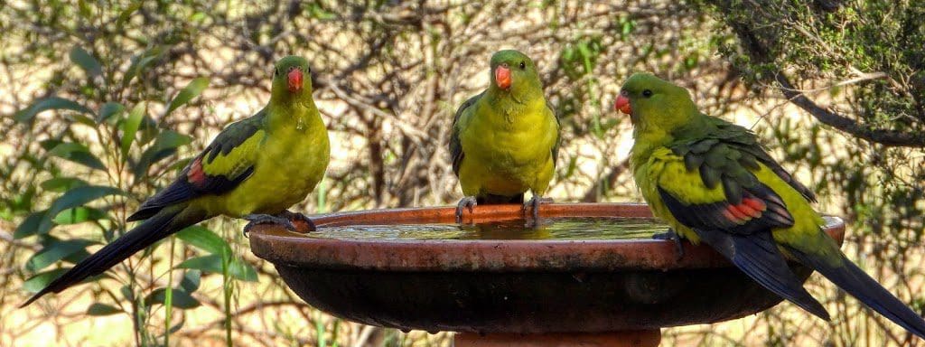
We saw three of the parrots from here (Elegant, Purple-crowned, Regent) plus Splendid Fairy-wren, Scarlet Robin, Western Yellow Robin and quite good photos of Grey Shrike Thrush, Restless Flycatcher, Dusky Woodswallow.
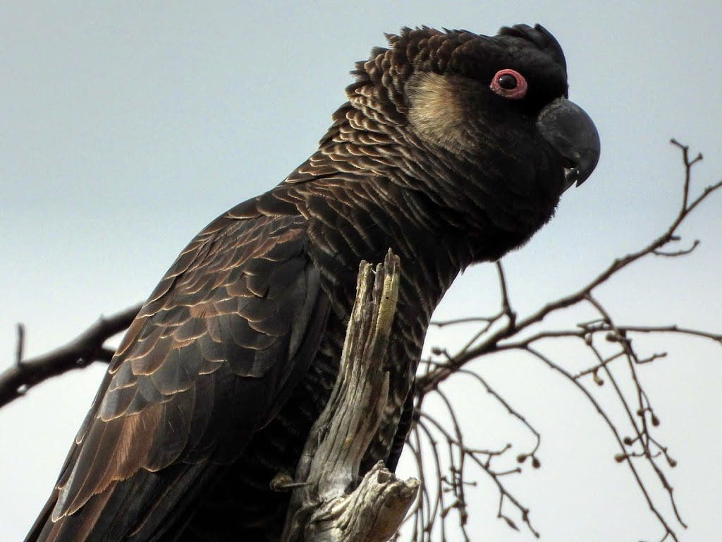
I took 143 photos of which 92 survived my first cull. I saw but did not photograph Carnaby’s Black Cockatoo. I added 16 new photos to the bird slideshow just from today. This is an excellent birding location with many hard to see local species on display – especially with the assistance of a guide.
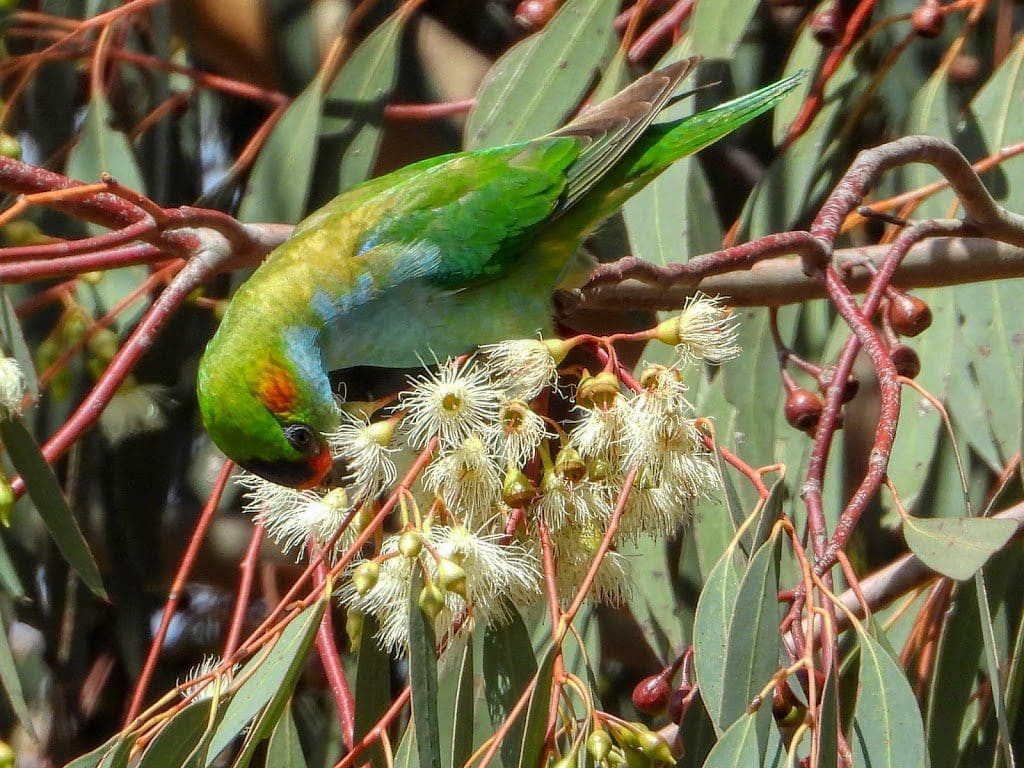
I really enjoy watching the purple-crowned lorikeets slithering through the leaves from blossom to blossom. Very active and very difficult to photograph.
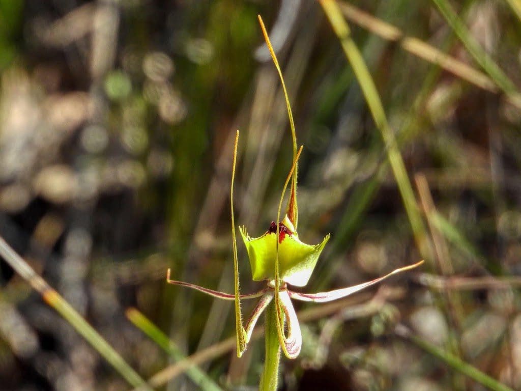
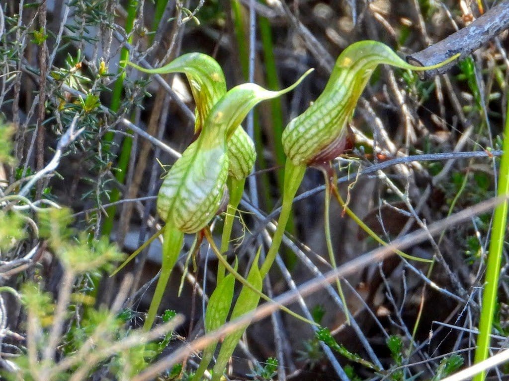
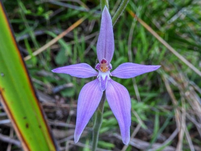
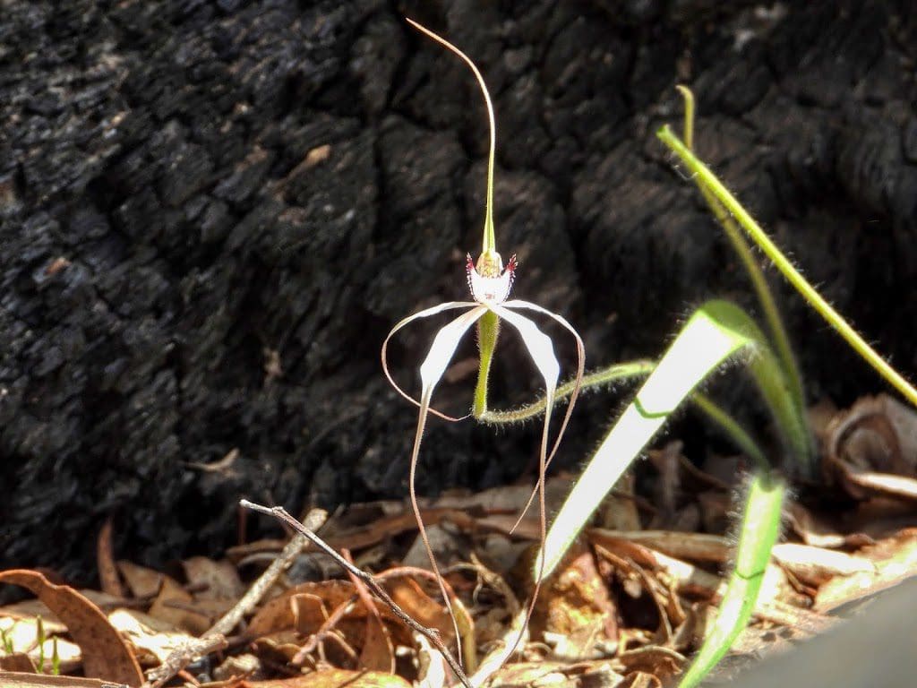
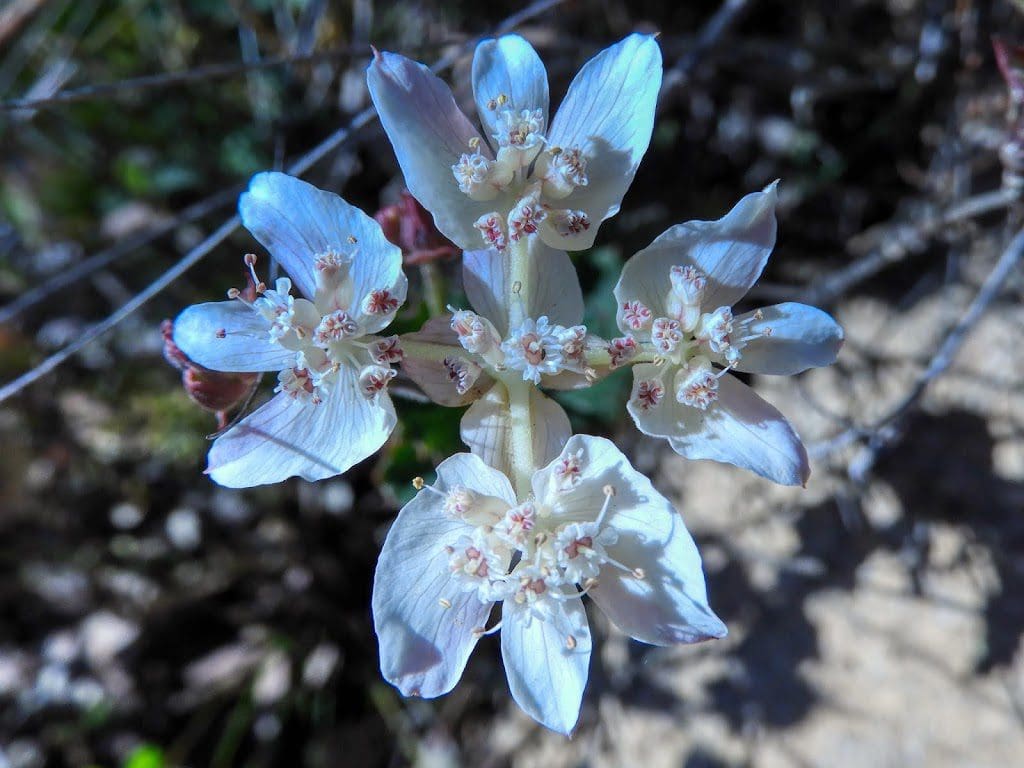
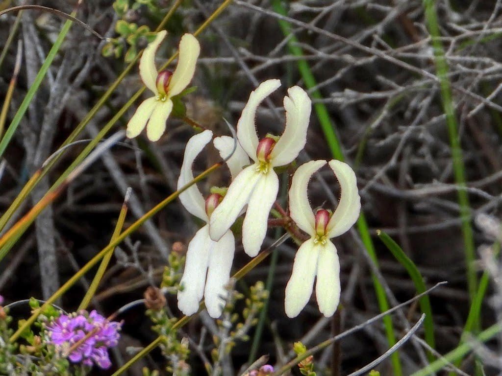
Monday 23 Sep 2019 Day 27. We had booked on the 3 hour, 9am Orchid and Wildflower Tour ($49 each) with ‘Bully’ or ‘His Majesty’.
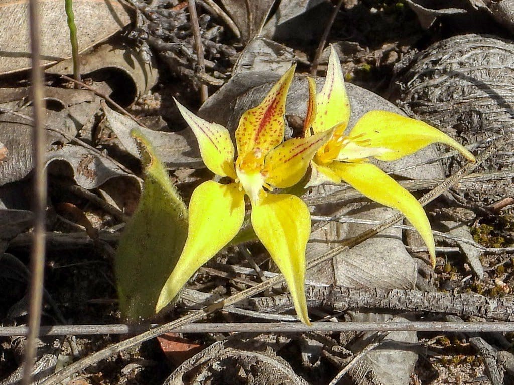
There are 1,5800+ plants in the Stirling Ranges – 82 or so are found only here. Orchids flower all year around and we hunted down the many that are in flower.
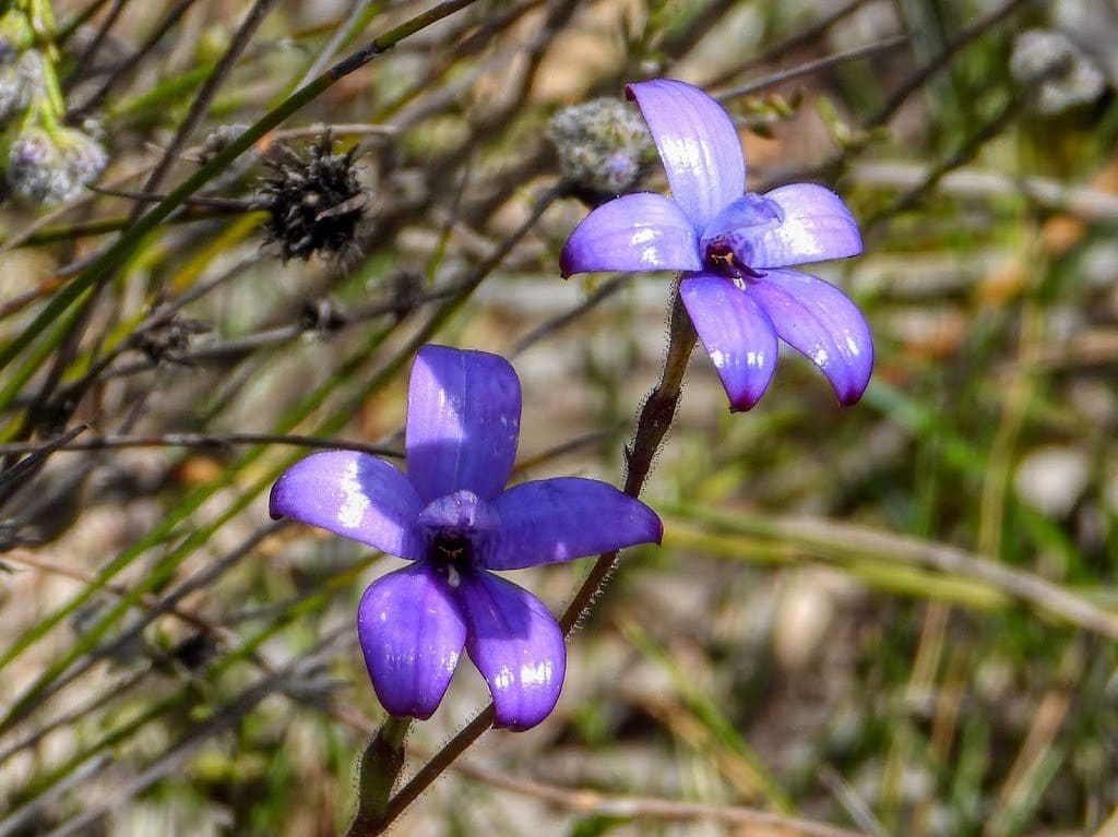
Bully is certainly knowledgeable about orchids and plants.
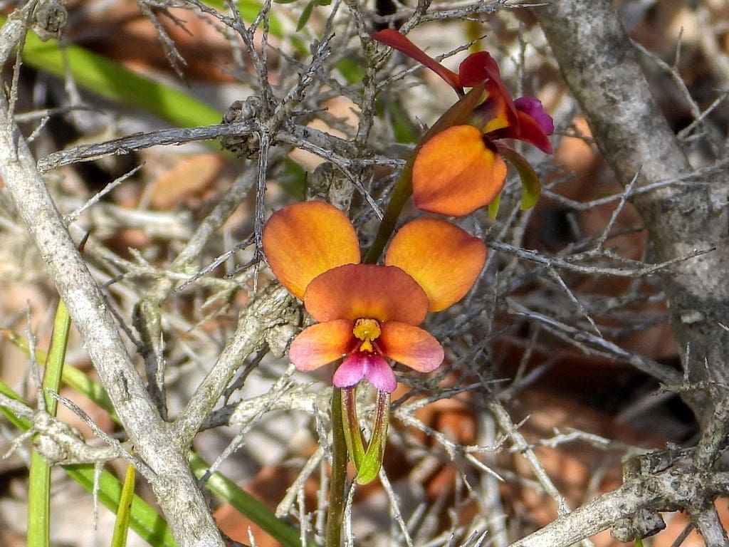
By the end, we were just a tad orchid-ed out.
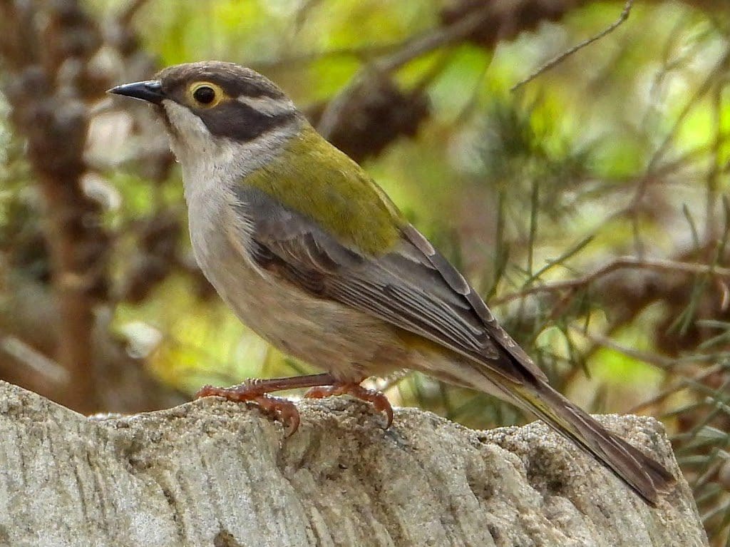
After lunch, I set up my camera overlooking one of the two birdbaths. Quite a lot of good bird photos. Some species and some individuals are at the water for parts of a seconds – in and out in the blink of an eye. Others, like to take their time and have a look around.
Tuesday 24 Sep 2019 Day 28. Two excitements today. First, we had a short walk up Bluff Knoll – the second highest peak in the Stirling Ranges.
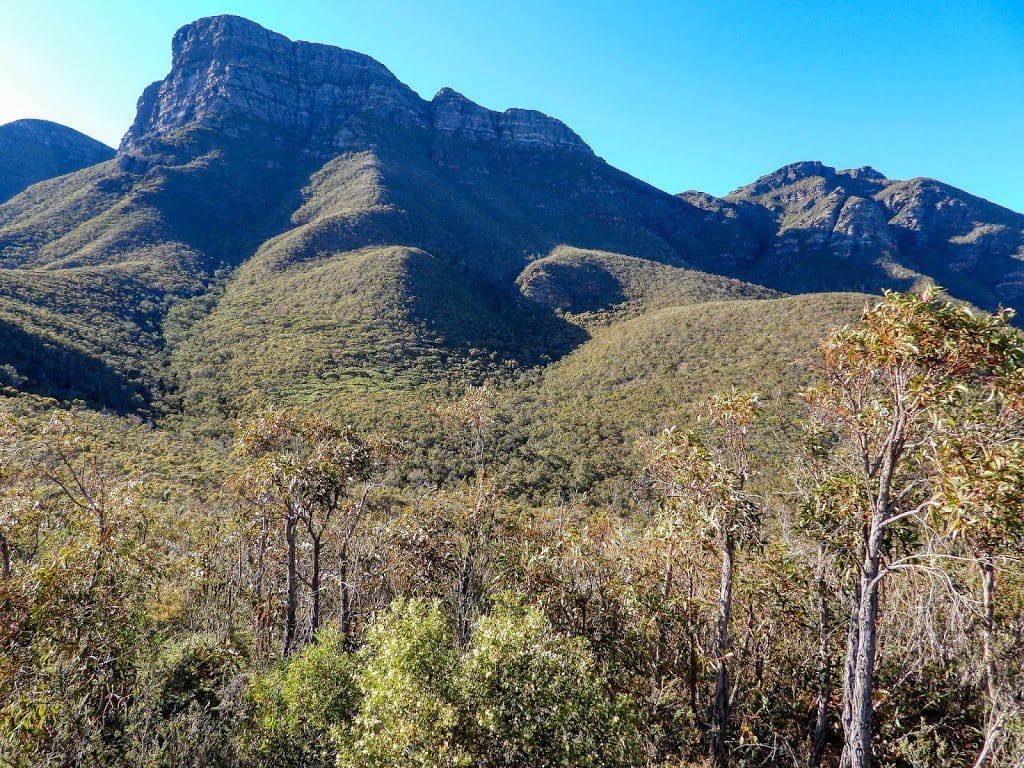
When I say ‘up’ I mean that we went 1.5km up the steep track towards the summit. A bit of a climb. Younger legs went past in a rush. We ambled and took photos. The 250m of heath immediately after the carpark was one of the most beautiful and prolific that I have seen.
Changes in vegetation from heath to mallee and back to heath and back to eucalypt – why did it do that? It has to be geology. The rocks underfoot were low grade metamorphics – slate and phyllite. The harder stuff (sandstone and quartzite) is in the peaks.
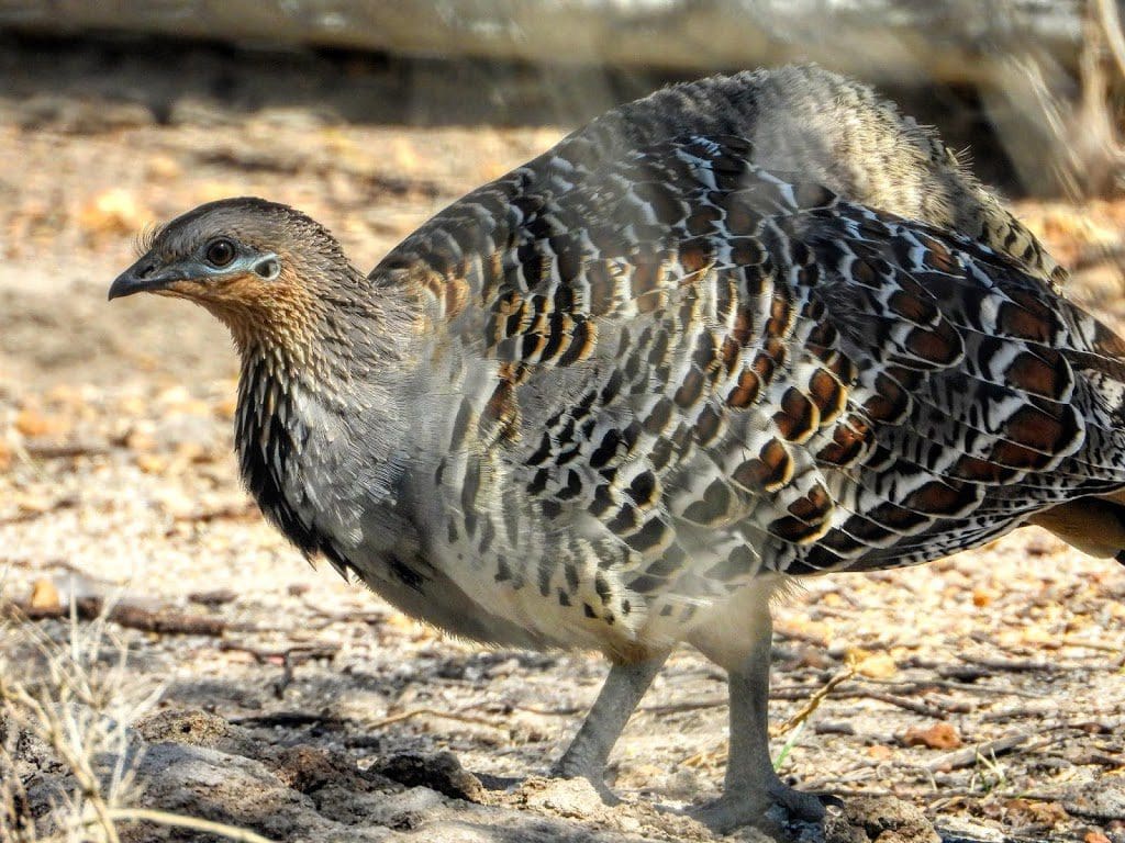
We then drove the 50km north to Ongerup where there is a Malleefowl park. They have managed to preserve a tiny bit of the Malleefowl’s habitat and put an aviary around an even smaller bit of it that has a few breeding birds. All the rest of the mallee – the birds normal habitat in which there were thousands of birds – has been knocked down for wheat.
Also at Orgerup was a local wildflower show put on by the local museum/herbarium – in village of about 500 people. We had an excellent talk with the two locals who were on duty.
On the way back we debated two interesting and related questions.
- Is there a geological reason for the huge plant diversity in SW WA? Is it a combination of arrival of angiosperms (flowering plants) about 125 – 80 m years ago, break up of Gondwana about 65m years ago, stability of this chuck of the Yilgarn craton, its frequent popping under and out of the sea, east Australia’s mountain building.
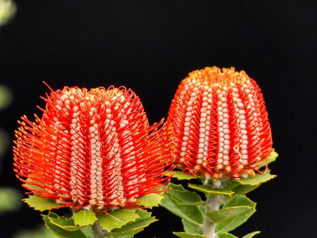
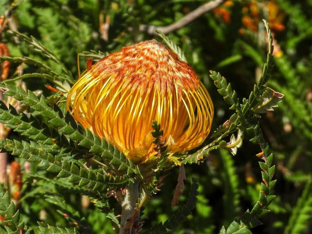
- More than 250 species of Acacia occur in SW WA and about 50 Banksia species (compared with just a few in the east) – why are there so many? What were the different needs, opportunities for species proliferation? What influence was soil type, isolation, microclimate, pollinators?
In the end, we decided that it is the harshness of the conditions. When everything is hunky-dory and everyone can survive without stress there is no need to adapt. But when things get extremely difficult, it might be a single individual that has something that allows it to survive when others don’t. As Darwin said, little changes add up over time to a new species. SW WA has certainly had times when climatically it got very difficult. So, we might have had a few individuals that made several new species to give the diversity we see now. But … why just here?
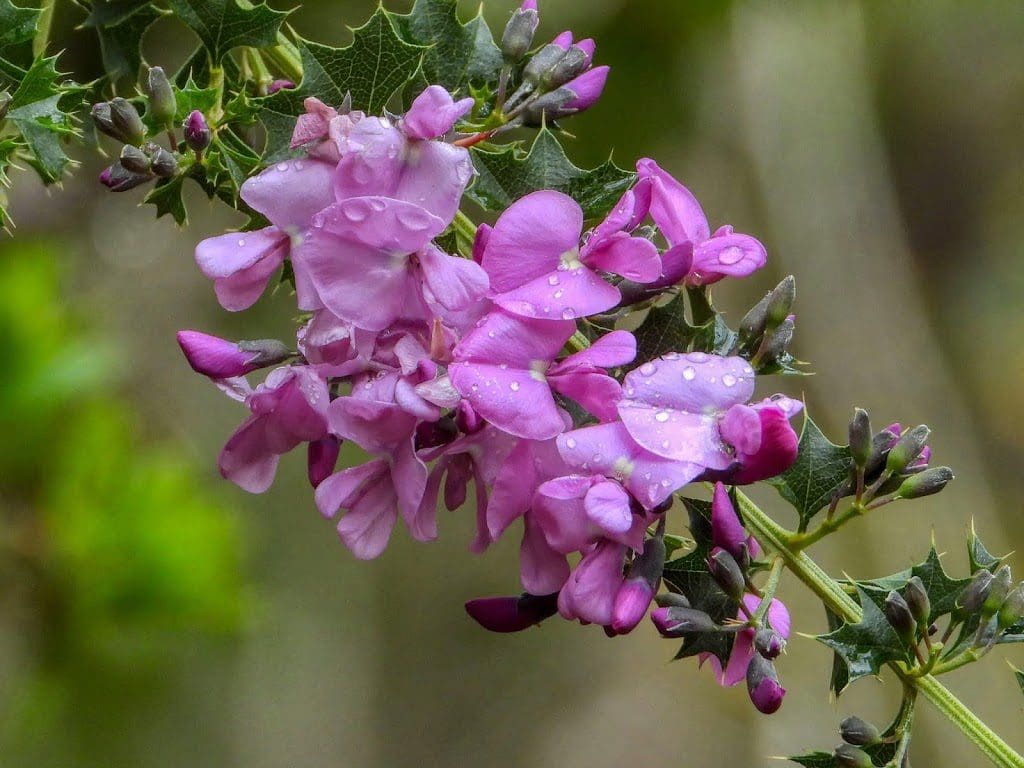
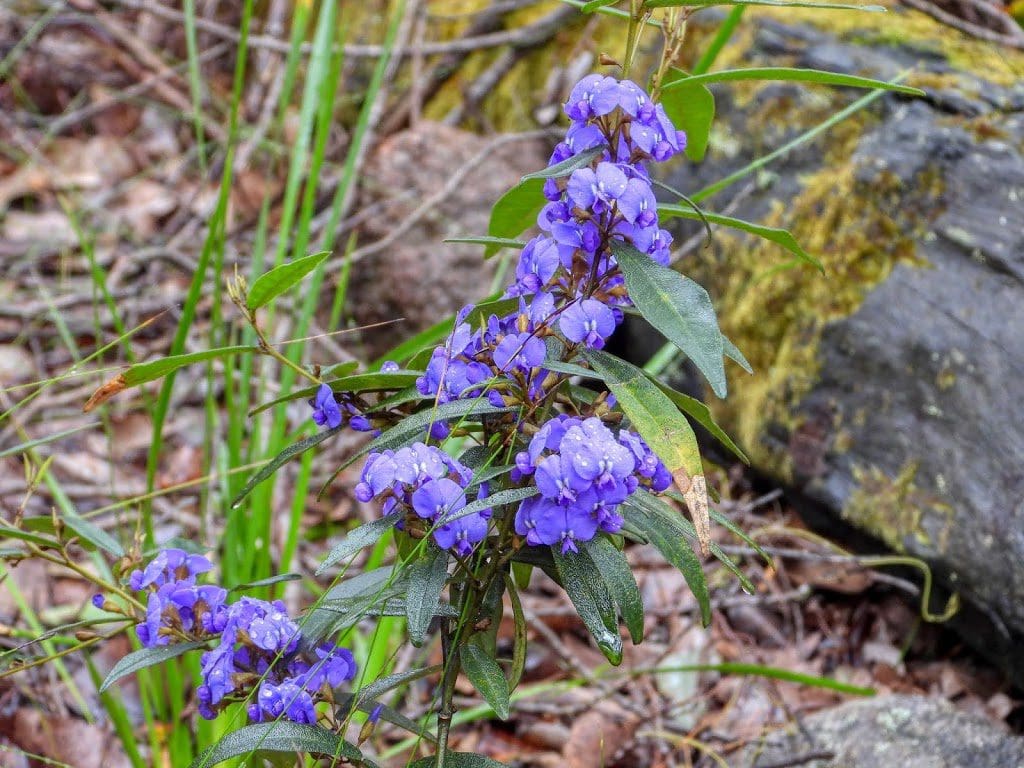
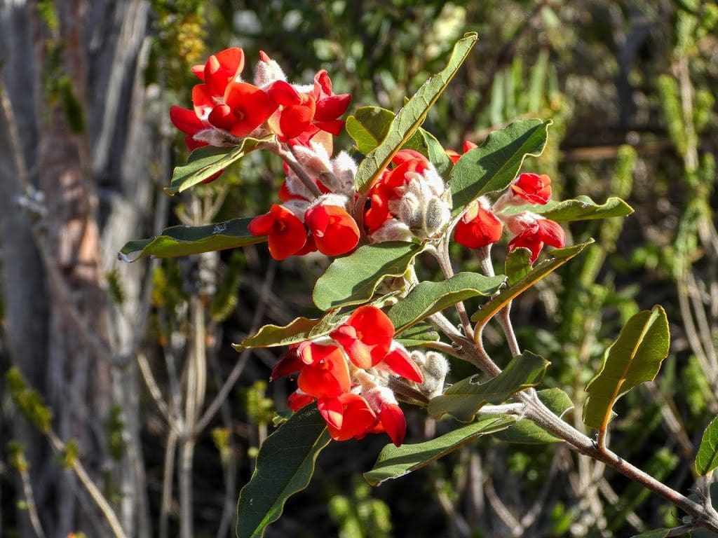
Wednesday 25 Sep 2019 Day 29. A bit windy and occasional light shower this morning which stopped our proposed mountain climb. We are getting a bit wildflower-ed out. We went for a walk to recover and what did we find – wildflowers.
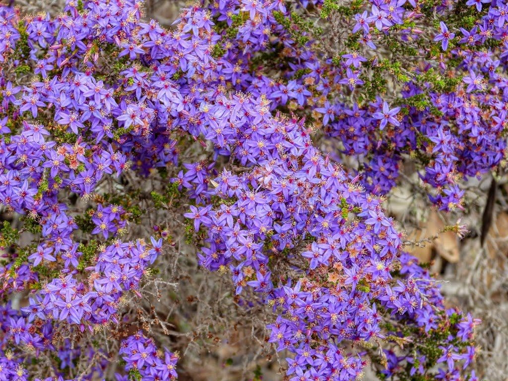
It is extraordinary the number and variety of wildflowers growing in the most difficult, harsh conditions. Probably, if all was happy and easy living they would not have had to form new species to occupy a little niche that allowed that bit to survive. A tough dry land – with scratchy, stoney wheat fields running right up to it.
That is the end of our 5 days here. Stirling Range Retreat is certainly a wonderful place to visit if you are interested in birds and plants. The difficulty here is that there is no phone reception of wifi. Five days without either is difficult.