Western Australia 2019 trip – Week 1
Intro. We are on a 5 week trip through WA. The first 2 weeks we will be with Kimberley Safari Tours travelling from Broome to Perth (through the Pilbara and down the coast). The last 3 weeks we will be driving ourselves around SW WA looking at wildlife, vegetation, landforms and flowers.
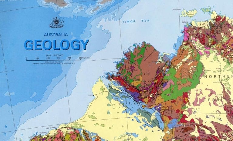
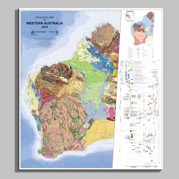
As you might expect, I’ve spent a bit of time acquainting myself with the geology of where we are going. These are a few of the useful resources:
- Department of Mines WA has a good introductory page and a good video on the construction of WA.
- I did read all of ‘The Geology of Australia’ by Johnson and Henderson. Although this is quite good for geology of the eastern states, it mostly ignores WA. A fairly good book on the construction of WA is ‘The birth of supercontinents’ by Johnson – also from WA Mines Dept – which looks at plate tectonics during the time span 2,000 million to 541 million years ago.
- portal.geoscience.gov.au gives access to geological maps for all of Australia and allows useful addition of map layers to help.
- Pilbara Geological Supplies is a useful place to buy a geological hand lens 10x.
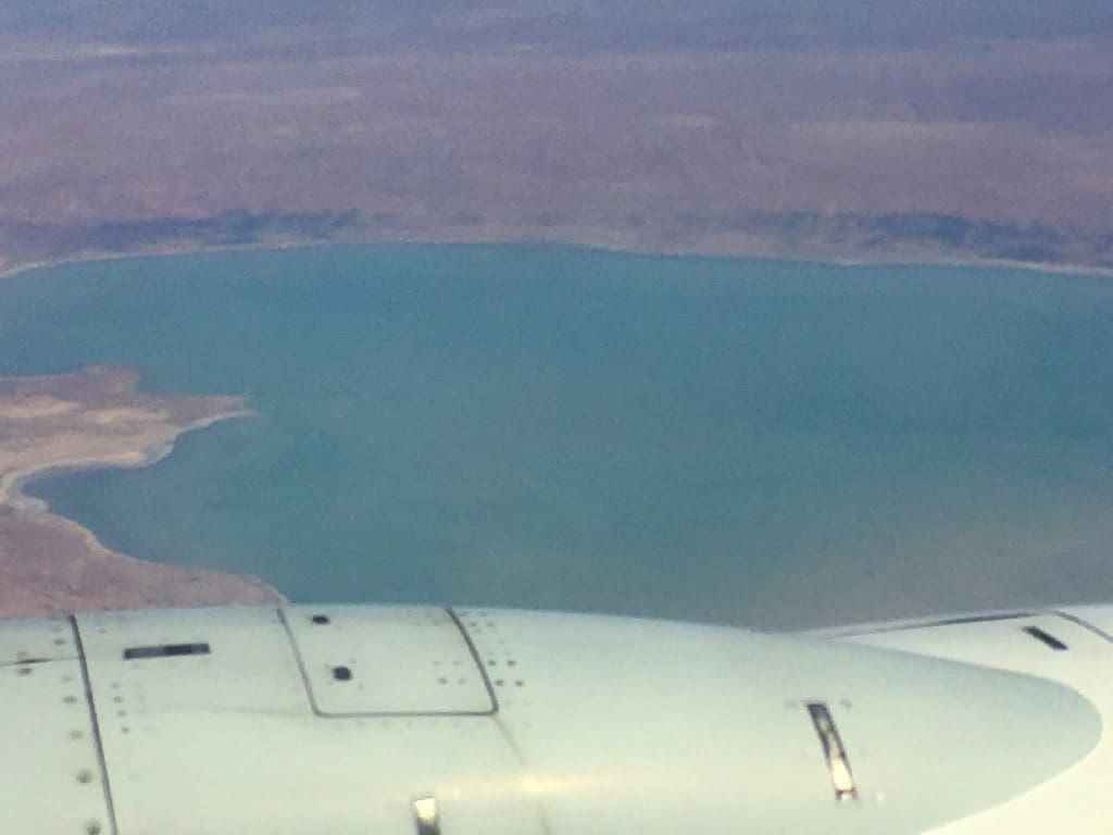 |
| A rare watery Lake Eyre |
I will skip over the initial part of getting from Wagga to Sydney by train and from Sydney to Broome by plane and the single overnight in Broome. Although … the plane ride was spectacular and we both ended up with window seats and had excellent views of the desert – over Lake Eyre and Uluru. We’ve been raving about it for a few hours. I did take quite a few photos with my iPhone.
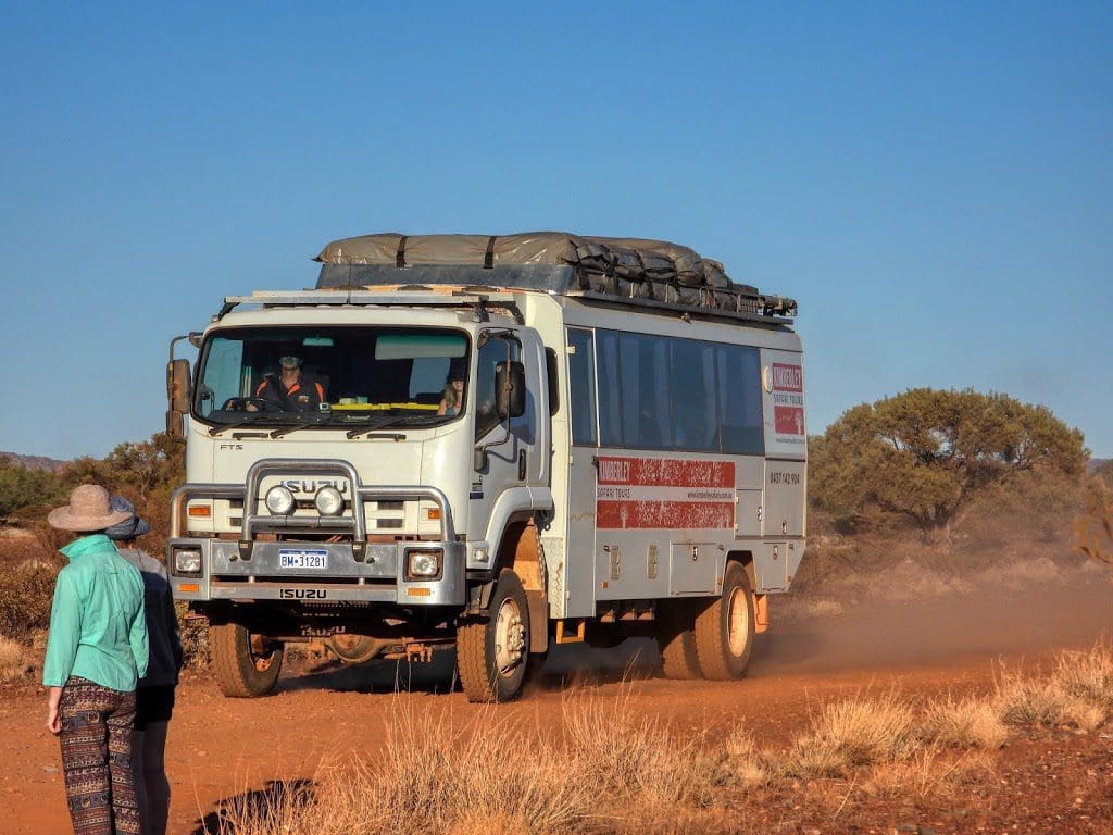
Wednesday 28 August 2019 Day 1. We were picked up just after 6:45am from our Broome accommodation (Moonlight Bay Suites) by the Kimberley Safari Tours truck with Matthew driving and then collected the rest of the group from around Broome and Cable Beach. Immediately onwards for our longish drive today. Our first stop was at Barn Hill Station when we stopped for morning tea. This is an excellent campground and would be an excellent place for an extended stay.
Then on to the Sandfire Roadhouse for a late lunch. and then on to 80 Mile Beach where we are staying for the night on a nice grassy patch in the middle of the campground. A short walk down to the beach during the afternoon.
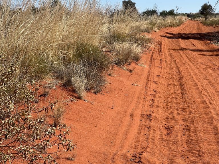
The road from Broome to here is straight, running across sand and mud covered with low shrubs – mainly acacia. Very few trees. Just before we reached 80 Mile Beach, we drove across a few sand dunes that make up the western edge of the Great Sandy Desert.
Thursday 29 August 2019 Day 2. Left 80 Mile Beach campground at 7:10 after getting up at 5:20. Drove along straight roads to Port Hedland. Until De Grey River we were on a Quaternary cover over the Canning Basin and Cretaceous Sandstone. This country is subject to periodic cyclones that dump a metre or so of rain at a time. Yet, there are no rivers. We are told that it just covers the land in a horizontal layer of water making its way to the sea. Hmm. From De Grey River, we entered the Pilbara with rocks about 2.5-3 billion years old.
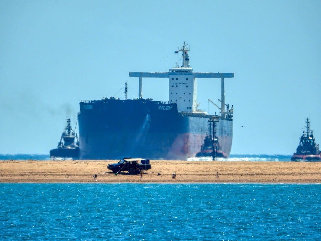
 |
| Empty (high in the water) boat pushed into place |
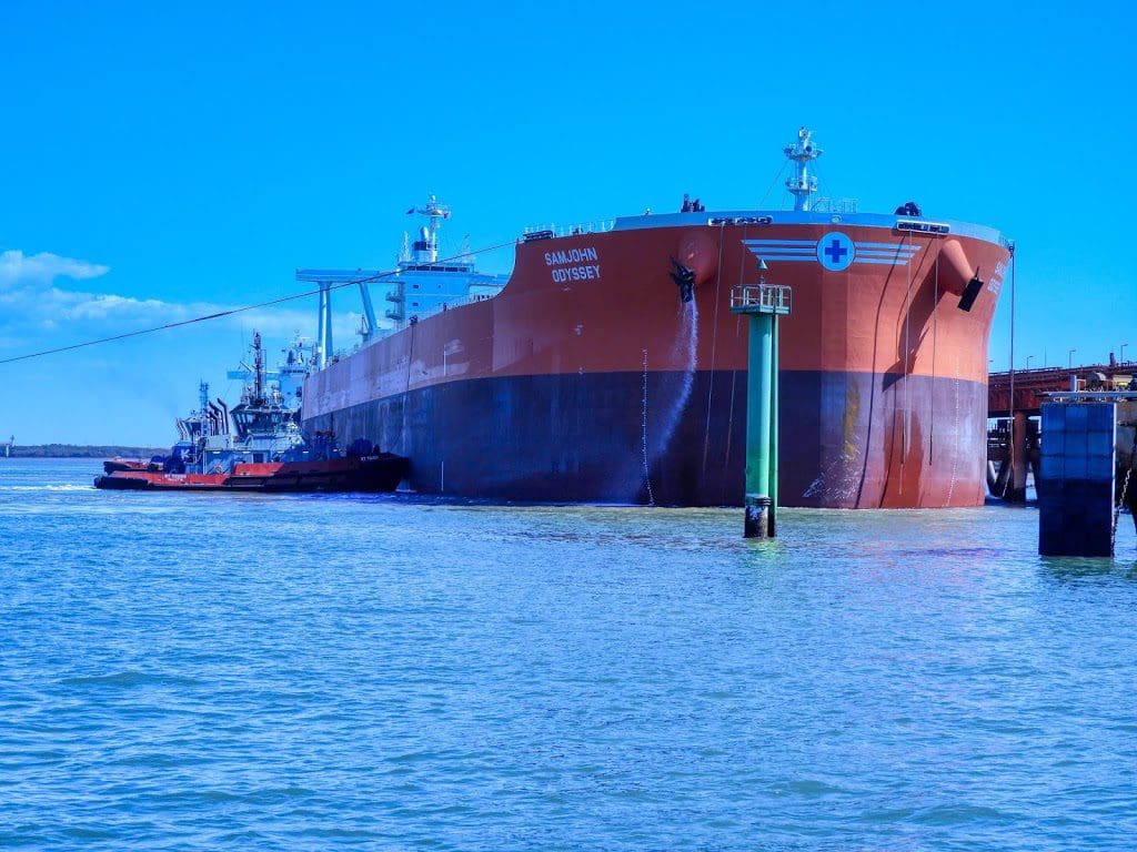
At Port Hedland, we had a tour of the Port put on for us by the Seafarers Centre. After a talk about history of the Port and staggering tonnages, we joined the boat making its round to pick up seaman for their 4 hours on land (where they bought up big) and delivered another lot back each complete with stuffed backpacks and white carry bags.
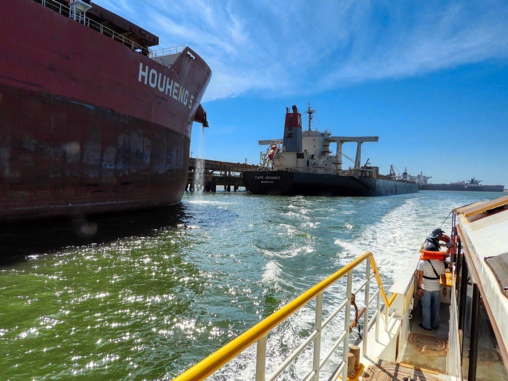 |
| Close boat is empty Distant boat is full (low in the water) |
The tonnage being filled each 24 hour period and moved out on each high tide is staggering. Hundreds of thousands of tonnes. According to the Port Authority, in August 2019 alone, 220 visits by ships exported almost 44 million tonnes of iron ore accounting for 91.67% of ship visits. In 2017-18, Port Hedland handled 519.4 million tonnes. Most of that is export and most is iron ore. Despite these jaw-dropping figures, plans are underway to almost double the current capacity. A very impressive tour – eye opening.
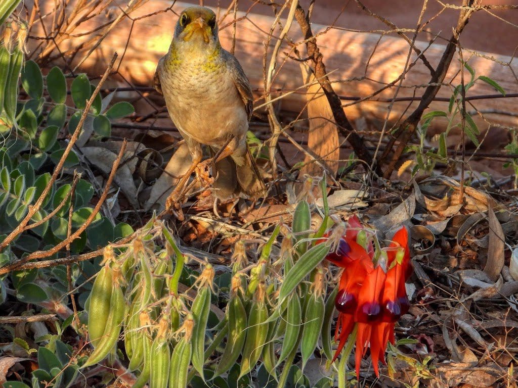
From there we had a short (one hour) drive to our overnight stop at Indee Station – a working cattle station where we saw the tail-end of the day’s muster. We are camped against a back fence in the homestead paddock with Sturt Desert Peas along the back of the tent with a yellow-throated miner feeding on them. Bliss. We slept without the fly over the tent with a view of the stars.
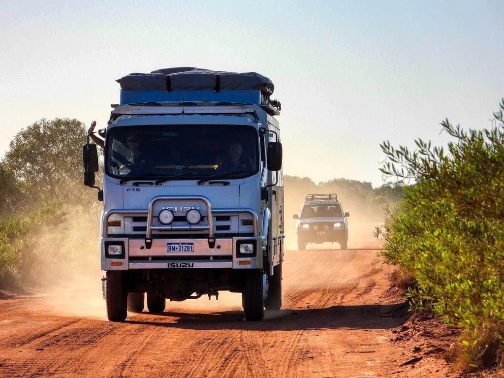 |
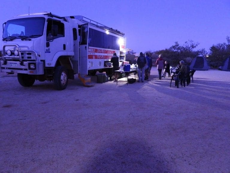
| Kimberley Safari Tours – Broome to Perth – Matthew Bambach driving |
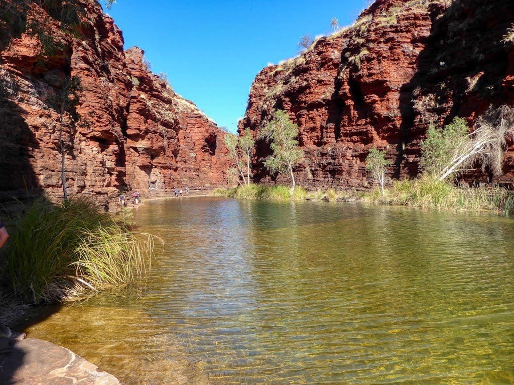
Friday 30 August 2019 Day 3. Drive to Karijini National Park took the morning. Along the way we passed many iron ore mines with a constant stream of four trailer road trains taking ore to Port Hedland.
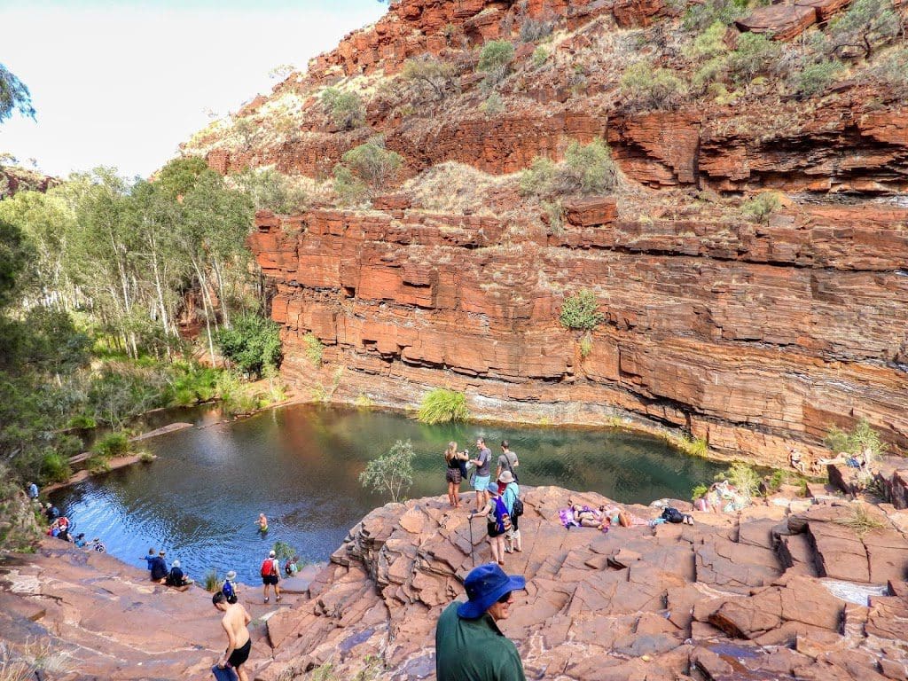
We are camped at the Dales Gorge camp area. A very flat campsite covered in small pebbles – difficult for tent pegs. After lunch, we went for a walk to the Gorge and an excellent swim in Fern Pool (for me) and the main (Fortescue Falls) pool for Helen.
A bit on the warm side when we walked the 5 mins to the Gorge top from our campsite, but the water is delightfully cool and we had a good chance to cool off.
We headed back to camp just on 5pm. An excellent restful day.
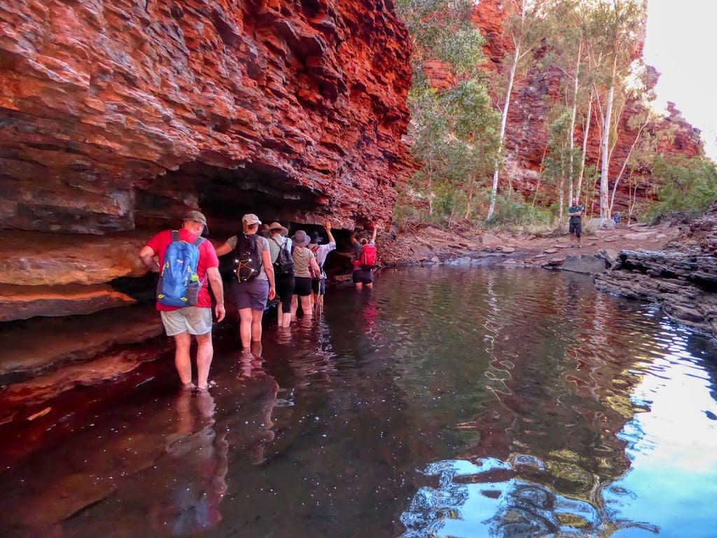
Saturday 31 August 2019 Day 4. Today was two spectacular gorges which both involved a fair bit of clambering and climbing. The first was to Weano Gorge which was a gentle walk in.
Then a walk through water, down a difficult ladder (made of rock bolted to the rock wall) to the beautiful (cold) Handrail pool. I did not swim.
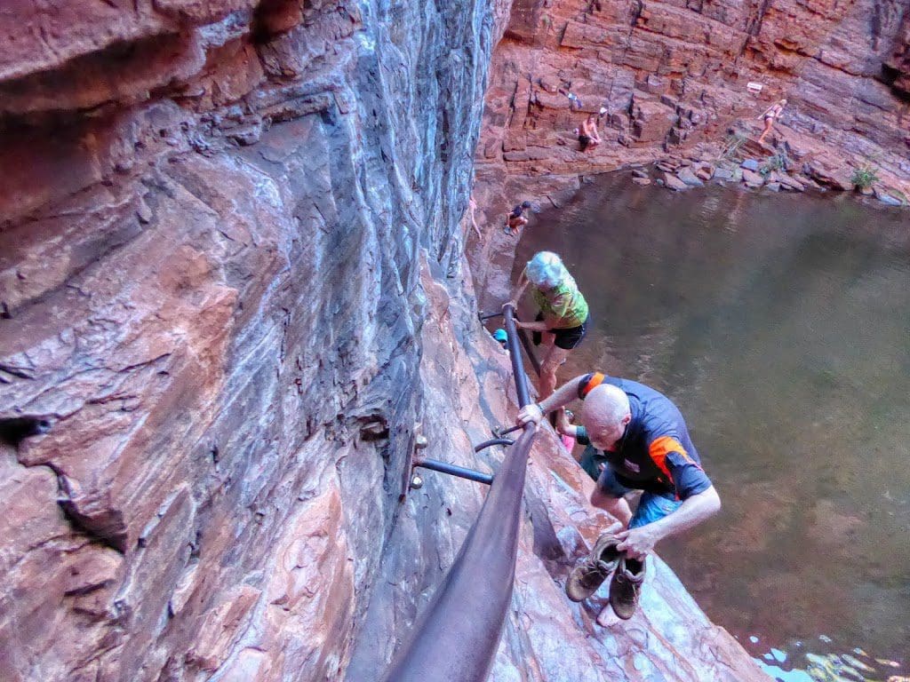
I did have a bit of a fall when one of the new knees did not bend enough to get me down a very long step – and threw me off into the rocks below. A bit bruised and skin off an elbow but ok. Climbed out of that one ok.
 |
| Walking away from Handrail Pool |

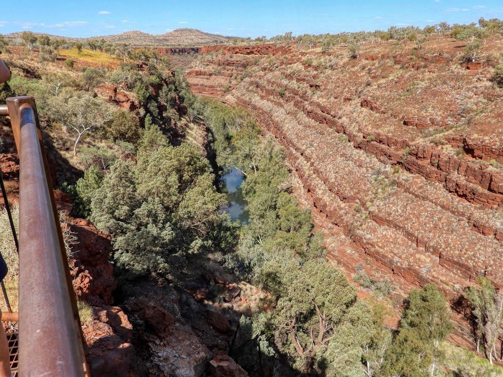
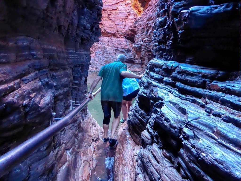
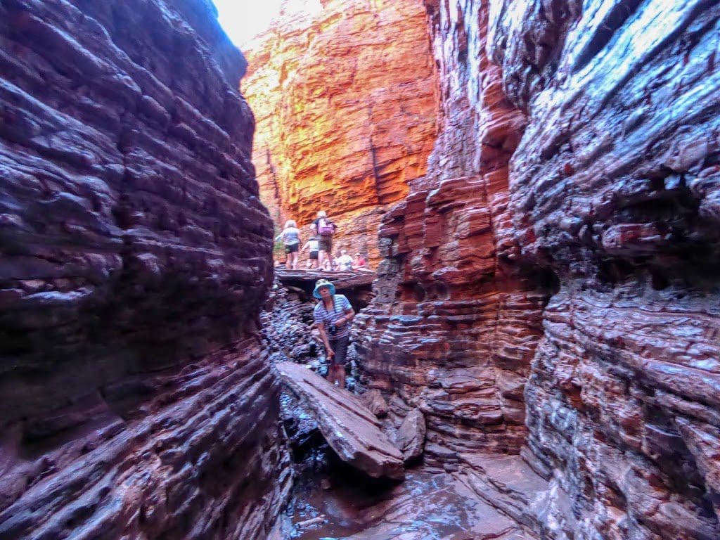
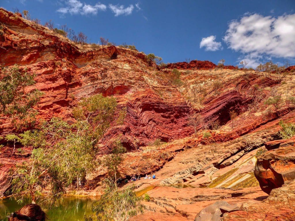
We then tackled a much more difficult gorge, Hancock, which began with steep steps and two ladders to the gorge bottom. Then, a walk along the gorge bottom – initially over rocks (slabs of Banded Iron Formation BIF) that litter the gorge floor, then through a long pool with slippery rocks.
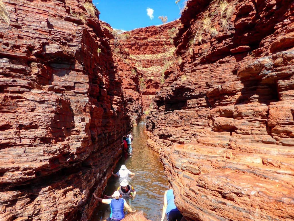
I stopped there, the rest went on through a long pool that needed swimming. I was not up to that and did not regret it. We then climbed back up the ladders and steps to the top. Very hard work for me. The work I did at the gym was a good but insufficient preparation. Although the steps were not as high as what I was using at the gym. there were an awful lot of them.
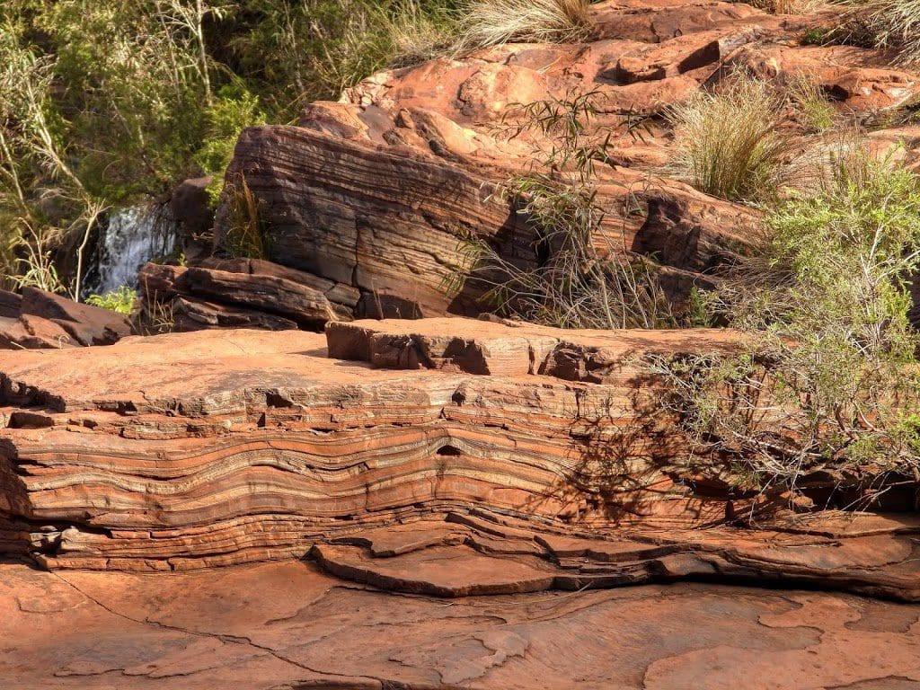
It is worth saying that the gorges cut down through BIF that is 2.8 billion years old – and are spectacular. I’m very glad that we’ve come here to see this magic place. I would wish that it was a bit cooler. As with the trip to the Kimberley in 2017, I find the heat difficult and sapping in some way. I certainly knocks me around.
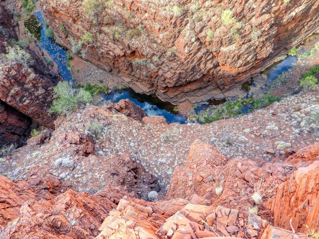
After lunch there, we called in at two lookouts (Joffre and Oxer) to look down into gorges. Then, back to the campground for dinner.
 |
| Kalamina Gorge |
Sunday 1 September 2019 Day 5. Two gorges and a lot of driving. Another of our early starts – up at 5:30 and away by 7:05.
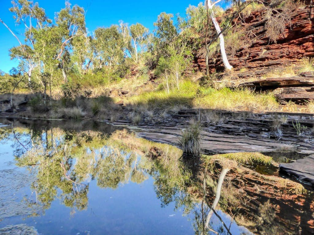
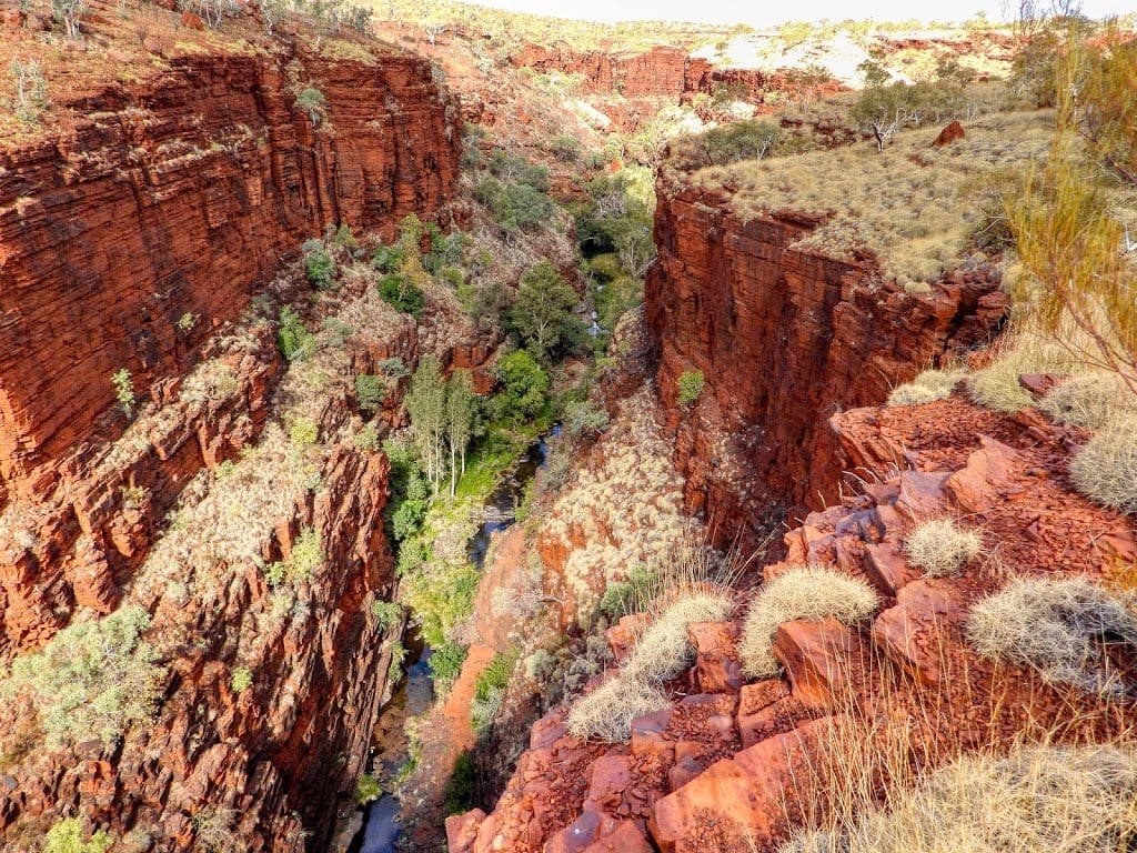
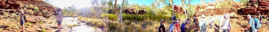
The first stop was the delightful Kalamina Gorge for an excellent walk. The gorge is really worth the effort.

After morning tea, we headed to Hamersley Gorge which is spectacular and a good swim. Mostly the Banded Iron Formation BIF is flat. In the Hamersley Gorge there is some sign of folding and faulting.
A few stairs to get down and up. Then lunch.
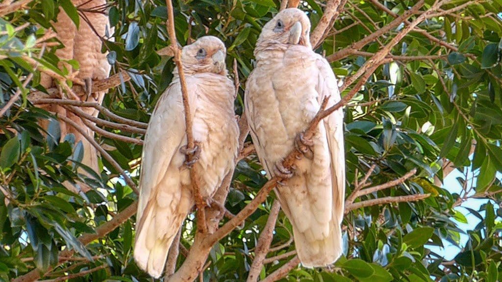
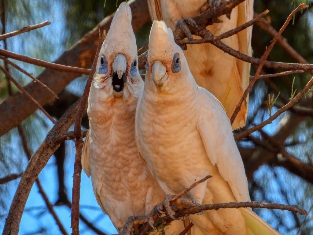
Then, on to Tom Price for a visit to the supermarket to top up with veggies and other perishables. The Little Corellas, which should be scrupulously white, are stained red by the relentless Pilbara iron dust that gets into everything. Then on to Cheela Station for the night.
 |
| Early morning walk at Cheela Station |
Monday 2 Sep 2019 Day 6. A day of driving – 580km in a U-shape to Exmouth at a 21º48’33’S about 1º further north than we were last night. We had morning tea at Nanutarra Roadhouse and lunch at Bullara Station and got into our Ningaloo Lighthouse campsite at about 3pm. We are here for two nights.
Tuesday 3 Sep 2019 Day 7. Snorkelling this morning from a small glass-bottomed boat to see Ningaloo Reef. Most went in and had a good snorkel. I did not go in. At the last minute I realised that I would not cope getting off and onto the boat. The first thing that I have not been able to do since the new knees. To my eyes, the reef at Ningaloo is disappointing with respect to colours and numbers of fish. We were spoilt with all we saw of the Great Barrier Reef in the 1970s and 80s.
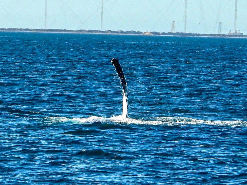
This evening, we went on a whale watch cruise. Quite a lot of humpback whales: blowing and having a good time as they migrate; tail flapping, showing flutes as they rolled and finally, on dusk, breaching. Very good displays. A good trip.
The whale in the movie below is pectoral-finning.