Western Australia 2019 trip – week 3

by | Sep 19, 2019 | Western Australia

Wednesday 11 Sep 2019 Day 15. This was a day off in Perth. We did little except sleep and find a good Malaysian restaurant nearby.

Thursday 12 Sep 2019 Day 16. A day of driving. We caught a Red Cat (bus) to Avis in Hay St Perth to pick up our car. As it turned out, we were early and had to wait for the truck with the car to arrive. We got away fine in a little blue Suzuki Swift. First, back to the Perth YHA to pick up our bags and then Freeway driving to the south of Perth. A stop for lunch at the delightful Bakery at Bridgetown.

From near Bridgetown south, we have been in tall Karri trees – many stands of beautiful timber. For the night we are in a small cabin at a tiny caravan park (Around tu-it Eco Park – the name is appropriate) near Northcliffe. Just over 400km.


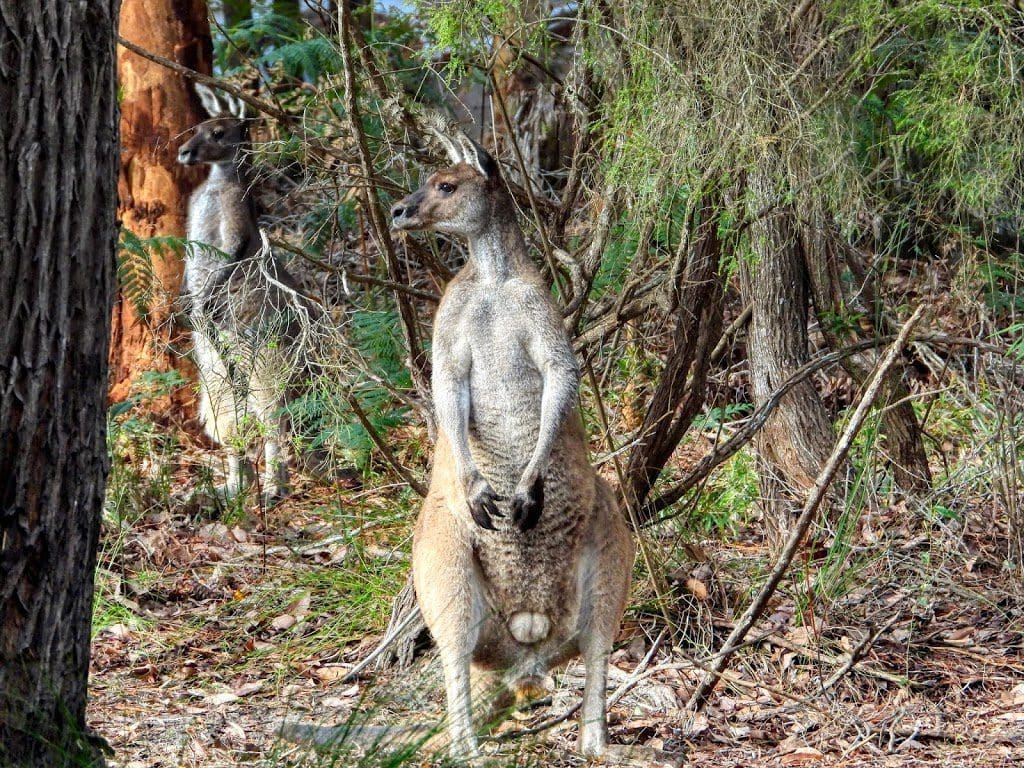
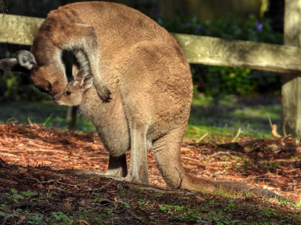
Friday 13 Sep 2019 Day 17. We woke this morning with quite a family of kangaroos just down the slope from our cottage – probably about 20, all adult females with young.

We drove 27  km south to Windy Harbour (appropriately named) for an outing, mainly across heathland with a few remnant Karri trees.

Right on the point at Windy Harbour there is a colony of nesting seabirds with some attempts to protect them. A bit difficult with the locals in the habit of driving on the beaches.

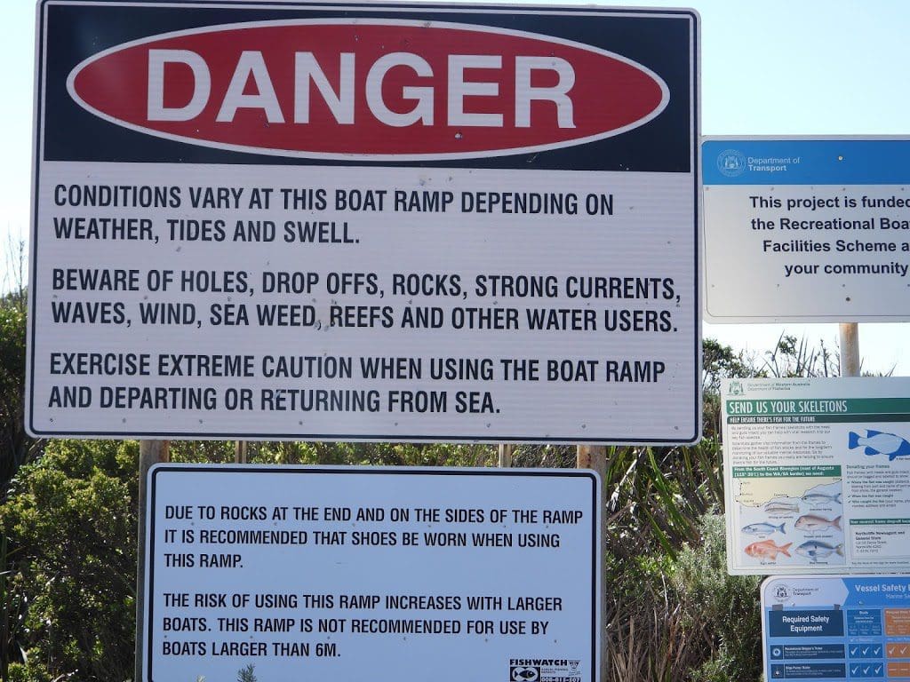
Looks like a very difficult boat ramp and very difficult piece of water. Northcliffe was a timber town. It is now mostly derelict with at least two museums (to timber) following collapse of that industry here. At Northcliffe, we are right down in the SW of WA 34’38”S. The coast is 27 km south of us.

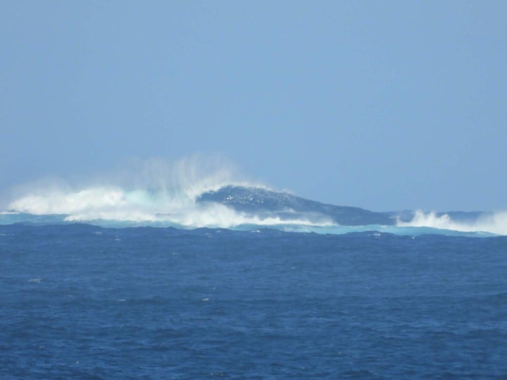
This area would be the first to catch every frontal system that heads for Australia – right at the northern edge of the Roaring Forties and (because we are almost the exact same latitude as Cape of Good Hope) with no land between here and South America.

Saturday 14 Sep 2019 Day 18. A short drive today – just 75km west to the few houses that comprise Normalup. Our drive today was often through the remains of forests that have been made into ‘National Parks’ after all the marketable timber was removed.

The last section (from about Walpole) still has old tall timber. These are ‘Tingle trees’ and were left because they are ‘rubbish timber’. After Walpole, we drove first on a one-way tourist loop to see Coalmine Beach and the anther one-way tourist loop to see Giant Tingle Trees.

Normalup has just a few houses (about 80 with 10 occupied – most of the rest are holiday mansions for the well healed from Perth), a restaurant and Normalup Riverside Chalets (where we are staying). No shops. Many birds and an excellent river at the front door. 

Monday 16 Sep 2019 Day 20. A short drive to Conspicuous Cliff which is well worth a look. From the highest point we saw several whales doing tail slaps.

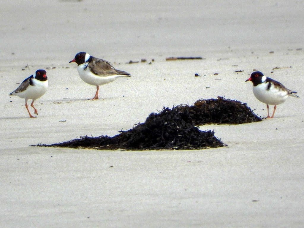
Along the sand, we saw three Hooded Plovers – endangered as they like to nest on sandy shores and get squashed by 4x4s. Good stairways/walkways leading to very good lookouts. 

On to Peaceful Bay and then on to the Tree Tops Walk which comprises of 6 * 60m long metal bridge spans with see through decking – 20 people per span and 10 on the platforms where it changes direction. An impressive structure that runs at canopy level through a Tingle forest. The structure was made to prevent people walking around the Tingle trees – which die when the soil around them is compacted.


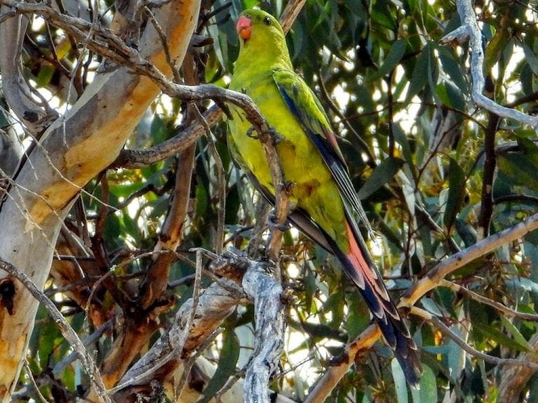
My slideshow of the Birds of Western Australia is here.

Shield Shrimp

When it rains across Australia’s vast inland region, temporary pools crop up all over the arid ground, giving life to a strange desert crustacean known as the shield shrimp (Triops australiensis).

Named after the formidable carapace that shields its head and upper body, T. australiensis can grow up to 7.6 cm long, and it uses its long, segmented tail and mass of 60 or so legs to propel itself through shallow water.

It also breathes through these legs – its sub-class Branchiopoda means ‘gill-legged’ – and in the females these legs bear ovisacs for carrying their tiny eggs.

Several pix in the Photo Gallery and a movie.

Acacia peuce

A rare and endangered plant. The tree grows up to 15 to 18 metres (49 to 59 ft) high, with short horizontal branches and pendulous branchlets covered in needle-like phyllodes adapted for the arid dry climate. It has a distinctive habit more similar to a sheoak or a conifer.

Although speculated to have been widespread across central Australia during wetter climates 400,000 years ago, the population is now mostly restricted to three sites, separated by the encroaching Simpson Desert. In the Northern Territory, the species is restricted to the Mac Clark (Acacia peuce) Conservation Reserve which is surrounded by a pastoral lease, Andado Station. The other two sites are near Boulia and Birdsville in Queensland. The tree is found in open arid plains that usually receive less than 150 millimetres (5.9 in) of rain per annum. They grow on shallow sand aprons overlaying gibber or clay slopes and plains and between longitudinal dunes or on alluvial flats between ephemeral watercourses.


Owen Springs Reserve on Hugh River

Owen Springs was a station on the Hugh River. The Hugh River flows into the Finke (when it actually flows). Both cut through the Western MacDonnell Ranges. The image above shows Owen Springs Reserve as a dot at lower right. The river it is next to is the Hugh. Hermannsburg, our next town, is near middle left edge. Hermannsburg is almost on the Finke River. You can see both Hugh and Finke Rivers cutting through sections of MacDonnell Ranges.

Palm Valley

Palm Valley is within the Finke Gorge National Park southwest of Alice Springs. Palm Valley has a smallish population of Red Cabbage Palms (Livistona mariae). The nearest related species is 850 kilometres away in Katherine NT. The average rainfall for Palm Valley is just 200 mm per year. Small pockets of semi-permanent spring-fed pools allow the unique flora and fauna (desert fish, shield shrimps tadpoles and frogs) to survive.

It had been assumed that the cabbage palms were remnants of a prehistoric time when the climate supported tropical rainforest in what is now the arid inland of Australia. Genetic analysis published in 2012 determined that Livistona mariae at Palm Valley is actually the same species as Livistona rigida from samples collected near Katherine and Mount Isa, both around 1,000 kilometres (620 mi) away. It is now thought that aboriginal people brought the palms to here from Mataranka.

Mound Springs

Mound Springs occur around the Western edge of the Great Artesian Basin and represent a natural discharge of Artesian water that was captured many hundreds of kilometers away from rain falling along the Great Dividing Range and New Guinea. This article provides details. Dalhousie is an excellent example of a mound spring.

Great Artesian Basin map Great Artesian Basin diagram